$1,450
Total Monthly Price2 Beds, 1 Bath, 920 sq ft


| Beds | Baths | Average SF |
|---|---|---|
| 1 Bedroom 1 Bedroom 1 Br | 1 Bath 1 Bath 1 Ba | 650 SF |
The fees below are based on community-supplied data and may exclude additional fees and utilities.
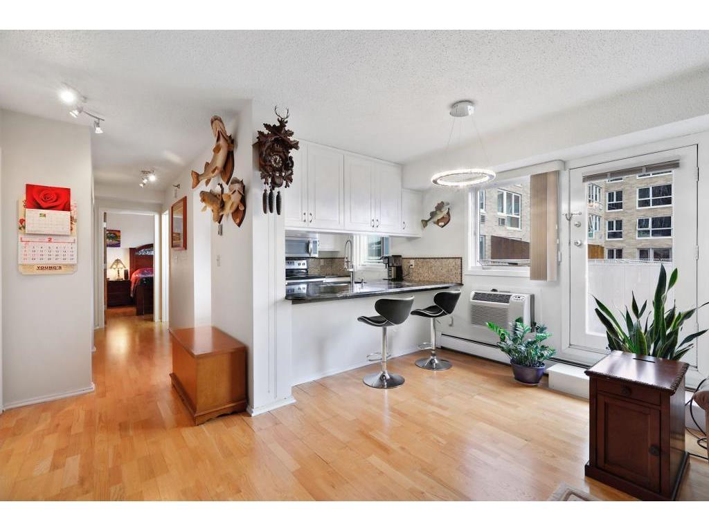
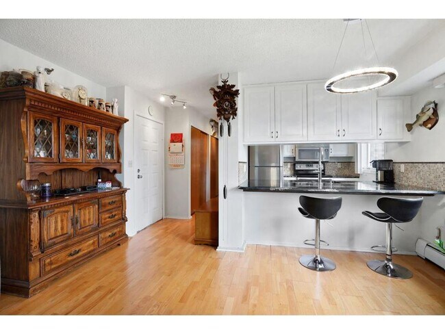
Live in the sky and on Skyway in this updated Centre Village 1BR, 1BA located in the heart of the downtown Mpls business district; just steps from Nicollet Mall, US Bank Stadium, Light Rail Station and Downtown East Commons Park. This 15th floor unit features a large private walkout patio, hardwood flooring, bright kitchen with granite counters, completely remodeled bathroom with a steam shower, and terrific views of Minneapolis. Centre Village full services and amenities (24 hr. concierge/security, outdoor pool and patio, fitness center with indoor jacuzzi and sauna, community room, library, etc.) Unit is located on amenity floor. Included with rent: 1 climate controlled storage unit, water/sewer/trash, gas, heating, basic cable, internet.
433 S 7th St is a condo located in Hennepin County and the 55415 ZIP Code. This area is served by the Minneapolis Public School Dist. attendance zone.
Known for its towering office buildings and vibrant cultural scene, Downtown is one of the most successfully revitalized areas in Minneapolis. With its central urban location, Downtown draws an intriguing mix of residents looking to live in the middle of the action.
Driving through Downtown, you might be surprised at the lack of people on the streets, but don't be fooled -- the buildings link together by a unique system of skyways that enable residents to walk comfortably, even during the legendary Minneapolis winters. During the warmer months, residents of Downtown enjoy living within walking distance of entertainment centers such as Target Field and the Nicollet Mall. Bordered by the historic Mill District, Downtown East, North Loop and the Mississippi River, the neighborhood offers quick access to the city's most lively neighborhoods.
Learn more about living in Downtown East| Colleges & Universities | Distance | ||
|---|---|---|---|
| Colleges & Universities | Distance | ||
| Walk: | 10 min | 0.5 mi | |
| Walk: | 15 min | 0.8 mi | |
| Walk: | 21 min | 1.1 mi | |
| Drive: | 6 min | 2.4 mi |
 The GreatSchools Rating helps parents compare schools within a state based on a variety of school quality indicators and provides a helpful picture of how effectively each school serves all of its students. Ratings are on a scale of 1 (below average) to 10 (above average) and can include test scores, college readiness, academic progress, advanced courses, equity, discipline and attendance data. We also advise parents to visit schools, consider other information on school performance and programs, and consider family needs as part of the school selection process.
Transportation options available in Minneapolis include Government Plaza Station, located 0.3 mile from 433 S 7th St Unit 1528. 433 S 7th St Unit 1528 is near Minneapolis-St Paul International/Wold-Chamberlain, located 10.2 miles or 21 minutes away.
| Transit / Subway | Distance | ||
|---|---|---|---|
| Transit / Subway | Distance | ||
|
|
Walk: | 6 min | 0.3 mi |
|
|
Walk: | 7 min | 0.4 mi |
|
|
Walk: | 10 min | 0.5 mi |
|
|
Walk: | 13 min | 0.7 mi |
| Walk: | 16 min | 0.9 mi |
| Commuter Rail | Distance | ||
|---|---|---|---|
| Commuter Rail | Distance | ||
|
|
Drive: | 5 min | 1.4 mi |
|
|
Drive: | 17 min | 10.2 mi |
|
|
Drive: | 16 min | 10.4 mi |
|
|
Drive: | 31 min | 21.6 mi |
|
|
Drive: | 32 min | 23.2 mi |
| Airports | Distance | ||
|---|---|---|---|
| Airports | Distance | ||
|
Minneapolis-St Paul International/Wold-Chamberlain
|
Drive: | 21 min | 10.2 mi |
Time and distance from 433 S 7th St Unit 1528.
| Shopping Centers | Distance | ||
|---|---|---|---|
| Shopping Centers | Distance | ||
| Walk: | 11 min | 0.6 mi | |
| Drive: | 4 min | 1.1 mi | |
| Drive: | 3 min | 1.2 mi |
| Parks and Recreation | Distance | ||
|---|---|---|---|
| Parks and Recreation | Distance | ||
|
Franklin Steele Square
|
Walk: | 10 min | 0.5 mi |
|
Elliot Park
|
Walk: | 10 min | 0.5 mi |
|
First Bridge Park
|
Walk: | 12 min | 0.6 mi |
|
Mill Ruins Park
|
Walk: | 12 min | 0.6 mi |
|
Mills City Museum
|
Walk: | 14 min | 0.7 mi |
| Hospitals | Distance | ||
|---|---|---|---|
| Hospitals | Distance | ||
| Walk: | 3 min | 0.2 mi | |
| Drive: | 5 min | 1.4 mi | |
| Drive: | 5 min | 2.0 mi |
| Military Bases | Distance | ||
|---|---|---|---|
| Military Bases | Distance | ||
| Drive: | 16 min | 7.2 mi |
$1,450
Total Monthly Price2 Beds, 1 Bath, 920 sq ft
$2,850
Total Monthly Price2 Beds, 2 Baths, 1,272 sq ft
$995
Total Monthly Price1 Bed, 1 Bath, 450 sq ft
$1,795
Total Monthly Price2 Beds, 1 Bath, 1,500 sq ft
$1,400
Total Monthly Price2 Beds, 1 Bath, 900 sq ft
$2,250
Total Monthly Price2 Beds, 2 Baths, 1,200 sq ft
$1,250
Total Monthly Price1 Bed, 1 Bath, 718 sq ft
$2,100
Total Monthly Price2 Beds, 2 Baths, 1,300 sq ft
$2,995
Total Monthly Price3 Beds, 3 Baths, 3,112 sq ft
$1,595
Total Monthly Price1 Bed, 1 Bath, 720 sq ft
What Are Walk Score®, Transit Score®, and Bike Score® Ratings?
Walk Score® measures the walkability of any address. Transit Score® measures access to public transit. Bike Score® measures the bikeability of any address.
What is a Sound Score Rating?
A Sound Score Rating aggregates noise caused by vehicle traffic, airplane traffic and local sources