
$1,200 / Month
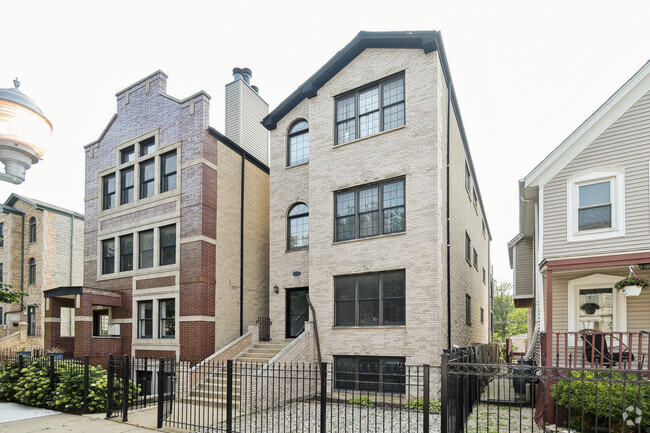
4303 S Harlem Ave Unit 7
Stickney, IL 60402
2 Weeks Ago
Favorites
4303 S Harlem Ave Unit 7

Favorites
Check Back Soon for Upcoming Availability
| Beds | Baths | Average SF |
|---|---|---|
| 1 Bedroom 1 Bedroom 1 Br | 1 Bath 1 Bath 1 Ba | 700 SF |
Fees and Policies
The fees below are based on community-supplied data and may exclude additional fees and utilities.
Pet policies are negotiable.
- Parking
-
Surface Lot--Assigned Parking
-
Other--Assigned Parking
Details
Utilities Included
-
Water
-
Heat
-
Trash Removal
-
Sewer
Lease Options
-
12 Months
About This Property
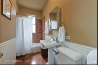
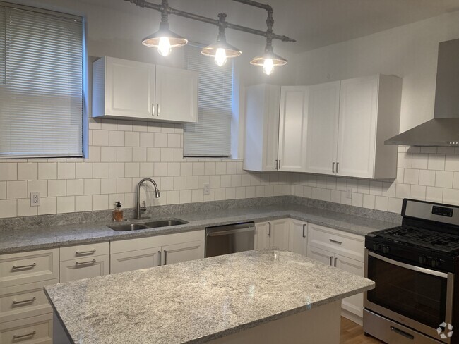
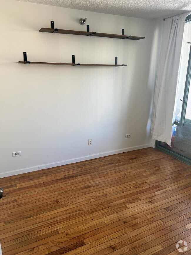
We now offer virtual video tours of all of our apartments! Schedule a virtual tour and rent this apartment from the comfort and safety of your home! Apply online! Fantastic one bedroom, one bathroom in Southwest suburban Stickney features heat included, brand new kitchen with stainless steel appliances, dishwasher, built in microwave, large combination living and dining rooms, built in AC unit, brand new engineered floors installed within the last 30 days, spacious bedroom, awesome closet space, newer bathroom, cats welcome, and one outdoor parking spot is included! Easy access to 55 and 290! Won't Last Long!
4303 S Harlem Ave is a condo located in Cook County and the 60402 ZIP Code. This area is served by the Lyons School District 103 attendance zone.
Unique Features
- NewConstruction
- SharedYard
- OutdoorArea
Condo Features
Air Conditioning
Hardwood Floors
Microwave
Refrigerator
- Air Conditioning
- Cable Ready
- Microwave
- Range
- Refrigerator
- Hardwood Floors
Location
Get Directions
Stickney is just 25 minutes west of Chicago, giving it a peaceful neighborhood feel while still being near the amenities of the city. There’s an endless variety of homes and apartments available to renters, all set on tree-lined streets with convenient back alleys for trash pickup.
On Stickney’s west side lies the Ottawa Woods Trail and a nexus of parks and green spaces that keep residents active. There’s not much in the way of restaurants and retail within the area’s boundaries, but there are plenty of offerings just north of Pershing Road to peruse. Stickney’s convenient location and proximity to major highways like I-290 and I-55 make it perfect for those who commute into the city for work.
Learn more about living in Stickney
Amenities
- Air Conditioning
- Cable Ready
- Microwave
- Range
- Refrigerator
- Hardwood Floors
- NewConstruction
- SharedYard
- OutdoorArea
Expenses
Utilities Included
Water, Heat, Trash Removal, Sewer
Included
Education
| Colleges & Universities | Distance | ||
|---|---|---|---|
| Colleges & Universities | Distance | ||
| Drive: | 13 min | 6.2 mi | |
| Drive: | 13 min | 6.3 mi | |
| Drive: | 14 min | 6.8 mi | |
| Drive: | 15 min | 8.3 mi |
4303 S Harlem Ave Unit 7 is within 13 minutes or 6.3 miles from Concordia University-Chicago. It is also near Dominican University, Priory and Dominican University.
Schools


Public Elementary School
Grades PK-5
244 Students
Attendance Zone
Public Middle School
Grades 6-8
688 Students
Attendance Zone
Public High School
Grades 9-12
3,533 Students
Attendance Zone
Private Elementary, Middle & High School
Grades K-12
Nearby
Private Elementary & Middle School
Grades PK-8
350 Students
Nearby
School data provided by
 The GreatSchools Rating helps parents compare schools within a state based on a variety of school quality indicators and provides a helpful picture of how effectively each school serves all of its students. Ratings are on a scale of 1 (below average) to 10 (above average) and can include test scores, college readiness, academic progress, advanced courses, equity, discipline and attendance data. We also advise parents to visit schools, consider other information on school performance and programs, and consider family needs as part of the school selection process.
View GreatSchools Rating Methodology
View GreatSchools Rating Methodology
Transportation options available in Stickney include 54Th/Cermak Station, located 4.6 miles from 4303 S Harlem Ave Unit 7. 4303 S Harlem Ave Unit 7 is near Chicago Midway International, located 4.1 miles or 7 minutes away, and Chicago O'Hare International, located 16.3 miles or 31 minutes away.
| Transit / Subway | Distance | ||
|---|---|---|---|
| Transit / Subway | Distance | ||
|
|
Drive: | 8 min | 4.6 mi |
|
|
Drive: | 8 min | 4.7 mi |
|
|
Drive: | 9 min | 4.8 mi |
|
|
Drive: | 10 min | 5.4 mi |
|
|
Drive: | 10 min | 6.6 mi |
| Commuter Rail | Distance | ||
|---|---|---|---|
| Commuter Rail | Distance | ||
|
|
Drive: | 2 min | 1.3 mi |
|
|
Drive: | 3 min | 1.7 mi |
|
|
Drive: | 4 min | 1.9 mi |
|
|
Drive: | 4 min | 1.9 mi |
|
|
Drive: | 5 min | 2.2 mi |
| Airports | Distance | ||
|---|---|---|---|
| Airports | Distance | ||
|
Chicago Midway International
|
Drive: | 7 min | 4.1 mi |
|
Chicago O'Hare International
|
Drive: | 31 min | 16.3 mi |
Time and distance from 4303 S Harlem Ave Unit 7.
| Shopping Centers | Distance | ||
|---|---|---|---|
| Shopping Centers | Distance | ||
| Walk: | 6 min | 0.3 mi | |
| Walk: | 9 min | 0.5 mi | |
| Drive: | 2 min | 1.2 mi |
4303 S Harlem Ave Unit 7 has 3 shopping centers within 1.2 miles, which is about a 2-minute walk. The miles and minutes will be for the farthest away property.
| Parks and Recreation | Distance | ||
|---|---|---|---|
| Parks and Recreation | Distance | ||
|
White Eagle Woods-North
|
Walk: | 11 min | 0.6 mi |
|
White Eagle Woods-South
|
Walk: | 13 min | 0.7 mi |
|
Andrew Toman Grove
|
Drive: | 6 min | 2.8 mi |
|
Brookfield Zoo
|
Drive: | 7 min | 3.1 mi |
|
Schuth's Grove / Callahan Grove
|
Drive: | 7 min | 3.6 mi |
4303 S Harlem Ave Unit 7 has 5 parks within 3.6 miles, including White Eagle Woods-North, White Eagle Woods-South, and Andrew Toman Grove.
| Hospitals | Distance | ||
|---|---|---|---|
| Hospitals | Distance | ||
| Drive: | 3 min | 1.6 mi | |
| Drive: | 8 min | 4.6 mi | |
| Drive: | 9 min | 4.8 mi |
4303 S Harlem Ave Unit 7 has 3 hospitals within 4.8 miles, the nearest is MacNeal Hospital which is 1.6 miles away and a 3 minute drive.
| Military Bases | Distance | ||
|---|---|---|---|
| Military Bases | Distance | ||
| Drive: | 35 min | 22.3 mi |
4303 S Harlem Ave Unit 7 is 22.3 miles and a 35 minute drive from US Military Reservation Naperville.
You May Also Like
Similar Rentals Nearby


What Are Walk Score®, Transit Score®, and Bike Score® Ratings?
Walk Score® measures the walkability of any address. Transit Score® measures access to public transit. Bike Score® measures the bikeability of any address.
What is a Sound Score Rating?
A Sound Score Rating aggregates noise caused by vehicle traffic, airplane traffic and local sources

4303 S Harlem Ave
Stickney, IL 60402