
$2,100
/ Month
43 Barton Ave
Staten Island, NY 10306
Favorites
914-429-4879
-
Bedrooms
3
-
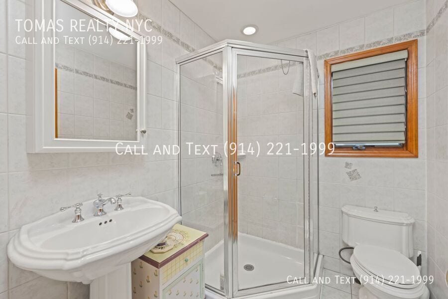
Bathrooms
2
-
Square Feet
1,872 sq ft
-
Available
Available Jul 1
43 Barton Ave

Favorites
43 Barton Ave is a townhome located in Richmond County and the 10306 ZIP Code. This area is served by the New York City Geographic District #31 attendance zone.
* Price shown is base rent. Excludes user-selected optional fees and variable or usage-based fees and required charges due at or prior to move-in or at move-out. Price, availability, fees, and any applicable rent special are subject to change without notice.
* Square footage definitions vary. Displayed square footage is approximate.
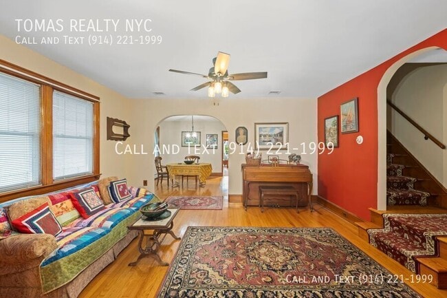
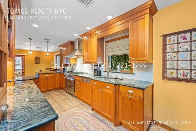
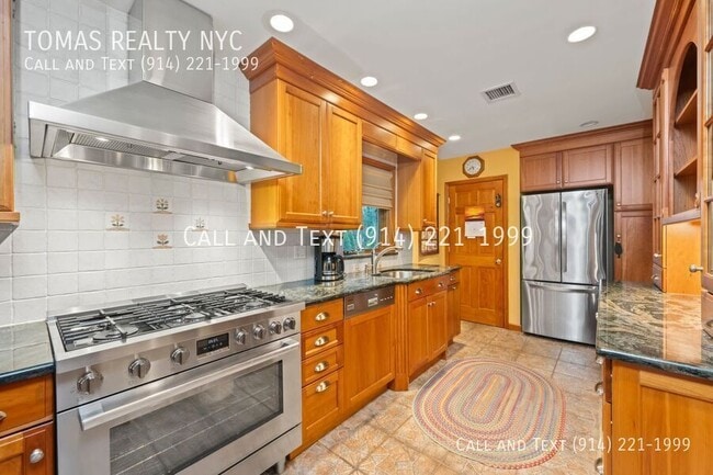
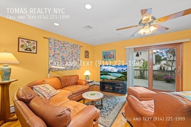
Townhome Features
Air Conditioning
Dishwasher
Microwave
Refrigerator
- Air Conditioning
- Fireplace
- Dishwasher
- Disposal
- Microwave
- Refrigerator
Fees and Policies
The fees listed below are community-provided and may exclude utilities or add-ons. All payments are made directly to the property and are non-refundable unless otherwise specified.
- Dogs Allowed
-
Fees not specified
- Cats Allowed
-
Fees not specified
Contact
- Listed by Tomas Cruz | TOMAS REALTY NYC
- Phone Number
- Contact
Location
Get Directions
Dongan Hills is a neighborhood on the eastern shore of Staten Island just minutes away from places like Ocean Breeze Fishing Pier and South Beach. Between Dongan Hills and the shoreline is Staten Island University Hospital and its wooded backyard known as Ocean Breeze Park. The hospital provides Dongan Hills’ residents with an abundance of jobs and quality healthcare, while the park serves as a peaceful outdoor oasis. Dongan Hills itself is made up of a variety of single-family homes, and renters will find that the rental market mostly consists of moderately priced houses. While New York City is only a 12-mile journey north by car or train, Dongan Hills’ residents have access to great food and a variety of shops in town along Hylan Boulevard and Richmond Road.
Learn more about living in Dongan Hills
Amenities
- Air Conditioning
- Fireplace
- Dishwasher
- Disposal
- Microwave
- Refrigerator
Education
| Colleges & Universities | Distance | ||
|---|---|---|---|
| Colleges & Universities | Distance | ||
| Drive: | 10 min | 3.2 mi | |
| Drive: | 14 min | 4.4 mi | |
| Drive: | 22 min | 10.2 mi | |
| Drive: | 25 min | 11.5 mi |
43 Barton Ave is within 10 minutes or 3.2 miles from Wagner College. It is also near Coll. of Staten Island, CUNY and Union County Coll., Elizabeth.
Schools


Public Elementary School
Grades PK-5
282 Students
Attendance Zone
Public Middle School
Grades 6-8
980 Students
Attendance Zone
Public High School
Grades 9-12
3,050 Students
Attendance Zone
Private Elementary & Middle School
Grades PK-8
Nearby
Private Elementary, Middle & High School
Grades PK-12
Nearby
School data provided by
 The GreatSchools Rating helps parents compare schools within a state based on a variety of school quality indicators and provides a helpful picture of how effectively each school serves all of its students. Ratings are on a scale of 1 (below average) to 10 (above average) and can include test scores, college readiness, academic progress, advanced courses, equity, discipline and attendance data. We also advise parents to visit schools, consider other information on school performance and programs, and consider family needs as part of the school selection process.
View GreatSchools Rating Methodology
Data provided by GreatSchools.org © 2026. All rights reserved.
View GreatSchools Rating Methodology
Data provided by GreatSchools.org © 2026. All rights reserved.
Transportation options available in Staten Island include Bay Ridge-95 Street, located 6.4 miles from 43 Barton Ave. 43 Barton Ave is near Newark Liberty International, located 16.4 miles or 29 minutes away, and John F Kennedy International, located 25.5 miles or 39 minutes away.
| Transit / Subway | Distance | ||
|---|---|---|---|
| Transit / Subway | Distance | ||
|
|
Drive: | 13 min | 6.4 mi |
|
|
Drive: | 13 min | 6.7 mi |
|
|
Drive: | 14 min | 7.1 mi |
| Drive: | 17 min | 8.1 mi | |
|
|
Drive: | 19 min | 9.3 mi |
| Commuter Rail | Distance | ||
|---|---|---|---|
| Commuter Rail | Distance | ||
|
|
Walk: | 4 min | 0.2 mi |
|
|
Walk: | 8 min | 0.4 mi |
|
|
Walk: | 16 min | 0.9 mi |
|
|
Walk: | 19 min | 1.0 mi |
|
|
Drive: | 6 min | 2.7 mi |
| Airports | Distance | ||
|---|---|---|---|
| Airports | Distance | ||
|
Newark Liberty International
|
Drive: | 29 min | 16.4 mi |
|
John F Kennedy International
|
Drive: | 39 min | 25.5 mi |
Getting Around
 What do Walkability, Transit, Drivability, and Bikeability mean?
Walkability measures the walking distance to day-to-day needs.
Transit measures access to public transportation.
Drivability measures congestion, parking availability, and access to major roads.
Bikeability measures the suitability for cycling.
How It Works
What do Walkability, Transit, Drivability, and Bikeability mean?
Walkability measures the walking distance to day-to-day needs.
Transit measures access to public transportation.
Drivability measures congestion, parking availability, and access to major roads.
Bikeability measures the suitability for cycling.
How It Works
Moderately Walkable
Walkability
70
/ 100
Exceptional Public Transit
Transit
90
/ 100
Moderately Drivable
Drivability
60
/ 100
Moderately Bikeable
Bikeability
60
/ 100
Scores provided by
-
Soundscore™
-
/ 100
Traffic
-Airport
-Businesses
-Scores provided by
HowLoud What is a Sound Score Rating? A Sound Score Rating aggregates noise caused by vehicle traffic, airplane traffic and local sources. How It WorksTime and distance from 43 Barton Ave.
| Shopping Centers | Distance | ||
|---|---|---|---|
| Shopping Centers | Distance | ||
| Drive: | 4 min | 1.4 mi | |
| Drive: | 5 min | 1.6 mi | |
| Drive: | 5 min | 1.7 mi |
43 Barton Ave has 3 shopping centers within 1.7 miles, which is about a 5-minute drive. The miles and minutes will be for the farthest away property.
| Parks and Recreation | Distance | ||
|---|---|---|---|
| Parks and Recreation | Distance | ||
|
Gateway NRA - Staten Island Unit - Miller Field
|
Drive: | 5 min | 1.7 mi |
|
Blood Root Valley
|
Drive: | 6 min | 2.3 mi |
|
High Rock Park
|
Drive: | 6 min | 2.3 mi |
|
Franklin D. Roosevelt Boardwalk and Beach
|
Drive: | 7 min | 2.3 mi |
|
Ocean Breeze Park
|
Drive: | 7 min | 2.5 mi |
43 Barton Ave has 5 parks within 2.5 miles, including Gateway NRA - Staten Island Unit - Miller Field, High Rock Park, and Franklin D. Roosevelt Boardwalk and Beach.
| Hospitals | Distance | ||
|---|---|---|---|
| Hospitals | Distance | ||
| Drive: | 4 min | 1.6 mi | |
| Drive: | 6 min | 2.1 mi | |
| Drive: | 13 min | 4.9 mi |
43 Barton Ave has 3 hospitals within 4.9 miles, the nearest is Staten Island University Hospital which is 1.6 miles away and a 4 minute drive.
| Military Bases | Distance | ||
|---|---|---|---|
| Military Bases | Distance | ||
| Drive: | 12 min | 4.2 mi | |
| Drive: | 14 min | 6.8 mi | |
| Drive: | 23 min | 11.3 mi |
43 Barton Ave has 3 military bases within 11.3 miles, the nearest is Naval Station NY Stapleton Site which is 4.2 miles away and a 12 minute drive.
You May Also Like
Similar Rentals Nearby
-
-
1 / 26

-
-
-
-

-
-

-

-


What Are Walk Score®, Transit Score®, and Bike Score® Ratings?
Walk Score® measures the walkability of any address. Transit Score® measures access to public transit. Bike Score® measures the bikeability of any address.
What is a Sound Score Rating?
A Sound Score Rating aggregates noise caused by vehicle traffic, airplane traffic and local sources.
43 Barton Ave
Staten Island, NY 10306