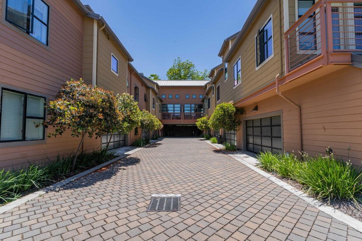
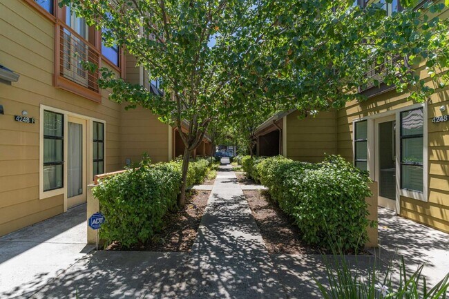
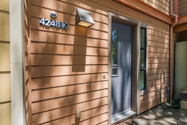
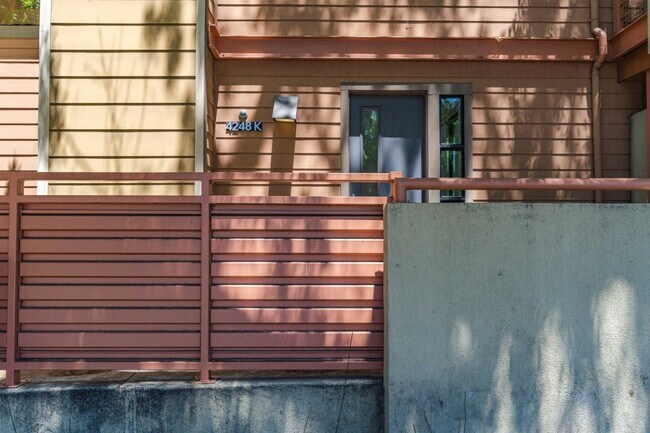
$5,095 / Month

4248 Rickeys Way

,

Palo Alto, CA 94306

2 Weeks Ago
| Edit

Under 30 minutes

Commute Time is calculated at rush hour.
Share Listing
Favorites
4248 Rickeys Way
Share Listing
Favorites

Check Back Soon for Upcoming Availability

Beds Baths Average SF
2 Bedrooms 2 Bedrooms 2 Br 2.5 Baths 2.5 Baths 2.5 Ba 1,766 SF

About This Property

Stunning modern 2-bedroom townhome in a highly sought-after neighborhood in Palo Alto! Designed with efficiency and sophistication in mind, Unit K 4248 Rickeys Way features top-of-the-line upgrades. This home is elegant with its huge space, vaulted ceilings, hardwood flooring, and carpeting. The open floor plan of the living room is made perfect for entertainment with the installed centralized sound system. Lounging outside is also made possible with the covered patio. The true gourmet kitchen has recently-upgraded stainless steel appliances, spacious granite counters, and expanded custom cabinetry with under-cabinet lighting. Upstairs, the huge masters bedroom features an oversized sliding door closet and an attached gorgeous full bathroom with walk-in storage, jack and jill sinks, and a shower and bathtub combo. Rickeys Way is the perfect location for those who want to enjoy the best amenities such as the clubhouse, swimming pool, childrens playground, BBQ, communal garden, and the extensive greenbelt. Easy commute to Stanford University and Silicon Valley Companies: Google, Facebook, and Apple. Excellent Palo Alto schools such as Juana Briones Elementary, Fletcher Middle, and Henry Gunn High are also nearby! Pet Friendly Pet Deposit - $500

4248 Rickeys Way is a condo located in Santa Clara County and the 94306 ZIP Code. This area is served by the Palo Alto Unified School District attendance zone.

Location
4248 Rickeys Way, Palo Alto,
CA 94306
Get Directions
City - Palo Alto

Living in Palo Alto places you in Silicon Valley, where historic neighborhoods complement the city's technological presence. Tree-lined streets wind through the community, which is anchored by Stanford University. University Avenue features local boutiques and restaurants housed in preserved historic buildings, while the Stanford Shopping Center offers high-end retail destinations. The city maintains 36 parks and preserves, including the Baylands Nature Preserve and Foothills Park, where residents enjoy hiking trails and outdoor activities. Palo Alto's infrastructure supports alternative transportation, with dedicated bike lanes throughout the city.

The rental market in Palo Alto reflects the area's popularity, with current average rents ranging from $2,634 for studios to $6,139 for four-bedroom homes. Recent trends show steady growth, with rent increases varying from 1.8% to 17% across different unit sizes over the past year.

Learn more about living in Palo Alto 

Below are rent ranges for similar nearby apartments

Education
Colleges & Universities Distance
Drive: 6 min 1.8 mi
Drive: 9 min 3.4 mi
Drive: 11 min 4.7 mi
Drive: 14 min 5.7 mi
4248 Rickeys Way is within 6 minutes or 1.8 miles from Foothill College, Middlefield. It is also near Stanford University and Foothill Coll., Los Altos.
Schools
Public Elementary School
Grades K-5
407 Students
Nearby
Public Elementary School
Grades K-5
260 Students
Attendance Zone
Public Middle School
Grades 6-8
572 Students
Attendance Zone
Public High School
Grades 9-12
1,643 Students
Attendance Zone
Private Elementary School
Grades PK-5
12 Students
Nearby
Private Elementary, Middle & High School
Grades K-12
Nearby
Private Elementary & Middle School
Grades K-8
296 Students
Nearby
Transportation

Transportation options available in Palo Alto include Mountain View Station, located 3.3 miles from 4248 Rickeys Way. 4248 Rickeys Way is near Norman Y Mineta San Jose International, located 12.7 miles or 20 minutes away, and San Francisco International, located 24.4 miles or 35 minutes away.

Transit / Subway Distance
Drive: 7 min 3.3 mi
Drive: 10 min 4.6 mi
Drive: 10 min 5.1 mi
Drive: 11 min 5.3 mi
Drive: 12 min 6.0 mi
Commuter Rail Distance
Drive: 5 min 2.1 mi
Drive: 6 min 2.3 mi
Drive: 9 min 3.8 mi
Drive: 10 min 3.8 mi
Drive: 11 min 4.8 mi
Airports Distance
Airports Distance
Norman Y Mineta San Jose International
Drive: 20 min 12.7 mi
San Francisco International
Drive: 35 min 24.4 mi

Walkability Near 4248 Rickeys Way Palo Alto, CA 94306

Getting Around
Fairly Walkable
Walkability
50 / 100
Some Public Transit
Transit
50 / 100
Very Drivable
Drivability
80 / 100
Moderately Bikeable
Bikeability
60 / 100

Scores provided by

What do Walkability, Transit, Drivability, and Bikeability mean? Walkability measures the walking distance to day-to-day needs. Transit measures access to public transportation. Drivability measures congestion, parking availability, and access to major roads. Bikeability measures the suitability for cycling. How It Works
-
Soundscore
- / 100

Traffic

-

Airport

-

Businesses

-

Scores provided by

HowLoud What is a Sound Score Rating? A Sound Score Rating aggregates noise caused by vehicle traffic, airplane traffic and local sources. How It Works
Points of Interest

Time and distance from 4248 Rickeys Way.

Shopping Centers Distance
Walk: 19 min 1.0 mi
Drive: 4 min 1.4 mi
Drive: 4 min 1.5 mi
4248 Rickeys Way has 3 shopping centers within 1.5 miles, which is about a 4-minute drive. The miles and minutes will be for the farthest away property.
Parks and Recreation Distance
Terman Park
Walk: 19 min 1.0 mi
J. Pearce Mitchell Park
Drive: 5 min 1.6 mi
Bol Park
Drive: 5 min 1.9 mi
Esther Clark Nature Preserve
Drive: 6 min 2.0 mi
Redwood Grove
Drive: 8 min 3.4 mi
4248 Rickeys Way has 5 parks within 3.4 miles, including Terman Park, J. Pearce Mitchell Park, and Bol Park.
Hospitals Distance
Hospitals Distance
Drive: 10 min 4.1 mi
Drive: 11 min 4.5 mi
Drive: 12 min 4.7 mi
4248 Rickeys Way has 3 hospitals within 4.7 miles, the nearest is Lucile Salter Packard Children's Hospital at Stanford which is 4.1 miles away and a 10 minute drive.
Military Bases Distance
Drive: 14 min 5.5 mi
4248 Rickeys Way is 5.5 miles and a 14 minute drive from Ames Research Center.

You May Also Like

Similar Rentals Nearby