

$3,195
/ Month
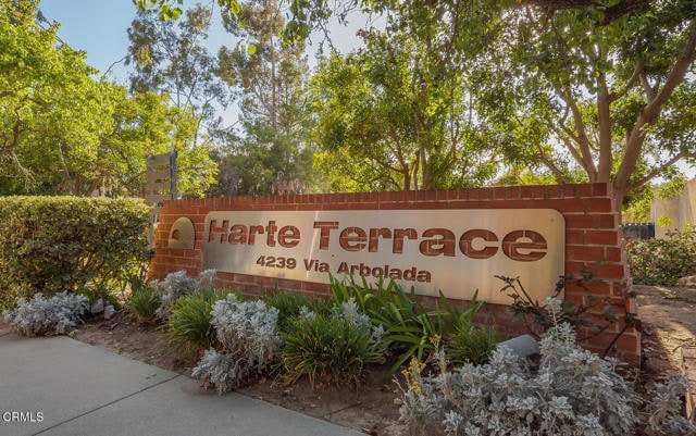
4239 Vía Arbolada Unit 104
Los Angeles, CA 90042
Today
|
Edit
Favorites
-
Bedrooms
2
-
Bathrooms
2
-
Square Feet
1,023 sq ft
-
Available
Available Now
Highlights
- Gated Parking
- Two Primary Bedrooms
- Canyon View
- Deck
- Contemporary Architecture
- Granite Countertops
4239 Vía Arbolada Unit 104

Favorites
About This Home
12 Month Lease,
$3,195 deposit,
Available Now
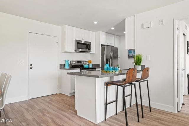
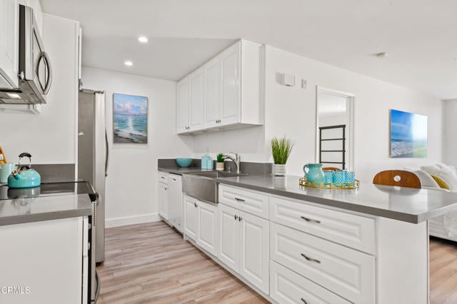
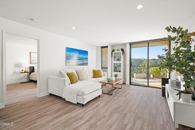
Large patio with stunning views. Natural sunlight throughout the day in all rooms. Excellent floor plan with a two split primary suite layout. Granite counter top in kitchen, and lots of cabinets. Laundry hook-ups inside the unit. No steps to go to the unit from the street. MLS# P1-24755
4239 Vía Arbolada is a condo located in Los Angeles County and the 90042 ZIP Code.
* Price shown is base rent. Excludes user-selected optional fees and variable or usage-based fees and required charges due at or prior to move-in or at move-out. Price, availability, fees, and any applicable rent special are subject to change without notice.
* Square footage definitions vary. Displayed square footage is approximate.
Home Details
Home Type
Condominium
Year Built
Built in 1982
Accessible Home Design
No Interior Steps
Accessible Parking
Bedrooms and Bathrooms
Double Master Bedroom
Bathtub with Shower
2 Full Bathrooms
2 Bedrooms
Home Design
Contemporary Architecture
Turnkey
Fire Rated Drywall
Stucco
Home Security
Security Lights
Interior Spaces
Living Room Balcony
Recessed Lighting
Laminate Flooring
1,023 Sq Ft Home
Kitchen
Granite Countertops
Electric Range
Eat-In Kitchen
Ice Maker
Microwave
Dishwasher
Water Line To Refrigerator
Laundry
Laundry Room
Dryer
Washer
Listing and Financial Details
Security Deposit $3,195
12-Month Minimum Lease Term
Available 11/1/25
Tax Lot 10
Assessor Parcel Number 5302012203
Rent includes association dues, water, trash collection, sewer, gardener
Lot Details
3.72 Acre Lot
Two or More Common Walls
Sprinkler System
Outdoor Features
Deck
Wood Patio
Rain Gutters
Exterior Lighting
Parking
Gated Parking
2 Car Attached Garage
Tandem Garage
Assigned Parking
Parking Available
Utilities
Forced Air Heating and Cooling System
Cable TV Available
Phone Available
Views
Canyon
Hills
Park or Greenbelt
Community Details
Overview
Property is near a preserve or public land
Pet Policy
Breed Restrictions
Pet Deposit $500
Recreation
Hiking Trails
Bike Trail
Security
Card or Code Access
Fees and Policies
The fees below are based on community-supplied data and may exclude additional fees and utilities.
- One-Time Basics
- Due at Move-In
- Security Deposit - Refundable$3,195
- Due at Move-In
- Other
- Garage Lot
- Garage - Attached
Property Fee Disclaimer: Based on community-supplied data and independent market research. Subject to change without notice. May exclude fees for mandatory or optional services and usage-based utilities.
Details
Utilities Included
-
Water
-
Trash Removal
-
Sewer
Lease Options
-
12 Months
Contact
- Listed by Hans Hagenmayer | Teamprovident, Inc.
- Contact
-
Source
 California Regional Multiple Listing Service
Copyright 2025 © California Regional MLS. All rights reserved.
Location
Get Directions
Amenities
- Washer/Dryer
- Air Conditioning
- Heating
- Dishwasher
- Ice Maker
- Granite Countertops
- Microwave
- Range
- Refrigerator
- Vinyl Flooring
- Balcony
- Patio
Expenses
Utilities Included
Water, Trash Removal, Sewer
Included
A quiet suburb outside of Los Angeles, Monterey Hills is known for its rolling hills, winding residential streets, and elevated city views. Check out Elephant Hill, a popular place to bike or hike that offers beautiful views of the neighborhood. Herman Park is nestled along Highway 110 in the north end of the neighborhood, offering tennis courts, playgrounds, and a dog park. And for more outdoor recreation, visit the biking paths and hiking trails at Ernest E. Debs Regional Park, bordering Monterey Hills.
Monterey Hills is a more secluded part of Northeast Los Angeles with larger lots, single-family homes, and tree-lined streets. However, if you cross over Highway 110, you’ll find theatres, restaurants, services, and more. Monterey Hills is located just seven miles northeast of Downtown Los Angeles and eight miles east of major attractions such as Griffith Park, the Los Angeles Zoo, the Greek Theatre, and Glendale Galleria.
Learn more about living in Monterey Hills
Education
| Colleges & Universities | Distance | ||
|---|---|---|---|
| Colleges & Universities | Distance | ||
| Drive: | 9 min | 3.9 mi | |
| Drive: | 11 min | 4.2 mi | |
| Drive: | 11 min | 4.2 mi | |
| Drive: | 9 min | 4.6 mi |
4239 Vía Arbolada Unit 104 is within 11 minutes or 4.2 miles from Cal State Los Angeles. It is also near USC, Health Sciences Campus and Occidental College.
Transportation options available in Los Angeles include Highland Park Station, located 2.1 miles from 4239 Vía Arbolada Unit 104. 4239 Vía Arbolada Unit 104 is near Bob Hope, located 18.5 miles or 28 minutes away, and Los Angeles International, located 21.5 miles or 35 minutes away.
| Transit / Subway | Distance | ||
|---|---|---|---|
| Transit / Subway | Distance | ||
|
|
Drive: | 6 min | 2.1 mi |
|
|
Drive: | 8 min | 3.2 mi |
|
|
Drive: | 8 min | 3.5 mi |
|
|
Drive: | 7 min | 3.6 mi |
|
|
Drive: | 8 min | 4.2 mi |
| Commuter Rail | Distance | ||
|---|---|---|---|
| Commuter Rail | Distance | ||
|
|
Drive: | 13 min | 5.4 mi |
|
|
Drive: | 12 min | 5.5 mi |
|
|
Drive: | 14 min | 7.8 mi |
| Drive: | 15 min | 9.4 mi | |
|
|
Drive: | 21 min | 10.2 mi |
| Airports | Distance | ||
|---|---|---|---|
| Airports | Distance | ||
|
Bob Hope
|
Drive: | 28 min | 18.5 mi |
|
Los Angeles International
|
Drive: | 35 min | 21.5 mi |
Time and distance from 4239 Vía Arbolada Unit 104.
| Shopping Centers | Distance | ||
|---|---|---|---|
| Shopping Centers | Distance | ||
| Drive: | 5 min | 1.8 mi | |
| Drive: | 6 min | 2.4 mi | |
| Drive: | 6 min | 2.5 mi |
4239 Vía Arbolada Unit 104 has 3 shopping centers within 2.5 miles, which is about a 6-minute drive. The miles and minutes will be for the farthest away property.
| Parks and Recreation | Distance | ||
|---|---|---|---|
| Parks and Recreation | Distance | ||
|
Audubon Center at Debs Park
|
Drive: | 6 min | 2.5 mi |
|
Chavez Ravine Arboretum
|
Drive: | 11 min | 6.2 mi |
|
Elysian Park
|
Drive: | 14 min | 6.2 mi |
|
Elyria Canyon Park
|
Drive: | 13 min | 6.5 mi |
|
Marsh Park
|
Drive: | 14 min | 6.8 mi |
4239 Vía Arbolada Unit 104 has 5 parks within 6.8 miles, including Audubon Center at Debs Park, Elyria Canyon Park, and Elysian Park.
| Hospitals | Distance | ||
|---|---|---|---|
| Hospitals | Distance | ||
| Drive: | 8 min | 3.6 mi | |
| Drive: | 9 min | 3.7 mi | |
| Drive: | 9 min | 4.4 mi |
4239 Vía Arbolada Unit 104 has 3 hospitals within 4.4 miles, the nearest is Keck Hospital of USC which is 3.6 miles away and a 8 minute drive.
| Military Bases | Distance | ||
|---|---|---|---|
| Military Bases | Distance | ||
| Drive: | 32 min | 23.1 mi | |
| Drive: | 43 min | 27.1 mi |
4239 Vía Arbolada Unit 104 is 23.1 miles from Los Angeles Air Force Base, and is convenient to other military bases, including Los Alamitos Army Airfield.
You May Also Like
Similar Rentals Nearby
-
-

-

-

-
-
1 / 13

-
1 / 25

-
1 / 22

-
1 / 20

-
1 / 26


What Are Walk Score®, Transit Score®, and Bike Score® Ratings?
Walk Score® measures the walkability of any address. Transit Score® measures access to public transit. Bike Score® measures the bikeability of any address.
What is a Sound Score Rating?
A Sound Score Rating aggregates noise caused by vehicle traffic, airplane traffic and local sources
4239 Vía Arbolada
Los Angeles, CA 90042