
$5,750
Total Monthly Price
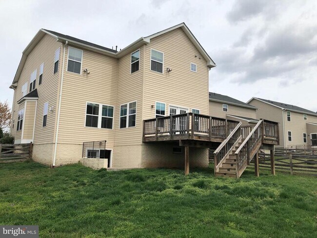
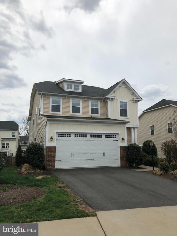
42007 Powells Farm Way
Aldie, VA 20105
Favorites
703-314-4799
-
Bedrooms
4
-
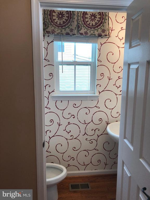
Bathrooms
3.5
-
Square Feet
3,831 sq ft
-
Available
Available May 18
Highlights
- Fireplace
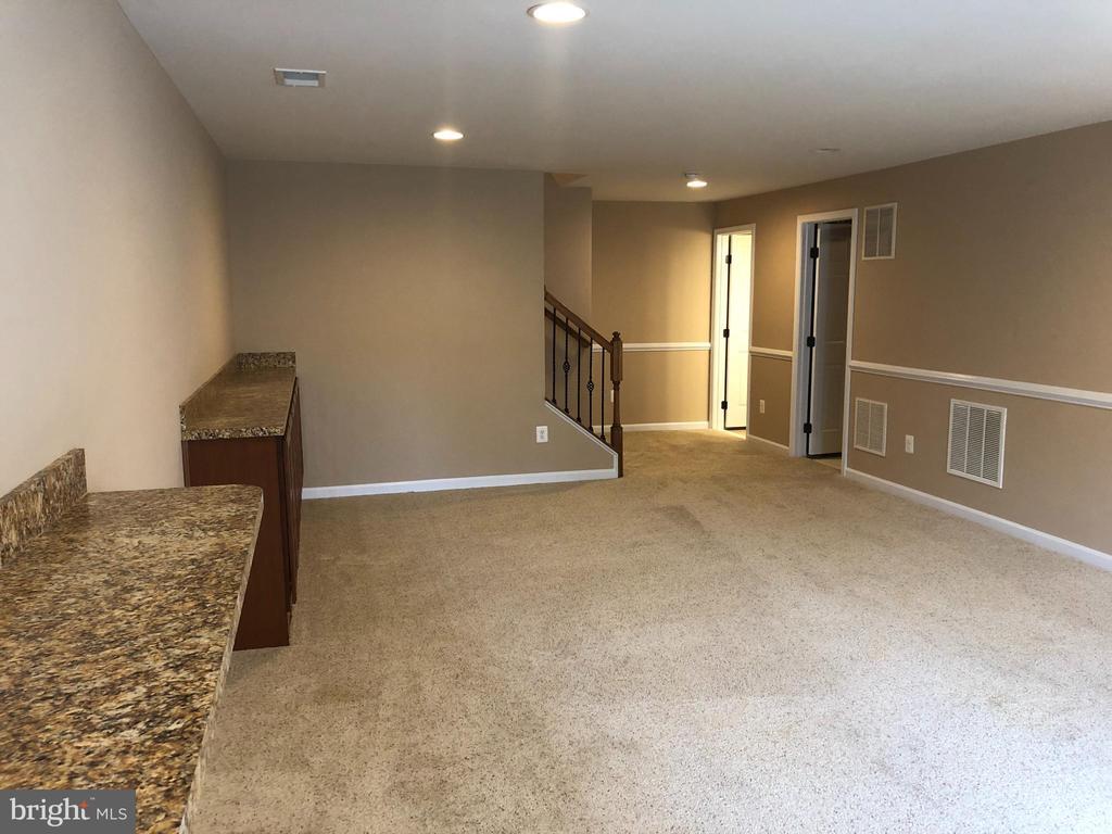
- Basement
42007 Powells Farm Way

Favorites
42007 Powells Farm Way is a house located in Loudoun County and the 20105 ZIP Code. This area is served by the Loudoun County Public Schools attendance zone.
* Price shown is total price based on community-supplied monthly required fees. Excludes user-selected optional fees and variable or usage-based fees and required charges due at or prior to move-in or at move-out. Price, availability, fees, and any applicable rent special are subject to change without notice.
* Square footage definitions vary. Displayed square footage is approximate.
House Features
- Fireplace
- Dishwasher
- Basement
Contact
- Listed by Arun K Sareen | Sareen Realty, Inc.
- Phone Number
- Contact
-
Source
 Bright MLS, Inc.
Copyright © 2026 Bright MLS, Inc.
Location
Get Directions
Aldie is a historic community in the mountains, roughly 38 miles northwest of Downtown Washington, DC. It is situated along a bend in the Little River in a gap between the Bull Run and Catoctin Mountains. The community dates back to 1765, when James and George Mercer built a tub mill here. That mill was later replaced by the current mill, built by James’ son Charles in 1803. The mill and its outbuildings still stand as part of Aldie Mill Historic Park. Charles built a house across from the mill and named it for his ancestral home in Scotland, Aldie Castle.
Aldie’s history continued into the Civil War, when it was the site of the Battle of Aldie. As a result, you’ll find several historical markers in Aldie. Since the area stayed relatively rural, the mill has remained untouched and is one of the state’s best-preserved mills, complete with its original machinery. Be sure to visit the Aldie Mill Historic District to experience this step back in time.
Learn more about living in Aldie
Amenities
- Fireplace
- Dishwasher
- Basement
Education
| Colleges & Universities | Distance | ||
|---|---|---|---|
| Colleges & Universities | Distance | ||
| Drive: | 16 min | 8.7 mi | |
| Drive: | 26 min | 13.0 mi | |
| Drive: | 28 min | 15.1 mi | |
| Drive: | 29 min | 15.8 mi |
42007 Powells Farm Way is within 16 minutes or 8.7 miles from NOVA, Manassas Campus. It is also near George Mason Univ., PWC and George Mason University.
Schools


Public Elementary School
Grades PK-5
815 Students
Attendance Zone
Public Middle School
Grades 6-8
1,587 Students
Attendance Zone
Public High School
Grades 9-12
1,771 Students
Attendance Zone
Private Elementary School
Grades PK-5
37 Students
Nearby
Private Elementary & Middle School
Grades K-8
55 Students
Nearby
Private High School
Grades 9-12
1,094 Students
Nearby
School data provided by
 The GreatSchools Rating helps parents compare schools within a state based on a variety of school quality indicators and provides a helpful picture of how effectively each school serves all of its students. Ratings are on a scale of 1 (below average) to 10 (above average) and can include test scores, college readiness, academic progress, advanced courses, equity, discipline and attendance data. We also advise parents to visit schools, consider other information on school performance and programs, and consider family needs as part of the school selection process.
View GreatSchools Rating Methodology
Data provided by GreatSchools.org © 2026. All rights reserved.
View GreatSchools Rating Methodology
Data provided by GreatSchools.org © 2026. All rights reserved.
Transportation options available in Aldie include Loudoun Gateway, Silver Line Center Platform, located 10.3 miles from 42007 Powells Farm Way. 42007 Powells Farm Way is near Washington Dulles International, located 13.0 miles or 26 minutes away, and Ronald Reagan Washington Ntl, located 35.2 miles or 54 minutes away.
| Transit / Subway | Distance | ||
|---|---|---|---|
| Transit / Subway | Distance | ||
| Drive: | 18 min | 10.3 mi | |
| Drive: | 18 min | 10.3 mi | |
| Drive: | 23 min | 12.9 mi | |
| Drive: | 27 min | 15.4 mi | |
| Drive: | 28 min | 17.3 mi |
| Commuter Rail | Distance | ||
|---|---|---|---|
| Commuter Rail | Distance | ||
|
|
Drive: | 26 min | 13.3 mi |
|
|
Drive: | 28 min | 14.9 mi |
|
|
Drive: | 38 min | 22.0 mi |
|
|
Drive: | 49 min | 29.2 mi |
|
|
Drive: | 48 min | 29.4 mi |
| Airports | Distance | ||
|---|---|---|---|
| Airports | Distance | ||
|
Washington Dulles International
|
Drive: | 26 min | 13.0 mi |
|
Ronald Reagan Washington Ntl
|
Drive: | 54 min | 35.2 mi |
Getting Around
 What do Walkability, Transit, Drivability, and Bikeability mean?
Walkability measures the walking distance to day-to-day needs.
Transit measures access to public transportation.
Drivability measures congestion, parking availability, and access to major roads.
Bikeability measures the suitability for cycling.
How It Works
What do Walkability, Transit, Drivability, and Bikeability mean?
Walkability measures the walking distance to day-to-day needs.
Transit measures access to public transportation.
Drivability measures congestion, parking availability, and access to major roads.
Bikeability measures the suitability for cycling.
How It Works
Somewhat Walkable
Walkability
20
/ 100
Minimal Public Transit
Transit
0
/ 100
Very Drivable
Drivability
80
/ 100
Fairly Bikeable
Bikeability
40
/ 100
Scores provided by
-
Soundscore™
-
/ 100
Traffic
-Airport
-Businesses
-Scores provided by
HowLoud What is a Sound Score Rating? A Sound Score Rating aggregates noise caused by vehicle traffic, airplane traffic and local sources. How It WorksTime and distance from 42007 Powells Farm Way.
| Shopping Centers | Distance | ||
|---|---|---|---|
| Shopping Centers | Distance | ||
| Drive: | 5 min | 2.3 mi | |
| Drive: | 7 min | 3.0 mi | |
| Drive: | 7 min | 3.1 mi |
42007 Powells Farm Way has 3 shopping centers within 3.1 miles, which is about a 7-minute drive. The miles and minutes will be for the farthest away property.
| Parks and Recreation | Distance | ||
|---|---|---|---|
| Parks and Recreation | Distance | ||
|
Gilbert's Corner Regional Park
|
Drive: | 12 min | 7.0 mi |
|
Aldie Mill Historic Park
|
Drive: | 16 min | 8.4 mi |
|
Manassas National Battlefield Park
|
Drive: | 17 min | 10.0 mi |
|
Ellanor C. Lawrence Park
|
Drive: | 22 min | 11.1 mi |
|
Steven F. Udvar-Hazy Center
|
Drive: | 21 min | 11.4 mi |
42007 Powells Farm Way has 5 parks within 11.4 miles, including Gilbert's Corner Regional Park, Aldie Mill Historic Park, and Manassas National Battlefield Park.
| Hospitals | Distance | ||
|---|---|---|---|
| Hospitals | Distance | ||
| Drive: | 6 min | 3.2 mi | |
| Drive: | 21 min | 12.2 mi | |
| Drive: | 22 min | 13.3 mi |
42007 Powells Farm Way has 3 hospitals within 13.3 miles, the nearest is Stonesprings Hospital Center which is 3.2 miles away and a 6 minute drive.
| Military Bases | Distance | ||
|---|---|---|---|
| Military Bases | Distance | ||
| Drive: | 35 min | 19.1 mi | |
| Drive: | 65 min | 29.9 mi | |
| Drive: | 73 min | 34.1 mi |
42007 Powells Farm Way has 3 military bases within 34.1 miles, the nearest is Vint Hill Farms Station which is 19.1 miles away and a 35 minute drive.
You May Also Like
Similar Rentals Nearby
-
-

-

-
 4 Beds$3,862Total Monthly PriceTotal Monthly Price NewPrices include required monthly fees of $61.Base Rent:4 Beds$3,800House for Rent
 -

-
 4 Beds$2,762Total Monthly PriceTotal Monthly Price NewPrices include required monthly fees of $61.Base Rent:4 Beds$2,700House for Rent
 -
 4 Beds, 3 Baths, 1,816 sq ft$4,500Total Monthly PriceTotal Monthly Price NewPrices include all required monthly fees.4005 Lees Corner Rd
 -
 5 Beds, 5 Baths, 6,372 sq ft$6,500Total Monthly PriceTotal Monthly Price NewPrices include all required monthly fees.2527 Hunter Mill Rd
 -
 7 Beds, 8 Baths, 8,469 sq ft$15,000Total Monthly PriceTotal Monthly Price NewPrices include all required monthly fees.9864 Walker Glen Ct
 -
 4 Beds, 3 Baths, 1,587 sq ft$4,195Total Monthly PriceTotal Monthly Price NewPrices include all required monthly fees.615 Kearney Ct SW
What Are Walk Score®, Transit Score®, and Bike Score® Ratings?
Walk Score® measures the walkability of any address. Transit Score® measures access to public transit. Bike Score® measures the bikeability of any address.
What is a Sound Score Rating?
A Sound Score Rating aggregates noise caused by vehicle traffic, airplane traffic and local sources.

42007 Powells Farm Way
Aldie, VA 20105