
$3,000 / Month
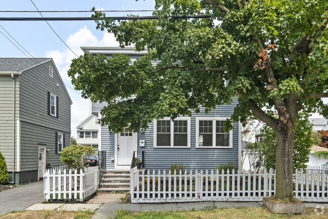
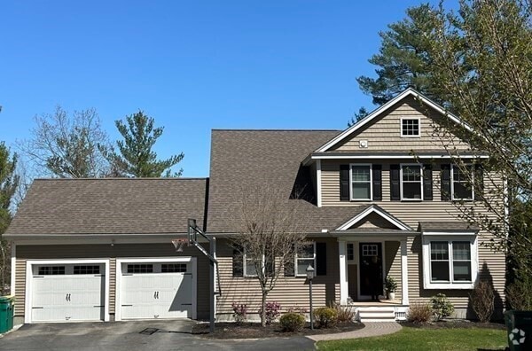
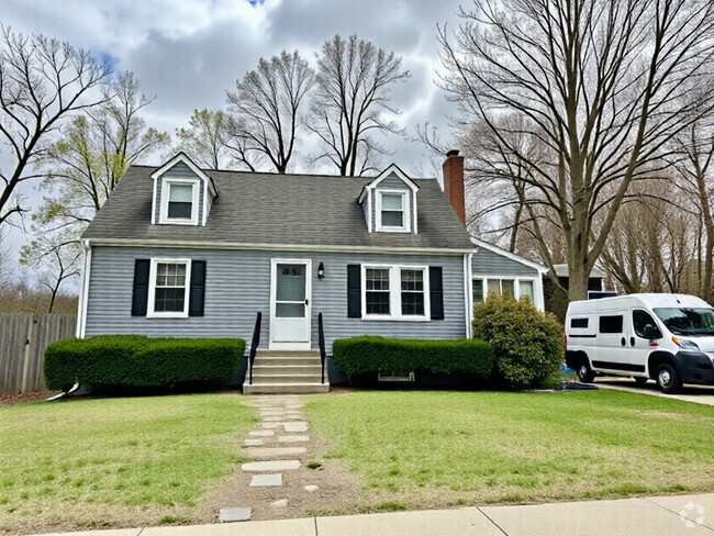
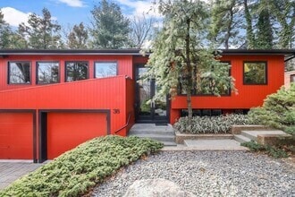
42 Mountain
Weston, MA 02493
2 Weeks Ago
Favorites
42 Mountain

Favorites
Check Back Soon for Upcoming Availability
| Beds | Baths | Average SF |
|---|---|---|
| 3 Bedrooms 3 Bedrooms 3 Br | 1 Bath 1 Bath 1 Ba | 1,074 SF |
Fees and Policies
The fees below are based on community-supplied data and may exclude additional fees and utilities.
- Dogs Allowed
-
Fees not specified
- Cats Allowed
-
Fees not specified
About This Property
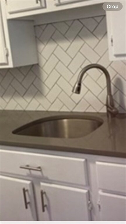
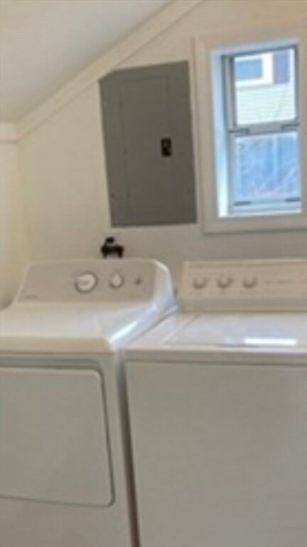
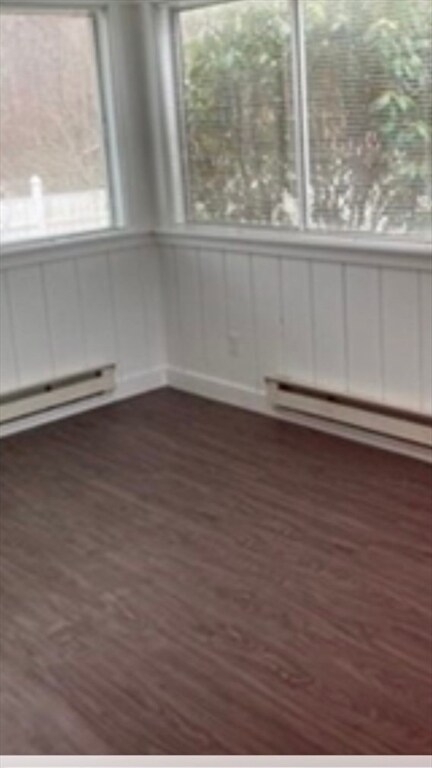
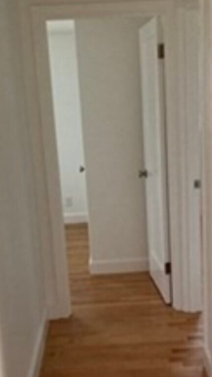
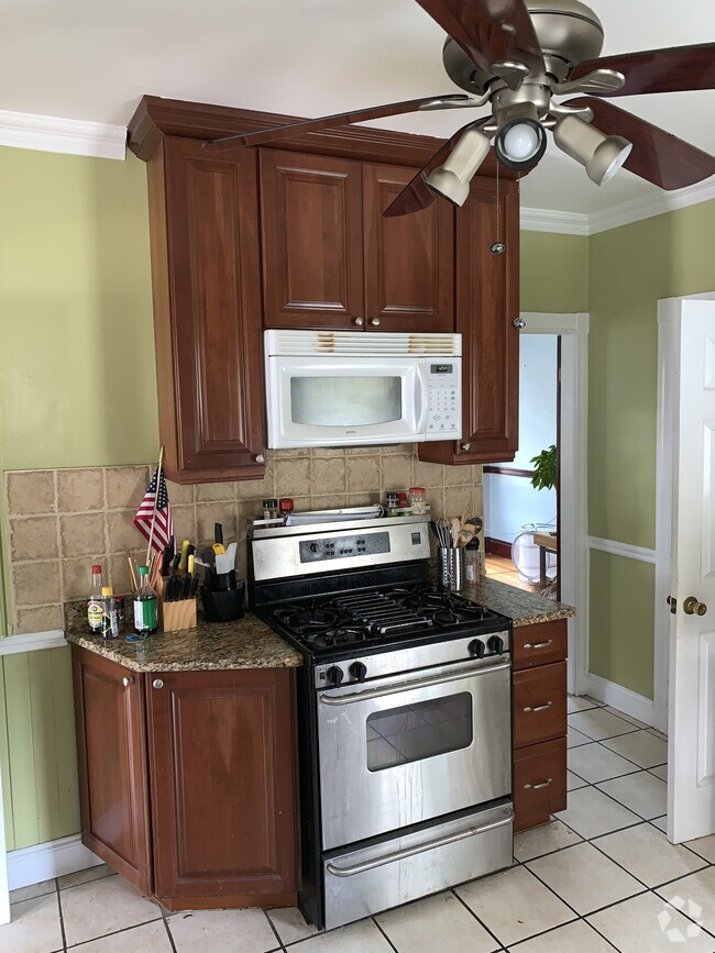
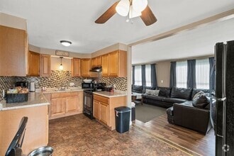
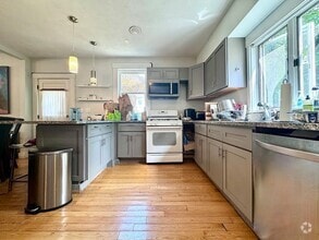
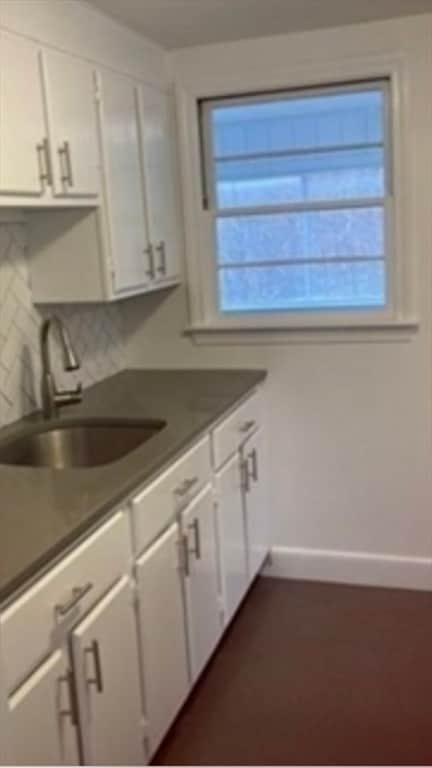
A cozy and comfortable single family home. Enjoy the privacy of a single family home and the convenience of one level living space. Freshly painted and newer updates include white cabinets,hardwood flooring in living,dining and bedrooms. Heated sunroom. Separate laundry area. Large yard to enjoy outdoor entertaining,gardening and relaxing. Situated close to Route 2. Occupancy only-heat,electric,water and cable are the responsibility of the tenant. No pets please.
42 Mountain is a house located in Middlesex County and the 02493 ZIP Code. This area is served by the Weston attendance zone.
Location
Get Directions
Just west of Boston and East of Worcester sits Metro West, a region that houses a group of towns and cities with significant historical backgrounds. A total of 19 municipalities make up the core of this community, but other municipalities are considered to be a part of the Interstate 495/Metro West Corridor.
Learn more about living in Metro WestBelow are rent ranges for similar nearby apartments
| Beds | Average Size | Lowest | Typical | Premium |
|---|---|---|---|---|
| Studio Studio Studio | 519-522 Sq Ft | $895 | $2,482 | $7,552 |
| 1 Bed 1 Bed 1 Bed | 829-831 Sq Ft | $1,495 | $3,041 | $10,326 |
| 2 Beds 2 Beds 2 Beds | 1213-1216 Sq Ft | $2,000 | $3,706 | $15,765 |
| 3 Beds 3 Beds 3 Beds | 1661-1666 Sq Ft | $1,550 | $4,828 | $23,065 |
| 4 Beds 4 Beds 4 Beds | 3354 Sq Ft | $1,050 | $6,603 | $20,000 |
Education
| Colleges & Universities | Distance | ||
|---|---|---|---|
| Colleges & Universities | Distance | ||
| Drive: | 10 min | 4.1 mi | |
| Drive: | 11 min | 5.2 mi | |
| Drive: | 16 min | 7.2 mi | |
| Drive: | 16 min | 8.2 mi |
42 Mountain is within 10 minutes or 4.1 miles from Brandeis University. It is also near Bentley University and Babson College.
Schools


Public Elementary School
Grades 4-5
266 Students
Attendance Zone
Public Elementary School
Grades PK-3
320 Students
Attendance Zone
Public Middle School
Grades 6-8
444 Students
Attendance Zone
Public High School
Grades 9-12
639 Students
Attendance Zone
Private Elementary & Middle School
Grades PK-8
320 Students
Nearby
Private Elementary, Middle & High School
Grades 3-12
107 Students
Nearby
School data provided by
 The GreatSchools Rating helps parents compare schools within a state based on a variety of school quality indicators and provides a helpful picture of how effectively each school serves all of its students. Ratings are on a scale of 1 (below average) to 10 (above average) and can include test scores, college readiness, academic progress, advanced courses, equity, discipline and attendance data. We also advise parents to visit schools, consider other information on school performance and programs, and consider family needs as part of the school selection process.
View GreatSchools Rating Methodology
View GreatSchools Rating Methodology
Transportation options available in Weston include Riverside, located 5.2 miles from 42 Mountain. 42 Mountain is near General Edward Lawrence Logan International, located 18.2 miles or 30 minutes away, and Worcester Regional, located 35.6 miles or 56 minutes away.
| Transit / Subway | Distance | ||
|---|---|---|---|
| Transit / Subway | Distance | ||
|
|
Drive: | 10 min | 5.2 mi |
|
|
Drive: | 10 min | 5.7 mi |
|
|
Drive: | 11 min | 6.4 mi |
|
|
Drive: | 14 min | 8.0 mi |
|
|
Drive: | 14 min | 8.2 mi |
| Commuter Rail | Distance | ||
|---|---|---|---|
| Commuter Rail | Distance | ||
|
|
Drive: | 3 min | 1.5 mi |
| Drive: | 6 min | 2.3 mi | |
| Drive: | 8 min | 3.9 mi | |
|
|
Drive: | 8 min | 4.0 mi |
|
|
Drive: | 19 min | 10.6 mi |
| Airports | Distance | ||
|---|---|---|---|
| Airports | Distance | ||
|
General Edward Lawrence Logan International
|
Drive: | 30 min | 18.2 mi |
|
Worcester Regional
|
Drive: | 56 min | 35.6 mi |
Time and distance from 42 Mountain.
| Shopping Centers | Distance | ||
|---|---|---|---|
| Shopping Centers | Distance | ||
| Drive: | 6 min | 3.0 mi | |
| Drive: | 7 min | 3.1 mi | |
| Drive: | 8 min | 3.6 mi |
42 Mountain has 3 shopping centers within 3.6 miles, which is about a 8-minute drive. The miles and minutes will be for the farthest away property.
| Parks and Recreation | Distance | ||
|---|---|---|---|
| Parks and Recreation | Distance | ||
|
Land's Sake Farm
|
Walk: | 17 min | 0.9 mi |
|
Hamlen Woods
|
Drive: | 7 min | 3.7 mi |
|
Greenways Conservation Area
|
Drive: | 7 min | 3.7 mi |
|
Hazel Brook Conservation Area
|
Drive: | 8 min | 3.8 mi |
|
Upper Mill Brook Conservation Area
|
Drive: | 7 min | 4.2 mi |
42 Mountain has 5 parks within 4.2 miles, including Land's Sake Farm, Hazel Brook Conservation Area, and Hamlen Woods.
| Hospitals | Distance | ||
|---|---|---|---|
| Hospitals | Distance | ||
| Drive: | 7 min | 3.4 mi | |
| Drive: | 9 min | 5.4 mi | |
| Drive: | 12 min | 6.3 mi |
42 Mountain has 3 hospitals within 6.3 miles, the nearest is Walden Behavioral Care which is 3.4 miles away and a 7 minute drive.
| Military Bases | Distance | ||
|---|---|---|---|
| Military Bases | Distance | ||
| Drive: | 13 min | 7.7 mi | |
| Drive: | 18 min | 9.0 mi |
42 Mountain is 7.7 miles from US Military Reservation, and is convenient to other military bases, including Hanscom Air Force Base.
You May Also Like
Similar Rentals Nearby
What Are Walk Score®, Transit Score®, and Bike Score® Ratings?
Walk Score® measures the walkability of any address. Transit Score® measures access to public transit. Bike Score® measures the bikeability of any address.
What is a Sound Score Rating?
A Sound Score Rating aggregates noise caused by vehicle traffic, airplane traffic and local sources
42 Mountain
Weston, MA 02493