
$3,175
/ Month
4146 Clarinbridge Cir
Dublin, CA 94568
Today
|
Edit
Favorites
925-980-2665
-
Bedrooms
2
-
Bathrooms
2
-
Square Feet
1,420 sq ft
-
Available
Available Jan 19
4146 Clarinbridge Cir

Favorites
About This Home
Available Jan 19
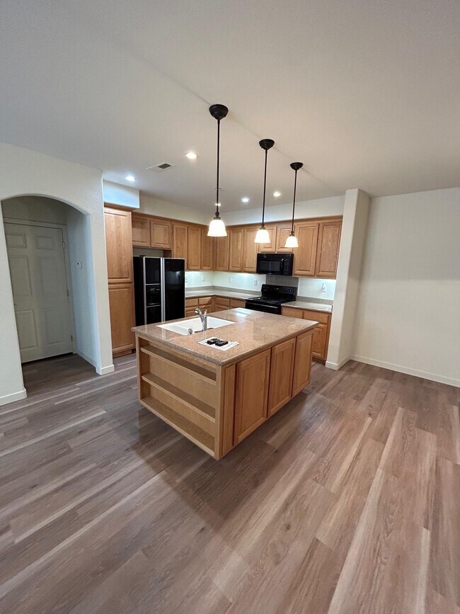
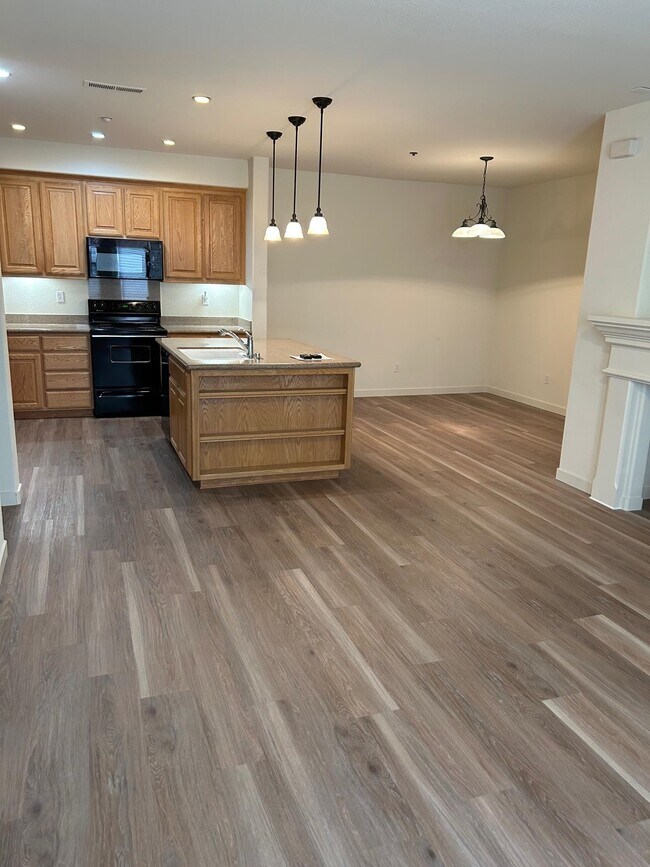
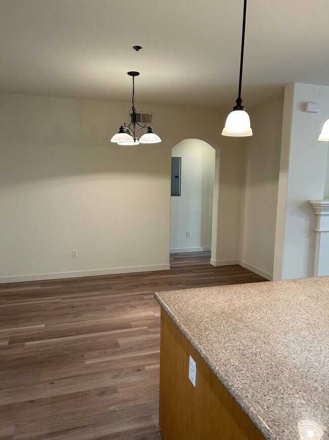
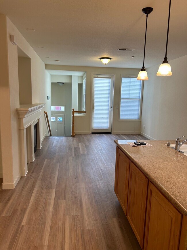
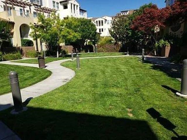
Classy executive living offering 2 master suites with luxury vinyl flooring. 2 full baths. 1420 sqft Big bright kitchen with granite counter tops and tons of storage Central heat and a/c 2 car garage Washer and dryer in unit Community pool and Gym Close to shopping,Bart and easy freeway access Come see all the amenities Dublin has to offer Pets allowed with size,breed and number restrictions Apply with RentSpree
4146 Clarinbridge Cir is a townhome located in Alameda County and the 94568 ZIP Code. This area is served by the Dublin Unified attendance zone.
* Price shown is base rent. Excludes user-selected optional fees and variable or usage-based fees and required charges due at or prior to move-in or at move-out. Price, availability, fees, and any applicable rent special are subject to change without notice.
* Square footage definitions vary. Displayed square footage is approximate.
Contact
- Listed by John Logerfo | Prestige Real Estate Srvcs
- Phone Number
- Contact
-
Source
 Bay East Association of REALTORS ®
Copyright© 2026 Bay East, Contra Costa, bridgeMLS. All rights reserved. All information provided by the listing agent/broker is deemed reliable but is not guaranteed and should be independently verified.
Location
Get Directions
The cities of Livermore, Dublin and Pleasanton form a loosely shaped triangle within California's Tri-Valley region, a cluster of three small valleys about 33 miles east of San Francisco and 35 miles northeast of San Jose. Known for its Mediterranean climate, rolling hills and historic vineyards, this once bucolic region now boasts three separate downtown areas, a bustling business community and some of the best wineries in the state.
At the eastern end of the region lies the city of Livermore. Once known as Livermores, Livermore Ranch and Nottingham, the city sits at the center of Livermore Valley, a historic region dotted with more than 5,000 acres of mostly family-owned vineyards. A pastoral neighborhood known for its charming yet functional hilltop windmills, Livermore hosts the internationally recognized and sometimes controversial center of scientific research, Lawrence Livermore National Laboratories.
Learn more about living in Dublin/Pleasanton/Livermore
Education
| Colleges & Universities | Distance | ||
|---|---|---|---|
| Colleges & Universities | Distance | ||
| Drive: | 11 min | 6.3 mi | |
| Drive: | 12 min | 6.6 mi | |
| Drive: | 24 min | 15.9 mi | |
| Drive: | 25 min | 18.2 mi |
4146 Clarinbridge Cir is within 12 minutes or 6.6 miles from Diablo Valley Coll, San Ramon. It is also near Las Positas College and Cal State East Bay.
Schools


Public Elementary School
Grades K-5
679 Students
Attendance Zone
Public Elementary School
Grades K-5
497 Students
Nearby
Public Middle School
Grades 6-8
1,590 Students
Attendance Zone
Public High School
Grades 9-12
2,665 Students
Nearby
Private Elementary & Middle School
Grades PK & 1-8
11 Students
Nearby
Private Elementary, Middle & High School
Grades K-12
673 Students
Nearby
Private Elementary School
Grades PK-6
Nearby
School data provided by
 The GreatSchools Rating helps parents compare schools within a state based on a variety of school quality indicators and provides a helpful picture of how effectively each school serves all of its students. Ratings are on a scale of 1 (below average) to 10 (above average) and can include test scores, college readiness, academic progress, advanced courses, equity, discipline and attendance data. We also advise parents to visit schools, consider other information on school performance and programs, and consider family needs as part of the school selection process.
View GreatSchools Rating Methodology
Data provided by GreatSchools.org © 2026. All rights reserved.
View GreatSchools Rating Methodology
Data provided by GreatSchools.org © 2026. All rights reserved.
Transportation options available in Dublin include Dublin Pleasanton Station, located 3.4 miles from 4146 Clarinbridge Cir. 4146 Clarinbridge Cir is near Metro Oakland International, located 22.2 miles or 29 minutes away, and Norman Y Mineta San Jose International, located 33.1 miles or 43 minutes away.
| Transit / Subway | Distance | ||
|---|---|---|---|
| Transit / Subway | Distance | ||
|
|
Drive: | 5 min | 3.4 mi |
|
|
Drive: | 5 min | 3.8 mi |
| Commuter Rail | Distance | ||
|---|---|---|---|
| Commuter Rail | Distance | ||
| Drive: | 11 min | 4.3 mi | |
| Drive: | 11 min | 4.4 mi | |
| Drive: | 12 min | 7.6 mi | |
| Drive: | 12 min | 7.8 mi | |
| Drive: | 14 min | 10.4 mi |
| Airports | Distance | ||
|---|---|---|---|
| Airports | Distance | ||
|
Metro Oakland International
|
Drive: | 29 min | 22.2 mi |
|
Norman Y Mineta San Jose International
|
Drive: | 43 min | 33.1 mi |
Time and distance from 4146 Clarinbridge Cir.
| Shopping Centers | Distance | ||
|---|---|---|---|
| Shopping Centers | Distance | ||
| Walk: | 7 min | 0.4 mi | |
| Walk: | 8 min | 0.5 mi | |
| Walk: | 10 min | 0.6 mi |
4146 Clarinbridge Cir has 3 shopping centers within 0.6 mile, which is about a 10-minute walk. The miles and minutes will be for the farthest away property.
| Parks and Recreation | Distance | ||
|---|---|---|---|
| Parks and Recreation | Distance | ||
|
Shadow Cliffs Regional Recreation Area
|
Drive: | 12 min | 4.8 mi |
|
Dublin Hills Regional Parks
|
Drive: | 16 min | 6.8 mi |
|
Bishop Ranch Regional Preserve
|
Drive: | 14 min | 9.3 mi |
|
Pleasanton Ridge Regional Park
|
Drive: | 19 min | 12.9 mi |
|
Los Vaqueros Watershed
|
Drive: | 21 min | 14.2 mi |
4146 Clarinbridge Cir has 5 parks within 14.2 miles, including Shadow Cliffs Regional Recreation Area, Dublin Hills Regional Parks, and Bishop Ranch Regional Preserve.
| Hospitals | Distance | ||
|---|---|---|---|
| Hospitals | Distance | ||
| Drive: | 3 min | 1.6 mi | |
| Drive: | 15 min | 10.5 mi |
4146 Clarinbridge Cir is 1.6 miles from Stanford Health Care - ValleyCare, and is convenient to other hospitals, including San Ramon Regional Medical Center.
You May Also Like
Similar Rentals Nearby


")


What Are Walk Score®, Transit Score®, and Bike Score® Ratings?
Walk Score® measures the walkability of any address. Transit Score® measures access to public transit. Bike Score® measures the bikeability of any address.
What is a Sound Score Rating?
A Sound Score Rating aggregates noise caused by vehicle traffic, airplane traffic and local sources
4146 Clarinbridge Cir
Dublin, CA 94568