
$7,800
/ Month
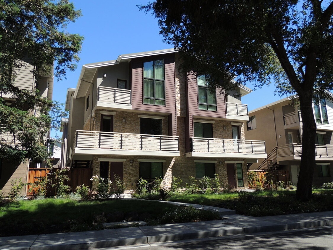
412 Cole Ct
Palo Alto, CA 94306
Today
|
Edit
Favorites
669-271-4225
-
Bedrooms
4
-
Bathrooms
3.5
-
Square Feet
2,120 sq ft
-
Available
Available Now
412 Cole Ct

Favorites
About This Home
$7,800 deposit,
Available Now
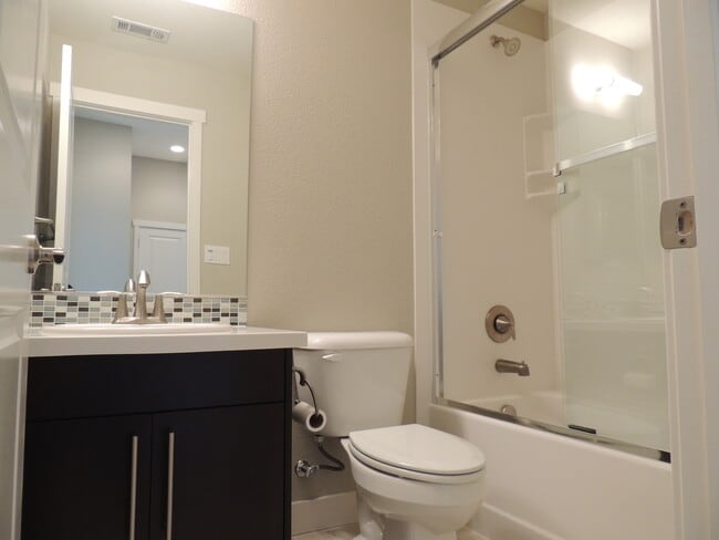
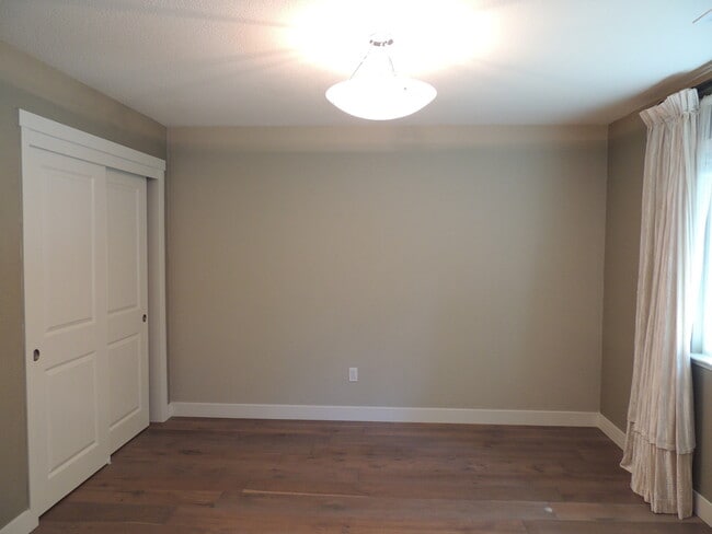
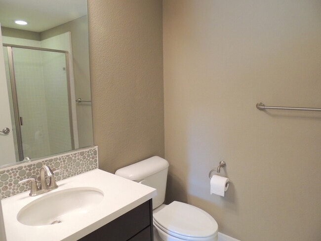
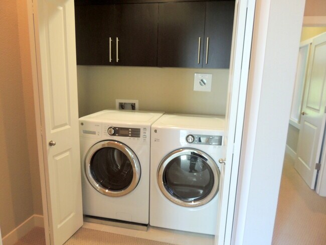
Fabulous duet home built in 2014. Designer high-end upgrades with a spacious living room. Large dining area and Gourmet kitchen with stainless steel appliances. Hardwood floors throughout and upgraded carpet. One block to El Camino Real for easy access to Palo Alto shopping and dining and San Antonio Center. Excellent Los Altos schools! This home has the most convenient access to everything you want and need! • Easy access to El Camino Real • Short walk to shopping, restaurants, 24 Hour Fitness, The Village at San Antonio Center • Short drive to private clubs: University Club of Palo Alto, Foothills Tennis, and Swimming Club Award Winning Schools: • Santa Rita Elementary, Egan Middle, Los Altos High (verify schools and availability with District) This 4-bedroom, 3.5 bathrooms, 2,120sqft. duet home offers: • Hardwood floors. • Kitchen with contemporary cabinetry and granite slab countertops. • Large Master Bedroom w/ floor to ceiling windows and private patio • Luxurious Master Bath w/ double sinks and large soaking tub • Upstairs laundry w/ deluxe washer & dryer • Downstairs bedroom w/ private bathroom • Attached 2 car garage This unit is Available October 10, 2025! Qualifications include: • Deposit: One-month Rent • Application Fee: $45.00 • Minimum Income: 2x's the monthly rent
412 Cole Ct is a house located in Santa Clara County and the 94306 ZIP Code. This area is served by the Los Altos Elementary attendance zone.
* Price shown is base rent. Excludes user-selected optional fees and variable or usage-based fees and required charges due at or prior to move-in or at move-out. Price, availability, fees, and any applicable rent special are subject to change without notice.
* Square footage definitions vary. Displayed square footage is approximate.
Fees and Policies
The fees below are based on community-supplied data and may exclude additional fees and utilities.
- One-Time Basics
- Due at Move-In
- Security Deposit - Refundable$7,800
- Due at Move-In
Property Fee Disclaimer: Based on community-supplied data and independent market research. Subject to change without notice. May exclude fees for mandatory or optional services and usage-based utilities.
Contact
- Listed by Pacific Gateway Properties, Inc. | Pacific Gateway Properties, Inc.
- Phone Number
- Contact
Location
Get Directions
Living in Palo Alto places you in Silicon Valley, where historic neighborhoods complement the city's technological presence. Tree-lined streets wind through the community, which is anchored by Stanford University. University Avenue features local boutiques and restaurants housed in preserved historic buildings, while the Stanford Shopping Center offers high-end retail destinations. The city maintains 36 parks and preserves, including the Baylands Nature Preserve and Foothills Park, where residents enjoy hiking trails and outdoor activities. Palo Alto's infrastructure supports alternative transportation, with dedicated bike lanes throughout the city.
The rental market in Palo Alto reflects the area's popularity, with current average rents ranging from $2,634 for studios to $6,139 for four-bedroom homes. Recent trends show steady growth, with rent increases varying from 1.8% to 17% across different unit sizes over the past year.
Learn more about living in Palo Alto
Education
| Colleges & Universities | Distance | ||
|---|---|---|---|
| Colleges & Universities | Distance | ||
| Drive: | 6 min | 1.9 mi | |
| Drive: | 9 min | 3.6 mi | |
| Drive: | 10 min | 4.1 mi | |
| Drive: | 14 min | 5.8 mi |
412 Cole Ct is within 6 minutes or 1.9 miles from Foothill College, Middlefield. It is also near Stanford University and Foothill Coll., Los Altos.
Schools


Public Elementary School
Grades K-5
367 Students
Nearby
Public Elementary School
Grades K-6
385 Students
Attendance Zone
Public Middle School
Grades 7-8
497 Students
Attendance Zone
Public High School
Grades 9-12
2,141 Students
Attendance Zone
Private Elementary, Middle & High School
Grades K-12
Nearby
Private Elementary School
Grades PK-5
Nearby
Private Elementary & Middle School
Grades K-8
268 Students
Nearby
School data provided by
 The GreatSchools Rating helps parents compare schools within a state based on a variety of school quality indicators and provides a helpful picture of how effectively each school serves all of its students. Ratings are on a scale of 1 (below average) to 10 (above average) and can include test scores, college readiness, academic progress, advanced courses, equity, discipline and attendance data. We also advise parents to visit schools, consider other information on school performance and programs, and consider family needs as part of the school selection process.
View GreatSchools Rating Methodology
Data provided by GreatSchools.org © 2025. All rights reserved.
View GreatSchools Rating Methodology
Data provided by GreatSchools.org © 2025. All rights reserved.
Transportation options available in Palo Alto include Mountain View Station, located 2.8 miles from 412 Cole Ct. 412 Cole Ct is near Norman Y Mineta San Jose International, located 12.3 miles or 20 minutes away, and San Francisco International, located 24.6 miles or 34 minutes away.
| Transit / Subway | Distance | ||
|---|---|---|---|
| Transit / Subway | Distance | ||
| Drive: | 6 min | 2.8 mi | |
|
|
Drive: | 6 min | 2.8 mi |
|
|
Drive: | 9 min | 4.1 mi |
| Drive: | 10 min | 4.7 mi | |
|
|
Drive: | 10 min | 4.7 mi |
| Commuter Rail | Distance | ||
|---|---|---|---|
| Commuter Rail | Distance | ||
| Walk: | 20 min | 1.1 mi | |
| Drive: | 6 min | 2.4 mi | |
| Drive: | 6 min | 2.7 mi | |
| Drive: | 8 min | 3.1 mi | |
| Drive: | 9 min | 3.3 mi |
| Airports | Distance | ||
|---|---|---|---|
| Airports | Distance | ||
|
Norman Y Mineta San Jose International
|
Drive: | 20 min | 12.3 mi |
|
San Francisco International
|
Drive: | 34 min | 24.6 mi |
Time and distance from 412 Cole Ct.
| Shopping Centers | Distance | ||
|---|---|---|---|
| Shopping Centers | Distance | ||
| Walk: | 2 min | 0.1 mi | |
| Walk: | 10 min | 0.6 mi | |
| Walk: | 14 min | 0.7 mi |
412 Cole Ct has 3 shopping centers within 0.7 mile, which is about a 14-minute walk. The miles and minutes will be for the farthest away property.
| Parks and Recreation | Distance | ||
|---|---|---|---|
| Parks and Recreation | Distance | ||
|
Terman Park
|
Drive: | 3 min | 1.2 mi |
|
J. Pearce Mitchell Park
|
Drive: | 6 min | 1.8 mi |
|
Bol Park
|
Drive: | 5 min | 2.0 mi |
|
Esther Clark Nature Preserve
|
Drive: | 6 min | 2.2 mi |
|
Redwood Grove
|
Drive: | 7 min | 3.0 mi |
412 Cole Ct has 5 parks within 3.0 miles, including Terman Park, J. Pearce Mitchell Park, and Bol Park.
| Hospitals | Distance | ||
|---|---|---|---|
| Hospitals | Distance | ||
| Drive: | 9 min | 3.9 mi | |
| Drive: | 10 min | 4.3 mi | |
| Drive: | 12 min | 4.8 mi |
412 Cole Ct has 3 hospitals within 4.8 miles, the nearest is El Camino Hospital which is 3.9 miles away and a 9 minute drive.
| Military Bases | Distance | ||
|---|---|---|---|
| Military Bases | Distance | ||
| Drive: | 13 min | 5.1 mi |
412 Cole Ct is 5.1 miles and a 13 minute drive from Ames Research Center.
You May Also Like
Similar Rentals Nearby


What Are Walk Score®, Transit Score®, and Bike Score® Ratings?
Walk Score® measures the walkability of any address. Transit Score® measures access to public transit. Bike Score® measures the bikeability of any address.
What is a Sound Score Rating?
A Sound Score Rating aggregates noise caused by vehicle traffic, airplane traffic and local sources

412 Cole Ct
Palo Alto, CA 94306