
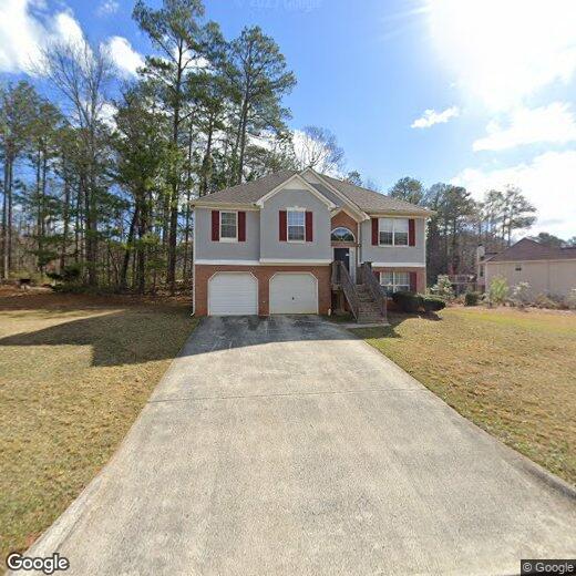
4110 Sweetsprings Ter SW
4110 Sweetsprings Ter SW
Powder Springs, GA 30127
2 Weeks Ago
|
Edit
Favorites
4110 Sweetsprings Ter SW

Favorites
Check Back Soon for Upcoming Availability
| Beds | Baths | Average SF |
|---|---|---|
| 4 Bedrooms 4 Bedrooms 4 Br | 3 Baths 3 Baths 3 Ba | — |
4110 Sweetsprings Ter SW,
Powder Springs,
GA
30127
Powder Springs is a suburban city located about ten miles southwest of Marietta and twenty miles northwest of Downtown Atlanta. Largely thanks to its prime location and fairly affordable rental market (largely composed of single-family homes), Powder Springs has become a highly popular home base among Atlanta-area commuters. Families in particular have been drawn by the area’s high-performing schools and classic small-town vibe.
Apart from a few small shopping centers, the city proper is almost entirely residential, although a large retail cluster sits on the northwest corner of town along Wendy Bagwell Parkway. Folks who appreciate the tranquility of the countryside will love the pastoral landscape surrounding Powder Springs, with lush nature preserves like Kennesaw Mountain and Sweetwater Creek just minutes away.
Learn more about living in Powder Springs
Education
| Colleges & Universities | Distance | ||
|---|---|---|---|
| Colleges & Universities | Distance | ||
| Drive: | 14 min | 6.1 mi | |
| Drive: | 21 min | 12.7 mi | |
| Drive: | 27 min | 14.3 mi | |
| Drive: | 32 min | 16.4 mi |
4110 Sweetsprings Ter SW is within 14 minutes or 6.1 miles from Chatt. Tech, Austell. It is also near Chatt. Tech, Paulding and Chatt. Tech, Marietta.
Walkability Near 4110 Sweetsprings Ter SW Powder Springs, GA 30127
Getting Around
 What do Walkability, Transit, Drivability, and Bikeability mean?
Walkability measures the walking distance to day-to-day needs.
Transit measures access to public transportation.
Drivability measures congestion, parking availability, and access to major roads.
Bikeability measures the suitability for cycling.
How It Works
What do Walkability, Transit, Drivability, and Bikeability mean?
Walkability measures the walking distance to day-to-day needs.
Transit measures access to public transportation.
Drivability measures congestion, parking availability, and access to major roads.
Bikeability measures the suitability for cycling.
How It Works
Not Walkable
Walkability
10
/ 100
Minimal Public Transit
Transit
0
/ 100
Exceptionally Drivable
Drivability
90
/ 100
Somewhat Bikeable
Bikeability
20
/ 100
Scores provided by
-
Soundscore™
-
/ 100
Traffic
-Airport
-Businesses
-Scores provided by
HowLoud What is a Sound Score Rating? A Sound Score Rating aggregates noise caused by vehicle traffic, airplane traffic and local sources. How It WorksYou May Also Like
Similar Rentals Nearby
-
-
-
 Total Monthly Price New4 Beds$2,407+Total Monthly PricePrices include base rent and required monthly fees of $7. Variable costs based on usage may apply.Base Rent:4 Beds$2,400+
 -
-
 Total Monthly Price New4 Beds$2,782+5 Beds$3,057+Total Monthly PricePrices include base rent and required monthly fees of $7. Variable costs based on usage may apply.Base Rent:4 Beds$2,775+5 Beds$3,050+
 -
 Total Monthly Price New4 Beds$2,451+Total Monthly PricePrices include base rent and required monthly fees of $8. Variable costs based on usage may apply.Base Rent:4 Beds$2,443+
 -

-
-
 Total Monthly Price New4 Beds$3,055+Total Monthly PricePrices include base rent and required monthly fees. Variable costs based on usage may apply.
 -
 4 Beds$2,895Total Monthly PriceTotal Monthly Price NewPrices include all required monthly fees.House for Rent


What Are Walk Score®, Transit Score®, and Bike Score® Ratings?
Walk Score® measures the walkability of any address. Transit Score® measures access to public transit. Bike Score® measures the bikeability of any address.
What is a Sound Score Rating?
A Sound Score Rating aggregates noise caused by vehicle traffic, airplane traffic and local sources.
4110 Sweetsprings Ter SW
Powder Springs, GA 30127