
$3,000
/ Month
41 Lyndale Ct
Shirley, NY 11967
2 Weeks Ago
|
Edit
Favorites
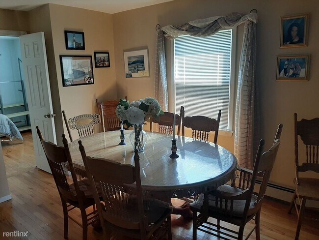
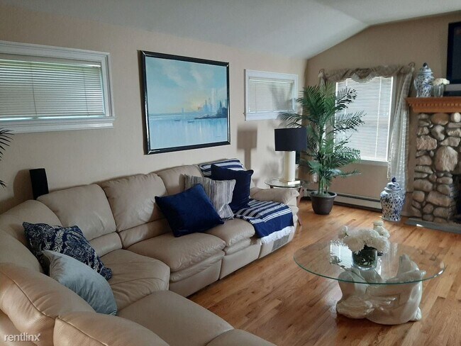
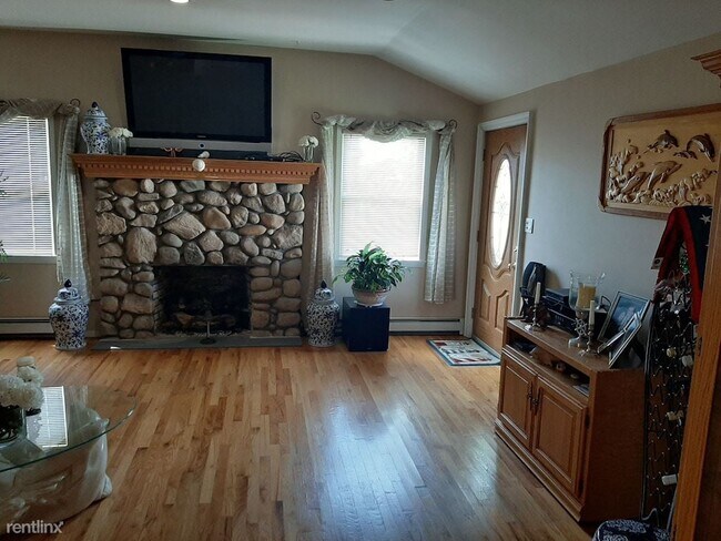
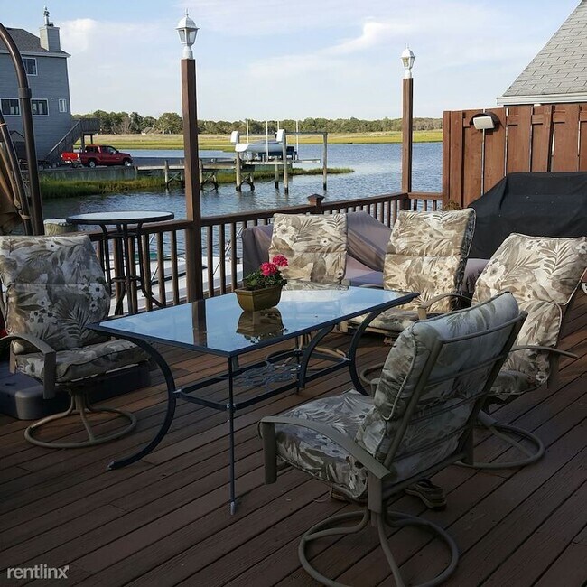
41 Lyndale Ct

Favorites
Check Back Soon for Upcoming Availability
| Beds | Baths | Average SF |
|---|---|---|
| 3 Bedrooms 3 Bedrooms 3 Br | 2 Baths 2 Baths 2 Ba | — |
Fees and Policies
The fees listed below are community-provided and may exclude utilities or add-ons. All payments are made directly to the property and are non-refundable unless otherwise specified.
- Dogs Allowed
-
Fees not specified
- Cats Allowed
-
Fees not specified
Details
Utilities Included
-
Water
-
Electricity
Property Information
-
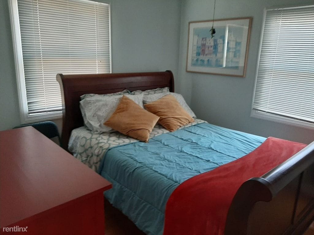
Furnished Units Available
About This Property
(221) 288-7430 - Walk over the bridge to the beautiful Ocean Beach. Free Summer Concerts every night in the summer. Other nearby activities: Riverhead Tanger Outlets, Fire Island/Dune Road beaches, Atlantis Marine Aquarium, Quogue Wildlife Sanctuary, Splish-splash Water Park, Golf, Miniature golf, Wineries, Antiquing, for more inquiring contact us on this email address hre827728(AT)gmail.com (RLNE7145900) Other Amenities: Furnished. Appliances: Refrigerator, Oven, Garbage Disposal, Washer & Dryer. Lease lengths: Month to Month. Utilities: Electricity Included, Water Included. Pet policies: Small Dogs Allowed, Cats Allowed.
41 Lyndale Ct is a house located in Suffolk County and the 11967 ZIP Code. This area is served by the William Floyd Union Free School District attendance zone.
Unique Features
- Oven
House Features
- Washer/Dryer
- Furnished
41 Lyndale Ct,
Shirley,
NY
11967
Nestled on the South Shore of Long Island, Shirley is a peaceful hamlet lush with natural beauty. Residents enjoy the best of rural and suburban living in Shirley, boasting vast stretches of green space along with a slew of national retailers and chain restaurants largely clustered on Montauk Highway and William Floyd Parkway.
Residents delight in their surrounding environment’s beauty at expansive parks like Smith Point Park and Wertheim National Wildlife Refuge. Convenience to the Montauk Branch of the Long Island Rail Road, as well as the Sunrise Highway and Long Island Expressway, connects Shirley to NYC and all that Long Island has to offer.
Learn more about living in ShirleyBelow are rent ranges for similar nearby apartments
Amenities
- Washer/Dryer
- Furnished
- Oven
Expenses
Utilities Included
Water, Electricity
Included
Education
| Colleges & Universities | Distance | ||
|---|---|---|---|
| Colleges & Universities | Distance | ||
| Drive: | 22 min | 13.7 mi | |
| Drive: | 28 min | 16.7 mi | |
| Drive: | 28 min | 17.3 mi | |
| Drive: | 34 min | 22.7 mi |
41 Lyndale Ct is within 22 minutes or 13.7 miles from St Joseph's Coll., Long Island. It is also near SUNY Suffolk Co., Ammerman and SUNY Suffolk Co., Eastern.
Schools


Public Elementary School
Grades K-5
Attendance Zone
Public Elementary School
Grades PK-5
Nearby
Public Middle School
Grades 6-8
Attendance Zone
Public High School
Grades 9-12
Attendance Zone
Private Elementary, Middle & High School
Grades PK-12
Nearby
School data provided by
 The GreatSchools Rating helps parents compare schools within a state based on a variety of school quality indicators and provides a helpful picture of how effectively each school serves all of its students. Ratings are on a scale of 1 (below average) to 10 (above average) and can include test scores, college readiness, academic progress, advanced courses, equity, discipline and attendance data. We also advise parents to visit schools, consider other information on school performance and programs, and consider family needs as part of the school selection process.
View GreatSchools Rating Methodology
Data provided by GreatSchools.org © 2026. All rights reserved.
View GreatSchools Rating Methodology
Data provided by GreatSchools.org © 2026. All rights reserved.
Walkability Near 41 Lyndale Ct Shirley, NY 11967
Getting Around
 What do Walkability, Transit, Drivability, and Bikeability mean?
Walkability measures the walking distance to day-to-day needs.
Transit measures access to public transportation.
Drivability measures congestion, parking availability, and access to major roads.
Bikeability measures the suitability for cycling.
How It Works
What do Walkability, Transit, Drivability, and Bikeability mean?
Walkability measures the walking distance to day-to-day needs.
Transit measures access to public transportation.
Drivability measures congestion, parking availability, and access to major roads.
Bikeability measures the suitability for cycling.
How It Works
Not Walkable
Walkability
10
/ 100
Minimal Public Transit
Transit
0
/ 100
Exceptionally Drivable
Drivability
100
/ 100
Fairly Bikeable
Bikeability
50
/ 100
Scores provided by
-
Soundscore™
-
/ 100
Traffic
-Airport
-Businesses
-Scores provided by
HowLoud What is a Sound Score Rating? A Sound Score Rating aggregates noise caused by vehicle traffic, airplane traffic and local sources. How It WorksYou May Also Like
Similar Rentals Nearby
-

-
 3 Beds, 2 Baths, 1,200 sq ft$3,500Total Monthly PriceTotal Monthly Price NewPrices include all required monthly fees.215 E Lakewood St
 -
 4 Beds, 3 Baths, 2,376 sq ft$35,000Total Monthly PriceTotal Monthly Price NewPrices include all required monthly fees.19 Rogers Ln
 -
 5 Beds, 4 Baths, 4,500 sq ft$60,000Total Monthly PriceTotal Monthly Price NewPrices include all required monthly fees.43 Shore Rd
 -
 6 Beds, 3 Baths, 3,035 sq ft$45,000Total Monthly PriceTotal Monthly Price NewPrices include all required monthly fees.24 N Quarter Rd
 -
 3 Beds, 2 Baths, 2,000 sq ft$40,000Total Monthly PriceTotal Monthly Price NewPrices include all required monthly fees.31 Liberty St
 -
 4 Beds, 3 Baths, 1,823 sq ft$20,000Total Monthly PriceTotal Monthly Price NewPrices include all required monthly fees.9 Ocame Ave
 -
 3 Beds, 1 Bath, 940 sq ft$4,250Total Monthly PriceTotal Monthly Price NewPrices include all required monthly fees.5 Birch Ct
 -
 4 Beds, 3 Baths, 2,222 sq ft$4,800Total Monthly PriceTotal Monthly Price NewPrices include all required monthly fees.3 Thornridge Ln
 -
 6 Beds, 5 Baths, 3,500 sq ft$35,000Total Monthly PriceTotal Monthly Price NewPrices include all required monthly fees.38 Pheasant Run
What Are Walk Score®, Transit Score®, and Bike Score® Ratings?
Walk Score® measures the walkability of any address. Transit Score® measures access to public transit. Bike Score® measures the bikeability of any address.
What is a Sound Score Rating?
A Sound Score Rating aggregates noise caused by vehicle traffic, airplane traffic and local sources.
41 Lyndale Ct
Shirley, NY 11967