
$1,295
/ Month
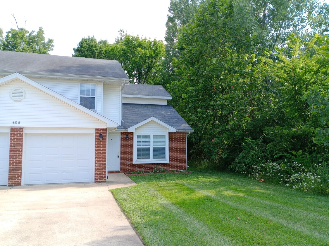
406 E Liberty Ln
Ashland, MO 65010
Favorites
406 E Liberty Ln

Favorites
Check Back Soon for Upcoming Availability
| Beds | Baths | Average SF |
|---|---|---|
| 4 Bedrooms 4 Bedrooms 4 Br | 3 Baths 3 Baths 3 Ba | 1,300 SF |
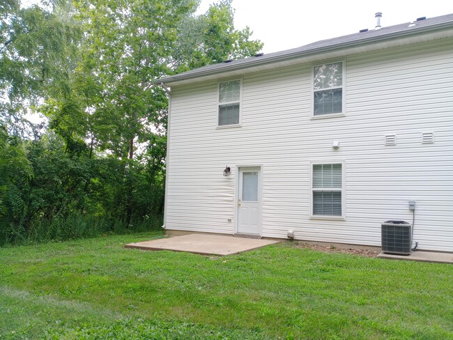
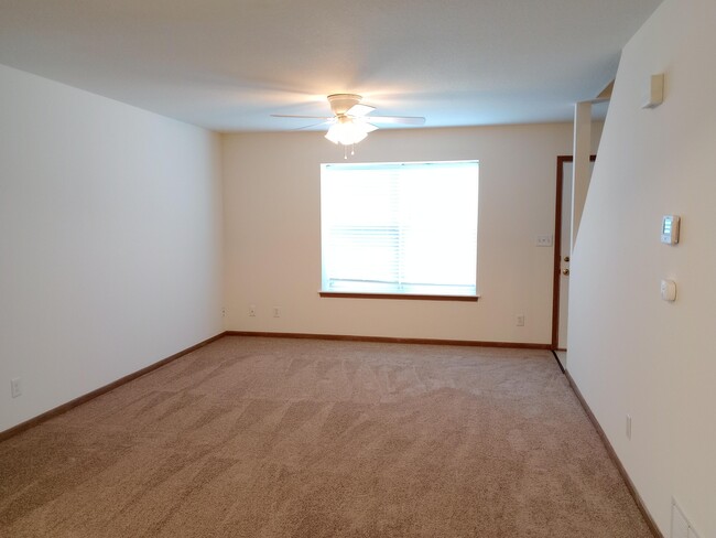
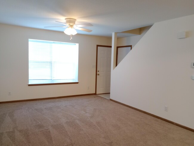
About This Property
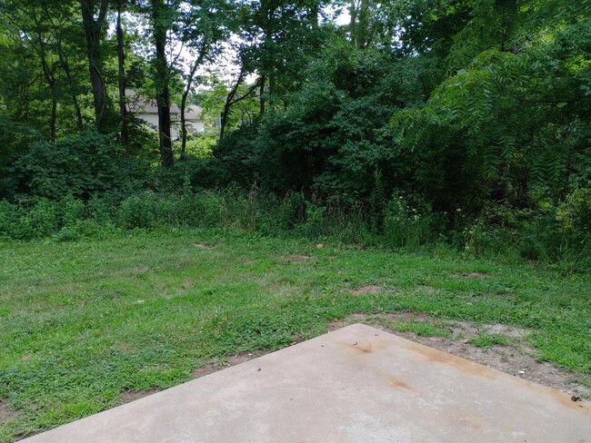
406 Liberty Lane Apt B - Available NOW!!! This is an incredible town home in Ashland,MO!! It features four bedrooms,three bathrooms,and a combined living/dining space with a breakfast bar. Other highlights of the property include a furnished washer & dryer,an attached single-car garage,plus lawn care services. **Approved Pets Welcome with Associated Fees!!** *This is a Smoke Free Property*
406 E Liberty Ln is a townhome located in Boone County and the 65010 ZIP Code. This area is served by the Southern Boone County R-I School District attendance zone.
406 E Liberty Ln,
Ashland,
MO
65010
Education
| Colleges & Universities | Distance | ||
|---|---|---|---|
| Colleges & Universities | Distance | ||
| Drive: | 22 min | 15.5 mi | |
| Drive: | 22 min | 16.3 mi | |
| Drive: | 22 min | 17.1 mi | |
| Drive: | 41 min | 23.4 mi |
406 E Liberty Ln is within 22 minutes or 15.5 miles from Missouri. It is also near Columbia College and Lincoln Univ., Jefferson City.
Schools


Public Elementary & Middle School
Grades K-8
629 Students
Attendance Zone
Public Elementary School
Grades PK-5
493 Students
Attendance Zone
Public Elementary School
Grades K-5
344 Students
Attendance Zone
Public High School
Grades 9-12
540 Students
Attendance Zone
Private Elementary & Middle School
Grades PK-8
58 Students
Nearby
Private Elementary & Middle School
Grades K-8
160 Students
Nearby
School data provided by
 The GreatSchools Rating helps parents compare schools within a state based on a variety of school quality indicators and provides a helpful picture of how effectively each school serves all of its students. Ratings are on a scale of 1 (below average) to 10 (above average) and can include test scores, college readiness, academic progress, advanced courses, equity, discipline and attendance data. We also advise parents to visit schools, consider other information on school performance and programs, and consider family needs as part of the school selection process.
View GreatSchools Rating Methodology
Data provided by GreatSchools.org © 2026. All rights reserved.
View GreatSchools Rating Methodology
Data provided by GreatSchools.org © 2026. All rights reserved.
Walkability Near 406 E Liberty Ln Ashland, MO 65010
Getting Around
 What do Walkability, Transit, Drivability, and Bikeability mean?
Walkability measures the walking distance to day-to-day needs.
Transit measures access to public transportation.
Drivability measures congestion, parking availability, and access to major roads.
Bikeability measures the suitability for cycling.
How It Works
What do Walkability, Transit, Drivability, and Bikeability mean?
Walkability measures the walking distance to day-to-day needs.
Transit measures access to public transportation.
Drivability measures congestion, parking availability, and access to major roads.
Bikeability measures the suitability for cycling.
How It Works
Somewhat Walkable
Walkability
20
/ 100
Exceptionally Drivable
Drivability
100
/ 100
Somewhat Bikeable
Bikeability
30
/ 100
Scores provided by
-
Soundscore™
-
/ 100
Traffic
-Airport
-Businesses
-Scores provided by
HowLoud What is a Sound Score Rating? A Sound Score Rating aggregates noise caused by vehicle traffic, airplane traffic and local sources. How It WorksYou May Also Like
Similar Rentals Nearby


What Are Walk Score®, Transit Score®, and Bike Score® Ratings?
Walk Score® measures the walkability of any address. Transit Score® measures access to public transit. Bike Score® measures the bikeability of any address.
What is a Sound Score Rating?
A Sound Score Rating aggregates noise caused by vehicle traffic, airplane traffic and local sources.
406 E Liberty Ln
Ashland, MO 65010