

$2,400
/ Month
400 Bissell Ave Unit 402
Richmond, CA 94801
Favorites
510-388-6780
-
Bedrooms
3
-
Bathrooms
1.5
-
Square Feet
900 sq ft
-
Available
Available Jun 10
Highlights
- Traditional Architecture
- Fenced
- Level Lot
- Wood Siding
- Carpet
- Vinyl Flooring
400 Bissell Ave Unit 402

Favorites
400 Bissell Ave is an apartment community located in Contra Costa County and the 94801 ZIP Code.
* Price shown is base rent. Excludes user-selected optional fees and variable or usage-based fees and required charges due at or prior to move-in or at move-out. Price, availability, fees, and any applicable rent special are subject to change without notice.
* Square footage definitions vary. Displayed square footage is approximate.
Home Details
Year Built
Built in 1919
Bedrooms and Bathrooms
1.5 Bathrooms
3 Bedrooms
Flooring
Linoleum
Carpet
Vinyl
Home Design
Traditional Architecture
Wood Siding
Apartment
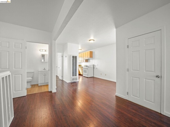
Interior Spaces
900 Sq Ft Home
1-Story Property
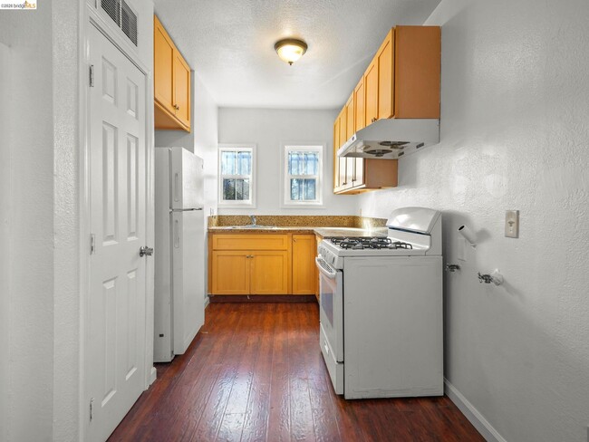
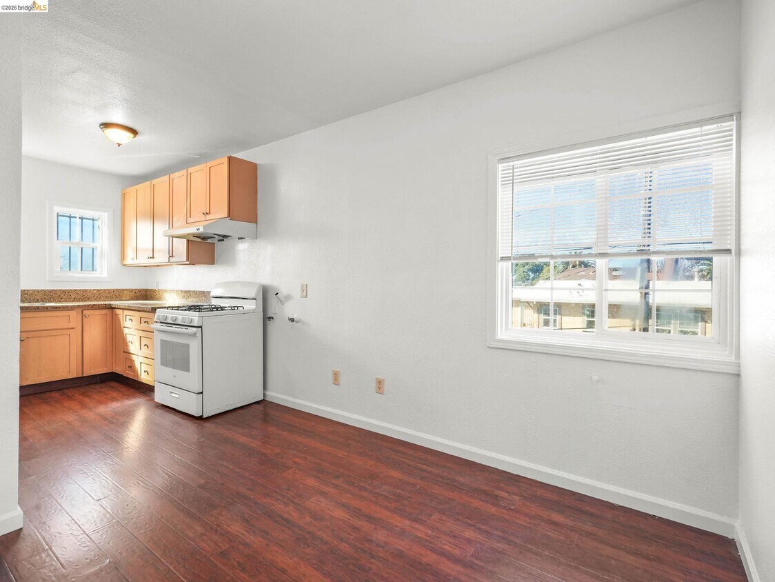
Kitchen
Gas Range
Laundry
Washer and Dryer Hookup
Lot Details
5,600 Sq Ft Lot
Fenced
Level Lot
Parking
Parking Lot
1 Car Garage
Utilities
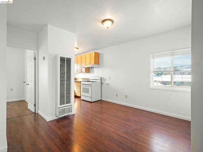
Wall Furnace
Community Details
Overview
No Home Owners Association
Bridge Aor Association
Iron Triangle Subdivision
Contact
- Listed by Curtis Estes | Growing Needs Real Estate
- Phone Number
- Contact
-
Source
 bridgeMLS
Copyright© 2026 Bay East, Contra Costa, bridgeMLS. All rights reserved. All information provided by the listing agent/broker is deemed reliable but is not guaranteed and should be independently verified.
Location
Get Directions
The Iron Triangle neighborhood sits in the heart of Central Richmond, California. With the area being largely residential, most rentals reside in the upper part of the triangle and an easy three-mile commute north to Point Richmond, a major shipping and industrial area. To the south, Berkeley and Oakland lie roughly 10 miles away via Interstate 580.
Locals often head for the Miller/Knox Regional Shoreline for a bit of jogging or cycling, or to cast a line off the fishing pier. Wade into the waters of San Francisco Bay at Keller Beach on the northern end of the park, or enjoy a show at the Masquers Playhouse, also just outside the Iron Triangle's southern border. Most eateries sit along Interstate 580, including several fast food chains. The MacDonald 80 Shopping Center lies roughly three miles east of the neighborhood. Drive another three miles and find Wildcat Canyon Regional Park and the Tilden Nature Area.
Learn more about living in Iron Triangle
Amenities
- Air Conditioning
- Heating
Education
| Colleges & Universities | Distance | ||
|---|---|---|---|
| Colleges & Universities | Distance | ||
| Drive: | 8 min | 3.7 mi | |
| Drive: | 16 min | 9.1 mi | |
| Drive: | 20 min | 10.2 mi | |
| Drive: | 19 min | 11.0 mi |
400 Bissell Ave Unit 402 is within 8 minutes or 3.7 miles from Contra Costa College. It is also near Berkeley City College and UC Berkeley.
Transportation options available in Richmond include Richmond Station, located 1.2 miles from 400 Bissell Ave Unit 402. 400 Bissell Ave Unit 402 is near Metro Oakland International, located 22.1 miles or 31 minutes away, and San Francisco International, located 29.8 miles or 43 minutes away.
| Transit / Subway | Distance | ||
|---|---|---|---|
| Transit / Subway | Distance | ||
|
|
Drive: | 3 min | 1.2 mi |
|
|
Drive: | 7 min | 3.5 mi |
|
|
Drive: | 10 min | 5.8 mi |
|
|
Drive: | 14 min | 8.5 mi |
|
|
Drive: | 16 min | 9.2 mi |
| Commuter Rail | Distance | ||
|---|---|---|---|
| Commuter Rail | Distance | ||
| Walk: | 15 min | 0.8 mi | |
|
|
Drive: | 10 min | 7.3 mi |
| Drive: | 16 min | 9.2 mi | |
| Drive: | 14 min | 9.6 mi | |
| Drive: | 16 min | 10.2 mi |
| Airports | Distance | ||
|---|---|---|---|
| Airports | Distance | ||
|
Metro Oakland International
|
Drive: | 31 min | 22.1 mi |
|
San Francisco International
|
Drive: | 43 min | 29.8 mi |
Getting Around
 What do Walkability, Transit, Drivability, and Bikeability mean?
Walkability measures the walking distance to day-to-day needs.
Transit measures access to public transportation.
Drivability measures congestion, parking availability, and access to major roads.
Bikeability measures the suitability for cycling.
How It Works
What do Walkability, Transit, Drivability, and Bikeability mean?
Walkability measures the walking distance to day-to-day needs.
Transit measures access to public transportation.
Drivability measures congestion, parking availability, and access to major roads.
Bikeability measures the suitability for cycling.
How It Works
Fairly Walkable
Walkability
50
/ 100
Some Public Transit
Transit
50
/ 100
Very Drivable
Drivability
80
/ 100
Moderately Bikeable
Bikeability
60
/ 100
Scores provided by
-
Soundscore™
-
/ 100
Traffic
-Airport
-Businesses
-Scores provided by
HowLoud What is a Sound Score Rating? A Sound Score Rating aggregates noise caused by vehicle traffic, airplane traffic and local sources. How It WorksTime and distance from 400 Bissell Ave Unit 402.
| Shopping Centers | Distance | ||
|---|---|---|---|
| Shopping Centers | Distance | ||
| Walk: | 9 min | 0.5 mi | |
| Drive: | 4 min | 1.9 mi |
400 Bissell Ave Unit 402 has 2 shopping centers within 1.9 miles, which is about a 4-minute drive. The miles and minutes will be for the farthest away property.
| Parks and Recreation | Distance | ||
|---|---|---|---|
| Parks and Recreation | Distance | ||
|
Rosie the Riveter WWII Home Front National Historical Park
|
Drive: | 5 min | 2.1 mi |
|
Marina Park & Green
|
Drive: | 6 min | 2.3 mi |
|
Miller/Knox Regional Shoreline
|
Drive: | 5 min | 2.4 mi |
|
Shimada Friendship Park
|
Drive: | 7 min | 3.0 mi |
|
Brooks Island Regional Preserve
|
Drive: | 9 min | 3.9 mi |
400 Bissell Ave Unit 402 has 5 parks within 3.9 miles, including Rosie the Riveter WWII Home Front National Historical Park, Marina Park & Green, and Miller/Knox Regional Shoreline.
| Hospitals | Distance | ||
|---|---|---|---|
| Hospitals | Distance | ||
| Drive: | 19 min | 10.7 mi | |
| Drive: | 20 min | 11.0 mi | |
| Drive: | 17 min | 11.6 mi |
400 Bissell Ave Unit 402 has 3 hospitals within 11.6 miles, the nearest is Alta Bates Summit Medical Center - Alta Bates Campus which is 10.7 miles away and a 19 minute drive.
| Military Bases | Distance | ||
|---|---|---|---|
| Military Bases | Distance | ||
| Drive: | 8 min | 3.7 mi | |
| Drive: | 13 min | 6.2 mi | |
| Drive: | 25 min | 15.8 mi |
400 Bissell Ave Unit 402 has 3 military bases within 15.8 miles, the nearest is Armory West Contra Costa which is 3.7 miles away and a 8 minute drive.
You May Also Like
Similar Rentals Nearby
-
-
-
-
3 Beds$6,880Total Monthly Price12 Month LeaseTotal Monthly Price NewPrices include base rent and required monthly fees. Variable costs based on usage may apply.Specials
Pets Allowed Fitness Center In Unit Washer & Dryer Stainless Steel Appliances Business Center Package Service Elevator
-
-
-
-
3 Beds$4,327+Total Monthly PriceTotal Monthly Price NewPrices include base rent and required monthly fees of $6. Variable costs based on usage may apply.Base Rent:3 Beds$4,320+1 Month Free
Pets Allowed Fitness Center Pool In Unit Washer & Dryer Clubhouse Stainless Steel Appliances Hardwood Floors
-
-


What Are Walk Score®, Transit Score®, and Bike Score® Ratings?
Walk Score® measures the walkability of any address. Transit Score® measures access to public transit. Bike Score® measures the bikeability of any address.
What is a Sound Score Rating?
A Sound Score Rating aggregates noise caused by vehicle traffic, airplane traffic and local sources.
400 Bissell Ave
Richmond, CA 94801