
$2,550 / Month
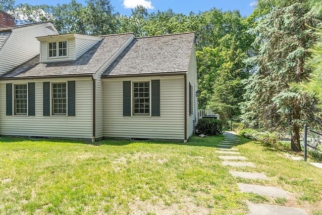
40 Orchard Ave
Weston, MA 02493
2 Weeks Ago
Favorites
40 Orchard Ave

Favorites
Check Back Soon for Upcoming Availability
| Beds | Baths | Average SF |
|---|---|---|
| 2 Bedrooms 2 Bedrooms 2 Br | 1 Bath 1 Bath 1 Ba | 923 SF |
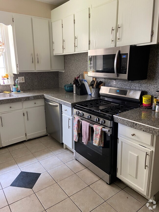
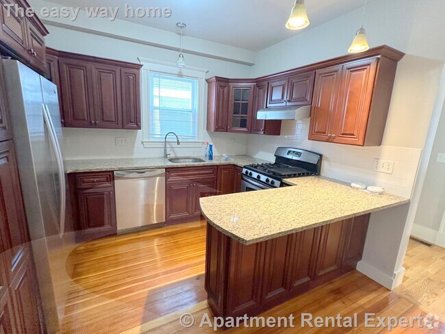
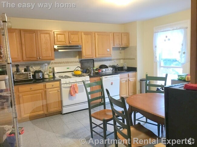
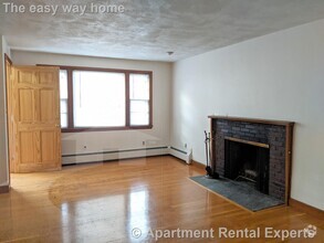
About This Property
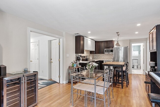
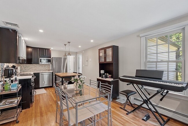
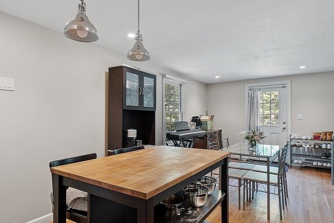
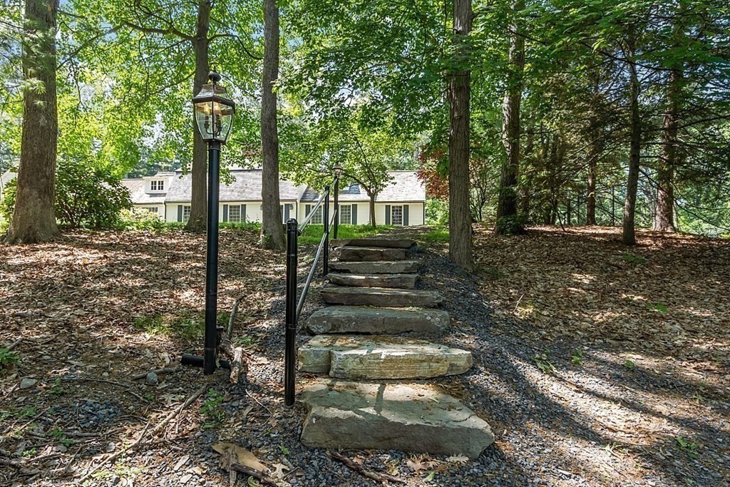
This is an amazing opportunity to secure a charming au pair apartment in the town of Weston offering excellent schools and a wealth of recreational opportunities. This one/two bedroom apartment is in an ideal location,convenient to all commuter locations. The beautifully maintained grounds provide a peaceful and tranquil environment lending to a comfortable and fulfilling lifestyle. Move in ready with an updated and open floor plan. All utilities included - heat,central AC,electric,water,hot water,yard maintenance,snow removal,refuse removal. Exclusive additional storage and washer and dryer in walk out lower level. Available July 1st.
40 Orchard Ave is a townhome located in Middlesex County and the 02493 ZIP Code. This area is served by the Weston attendance zone.
Location
Get Directions
Just west of Boston and East of Worcester sits Metro West, a region that houses a group of towns and cities with significant historical backgrounds. A total of 19 municipalities make up the core of this community, but other municipalities are considered to be a part of the Interstate 495/Metro West Corridor.
Learn more about living in Metro WestBelow are rent ranges for similar nearby apartments
| Beds | Average Size | Lowest | Typical | Premium |
|---|---|---|---|---|
| Studio Studio Studio | 528-531 Sq Ft | $895 | $2,573 | $7,330 |
| 1 Bed 1 Bed 1 Bed | 790-791 Sq Ft | $1,495 | $3,014 | $10,753 |
| 2 Beds 2 Beds 2 Beds | 1160-1162 Sq Ft | $2,000 | $3,723 | $15,621 |
| 3 Beds 3 Beds 3 Beds | 1622-1627 Sq Ft | $2,190 | $4,984 | $23,197 |
| 4 Beds 4 Beds 4 Beds | 3602 Sq Ft | $1,025 | $6,483 | $20,000 |
Education
| Colleges & Universities | Distance | ||
|---|---|---|---|
| Colleges & Universities | Distance | ||
| Drive: | 7 min | 2.7 mi | |
| Drive: | 11 min | 4.8 mi | |
| Drive: | 13 min | 5.3 mi | |
| Drive: | 12 min | 5.7 mi |
40 Orchard Ave is within 7 minutes or 2.7 miles from Brandeis University. It is also near Babson College and Wellesley College.
Schools


Public Elementary School
Grades PK-3
331 Students
Attendance Zone
Public Elementary School
Grades 4-5
266 Students
Attendance Zone
Public Middle School
Grades 6-8
444 Students
Attendance Zone
Public High School
Grades 9-12
639 Students
Attendance Zone
Private Elementary, Middle & High School
Grades 3-12
161 Students
Nearby
Private Elementary & Middle School
Grades PK-8
320 Students
Nearby
School data provided by
 The GreatSchools Rating helps parents compare schools within a state based on a variety of school quality indicators and provides a helpful picture of how effectively each school serves all of its students. Ratings are on a scale of 1 (below average) to 10 (above average) and can include test scores, college readiness, academic progress, advanced courses, equity, discipline and attendance data. We also advise parents to visit schools, consider other information on school performance and programs, and consider family needs as part of the school selection process.
View GreatSchools Rating Methodology
View GreatSchools Rating Methodology
Transportation options available in Weston include Woodland Station, located 2.5 miles from 40 Orchard Ave. 40 Orchard Ave is near General Edward Lawrence Logan International, located 15.2 miles or 23 minutes away, and Worcester Regional, located 38.1 miles or 54 minutes away.
| Transit / Subway | Distance | ||
|---|---|---|---|
| Transit / Subway | Distance | ||
|
|
Drive: | 6 min | 2.5 mi |
|
|
Drive: | 6 min | 2.6 mi |
|
|
Drive: | 7 min | 3.2 mi |
|
|
Drive: | 10 min | 4.4 mi |
|
|
Drive: | 10 min | 5.1 mi |
| Commuter Rail | Distance | ||
|---|---|---|---|
| Commuter Rail | Distance | ||
|
|
Drive: | 6 min | 2.2 mi |
|
|
Drive: | 5 min | 2.3 mi |
|
|
Drive: | 6 min | 2.9 mi |
|
|
Drive: | 11 min | 7.4 mi |
|
|
Drive: | 12 min | 8.2 mi |
| Airports | Distance | ||
|---|---|---|---|
| Airports | Distance | ||
|
General Edward Lawrence Logan International
|
Drive: | 23 min | 15.2 mi |
|
Worcester Regional
|
Drive: | 54 min | 38.1 mi |
Time and distance from 40 Orchard Ave.
| Shopping Centers | Distance | ||
|---|---|---|---|
| Shopping Centers | Distance | ||
| Drive: | 4 min | 2.0 mi | |
| Drive: | 4 min | 2.1 mi | |
| Drive: | 9 min | 3.8 mi |
40 Orchard Ave has 3 shopping centers within 3.8 miles, which is about a 9-minute drive. The miles and minutes will be for the farthest away property.
| Parks and Recreation | Distance | ||
|---|---|---|---|
| Parks and Recreation | Distance | ||
|
Land's Sake Farm
|
Drive: | 6 min | 2.5 mi |
|
Whitin Observatory
|
Drive: | 11 min | 4.8 mi |
|
Hemlock Gorge Reservation
|
Drive: | 10 min | 5.0 mi |
|
Wellesley College Botanic Gardens
|
Drive: | 10 min | 5.0 mi |
|
Hamlen Woods
|
Drive: | 12 min | 5.0 mi |
40 Orchard Ave has 5 parks within 5.0 miles, including Land's Sake Farm, Hemlock Gorge Reservation, and Whitin Observatory.
| Hospitals | Distance | ||
|---|---|---|---|
| Hospitals | Distance | ||
| Drive: | 5 min | 2.2 mi | |
| Drive: | 7 min | 3.2 mi | |
| Drive: | 11 min | 6.4 mi |
40 Orchard Ave has 3 hospitals within 6.4 miles, the nearest is Newton - Wellesley Hospital which is 2.2 miles away and a 5 minute drive.
| Military Bases | Distance | ||
|---|---|---|---|
| Military Bases | Distance | ||
| Drive: | 16 min | 8.4 mi | |
| Drive: | 19 min | 10.2 mi |
40 Orchard Ave is 8.4 miles from US Military Reservation, and is convenient to other military bases, including Hanscom Air Force Base.
You May Also Like
Similar Rentals Nearby


What Are Walk Score®, Transit Score®, and Bike Score® Ratings?
Walk Score® measures the walkability of any address. Transit Score® measures access to public transit. Bike Score® measures the bikeability of any address.
What is a Sound Score Rating?
A Sound Score Rating aggregates noise caused by vehicle traffic, airplane traffic and local sources
40 Orchard Ave
Weston, MA 02493