
$1,590
/ Month
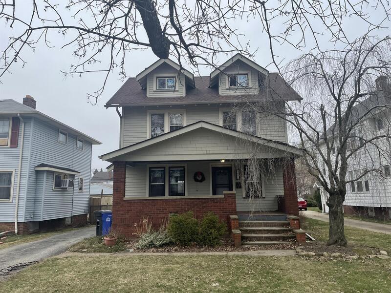
3874 W 157th St
Cleveland, OH 44111
2 Weeks Ago
|
Edit
Favorites
3874 W 157th St

Favorites
Check Back Soon for Upcoming Availability
| Beds | Baths | Average SF |
|---|---|---|
| 4 Bedrooms 4 Bedrooms 4 Br | 1 Bath 1 Bath 1 Ba | 1,296 SF |
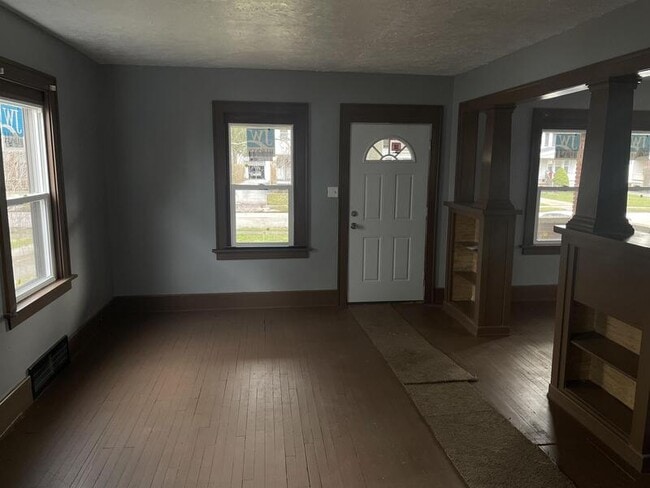
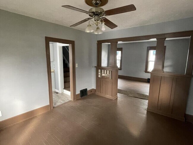
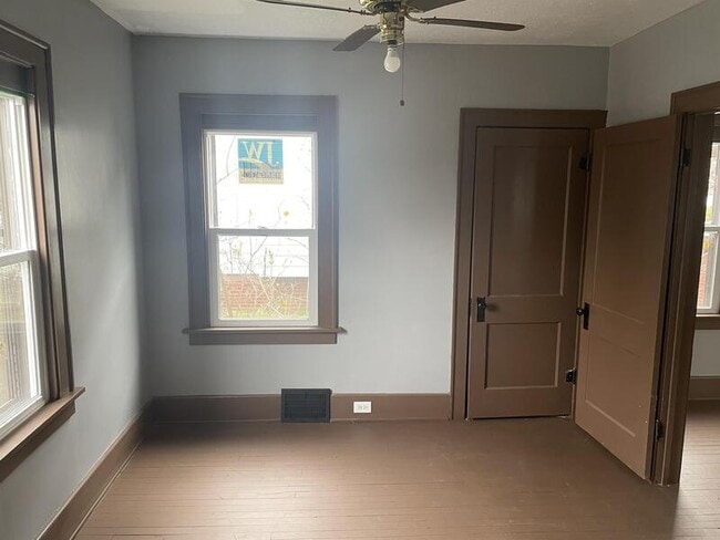
About This Property
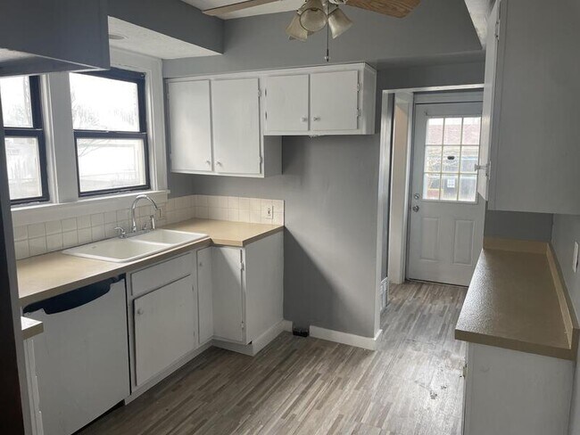
JUNE SPECIAL! MOVE-IN DURING JUNE AND GET HALF MONTH OFF! Subject to 6 rent payments on time. This beautiful 2 story w/ 2 car garage sits in the exclusive KAMM'S CORNER neighborhood and has great schools, parks and it's a quick drive to the stores and restaurants on Lorain ave! If you are looking for a quiet and safe place to settle down look no more Property was FULLY UPDATED and ready for a family to make it HOME! This one wont stay available for long, schedule your showing today.
3874 W 157th St is a house located in Cuyahoga County and the 44111 ZIP Code. This area is served by the Cleveland Metropolitan attendance zone.
Location
Get Directions
Kamm's Corners, a suburban community within the western border of Cleveland, Ohio, provides an eclectic mix of residential, commercial, and industrial development. This popular neighborhood, named for Oswald Kamm from the 1800s, features apartments for rent near Highway 237 in the area's central section. Close recreational venues include the Mastick Woods and Little Met golf courses.
Neighborhood residents can reach Downtown Cleveland in less than 15 minutes, and the Cleveland Hopkins International Airport sits about 10 minutes away. During summer and fall, locals enjoy shopping for local produce while socializing at the Kamm's Corners Farmers Market. There are plenty of restaurants and bars that surround the area, welcoming residents who gather to watch Cleveland Browns or Ohio State games.
Learn more about living in Kamm's CornersBelow are rent ranges for similar nearby apartments
Education
| Colleges & Universities | Distance | ||
|---|---|---|---|
| Colleges & Universities | Distance | ||
| Drive: | 14 min | 6.0 mi | |
| Drive: | 13 min | 7.2 mi | |
| Drive: | 18 min | 8.6 mi | |
| Drive: | 15 min | 9.7 mi |
3874 W 157th St is within 14 minutes or 6.0 miles from Cuyahoga C.C., West. It is also near Baldwin - Wallace College and Cuyahoga C.C., Western Campus.
Schools


Public Elementary, Middle & High School
Grades 2 & 8-12
434 Students
Attendance Zone
Public Elementary & High School
Grades 3-5 & 9-12
622 Students
Attendance Zone
Public Elementary, Middle & High School
Grades 2 & 8-12
413 Students
Attendance Zone
Public Elementary & Middle School
Grades PK-8
438 Students
Attendance Zone
Public Elementary & Middle School
Grades PK-8
552 Students
Attendance Zone
Public High School
Grades 9-12
163 Students
Attendance Zone
Private Elementary & Middle School
Grades PK-8
70 Students
Nearby
Private Elementary & Middle School
Grades PK-8
365 Students
Nearby
Private High School
Grades 9-12
694 Students
Nearby
School data provided by
 The GreatSchools Rating helps parents compare schools within a state based on a variety of school quality indicators and provides a helpful picture of how effectively each school serves all of its students. Ratings are on a scale of 1 (below average) to 10 (above average) and can include test scores, college readiness, academic progress, advanced courses, equity, discipline and attendance data. We also advise parents to visit schools, consider other information on school performance and programs, and consider family needs as part of the school selection process.
View GreatSchools Rating Methodology
Data provided by GreatSchools.org © 2025. All rights reserved.
View GreatSchools Rating Methodology
Data provided by GreatSchools.org © 2025. All rights reserved.
Transportation options available in Cleveland include W 150 - Puritas, located 0.6 mile from 3874 W 157th St. 3874 W 157th St is near Cleveland-Hopkins International, located 4.6 miles or 12 minutes away.
| Transit / Subway | Distance | ||
|---|---|---|---|
| Transit / Subway | Distance | ||
|
|
Walk: | 12 min | 0.6 mi |
| Walk: | 21 min | 1.1 mi | |
|
|
Walk: | 21 min | 1.1 mi |
| Drive: | 5 min | 1.8 mi | |
|
|
Drive: | 5 min | 1.8 mi |
| Commuter Rail | Distance | ||
|---|---|---|---|
| Commuter Rail | Distance | ||
|
|
Drive: | 20 min | 9.8 mi |
| Drive: | 24 min | 14.0 mi | |
| Drive: | 26 min | 15.5 mi | |
| Drive: | 34 min | 20.8 mi | |
|
|
Drive: | 29 min | 21.3 mi |
| Airports | Distance | ||
|---|---|---|---|
| Airports | Distance | ||
|
Cleveland-Hopkins International
|
Drive: | 12 min | 4.6 mi |
Time and distance from 3874 W 157th St.
| Shopping Centers | Distance | ||
|---|---|---|---|
| Shopping Centers | Distance | ||
| Walk: | 12 min | 0.6 mi | |
| Walk: | 14 min | 0.8 mi | |
| Drive: | 3 min | 1.3 mi |
3874 W 157th St has 3 shopping centers within 1.3 miles, which is about a 3-minute walk. The miles and minutes will be for the farthest away property.
| Parks and Recreation | Distance | ||
|---|---|---|---|
| Parks and Recreation | Distance | ||
|
Lakefront Reservation and Edgewater Park
|
Drive: | 13 min | 5.7 mi |
|
Big Creek Reservation
|
Drive: | 12 min | 6.0 mi |
|
Cleveland Metroparks Zoo
|
Drive: | 12 min | 7.1 mi |
|
Rocky River Nature Center
|
Drive: | 13 min | 7.4 mi |
|
Great Lakes Science Center
|
Drive: | 17 min | 8.9 mi |
3874 W 157th St has 5 parks within 8.9 miles, including Lakefront Reservation and Edgewater Park, Big Creek Reservation, and Cleveland Metroparks Zoo.
| Hospitals | Distance | ||
|---|---|---|---|
| Hospitals | Distance | ||
| Walk: | 16 min | 0.8 mi | |
| Drive: | 14 min | 7.1 mi | |
| Drive: | 13 min | 7.5 mi |
3874 W 157th St has 3 hospitals within 7.5 miles, the nearest is Fairview Hospital which is 0.8 mile away and a 16 minute walk.
| Military Bases | Distance | ||
|---|---|---|---|
| Military Bases | Distance | ||
| Drive: | 88 min | 74.7 mi | |
| Drive: | 94 min | 76.9 mi |
3874 W 157th St is 74.7 miles from Mansfield Lahm Airport Air Guard Station, and is convenient to other military bases, including Camp Perry Air Guard Station.
You May Also Like
Similar Rentals Nearby


What Are Walk Score®, Transit Score®, and Bike Score® Ratings?
Walk Score® measures the walkability of any address. Transit Score® measures access to public transit. Bike Score® measures the bikeability of any address.
What is a Sound Score Rating?
A Sound Score Rating aggregates noise caused by vehicle traffic, airplane traffic and local sources

3874 W 157th St
Cleveland, OH 44111