$1,495
/ Month
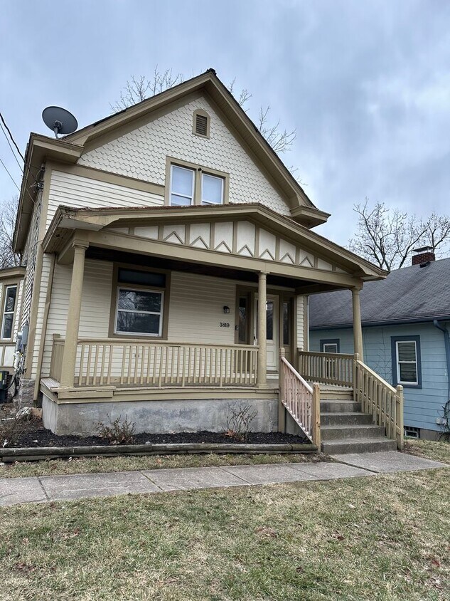
3819 St Martins Pl
Cheviot, OH 45211
2 Weeks Ago
|
Edit
Favorites
3819 St Martins Pl

Favorites
Check Back Soon for Upcoming Availability
| Beds | Baths | Average SF |
|---|---|---|
| 3 Bedrooms 3 Bedrooms 3 Br | 2 Baths 2 Baths 2 Ba | 1,326 SF |
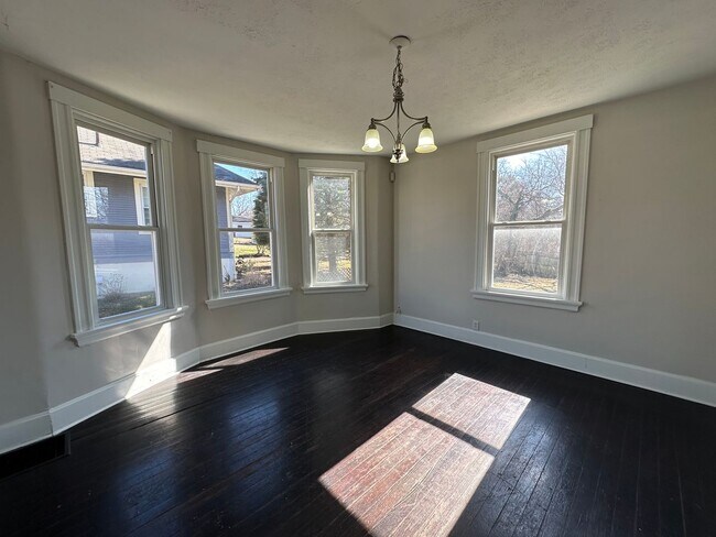
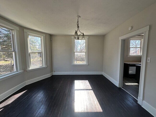
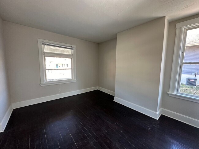
About This Property
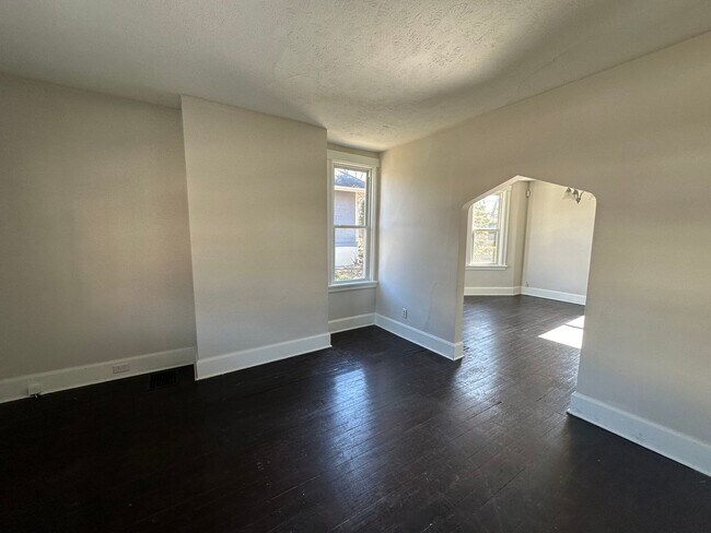
Welcome to Cheviot. This charming house offers a cozy and comfortable living space with three bedrooms and two bathrooms. The spacious driveway provides convenient parking for you and your guests. Step into the backyard and enjoy the fresh air and ample space for outdoor activities. Inside, you'll find a washer and dryer hookup, making laundry days a breeze. This house is perfect for those seeking a simple and functional living space. Don't miss out on the opportunity to make this lovely house your new home. Contact us today to schedule a tour and experience the charm of Cheviot
3819 St Martins Pl is a house located in Hamilton County and the 45211 ZIP Code. This area is served by the Cincinnati Public Schools attendance zone.
Location
Get Directions
Below are rent ranges for similar nearby apartments
Education
| Colleges & Universities | Distance | ||
|---|---|---|---|
| Colleges & Universities | Distance | ||
| Drive: | 12 min | 5.4 mi | |
| Drive: | 16 min | 6.3 mi | |
| Drive: | 14 min | 6.6 mi | |
| Drive: | 16 min | 7.1 mi |
3819 St Martins Pl is within 12 minutes or 5.4 miles from College of Mount St. Joseph. It is also near Cincinnati State and University of Cincinnati.
Schools


Public Elementary & Middle School
Grades PK-7
569 Students
Attendance Zone
Public Middle & High School
Grades 7-12
897 Students
Attendance Zone
Public Middle & High School
Grades 7-12
760 Students
Attendance Zone
Private Elementary & Middle School
Grades PK-8
381 Students
Nearby
Private Elementary & Middle School
Grades K-8
268 Students
Nearby
Private High School
Grades 9-12
495 Students
Nearby
School data provided by
 The GreatSchools Rating helps parents compare schools within a state based on a variety of school quality indicators and provides a helpful picture of how effectively each school serves all of its students. Ratings are on a scale of 1 (below average) to 10 (above average) and can include test scores, college readiness, academic progress, advanced courses, equity, discipline and attendance data. We also advise parents to visit schools, consider other information on school performance and programs, and consider family needs as part of the school selection process.
View GreatSchools Rating Methodology
Data provided by GreatSchools.org © 2025. All rights reserved.
View GreatSchools Rating Methodology
Data provided by GreatSchools.org © 2025. All rights reserved.
Transportation options available in Cheviot include Brewery District Station, Elm & Henry, located 6.5 miles from 3819 St Martins Pl. 3819 St Martins Pl is near Cincinnati/Northern Kentucky International, located 21.4 miles or 40 minutes away.
| Transit / Subway | Distance | ||
|---|---|---|---|
| Transit / Subway | Distance | ||
| Drive: | 15 min | 6.5 mi | |
| Drive: | 15 min | 6.7 mi | |
| Drive: | 16 min | 6.7 mi | |
| Drive: | 16 min | 6.8 mi | |
| Drive: | 16 min | 7.0 mi |
| Commuter Rail | Distance | ||
|---|---|---|---|
| Commuter Rail | Distance | ||
|
|
Drive: | 15 min | 7.3 mi |
| Airports | Distance | ||
|---|---|---|---|
| Airports | Distance | ||
|
Cincinnati/Northern Kentucky International
|
Drive: | 40 min | 21.4 mi |
Time and distance from 3819 St Martins Pl.
| Shopping Centers | Distance | ||
|---|---|---|---|
| Shopping Centers | Distance | ||
| Walk: | 13 min | 0.7 mi | |
| Drive: | 4 min | 1.2 mi | |
| Drive: | 4 min | 1.5 mi |
3819 St Martins Pl has 3 shopping centers within 1.5 miles, which is about a 4-minute drive. The miles and minutes will be for the farthest away property.
| Parks and Recreation | Distance | ||
|---|---|---|---|
| Parks and Recreation | Distance | ||
|
Mt. Airy Forest
|
Drive: | 8 min | 3.3 mi |
|
Imago Earth Center
|
Drive: | 13 min | 5.0 mi |
|
Mitchell Memorial Forest
|
Drive: | 13 min | 5.2 mi |
|
Buttercup Valley
|
Drive: | 13 min | 5.3 mi |
|
Embshoff Woods
|
Drive: | 16 min | 5.6 mi |
3819 St Martins Pl has 5 parks within 5.6 miles, including Mt. Airy Forest, Imago Earth Center, and Mitchell Memorial Forest.
| Hospitals | Distance | ||
|---|---|---|---|
| Hospitals | Distance | ||
| Drive: | 9 min | 2.9 mi | |
| Drive: | 13 min | 5.9 mi | |
| Drive: | 16 min | 7.1 mi |
3819 St Martins Pl has 3 hospitals within 7.1 miles, the nearest is Mercy Health - West Hospital which is 2.9 miles away and a 9 minute drive.
| Military Bases | Distance | ||
|---|---|---|---|
| Military Bases | Distance | ||
| Drive: | 75 min | 56.1 mi | |
| Drive: | 82 min | 61.2 mi | |
| Drive: | 84 min | 64.5 mi |
3819 St Martins Pl has 3 military bases within 64.5 miles, the nearest is Gentile Air Force Station which is 56.1 miles away and a 75 minute drive.
You May Also Like
Similar Rentals Nearby


What Are Walk Score®, Transit Score®, and Bike Score® Ratings?
Walk Score® measures the walkability of any address. Transit Score® measures access to public transit. Bike Score® measures the bikeability of any address.
What is a Sound Score Rating?
A Sound Score Rating aggregates noise caused by vehicle traffic, airplane traffic and local sources

3819 St Martins Pl
Cheviot, OH 45211