

$4,850
/ Month
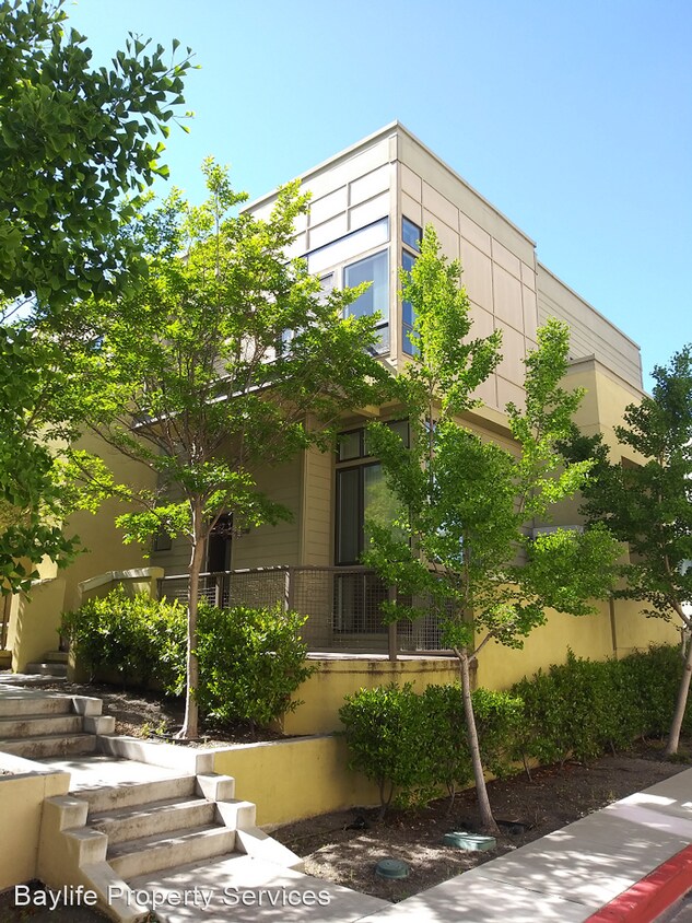
3724 Heron Way
Palo Alto, CA 94303
2 Weeks Ago
|
Edit
Favorites
3724 Heron Way

Favorites
Check Back Soon for Upcoming Availability
| Beds | Baths | Average SF |
|---|---|---|
| 3 Bedrooms 3 Bedrooms 3 Br | 2.5 Baths 2.5 Baths 2.5 Ba | 1,605 SF |
Fees and Policies
The fees below are based on community-supplied data and may exclude additional fees and utilities.
About This Property
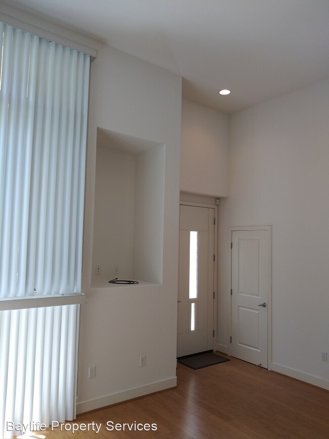
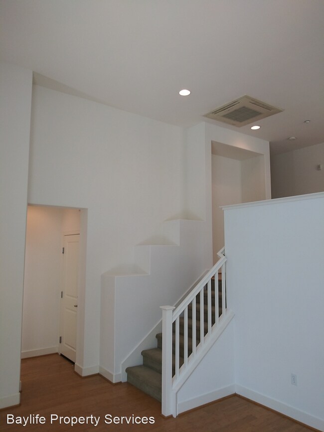
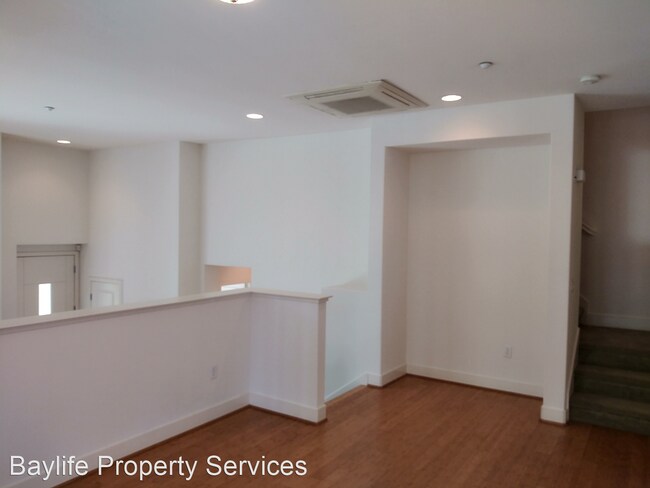
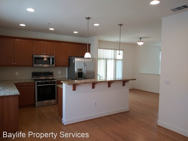
(510) 580-1948 - Beautiful 3bed/2.5bath townhouse for rent in Palo Alto, near 101 & San Antonio - Spacious 3bed/2.5bath townhouse available for immediate rent. Convenient location with easy access to shops, restaurants, parks, trails, golf & more. Minutes from Google, Intuit, Stanford & other campuses. Top area schools - Fairmeadow Elementary, Jane Lathrop Stanford Middle, Gunn High. - Luxury multi-level townhouse with attached 2 car garage - Engineered wood & carpet floors - Dual zone A/C - Spacious open kitchen with latest stainless steel appliances - High ceiling - Washer & dryer - Patio/Balcony - Large closets - Dual tub & shower in master bathroom Looking for 12 month or longer lease. Tenant to pay all utilities. - Rental insurance with liability coverage required by move-in - No pets - No smoking property - Credit, income, and rental history verification required No Pets Allowed (RLNE5828620) Pet policies: No Dogs Allowed, No Cats Allowed.
3724 Heron Way is a house located in Santa Clara County and the 94303 ZIP Code. This area is served by the Palo Alto Unified attendance zone.
Unique Features
- No Dogs Allowed, No Cats Allowed
Location
Get Directions
Palo Alto is known as the birthplace of Silicon Valley and that unique heritage is proudly on display, with the Computer History Museum just down the street from Google’s world headquarters and countless other tech companies all over town. The restaurant scene rivals that of nearby San Francisco, with many small, independent eateries serving up some of the best food in the Bay Area.
With close proximity to the country’s tech center, it’s no surprise that Palo Alto apartments come with some of the most incredible amenities around. Residents also have access to dozens of options for outdoor recreation, including the gorgeous hiking and biking trails through the surrounding nature preserves, several golf courses, and easy access to San Francisco Bay. Bicycling is a popular mode of transportation around Palo Alto, with many bike-friendly routes around the city.
Palo Alto is famous as the home of Stanford University, and the campus is one of the most dominant landmarks in the area.
Learn more about living in Palo AltoBelow are rent ranges for similar nearby apartments
Amenities
- No Dogs Allowed, No Cats Allowed
Education
| Colleges & Universities | Distance | ||
|---|---|---|---|
| Colleges & Universities | Distance | ||
| Drive: | 5 min | 1.3 mi | |
| Drive: | 13 min | 4.4 mi | |
| Drive: | 14 min | 5.9 mi | |
| Drive: | 17 min | 6.6 mi |
3724 Heron Way is within 5 minutes or 1.3 miles from Foothill College, Middlefield. It is also near Stanford University and Menlo College.
Schools


Public Elementary School
Grades K-5
367 Students
Nearby
Public Elementary School
Grades K-5
403 Students
Attendance Zone
Public Middle School
Grades 6-8
996 Students
Attendance Zone
Public High School
Grades 9-12
1,787 Students
Attendance Zone
Private Elementary & Middle School
Grades PK-8
Nearby
Private Elementary, Middle & High School
Grades K-12
Nearby
Private Middle School
Grades 6-8
Nearby
Private High School
Grades 9-12
13 Students
Nearby
School data provided by
 The GreatSchools Rating helps parents compare schools within a state based on a variety of school quality indicators and provides a helpful picture of how effectively each school serves all of its students. Ratings are on a scale of 1 (below average) to 10 (above average) and can include test scores, college readiness, academic progress, advanced courses, equity, discipline and attendance data. We also advise parents to visit schools, consider other information on school performance and programs, and consider family needs as part of the school selection process.
View GreatSchools Rating Methodology
Data provided by GreatSchools.org © 2025. All rights reserved.
View GreatSchools Rating Methodology
Data provided by GreatSchools.org © 2025. All rights reserved.
Transportation options available in Palo Alto include Bayshore Nasa Station, located 4.2 miles from 3724 Heron Way. 3724 Heron Way is near Norman Y Mineta San Jose International, located 11.7 miles or 17 minutes away, and San Francisco International, located 22.7 miles or 31 minutes away.
| Transit / Subway | Distance | ||
|---|---|---|---|
| Transit / Subway | Distance | ||
| Drive: | 7 min | 4.2 mi | |
|
|
Drive: | 8 min | 4.3 mi |
| Drive: | 8 min | 4.5 mi | |
|
|
Drive: | 8 min | 4.6 mi |
|
|
Drive: | 9 min | 4.7 mi |
| Commuter Rail | Distance | ||
|---|---|---|---|
| Commuter Rail | Distance | ||
| Drive: | 6 min | 2.4 mi | |
| Drive: | 8 min | 2.9 mi | |
| Drive: | 8 min | 3.2 mi | |
| Drive: | 10 min | 4.1 mi | |
| Drive: | 10 min | 4.3 mi |
| Airports | Distance | ||
|---|---|---|---|
| Airports | Distance | ||
|
Norman Y Mineta San Jose International
|
Drive: | 17 min | 11.7 mi |
|
San Francisco International
|
Drive: | 31 min | 22.7 mi |
Time and distance from 3724 Heron Way.
| Shopping Centers | Distance | ||
|---|---|---|---|
| Shopping Centers | Distance | ||
| Walk: | 19 min | 1.0 mi | |
| Drive: | 4 min | 1.2 mi | |
| Drive: | 4 min | 1.3 mi |
3724 Heron Way has 3 shopping centers within 1.3 miles, which is about a 4-minute walk. The miles and minutes will be for the farthest away property.
| Parks and Recreation | Distance | ||
|---|---|---|---|
| Parks and Recreation | Distance | ||
|
J. Pearce Mitchell Park
|
Walk: | 16 min | 0.9 mi |
|
Terman Park
|
Drive: | 8 min | 2.6 mi |
|
Stevens Creek Shoreline Nature Study Area
|
Drive: | 9 min | 3.3 mi |
|
The Environmental Volunteers EcoCenter
|
Drive: | 8 min | 3.4 mi |
|
Baylands Preserve
|
Drive: | 10 min | 3.8 mi |
3724 Heron Way has 5 parks within 3.8 miles, including J. Pearce Mitchell Park, Terman Park, and The Environmental Volunteers EcoCenter.
| Hospitals | Distance | ||
|---|---|---|---|
| Hospitals | Distance | ||
| Drive: | 13 min | 5.1 mi | |
| Drive: | 15 min | 5.6 mi | |
| Drive: | 10 min | 5.7 mi |
3724 Heron Way has 3 hospitals within 5.7 miles, the nearest is Lucile Salter Packard Children's Hospital at Stanford which is 5.1 miles away and a 13 minute drive.
| Military Bases | Distance | ||
|---|---|---|---|
| Military Bases | Distance | ||
| Drive: | 10 min | 4.6 mi |
3724 Heron Way is 4.6 miles and a 10 minute drive from Ames Research Center.
You May Also Like
Similar Rentals Nearby


What Are Walk Score®, Transit Score®, and Bike Score® Ratings?
Walk Score® measures the walkability of any address. Transit Score® measures access to public transit. Bike Score® measures the bikeability of any address.
What is a Sound Score Rating?
A Sound Score Rating aggregates noise caused by vehicle traffic, airplane traffic and local sources
3724 Heron Way
Palo Alto, CA 94303