

$2,250 / Month
3666 Sugar Maple St
Decatur, GA 30034
1 Day Ago
Favorites
770-305-7934
-
Bedrooms
4
-
Bathrooms
3.5
-
Square Feet
1,902 sq ft
-
Available
Available Now
Highlights
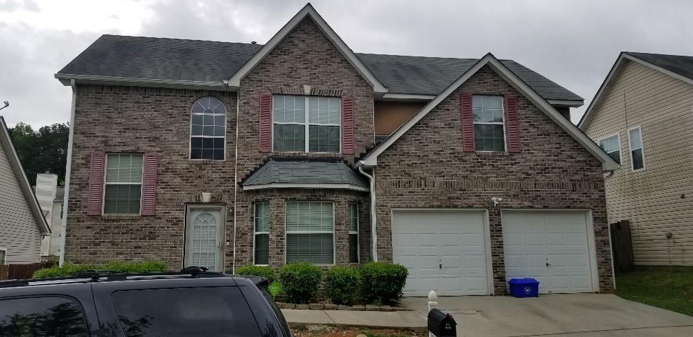
- Traditional Architecture
- Wood Flooring
- 2 Car Attached Garage
- 1-Story Property
- Central Air
- Level Lot
3666 Sugar Maple St

Favorites
About This Home
Available Now
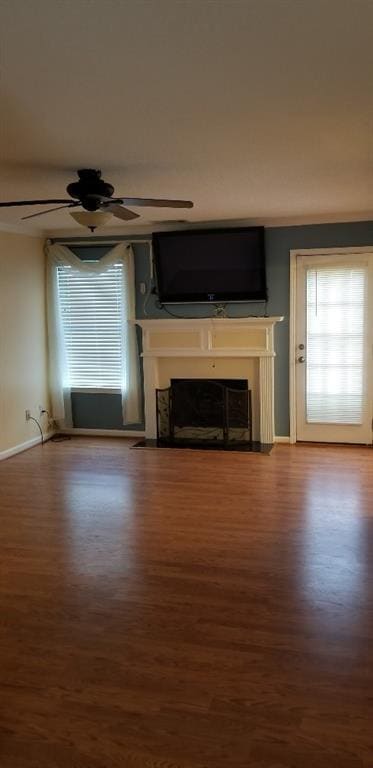
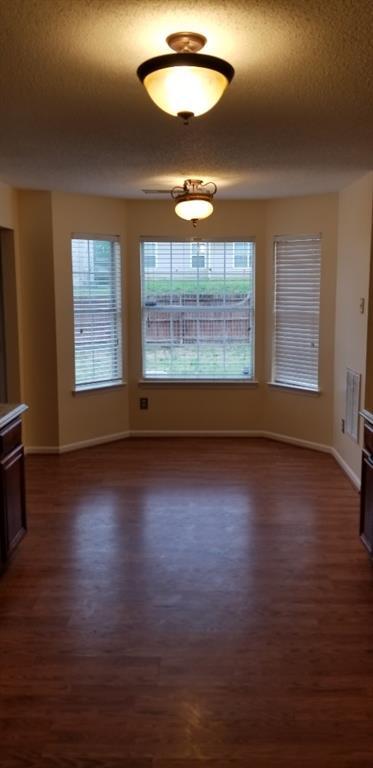
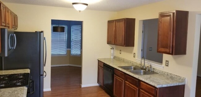
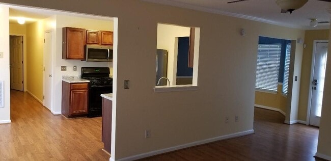
This spacious two-story home features a large master suite with a cozy sitting area,elegant tray ceiling,walk-in closet,garden tub,and separate shower. The inviting family room offers a fireplace and a mounted flat-screen TV,perfect for relaxing evenings. Enjoy the convenience of a separate laundry room and a generous kitchen with a bright breakfast area. Step outside to a fenced backyard,ideal for outdoor enjoyment and privacy.
3666 Sugar Maple St is a house located in DeKalb County and the 30034 ZIP Code. This area is served by the DeKalb County attendance zone.
* Price shown is base rent and may not include non-optional fees and utilities.
Price, availability, fees, and any applicable rent special are subject to change without notice.
* Square footage definitions vary. Displayed square footage is approximate.
Home Details
Home Type
Single Family Detached Home
Year Built
Built in 2004
Bedrooms and Bathrooms
3.5 Bathrooms
4 Bedrooms
Flooring
Wood
Carpet
Home Design
Traditional Architecture
Brick Exterior Construction
Composition Roof
Interior Spaces
Living Room with Fireplace
1-Story Property
1,902 Sq Ft Home
Listing and Financial Details
12 Month Lease Term
Assessor Parcel Number 15 057 04 060
Lot Details
6,098 Sq Ft Lot
No Common Walls
Level Lot
Parking
2 Car Attached Garage
Schools
Oak Grove - Dekalb Elementary School
Cedar Grove Middle School
Cedar Grove High School
Utilities
Central Air
Heat Pump System
Community Details
Overview
The Woods Of Oakvale Subdivision
Contact
- Listed by Calvin Gleaton | EXP Realty,LLC.
- Phone Number
- Contact
-
Source
 First Multiple Listing Service, Inc.
Copyright © 2025 First Multiple Listing Service, Inc. All rights reserved. All information provided by the listing agent/broker is deemed reliable but is not guaranteed and should be independently verified.
Location
Get Directions
Southeast DeKalb refers to a sprawling region in the southeastern portion of DeKalb County. Among the many communities in this area are the communities of Clarkston, Stone Mountain, Lithonia, Panthersville, Gresham Park, and Sheffield Woods.
Each community in this region has its own distinct character. Southeast DeKalb offers ample opportunities for outdoor recreation at destinations such as Stone Mountain Park, Panola Mountain State Park, and Arabia Mountain National Heritage Area. Southeast DeKalb sits within easy driving distance of all that Greater Atlanta has to offer, with close proximity to major thoroughfares like I-285, I-20, and U.S. 278.
Learn more about living in Southeast DeKalb
Education
| Colleges & Universities | Distance | ||
|---|---|---|---|
| Colleges & Universities | Distance | ||
| Drive: | 5 min | 1.9 mi | |
| Drive: | 16 min | 7.4 mi | |
| Drive: | 22 min | 9.5 mi | |
| Drive: | 19 min | 11.0 mi |
3666 Sugar Maple St is within 5 minutes or 1.9 miles from Georgia Perim. Coll., Decatur. It is also near Agnes Scott College and Clayton State University.
Schools


Public Elementary School
Grades PK-5
668 Students
Attendance Zone
Public Middle School
Grades 6-8
777 Students
Attendance Zone
Public High School
Grades 9-12
1,123 Students
Attendance Zone
Private Elementary School
Grades PK-3
Nearby
Private Elementary & Middle School
Grades PK-8
100 Students
Nearby
Private Elementary & Middle School
Grades PK-9
Nearby
Private Elementary, Middle & High School
Grades PK-12
Nearby
School data provided by
 The GreatSchools Rating helps parents compare schools within a state based on a variety of school quality indicators and provides a helpful picture of how effectively each school serves all of its students. Ratings are on a scale of 1 (below average) to 10 (above average) and can include test scores, college readiness, academic progress, advanced courses, equity, discipline and attendance data. We also advise parents to visit schools, consider other information on school performance and programs, and consider family needs as part of the school selection process.
View GreatSchools Rating Methodology
Data provided by GreatSchools.org © 2025. All rights reserved.
View GreatSchools Rating Methodology
Data provided by GreatSchools.org © 2025. All rights reserved.
Transportation options available in Decatur include Decatur, located 8.2 miles from 3666 Sugar Maple St. 3666 Sugar Maple St is near Hartsfield - Jackson Atlanta International, located 12.2 miles or 24 minutes away.
| Transit / Subway | Distance | ||
|---|---|---|---|
| Transit / Subway | Distance | ||
|
|
Drive: | 17 min | 8.2 mi |
|
|
Drive: | 18 min | 8.6 mi |
|
|
Drive: | 14 min | 8.6 mi |
|
|
Drive: | 18 min | 8.7 mi |
|
|
Drive: | 17 min | 9.5 mi |
| Commuter Rail | Distance | ||
|---|---|---|---|
| Commuter Rail | Distance | ||
|
|
Drive: | 26 min | 15.6 mi |
| Airports | Distance | ||
|---|---|---|---|
| Airports | Distance | ||
|
Hartsfield - Jackson Atlanta International
|
Drive: | 24 min | 12.2 mi |
Time and distance from 3666 Sugar Maple St.
| Shopping Centers | Distance | ||
|---|---|---|---|
| Shopping Centers | Distance | ||
| Drive: | 6 min | 2.4 mi | |
| Drive: | 6 min | 2.5 mi | |
| Drive: | 6 min | 2.6 mi |
3666 Sugar Maple St has 3 shopping centers within 2.6 miles, which is about a 6-minute drive. The miles and minutes will be for the farthest away property.
| Parks and Recreation | Distance | ||
|---|---|---|---|
| Parks and Recreation | Distance | ||
|
Ferns of the World Garden
|
Drive: | 3 min | 1.4 mi |
|
Wylde Center and Oakhurst Community Garden
|
Drive: | 15 min | 7.1 mi |
|
Bradley Observatory
|
Drive: | 16 min | 7.6 mi |
|
South River Watershed Alliance
|
Drive: | 18 min | 8.3 mi |
|
Panola Mountain State Park
|
Drive: | 17 min | 8.6 mi |
3666 Sugar Maple St has 5 parks within 8.6 miles, including Ferns of the World Garden, Wylde Center and Oakhurst Community Garden, and Panola Mountain State Park.
| Hospitals | Distance | ||
|---|---|---|---|
| Hospitals | Distance | ||
| Drive: | 4 min | 1.8 mi | |
| Drive: | 19 min | 9.3 mi | |
| Drive: | 17 min | 9.5 mi |
3666 Sugar Maple St has 3 hospitals within 9.5 miles, the nearest is Georgia Regional Hospital Atlanta which is 1.8 miles away and a 4 minute drive.
| Military Bases | Distance | ||
|---|---|---|---|
| Military Bases | Distance | ||
| Drive: | 18 min | 7.5 mi | |
| Drive: | 27 min | 16.0 mi |
3666 Sugar Maple St is 7.5 miles from Fort Gillem, and is convenient to other military bases, including Fort McPherson.
You May Also Like
Similar Rentals Nearby
-
-
-
1 / 28

-
1 / 19

-
-
-
-
1 / 17

-

-


What Are Walk Score®, Transit Score®, and Bike Score® Ratings?
Walk Score® measures the walkability of any address. Transit Score® measures access to public transit. Bike Score® measures the bikeability of any address.
What is a Sound Score Rating?
A Sound Score Rating aggregates noise caused by vehicle traffic, airplane traffic and local sources
3666 Sugar Maple St
Decatur, GA 30034