
$2,750
/ Month
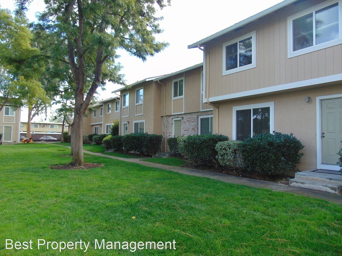
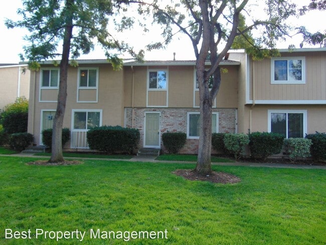
3647 Carrigan Cmn
Livermore, CA 94550
Favorites
-
Bedrooms
3
-
Bathrooms
1.5
-
Square Feet
1,242 sq ft
3647 Carrigan Cmn

Favorites
About This Home
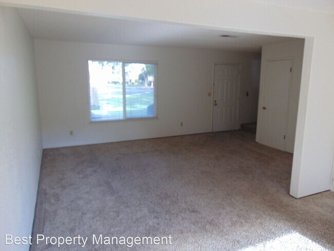
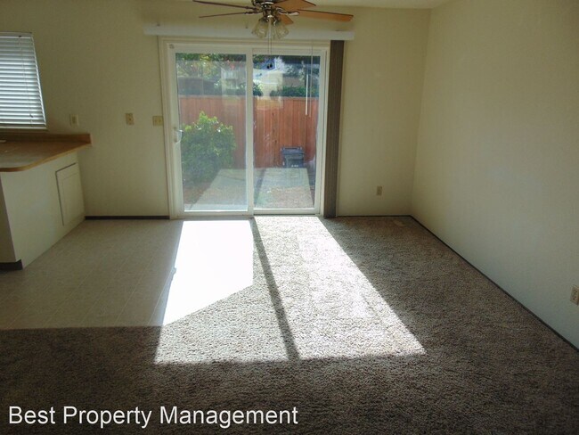
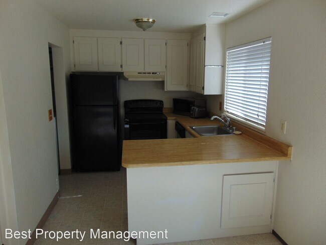
- Great Condo near downtown Livermore - Located a mile away from Downtown Livermore's shopping, restaurants, and wineries. Great place with brand new laminate floors throughout, and paint throughout. Walking distance to great schools in the area. The patio is good sized and landscaped with storage space. Quiet and safe neighborhood. Text for Showing information: Megan Pato Best Property Management Inc DRE # 02016922 (RLNE3748219) Pet policies: Small Dogs Allowed, Cats Allowed, Large Dogs Allowed.
3647 Carrigan Cmn is a house located in Alameda County and the 94550 ZIP Code. This area is served by the Livermore Valley Joint Unified School District attendance zone.
* Price shown is base rent. Excludes user-selected optional fees and variable or usage-based fees and required charges due at or prior to move-in or at move-out. Price, availability, fees, and any applicable rent special are subject to change without notice.
* Square footage definitions vary. Displayed square footage is approximate.
Fees and Policies
The fees listed below are community-provided and may exclude utilities or add-ons. All payments are made directly to the property and are non-refundable unless otherwise specified.
- Dogs Allowed
-
Fees not specified
-
Weight limit--
-
Pet Limit--
Contact
- Listed by Best Property Management
Location
Get Directions
The cities of Livermore, Dublin and Pleasanton form a loosely shaped triangle within California's Tri-Valley region, a cluster of three small valleys about 33 miles east of San Francisco and 35 miles northeast of San Jose. Known for its Mediterranean climate, rolling hills and historic vineyards, this once bucolic region now boasts three separate downtown areas, a bustling business community and some of the best wineries in the state.
At the eastern end of the region lies the city of Livermore. Once known as Livermores, Livermore Ranch and Nottingham, the city sits at the center of Livermore Valley, a historic region dotted with more than 5,000 acres of mostly family-owned vineyards. A pastoral neighborhood known for its charming yet functional hilltop windmills, Livermore hosts the internationally recognized and sometimes controversial center of scientific research, Lawrence Livermore National Laboratories.
Learn more about living in Dublin/Pleasanton/Livermore
Education
| Colleges & Universities | Distance | ||
|---|---|---|---|
| Colleges & Universities | Distance | ||
| Drive: | 11 min | 5.0 mi | |
| Drive: | 22 min | 13.6 mi | |
| Drive: | 22 min | 14.4 mi | |
| Drive: | 27 min | 16.3 mi |
3647 Carrigan Cmn is within 11 minutes or 5.0 miles from Las Positas College. It is also near Diablo Valley Coll, San Ramon and San Joaquin Delta, Mtn. House.
Schools


Public Elementary School
Grades K-5
537 Students
Nearby
Public Elementary School
Grades K-5
489 Students
Attendance Zone
Public Middle School
Grades 6-8
581 Students
Attendance Zone
Public High School
Grades 9-12
1,827 Students
Attendance Zone
Private Elementary School
Grades PK-5
Nearby
Private Elementary, Middle & High School
Grades K-12
Nearby
Private Elementary & Middle School
Grades K-8
271 Students
Nearby
School data provided by
 The GreatSchools Rating helps parents compare schools within a state based on a variety of school quality indicators and provides a helpful picture of how effectively each school serves all of its students. Ratings are on a scale of 1 (below average) to 10 (above average) and can include test scores, college readiness, academic progress, advanced courses, equity, discipline and attendance data. We also advise parents to visit schools, consider other information on school performance and programs, and consider family needs as part of the school selection process.
View GreatSchools Rating Methodology
Data provided by GreatSchools.org © 2026. All rights reserved.
View GreatSchools Rating Methodology
Data provided by GreatSchools.org © 2026. All rights reserved.
Transportation options available in Livermore include Dublin Pleasanton Station, located 10.4 miles from 3647 Carrigan Cmn. 3647 Carrigan Cmn is near Metro Oakland International, located 29.2 miles or 38 minutes away, and Norman Y Mineta San Jose International, located 31.2 miles or 45 minutes away.
| Transit / Subway | Distance | ||
|---|---|---|---|
| Transit / Subway | Distance | ||
|
|
Drive: | 15 min | 10.4 mi |
|
|
Drive: | 15 min | 10.8 mi |
| Commuter Rail | Distance | ||
|---|---|---|---|
| Commuter Rail | Distance | ||
| Walk: | 18 min | 1.0 mi | |
| Drive: | 10 min | 4.3 mi | |
| Drive: | 15 min | 8.0 mi | |
| Drive: | 34 min | 20.3 mi | |
| Drive: | 34 min | 20.4 mi |
| Airports | Distance | ||
|---|---|---|---|
| Airports | Distance | ||
|
Metro Oakland International
|
Drive: | 38 min | 29.2 mi |
|
Norman Y Mineta San Jose International
|
Drive: | 45 min | 31.2 mi |
Getting Around
 What do Walkability, Transit, Drivability, and Bikeability mean?
Walkability measures the walking distance to day-to-day needs.
Transit measures access to public transportation.
Drivability measures congestion, parking availability, and access to major roads.
Bikeability measures the suitability for cycling.
How It Works
What do Walkability, Transit, Drivability, and Bikeability mean?
Walkability measures the walking distance to day-to-day needs.
Transit measures access to public transportation.
Drivability measures congestion, parking availability, and access to major roads.
Bikeability measures the suitability for cycling.
How It Works
Fairly Walkable
Walkability
50
/ 100
Limited Public Transit
Transit
30
/ 100
Very Drivable
Drivability
80
/ 100
Moderately Bikeable
Bikeability
60
/ 100
Scores provided by
-
Soundscore™
-
/ 100
Traffic
-Airport
-Businesses
-Scores provided by
HowLoud What is a Sound Score Rating? A Sound Score Rating aggregates noise caused by vehicle traffic, airplane traffic and local sources. How It WorksTime and distance from 3647 Carrigan Cmn.
| Shopping Centers | Distance | ||
|---|---|---|---|
| Shopping Centers | Distance | ||
| Walk: | 5 min | 0.3 mi | |
| Walk: | 15 min | 0.8 mi | |
| Walk: | 16 min | 0.9 mi |
3647 Carrigan Cmn has 3 shopping centers within 0.9 mile, which is about a 16-minute walk. The miles and minutes will be for the farthest away property.
| Parks and Recreation | Distance | ||
|---|---|---|---|
| Parks and Recreation | Distance | ||
|
Shadow Cliffs Regional Recreation Area
|
Drive: | 12 min | 5.6 mi |
|
Brushy Peak Regional Preserve
|
Drive: | 16 min | 7.2 mi |
|
Del Valle Regional Park
|
Drive: | 24 min | 8.0 mi |
|
Los Vaqueros Watershed
|
Drive: | 17 min | 8.7 mi |
|
Carnegie State Vehicle Recreation Area
|
Drive: | 21 min | 11.3 mi |
3647 Carrigan Cmn has 5 parks within 11.3 miles, including Shadow Cliffs Regional Recreation Area, Brushy Peak Regional Preserve, and Del Valle Regional Park.
| Hospitals | Distance | ||
|---|---|---|---|
| Hospitals | Distance | ||
| Drive: | 14 min | 8.7 mi |
3647 Carrigan Cmn is 8.7 miles and a 14 minute drive from Stanford Health Care - ValleyCare.
| Military Bases | Distance | ||
|---|---|---|---|
| Military Bases | Distance | ||
| Drive: | 45 min | 33.3 mi | |
| Drive: | 50 min | 34.0 mi | |
| Drive: | 60 min | 44.5 mi |
3647 Carrigan Cmn has 3 military bases within 44.5 miles, the nearest is Sharpe Army Depot which is 33.3 miles away and a 45 minute drive.
You May Also Like
Similar Rentals Nearby
-
-

-
 4 Beds$5,410Total Monthly PriceTotal Monthly Price NewPrices include all required monthly fees.House for Rent
 -
 3 Beds$3,710Total Monthly PriceTotal Monthly Price NewPrices include all required monthly fees.House for Rent
 -

-
 4 Beds$4,220Total Monthly PriceTotal Monthly Price NewPrices include all required monthly fees.House for Rent
 -
 4 Beds$3,860Total Monthly PriceTotal Monthly Price NewPrices include all required monthly fees.House for Rent
 -

-

-
 4 Beds$4,500Total Monthly PriceTotal Monthly Price NewPrices include all required monthly fees.House for Rent
What Are Walk Score®, Transit Score®, and Bike Score® Ratings?
Walk Score® measures the walkability of any address. Transit Score® measures access to public transit. Bike Score® measures the bikeability of any address.
What is a Sound Score Rating?
A Sound Score Rating aggregates noise caused by vehicle traffic, airplane traffic and local sources.

3647 Carrigan Cmn
Livermore, CA 94550