$2,195 / Month
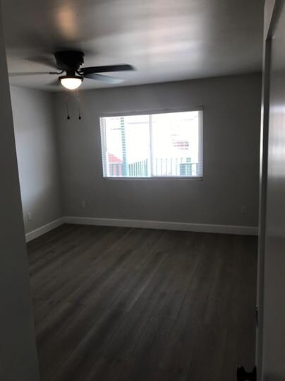
363 Roosevelt St Unit 6
Chula Vista, CA 91910
2 Weeks Ago
Favorites
363 Roosevelt St Unit 6

Favorites
Check Back Soon for Upcoming Availability
| Beds | Baths | Average SF |
|---|---|---|
| 1 Bedroom 1 Bedroom 1 Br | 1 Bath 1 Bath 1 Ba | — |
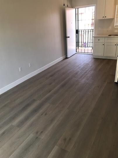
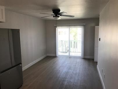
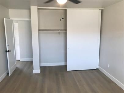
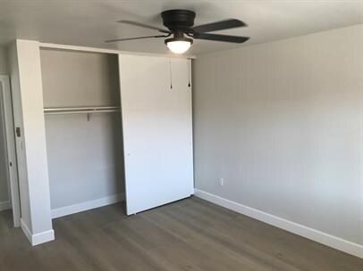
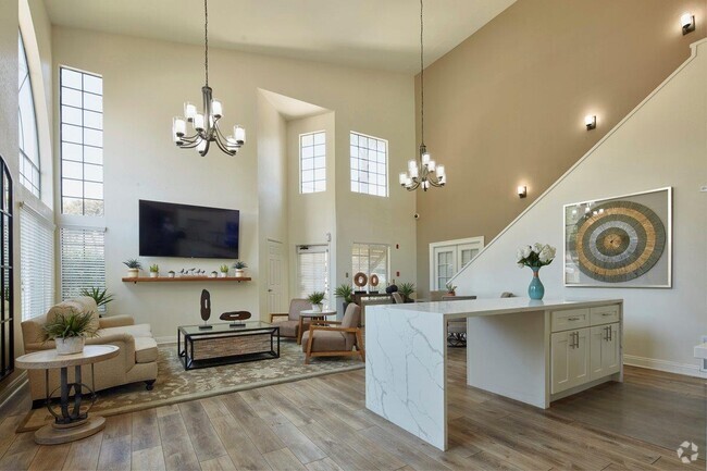
About This Property
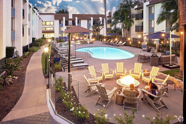
Centrally located in a quiet and safe residential neighborhood with convenient access to amenities including: public transportation (H Street Transit Station), markets & grocery stores, shopping centers, churches, medical facilities (Scripps Mercy Hospital Chula Vista, Chula Vista Family Health Center), and schools (Chula Vista Middle School, Hilltop Elementary School, Hilltop Middle School). Close enough to I-5 and I-805 that downtown or the airport are just minutes away and only one block to 3rd Ave Chula Vista Village which contains dozens of restaurants, pubs and bars. Walk score of 82 "very walkable".
363 Roosevelt St is an apartment community located in San Diego County and the 91910 ZIP Code.
Location
Get Directions
Situated about nine miles south of San Diego, Downtown Chula Vista is the core of the city. Residents enjoy convenient shopping at Chula Vista Center, and a wide range of diverse eateries located throughout the area.
While the neighborhood is at the center of the city, options for outdoor recreation are aplenty. San Diego Bay National Wildlife Refuge, Bayside Park, Rohr Park, and Silver Strand Beach are all within close proximity to Downtown Chula Vista. Quick access to I-5 and I-805 connects Downtown Chula Vista to the Greater San Diego Area and beyond.
Learn more about living in Downtown Chula VistaBelow are rent ranges for similar nearby apartments
Education
| Colleges & Universities | Distance | ||
|---|---|---|---|
| Colleges & Universities | Distance | ||
| Drive: | 12 min | 5.4 mi | |
| Drive: | 11 min | 8.8 mi | |
| Drive: | 13 min | 9.2 mi | |
| Drive: | 13 min | 10.0 mi |
363 Roosevelt St Unit 6 is within 12 minutes or 5.4 miles from Southwestern Coll, Chula Vista. It is also near San Diego City College and Thomas Jefferson School of Law.
Transportation options available in Chula Vista include H Street Station, located 1.1 miles from 363 Roosevelt St Unit 6. 363 Roosevelt St Unit 6 is near San Diego International, located 12.5 miles or 17 minutes away.
| Transit / Subway | Distance | ||
|---|---|---|---|
| Transit / Subway | Distance | ||
|
|
Drive: | 2 min | 1.1 mi |
|
|
Drive: | 3 min | 1.8 mi |
|
|
Drive: | 6 min | 3.4 mi |
|
|
Drive: | 6 min | 3.6 mi |
|
|
Drive: | 7 min | 4.5 mi |
| Commuter Rail | Distance | ||
|---|---|---|---|
| Commuter Rail | Distance | ||
|
|
Drive: | 14 min | 9.8 mi |
|
|
Drive: | 16 min | 13.2 mi |
|
|
Drive: | 29 min | 24.0 mi |
|
|
Drive: | 39 min | 29.9 mi |
|
|
Drive: | 42 min | 33.5 mi |
| Airports | Distance | ||
|---|---|---|---|
| Airports | Distance | ||
|
San Diego International
|
Drive: | 17 min | 12.5 mi |
Time and distance from 363 Roosevelt St Unit 6.
| Shopping Centers | Distance | ||
|---|---|---|---|
| Shopping Centers | Distance | ||
| Walk: | 9 min | 0.5 mi | |
| Walk: | 14 min | 0.8 mi | |
| Walk: | 16 min | 0.8 mi |
363 Roosevelt St Unit 6 has 3 shopping centers within 0.8 mile, which is about a 16-minute walk. The miles and minutes will be for the farthest away property.
| Parks and Recreation | Distance | ||
|---|---|---|---|
| Parks and Recreation | Distance | ||
|
Living Coast Discovery Center
|
Drive: | 3 min | 1.7 mi |
|
San Diego Bay National Wildlife Refuge
|
Drive: | 6 min | 2.5 mi |
|
Otay Valley Regional Park
|
Drive: | 8 min | 4.1 mi |
|
Sweetwater Regional Park
|
Drive: | 10 min | 5.5 mi |
|
Silver Strand State Beach
|
Drive: | 19 min | 9.9 mi |
363 Roosevelt St Unit 6 has 5 parks within 9.9 miles, including Living Coast Discovery Center, San Diego Bay National Wildlife Refuge, and Otay Valley Regional Park.
| Hospitals | Distance | ||
|---|---|---|---|
| Hospitals | Distance | ||
| Drive: | 8 min | 4.5 mi | |
| Drive: | 9 min | 4.6 mi | |
| Drive: | 12 min | 9.3 mi |
363 Roosevelt St Unit 6 has 3 hospitals within 9.3 miles, the nearest is Paradise Valley Hospital which is 4.5 miles away and a 8 minute drive.
| Military Bases | Distance | ||
|---|---|---|---|
| Military Bases | Distance | ||
| Drive: | 7 min | 4.5 mi | |
| Drive: | 18 min | 13.0 mi |
363 Roosevelt St Unit 6 is 4.5 miles from San Diego Naval Air Station, and is convenient to other military bases, including US Naval Amphibious Base.
You May Also Like
Similar Rentals Nearby


What Are Walk Score®, Transit Score®, and Bike Score® Ratings?
Walk Score® measures the walkability of any address. Transit Score® measures access to public transit. Bike Score® measures the bikeability of any address.
What is a Sound Score Rating?
A Sound Score Rating aggregates noise caused by vehicle traffic, airplane traffic and local sources

363 Roosevelt St
Chula Vista, CA 91910