
Apollo South Bay
12888 Crenshaw Blvd,
Gardena, CA 90249
$2,494 - $4,571
Studio - 2 Beds

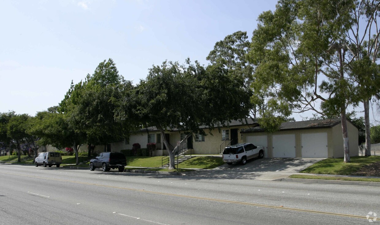
Discover a new home at 3621-3653 W 120th St in Hawthorne, CA. The 3621-3653 W. 120th St. location in Hawthorne's 90250 area has so much to offer its residents. The professional leasing team is available to assist you in finding your new place. Be sure to come for a visit to view the available floorplans. So get a head start on your move. Contact or stop by 3621-3653 W 120th St to schedule a tour today!
3621-3653 W 120th St is an apartment community located in Los Angeles County and the 90250 ZIP Code. This area is served by the Inglewood Unified School District attendance zone.
Air Conditioning
High Speed Internet Access
Smoke Free
Heating
South Bay is a sprawling region of the Los Angeles metropolitan area in the southwest corner of the county. Spread across the city of Torrance, South Bay sits just off the coast, where you’ll find beautiful beaches and waterfront cities like Redondo Beach, Hermosa Beach, Manhattan Beach, and Long Beach. Abundant shopping opportunities are available in this sector of LA, including the South Bay Galleria, Del Amo Fashion Center, and Torrance Promenade. Residents of South Bay can easily commute into Santa Monica, Inglewood, or Downtown Los Angeles for work or leisure. Locals enjoy being so close to the coast, where they can enjoy the great outdoors by swimming, fishing, boating, and more.
Learn more about living in South Bay| Colleges & Universities | Distance | ||
|---|---|---|---|
| Colleges & Universities | Distance | ||
| Drive: | 6 min | 2.6 mi | |
| Drive: | 7 min | 3.9 mi | |
| Drive: | 11 min | 6.8 mi | |
| Drive: | 13 min | 7.9 mi |


Transportation options available in Hawthorne include Crenshaw Station, located 0.8 mile from 3621-3653 W 120th St. 3621-3653 W 120th St is near Los Angeles International, located 5.9 miles or 11 minutes away, and Long Beach (Daugherty Field), located 16.1 miles or 24 minutes away.
| Transit / Subway | Distance | ||
|---|---|---|---|
| Transit / Subway | Distance | ||
|
|
Walk: | 15 min | 0.8 mi |
|
|
Drive: | 4 min | 2.9 mi |
| Drive: | 6 min | 3.2 mi | |
|
|
Drive: | 7 min | 3.9 mi |
|
|
Drive: | 7 min | 4.3 mi |
| Commuter Rail | Distance | ||
|---|---|---|---|
| Commuter Rail | Distance | ||
|
|
Drive: | 20 min | 14.2 mi |
|
|
Drive: | 22 min | 14.4 mi |
|
|
Drive: | 24 min | 16.4 mi |
|
|
Drive: | 26 min | 17.9 mi |
| Drive: | 24 min | 18.3 mi |
| Airports | Distance | ||
|---|---|---|---|
| Airports | Distance | ||
|
Los Angeles International
|
Drive: | 11 min | 5.9 mi |
|
Long Beach (Daugherty Field)
|
Drive: | 24 min | 16.1 mi |
Scores provided by
Traffic
-Airport
-Businesses
-Scores provided by
HowLoud What is a Sound Score Rating? A Sound Score Rating aggregates noise caused by vehicle traffic, airplane traffic and local sources. How It WorksTime and distance from 3621-3653 W 120th St.
| Shopping Centers | Distance | ||
|---|---|---|---|
| Shopping Centers | Distance | ||
| Walk: | 17 min | 0.9 mi | |
| Walk: | 18 min | 1.0 mi | |
| Drive: | 3 min | 1.2 mi |
| Parks and Recreation | Distance | ||
|---|---|---|---|
| Parks and Recreation | Distance | ||
|
Watts Towers-Rodia State Park
|
Drive: | 10 min | 6.5 mi |
|
Watts Senior Center & Rose Garden
|
Drive: | 10 min | 6.9 mi |
|
Dockweiler State Beach
|
Drive: | 11 min | 7.0 mi |
|
Compton Creek Natural Park at George Washington Elementary
|
Drive: | 11 min | 7.5 mi |
|
Kenneth Hahn State Recreation Area
|
Drive: | 18 min | 8.9 mi |
| Hospitals | Distance | ||
|---|---|---|---|
| Hospitals | Distance | ||
| Drive: | 5 min | 2.5 mi | |
| Drive: | 8 min | 5.4 mi | |
| Drive: | 8 min | 6.3 mi |
| Military Bases | Distance | ||
|---|---|---|---|
| Military Bases | Distance | ||
| Drive: | 6 min | 3.2 mi |
Pets Allowed In Unit Washer & Dryer Maintenance on site Heat Controlled Access Elevator
What Are Walk Score®, Transit Score®, and Bike Score® Ratings?
Walk Score® measures the walkability of any address. Transit Score® measures access to public transit. Bike Score® measures the bikeability of any address.
What is a Sound Score Rating?
A Sound Score Rating aggregates noise caused by vehicle traffic, airplane traffic and local sources.
3621-3653 W 120th St
Hawthorne, CA 90250

")


