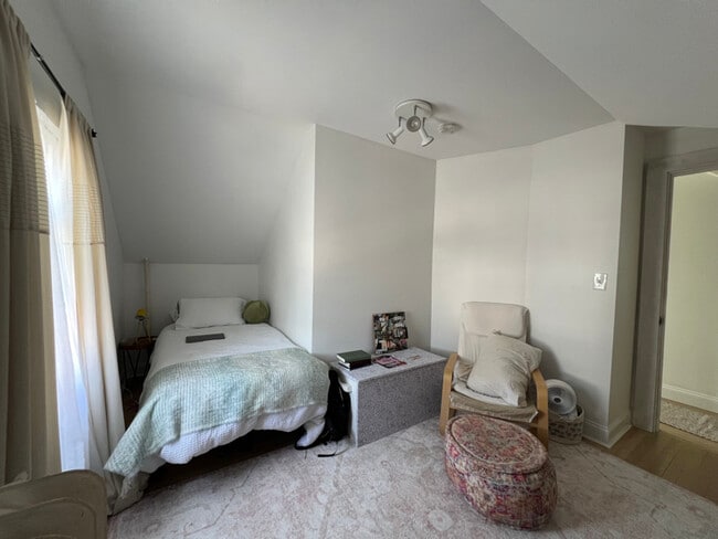
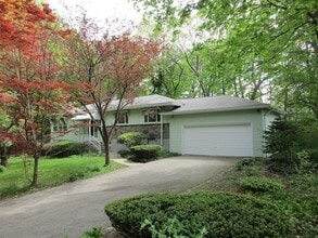
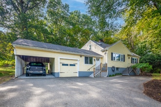
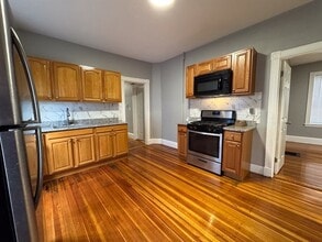
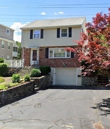
3 Beds, 2.5 Baths, 1,800 sq ft
36 Howland St
Needham, MA 02492

Check Back Soon for Upcoming Availability
| Beds | Baths | Average SF |
|---|---|---|
| 3 Bedrooms 3 Bedrooms 3 Br | 2 Baths 2 Baths 2 Ba | 1,526 SF |
About This Property
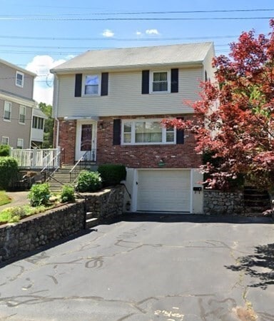
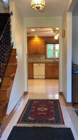
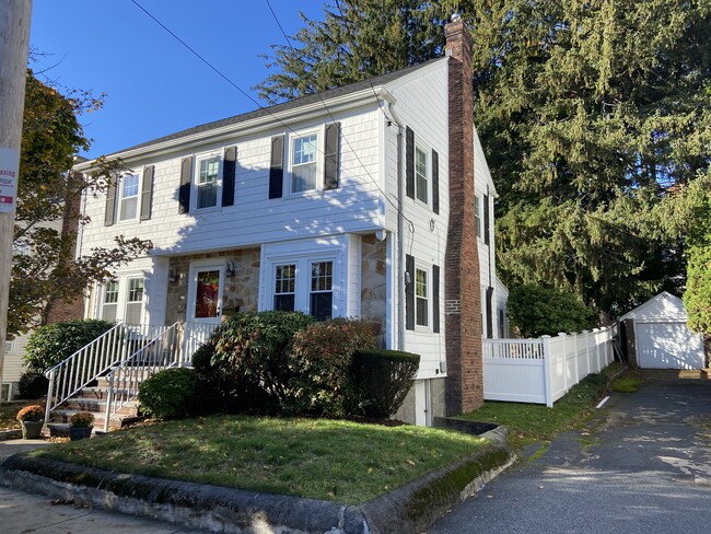
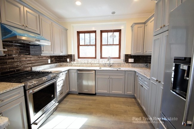
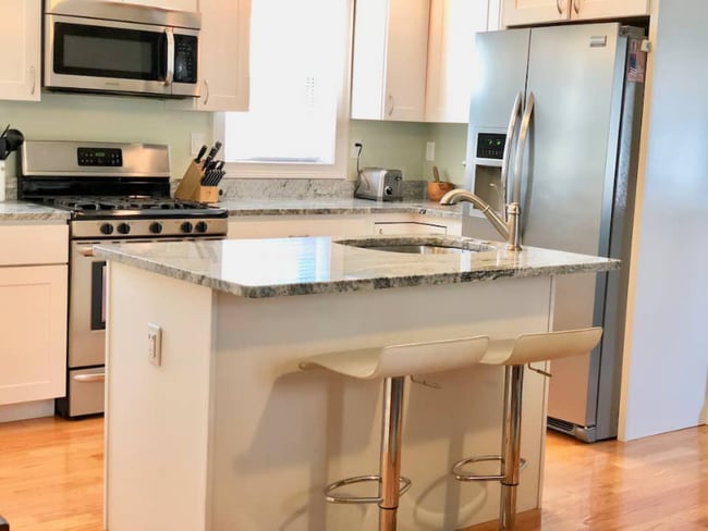
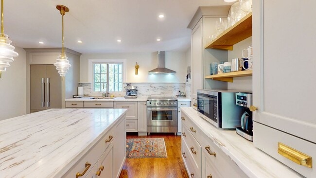
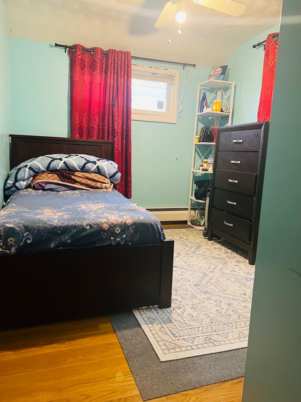
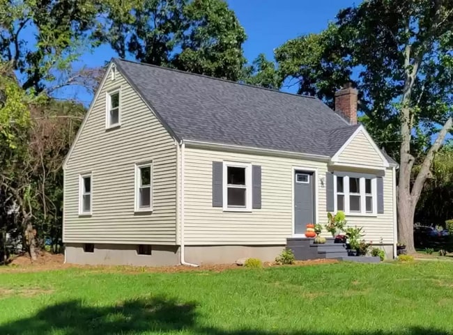
Cherished family home features living room,dining room,eat-in kitchen,family room,and full bath on the first floor. Three bedrooms,all with double closets,and a full bath complete the second floor. One car garage. Patio and deck. Great commuter location. Located within close proximity to Needham Junction Train Station. Gas heat. House is cooled by three mini-split systems and one in-wall A/C. Some furnishings may remain for tenant's use or may be removed. Available for mid January occupancy.
36 Howland St is a house located in Norfolk County and the 02492 ZIP Code. This area is served by the Needham attendance zone.
Just west of Boston and East of Worcester sits Metro West, a region that houses a group of towns and cities with significant historical backgrounds. A total of 19 municipalities make up the core of this community, but other municipalities are considered to be a part of the Interstate 495/Metro West Corridor.
Learn more about living in Metro WestBelow are rent ranges for similar nearby apartments
| Beds | Average Size | Lowest | Typical | Premium |
|---|---|---|---|---|
| Studio Studio Studio | 503-505 Sq Ft | $895 | $2,191 | $7,966 |
| 1 Bed 1 Bed 1 Bed | 840-842 Sq Ft | $1,140 | $2,739 | $9,252 |
| 2 Beds 2 Beds 2 Beds | 1254-1256 Sq Ft | $1,500 | $3,357 | $14,862 |
| 3 Beds 3 Beds 3 Beds | 1569-1574 Sq Ft | $2,150 | $4,473 | $21,492 |
| 4 Beds 4 Beds 4 Beds | 2982 Sq Ft | $975 | $5,522 | $12,000 |
| Colleges & Universities | Distance | ||
|---|---|---|---|
| Colleges & Universities | Distance | ||
| Drive: | 6 min | 2.9 mi | |
| Drive: | 12 min | 5.2 mi | |
| Drive: | 14 min | 7.2 mi | |
| Drive: | 15 min | 7.6 mi |
 The GreatSchools Rating helps parents compare schools within a state based on a variety of school quality indicators and provides a helpful picture of how effectively each school serves all of its students. Ratings are on a scale of 1 (below average) to 10 (above average) and can include test scores, college readiness, academic progress, advanced courses, equity, discipline and attendance data. We also advise parents to visit schools, consider other information on school performance and programs, and consider family needs as part of the school selection process.
View GreatSchools Rating Methodology
Data provided by GreatSchools.org © 2025. All rights reserved.
Transportation options available in Needham include Newton Highlands Station, located 4.2 miles from 36 Howland St. 36 Howland St is near General Edward Lawrence Logan International, located 17.4 miles or 31 minutes away, and Worcester Regional, located 36.1 miles or 62 minutes away.
| Transit / Subway | Distance | ||
|---|---|---|---|
| Transit / Subway | Distance | ||
|
|
Drive: | 8 min | 4.2 mi |
|
|
Drive: | 10 min | 4.4 mi |
|
|
Drive: | 10 min | 4.6 mi |
|
|
Drive: | 10 min | 5.3 mi |
|
|
Drive: | 10 min | 5.9 mi |
| Commuter Rail | Distance | ||
|---|---|---|---|
| Commuter Rail | Distance | ||
|
|
Walk: | 9 min | 0.5 mi |
|
|
Walk: | 12 min | 0.7 mi |
|
|
Drive: | 4 min | 1.4 mi |
|
|
Drive: | 3 min | 1.6 mi |
|
|
Drive: | 8 min | 4.3 mi |
| Airports | Distance | ||
|---|---|---|---|
| Airports | Distance | ||
|
General Edward Lawrence Logan International
|
Drive: | 31 min | 17.4 mi |
|
Worcester Regional
|
Drive: | 62 min | 36.1 mi |
Time and distance from 36 Howland St.
| Shopping Centers | Distance | ||
|---|---|---|---|
| Shopping Centers | Distance | ||
| Walk: | 11 min | 0.6 mi | |
| Drive: | 5 min | 2.7 mi | |
| Drive: | 5 min | 2.8 mi |
| Parks and Recreation | Distance | ||
|---|---|---|---|
| Parks and Recreation | Distance | ||
|
Cutler Park Reservation
|
Drive: | 6 min | 3.0 mi |
|
Hemlock Gorge Reservation
|
Drive: | 7 min | 3.4 mi |
|
Brook Farm Historic Site
|
Drive: | 10 min | 4.7 mi |
|
Horticultural Society at Elm Bank
|
Drive: | 13 min | 5.1 mi |
|
Elm Bank Reservation
|
Drive: | 14 min | 6.4 mi |
| Hospitals | Distance | ||
|---|---|---|---|
| Hospitals | Distance | ||
| Walk: | 11 min | 0.6 mi | |
| Drive: | 10 min | 5.6 mi | |
| Drive: | 11 min | 5.6 mi |
| Military Bases | Distance | ||
|---|---|---|---|
| Military Bases | Distance | ||
| Drive: | 15 min | 7.8 mi | |
| Drive: | 27 min | 15.6 mi |
You May Also Like
Similar Rentals Nearby
-
Total Monthly Price New$3,400Total Monthly PricePrices include all required monthly fees.12 Month LeaseHouse for Rent
-
-
-
-
-
-
-
-
-
$3,60012 Month LeaseHouse for Rent4 Beds | 1 Bath | 1,500 sq ft
What Are Walk Score®, Transit Score®, and Bike Score® Ratings?
Walk Score® measures the walkability of any address. Transit Score® measures access to public transit. Bike Score® measures the bikeability of any address.
What is a Sound Score Rating?
A Sound Score Rating aggregates noise caused by vehicle traffic, airplane traffic and local sources
