

$3,900 / Month
358 Hunnewell St
Needham, MA 02494
Today
Favorites
857-205-8888
-
Bedrooms
3
-
Bathrooms
2
-
Square Feet
1,855 sq ft
-
Available
Available Sep 1
Highlights
- Medical Services
- Property is near public transit
- Wood Flooring
- Solid Surface Countertops
- Bathtub
- No Cooling
358 Hunnewell St

Favorites
About This Home
$3,900 deposit,
Available Sep 1
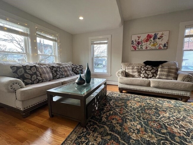
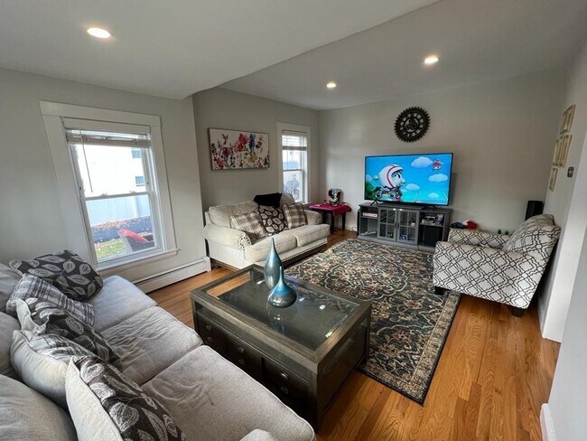
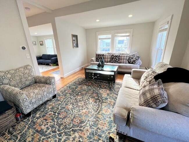
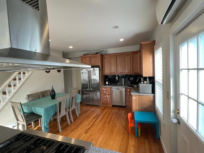
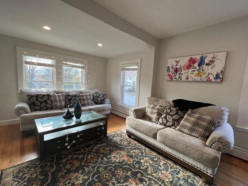
Don't miss the opportunity to rent and experience this prime living in the sought-after Needham area,offering the comfort of a single-family home. Situated in Needham Heights,this property provides quick access to public transportation,I-95,and a variety of shopping options including Trader Joe's and CVS,along with excellent dining choices. The well-maintained condo features recent upgrades such as a new heating system,water tank,roof,and updated electrical wiring. Enjoy a modern kitchen,2 fully renovated bathrooms,new carpeting in the master bedroom,and a private deck for outdoor entertaining. Additionally,the unit boasts a spacious basement and a walk-up attic,providing ample storage space. The lease is a minimum of 12 months. [PHOTOS ARE BEFORE TENANT] MLS# 73396953
358 Hunnewell St is a townhome located in Norfolk County and the 02494 ZIP Code. This area is served by the Needham attendance zone.
* Price shown is base rent and may not include non-optional fees and utilities.
Price, availability, fees, and any applicable rent special are subject to change without notice.
* Square footage definitions vary. Displayed square footage is approximate.
Home Details
Year Built
Built in 1984
Accessible Home Design
Entry on the 1st floor
Basement
Laundry in Basement
Bedrooms and Bathrooms
Bathtub
Primary bedroom located on second floor
2 Full Bathrooms
3 Bedrooms
Flooring
Wood
Wall to Wall Carpet
Home Design
Property Attached
Interior Spaces
1,855 Sq Ft Home
Kitchen
Solid Surface Countertops
Range with Range Hood
Microwave
Dishwasher
Disposal
Laundry
Washer and Gas Dryer Hookup
Listing and Financial Details
Security Deposit $3,900
Property Available on 9/1/25
12 Month Lease Term
Assessor Parcel Number 142564
Rent includes occupancy only
Location
Property is near public transit
Property is near schools
Lot Details
2.3 Acre Lot
Parking
2 Car Parking Spaces
Schools
Eliot Elementary School
Pollard Middle School
Needham High School
Utilities
No Cooling
Community Details
Amenities
Medical Services
Shops
Overview
Property has a Home Owners Association
Pet Policy
Call for details about the types of pets allowed
Fees and Policies
The fees below are based on community-supplied data and may exclude additional fees and utilities.
Pet policies are negotiable.
Contact
- Listed by Charlotte Liu | Keller Williams Realty
- Phone Number
-
Source
 MLS Property Information Network
The property listing data and information set forth herein were provided to MLS Property Information Network, Inc. from third party sources, including sellers, lessors and public records, and were compiled by MLS Property Information Network, Inc. The property listing data and information are for the personal, non-commercial use of consumers having a good faith interest in purchasing or leasing listed properties of the type displayed to them and may not be used for any purpose other than to identify prospective properties which such consumers may have a good faith interest in purchasing or leasing. MLS Property Information Network, Inc. and its subscribers disclaim any and all representations and warranties as to the accuracy of the property listing data and information set forth herein. All properties are subject to prior sale, change or withdrawal. Copyright © 2025 MLS Property Information Network, Inc. All rights reserved.
Location
Get Directions
Amenities
- Dishwasher
- Disposal
- Microwave
- Range
- Refrigerator
Just west of Boston and East of Worcester sits Metro West, a region that houses a group of towns and cities with significant historical backgrounds. A total of 19 municipalities make up the core of this community, but other municipalities are considered to be a part of the Interstate 495/Metro West Corridor.
Learn more about living in Metro West
Education
| Colleges & Universities | Distance | ||
|---|---|---|---|
| Colleges & Universities | Distance | ||
| Drive: | 7 min | 3.2 mi | |
| Drive: | 11 min | 4.4 mi | |
| Drive: | 11 min | 5.7 mi | |
| Drive: | 14 min | 7.0 mi |
358 Hunnewell St is within 7 minutes or 3.2 miles from Babson College. It is also near Wellesley College and Boston College.
Schools


Public Elementary School
Grades K-5
280 Students
Nearby
Public Elementary & Middle School
Grades 6
446 Students
Attendance Zone
Public Elementary School
Grades K-5
426 Students
Attendance Zone
Public Middle School
Grades 6-8
657 Students
Nearby
Public Middle School
Grades 7-8
818 Students
Attendance Zone
Public High School
Grades 9-12
1,645 Students
Attendance Zone
Private Elementary School
Grades PK-6
174 Students
Nearby
Private Elementary & Middle School
Grades PK-8
353 Students
Nearby
Private Middle & High School
Grades 7-12
9 Students
Nearby
Private Middle School
Grades 6-8
109 Students
Nearby
Private High School
Grades 9-12
10 Students
Nearby
School data provided by
 The GreatSchools Rating helps parents compare schools within a state based on a variety of school quality indicators and provides a helpful picture of how effectively each school serves all of its students. Ratings are on a scale of 1 (below average) to 10 (above average) and can include test scores, college readiness, academic progress, advanced courses, equity, discipline and attendance data. We also advise parents to visit schools, consider other information on school performance and programs, and consider family needs as part of the school selection process.
View GreatSchools Rating Methodology
Data provided by GreatSchools.org © 2025. All rights reserved.
View GreatSchools Rating Methodology
Data provided by GreatSchools.org © 2025. All rights reserved.
Transportation options available in Needham include Newton Highlands Station, located 2.8 miles from 358 Hunnewell St. 358 Hunnewell St is near General Edward Lawrence Logan International, located 15.9 miles or 28 minutes away, and Worcester Regional, located 42.4 miles or 61 minutes away.
| Transit / Subway | Distance | ||
|---|---|---|---|
| Transit / Subway | Distance | ||
|
|
Drive: | 5 min | 2.8 mi |
|
|
Drive: | 6 min | 2.9 mi |
|
|
Drive: | 7 min | 3.2 mi |
|
|
Drive: | 7 min | 3.4 mi |
|
|
Drive: | 8 min | 4.6 mi |
| Commuter Rail | Distance | ||
|---|---|---|---|
| Commuter Rail | Distance | ||
|
|
Walk: | 6 min | 0.3 mi |
|
|
Drive: | 2 min | 1.3 mi |
|
|
Drive: | 3 min | 1.8 mi |
|
|
Drive: | 5 min | 2.6 mi |
|
|
Drive: | 6 min | 2.9 mi |
| Airports | Distance | ||
|---|---|---|---|
| Airports | Distance | ||
|
General Edward Lawrence Logan International
|
Drive: | 28 min | 15.9 mi |
|
Worcester Regional
|
Drive: | 61 min | 42.4 mi |
Time and distance from 358 Hunnewell St.
| Shopping Centers | Distance | ||
|---|---|---|---|
| Shopping Centers | Distance | ||
| Drive: | 2 min | 1.2 mi | |
| Drive: | 2 min | 1.2 mi | |
| Drive: | 2 min | 1.4 mi |
358 Hunnewell St has 3 shopping centers within 1.4 miles, which is about a 2-minute drive. The miles and minutes will be for the farthest away property.
| Parks and Recreation | Distance | ||
|---|---|---|---|
| Parks and Recreation | Distance | ||
|
Hemlock Gorge Reservation
|
Drive: | 4 min | 1.8 mi |
|
Cutler Park Reservation
|
Drive: | 3 min | 1.9 mi |
|
Whitin Observatory
|
Drive: | 9 min | 3.8 mi |
|
Wellesley College Botanic Gardens
|
Drive: | 8 min | 4.1 mi |
|
Brook Farm Historic Site
|
Drive: | 8 min | 4.7 mi |
358 Hunnewell St has 5 parks within 4.7 miles, including Hemlock Gorge Reservation, Cutler Park Reservation, and Whitin Observatory.
| Hospitals | Distance | ||
|---|---|---|---|
| Hospitals | Distance | ||
| Drive: | 2 min | 1.4 mi | |
| Drive: | 6 min | 3.1 mi | |
| Drive: | 10 min | 5.7 mi |
358 Hunnewell St has 3 hospitals within 5.7 miles, the nearest is Beth Israel Deaconess Hospital - Needham which is 1.4 miles away and a 2 minute drive.
| Military Bases | Distance | ||
|---|---|---|---|
| Military Bases | Distance | ||
| Drive: | 14 min | 7.0 mi | |
| Drive: | 24 min | 14.1 mi |
358 Hunnewell St is 7.0 miles from US Military Reservation, and is convenient to other military bases, including Hanscom Air Force Base.
You May Also Like
Similar Rentals Nearby


What Are Walk Score®, Transit Score®, and Bike Score® Ratings?
Walk Score® measures the walkability of any address. Transit Score® measures access to public transit. Bike Score® measures the bikeability of any address.
What is a Sound Score Rating?
A Sound Score Rating aggregates noise caused by vehicle traffic, airplane traffic and local sources
358 Hunnewell St
Needham, MA 02494