
Meridia Roselle Park 10
10 W Westfield Ave W,
Roselle Park, NJ 07204
$1,795 - $3,195
Studio - 2 Beds
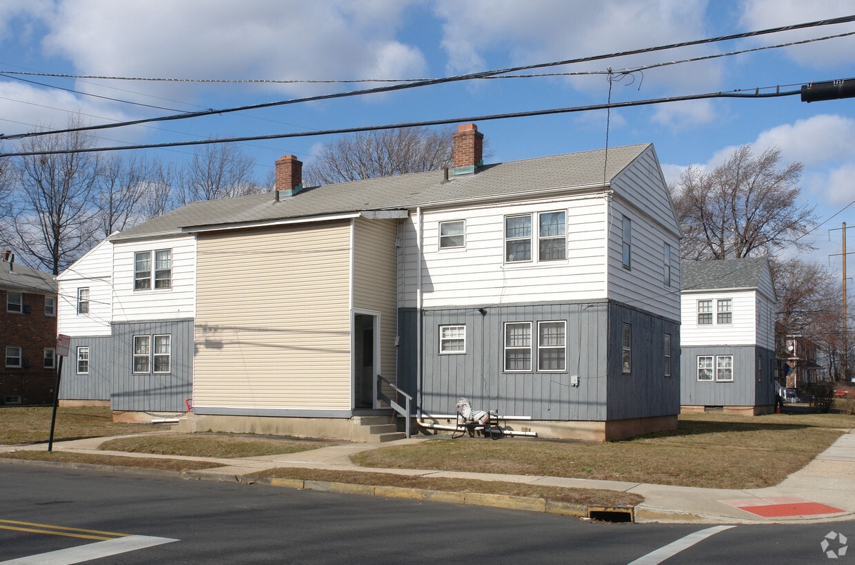
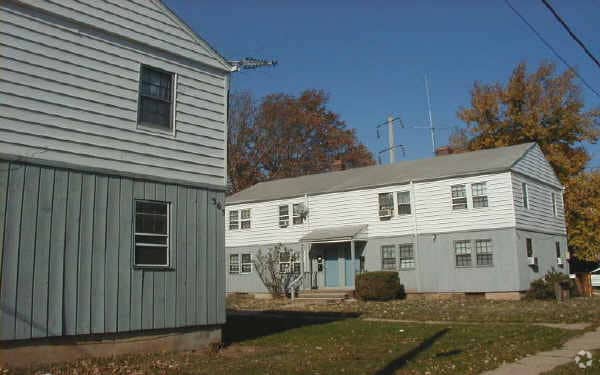
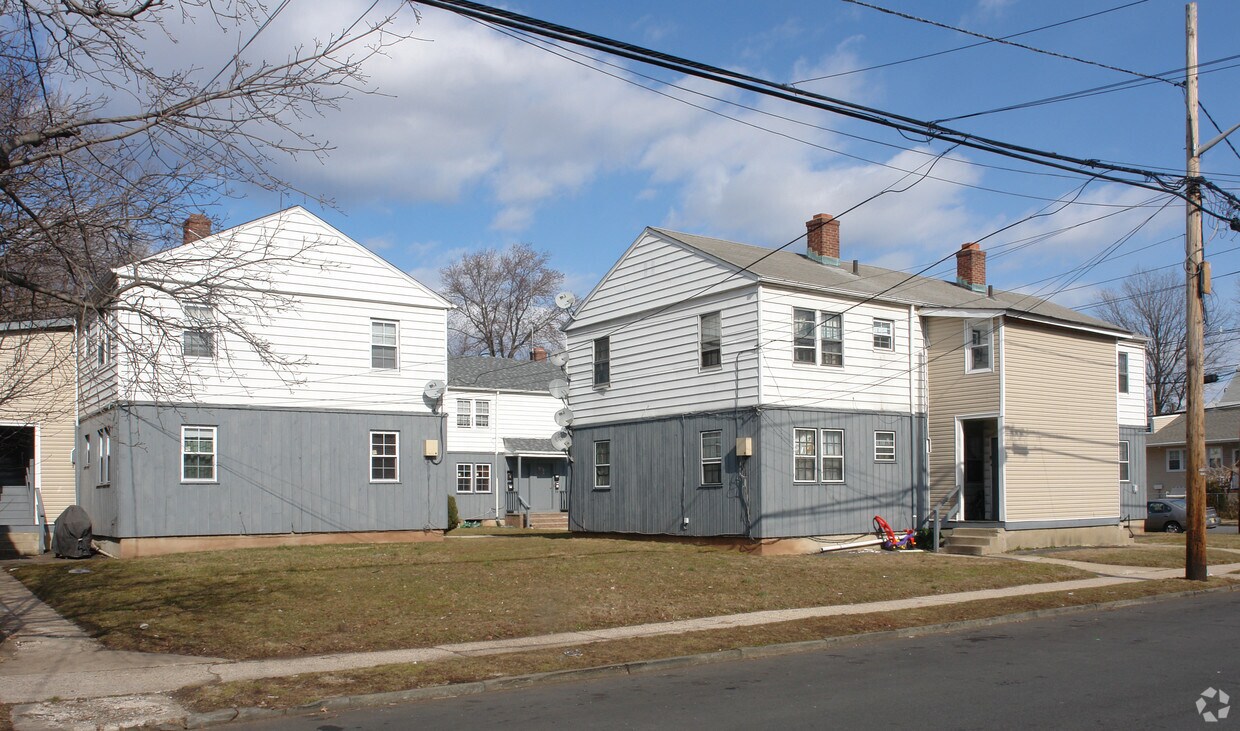

At 355-363 New York Ave in Elizabeth, NJ, experience great living. The address for this community is on New York Ave in the 07202 area of Elizabeth. The professional leasing team is ready to help you find your perfect place. Make a visit to check out the apartment floorplan options. Get a head start on moving now. Contact or stop by 355-363 New York Ave to check the current floorplan availability!
355-363 New York Ave is an apartment community located in Union County and the 07202 ZIP Code. This area is served by the Elizabeth Public School District attendance zone.
Living in Elizabeth, New Jersey combines metropolitan accessibility with historical significance, just 20 miles from Manhattan. The city offers various housing options, from historic single-family homes to apartments, with average rents ranging from $1,371 for studios to $2,013 for three-bedroom units. Elizabeth's neighborhoods each showcase distinct characteristics - the Midtown district features Art Deco architecture, while the Elizabethport area near the waterfront has experienced recent development. The Elmora and Peterstown areas maintain their established cultural heritage through local markets and architecture.
Elizabeth's position as a transportation hub includes multiple train stations providing direct access to Newark and New York City. The Mills at Jersey Gardens outlet mall and the Port Newark-Elizabeth Marine Terminal contribute to the local economy. For outdoor recreation, Warinanco Park offers boating facilities and seasonal activities.
Learn more about living in Elizabeth| Colleges & Universities | Distance | ||
|---|---|---|---|
| Colleges & Universities | Distance | ||
| Drive: | 4 min | 1.7 mi | |
| Drive: | 6 min | 2.5 mi | |
| Drive: | 12 min | 6.2 mi | |
| Drive: | 17 min | 6.5 mi |


Transportation options available in Elizabeth include Military Park, located 7.6 miles from 355-363 New York Ave. 355-363 New York Ave is near Newark Liberty International, located 8.1 miles or 13 minutes away, and LaGuardia, located 25.9 miles or 47 minutes away.
| Transit / Subway | Distance | ||
|---|---|---|---|
| Transit / Subway | Distance | ||
|
|
Drive: | 12 min | 7.6 mi |
| Drive: | 14 min | 7.7 mi | |
|
|
Drive: | 12 min | 8.1 mi |
|
|
Drive: | 16 min | 9.0 mi |
|
|
Drive: | 17 min | 9.8 mi |
| Commuter Rail | Distance | ||
|---|---|---|---|
| Commuter Rail | Distance | ||
|
|
Drive: | 5 min | 1.8 mi |
|
|
Drive: | 6 min | 2.9 mi |
|
|
Drive: | 6 min | 3.1 mi |
|
|
Drive: | 8 min | 3.4 mi |
|
|
Drive: | 7 min | 3.7 mi |
| Airports | Distance | ||
|---|---|---|---|
| Airports | Distance | ||
|
Newark Liberty International
|
Drive: | 13 min | 8.1 mi |
|
LaGuardia
|
Drive: | 47 min | 25.9 mi |
Scores provided by
Traffic
-Airport
-Businesses
-Scores provided by
HowLoud What is a Sound Score Rating? A Sound Score Rating aggregates noise caused by vehicle traffic, airplane traffic and local sources. How It WorksTime and distance from 355-363 New York Ave.
| Shopping Centers | Distance | ||
|---|---|---|---|
| Shopping Centers | Distance | ||
| Walk: | 11 min | 0.6 mi | |
| Drive: | 3 min | 1.2 mi | |
| Drive: | 4 min | 1.4 mi |
| Parks and Recreation | Distance | ||
|---|---|---|---|
| Parks and Recreation | Distance | ||
|
Hawk Rise Sanctuary
|
Drive: | 11 min | 4.5 mi |
|
Staten Island Industrial Park
|
Drive: | 10 min | 5.2 mi |
|
William T. Davis Wildlife Refuge
|
Drive: | 11 min | 6.4 mi |
|
Liberty State Park
|
Drive: | 12 min | 6.5 mi |
|
Faber Park
|
Drive: | 12 min | 6.5 mi |
| Hospitals | Distance | ||
|---|---|---|---|
| Hospitals | Distance | ||
| Drive: | 4 min | 1.6 mi | |
| Drive: | 11 min | 5.4 mi | |
| Drive: | 12 min | 6.0 mi |
| Military Bases | Distance | ||
|---|---|---|---|
| Military Bases | Distance | ||
| Drive: | 22 min | 9.4 mi | |
| Drive: | 19 min | 9.8 mi | |
| Drive: | 19 min | 12.0 mi |
What Are Walk Score®, Transit Score®, and Bike Score® Ratings?
Walk Score® measures the walkability of any address. Transit Score® measures access to public transit. Bike Score® measures the bikeability of any address.
What is a Sound Score Rating?
A Sound Score Rating aggregates noise caused by vehicle traffic, airplane traffic and local sources.

355-363 New York Ave
Elizabeth, NJ 07202


