

$1,300
/ Month
35176 Chestnut Ridge Rd
North Ridgeville, OH 44039
2 Weeks Ago
|
Edit
Favorites
35176 Chestnut Ridge Rd

Favorites
Check Back Soon for Upcoming Availability
| Beds | Baths | Average SF |
|---|---|---|
| 3 Bedrooms 3 Bedrooms 3 Br | 2 Baths 2 Baths 2 Ba | — |
About This Property
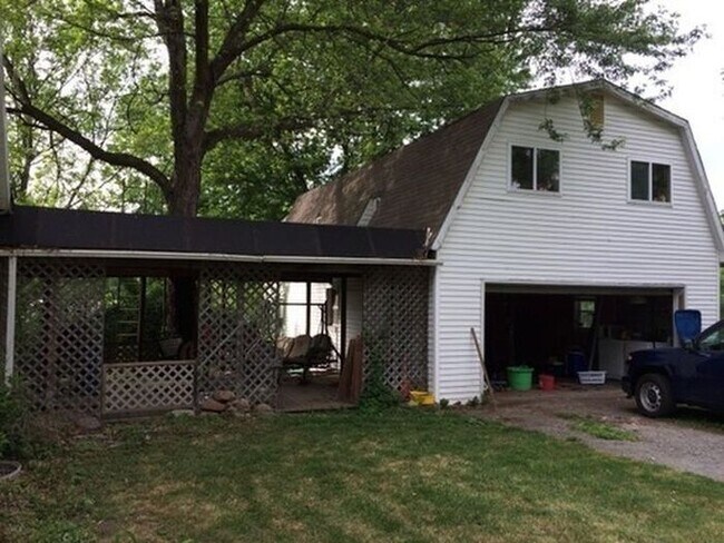
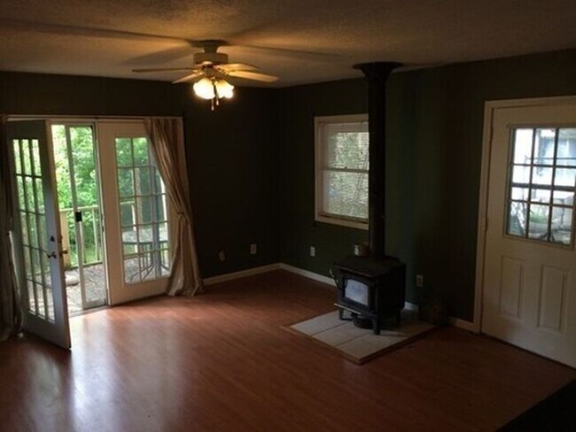
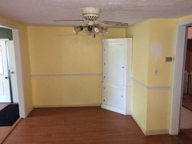
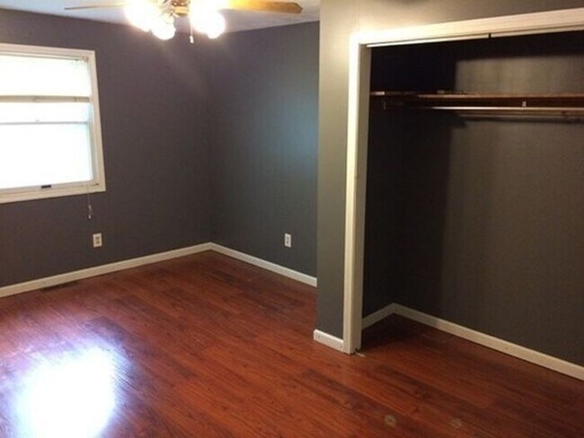
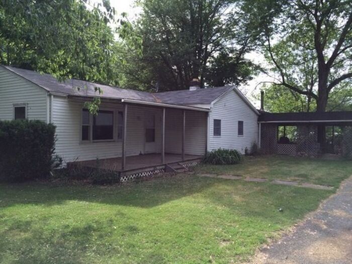
This charming three-bedroom, single-family home has one full and one half bathrooms. This ranch has easy care laminate floors throughout and a first floor laundry room. A large family room with a wood-burner and French doors leads to an expansive 5-acre yard. Additionally, this home offers a two-car garage with a large upstairs workshop. Dogs and cats permitted with a pet fee. Not metro approved, application required. This home will be available May 14th, so hurry to reserve a viewing appointment today! Contact us to schedule a showing.
35176 Chestnut Ridge Rd is a house located in Lorain County and the 44039 ZIP Code. This area is served by the North Ridgeville City School District attendance zone.
35176 Chestnut Ridge Rd,
North Ridgeville,
OH
44039
North Ridgeville sits on the eastern edge of Lorain County, close enough to Cleveland to take advantage of a major metro without being absorbed by it. Ranked the safest city in Ohio, it has grown steadily into one of the most sought-after addresses in northern Ohio, drawing renters who want breathing room alongside genuine accessibility. The city sits about 20 miles west of downtown Cleveland, with Interstate 80 and 480 providing straightforward connections to the broader region, including Cleveland Hopkins International Airport. Lorain County Community College and a branch of the University of Findlay both operate campuses here, giving the city an educational anchor that supports a range of career paths. The housing mix leans toward garden-style apartment communities and townhome rentals, with options spread across mostly residential corridors.
Learn more about living in North Ridgeville
Education
| Colleges & Universities | Distance | ||
|---|---|---|---|
| Colleges & Universities | Distance | ||
| Drive: | 19 min | 8.3 mi | |
| Drive: | 21 min | 9.4 mi | |
| Drive: | 16 min | 9.8 mi | |
| Drive: | 20 min | 10.5 mi |
35176 Chestnut Ridge Rd is within 16 minutes or 9.8 miles from Lorain County Comm. Coll.. It is also near Cuyahoga C.C., Westshore and Cuyahoga C.C., West.
Schools


Public Elementary School
Grades PK-5
269 Students
Nearby
Public Elementary & Middle School
Grades K-8
400 Students
Nearby
Public Elementary School
Grades K-5
325 Students
Nearby
Public Elementary & Middle School
Grades K-8
1,863 Students
Attendance Zone
Public Elementary School
Grades K-5
626 Students
Attendance Zone
Public High School
Grades 9-12
1,232 Students
Attendance Zone
Private Elementary, Middle & High School
Grades K-12
389 Students
Nearby
Private Elementary & Middle School
Grades PK-8
293 Students
Nearby
School data provided by
 The GreatSchools Rating helps parents compare schools within a state based on a variety of school quality indicators and provides a helpful picture of how effectively each school serves all of its students. Ratings are on a scale of 1 (below average) to 10 (above average) and can include test scores, college readiness, academic progress, advanced courses, equity, discipline and attendance data. We also advise parents to visit schools, consider other information on school performance and programs, and consider family needs as part of the school selection process.
View GreatSchools Rating Methodology
Data provided by GreatSchools.org © 2026. All rights reserved.
View GreatSchools Rating Methodology
Data provided by GreatSchools.org © 2026. All rights reserved.
Transportation options available in North Ridgeville include Airport Station, located 11.8 miles from 35176 Chestnut Ridge Rd. 35176 Chestnut Ridge Rd is near Cleveland-Hopkins International, located 11.2 miles or 20 minutes away.
| Transit / Subway | Distance | ||
|---|---|---|---|
| Transit / Subway | Distance | ||
| Drive: | 19 min | 11.8 mi |
| Commuter Rail | Distance | ||
|---|---|---|---|
| Commuter Rail | Distance | ||
|
|
Drive: | 12 min | 7.6 mi |
| Drive: | 35 min | 23.3 mi | |
|
|
Drive: | 39 min | 24.2 mi |
| Drive: | 37 min | 24.8 mi | |
| Drive: | 40 min | 29.8 mi |
| Airports | Distance | ||
|---|---|---|---|
| Airports | Distance | ||
|
Cleveland-Hopkins International
|
Drive: | 20 min | 11.2 mi |
Walkability Near 35176 Chestnut Ridge Rd North Ridgeville, OH 44039
Getting Around
 What do Walkability, Transit, Drivability, and Bikeability mean?
Walkability measures the walking distance to day-to-day needs.
Transit measures access to public transportation.
Drivability measures congestion, parking availability, and access to major roads.
Bikeability measures the suitability for cycling.
How It Works
What do Walkability, Transit, Drivability, and Bikeability mean?
Walkability measures the walking distance to day-to-day needs.
Transit measures access to public transportation.
Drivability measures congestion, parking availability, and access to major roads.
Bikeability measures the suitability for cycling.
How It Works
Somewhat Walkable
Walkability
20
/ 100
Minimal Public Transit
Transit
0
/ 100
Exceptionally Drivable
Drivability
100
/ 100
Fairly Bikeable
Bikeability
40
/ 100
Scores provided by
-
Soundscore™
-
/ 100
Traffic
-Airport
-Businesses
-Scores provided by
HowLoud What is a Sound Score Rating? A Sound Score Rating aggregates noise caused by vehicle traffic, airplane traffic and local sources. How It WorksTime and distance from 35176 Chestnut Ridge Rd.
| Shopping Centers | Distance | ||
|---|---|---|---|
| Shopping Centers | Distance | ||
| Drive: | 5 min | 2.2 mi | |
| Drive: | 6 min | 2.3 mi | |
| Drive: | 6 min | 2.5 mi |
35176 Chestnut Ridge Rd has 3 shopping centers within 2.5 miles, which is about a 6-minute drive. The miles and minutes will be for the farthest away property.
| Parks and Recreation | Distance | ||
|---|---|---|---|
| Parks and Recreation | Distance | ||
|
Bradley Woods Reservation
|
Drive: | 9 min | 4.1 mi |
|
Sandy Ridge Reservation
|
Drive: | 10 min | 4.7 mi |
|
Miller Nature Preserve
|
Drive: | 10 min | 6.6 mi |
|
Columbia Reservation
|
Drive: | 12 min | 7.8 mi |
|
Black River Reservation
|
Drive: | 18 min | 10.8 mi |
35176 Chestnut Ridge Rd has 5 parks within 10.8 miles, including Bradley Woods Reservation, Sandy Ridge Reservation, and Miller Nature Preserve.
| Hospitals | Distance | ||
|---|---|---|---|
| Hospitals | Distance | ||
| Drive: | 13 min | 6.2 mi | |
| Drive: | 12 min | 7.5 mi | |
| Drive: | 21 min | 9.7 mi |
35176 Chestnut Ridge Rd has 3 hospitals within 9.7 miles, the nearest is UH St. John Medical Center which is 6.2 miles away and a 13 minute drive.
| Military Bases | Distance | ||
|---|---|---|---|
| Military Bases | Distance | ||
| Drive: | 84 min | 63.0 mi | |
| Drive: | 83 min | 67.2 mi |
35176 Chestnut Ridge Rd is 63.0 miles from Mansfield Lahm Airport Air Guard Station, and is convenient to other military bases, including Camp Perry Air Guard Station.
You May Also Like
Similar Rentals Nearby


What Are Walk Score®, Transit Score®, and Bike Score® Ratings?
Walk Score® measures the walkability of any address. Transit Score® measures access to public transit. Bike Score® measures the bikeability of any address.
What is a Sound Score Rating?
A Sound Score Rating aggregates noise caused by vehicle traffic, airplane traffic and local sources.
35176 Chestnut Ridge Rd
North Ridgeville, OH 44039