
The Station Apartments
5959 Broadway,
Bronx, NY 10463
$1,750 - $2,300
Studio - 1 Bed
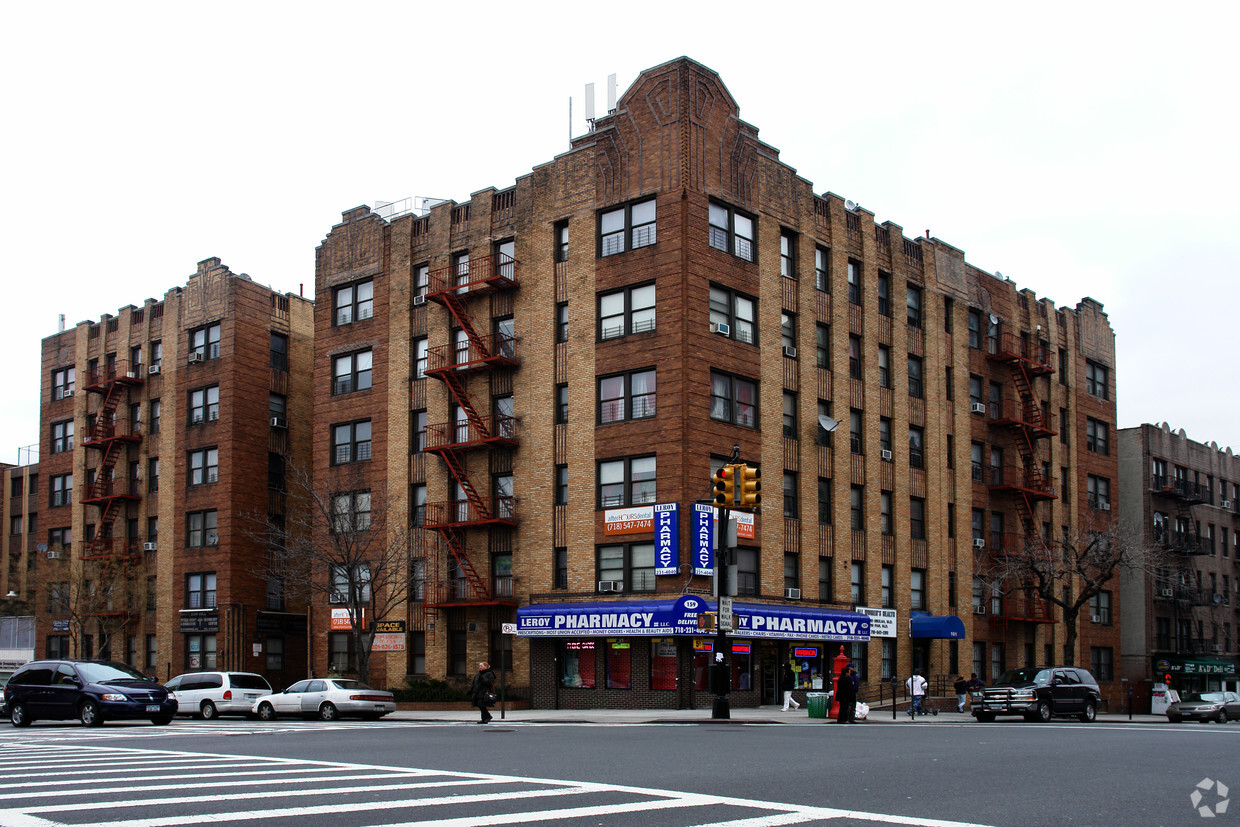
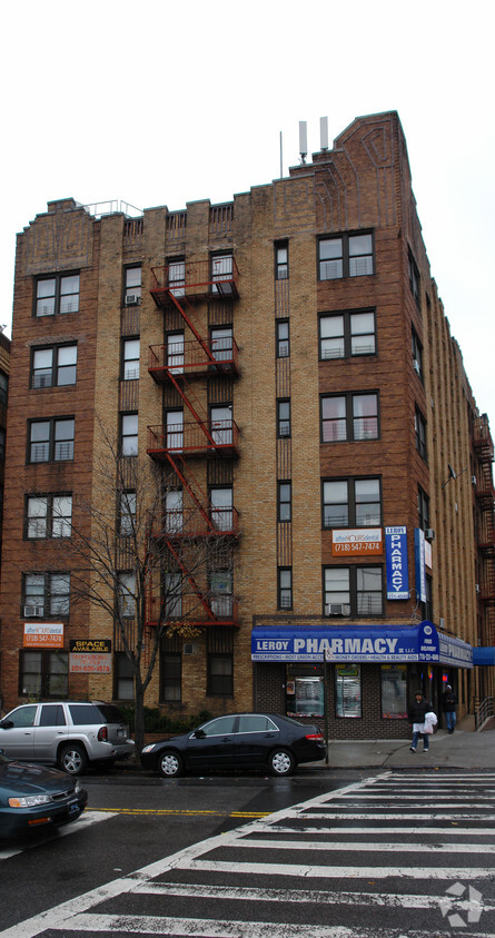
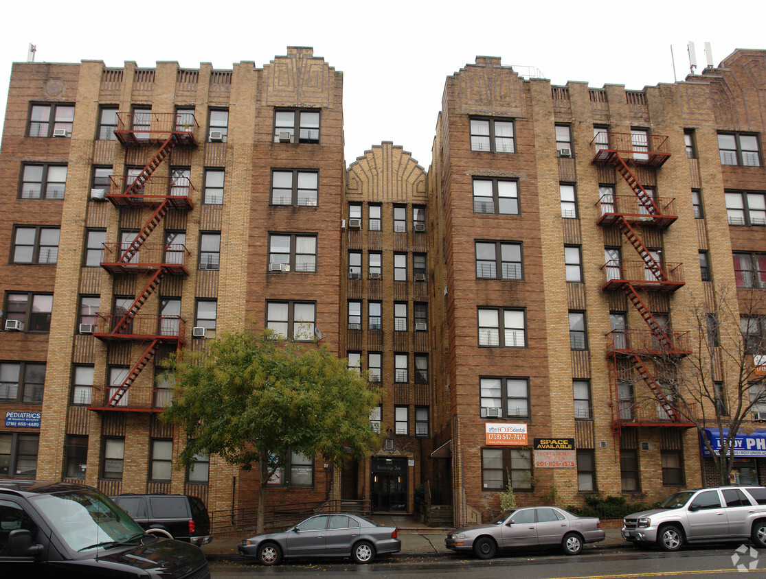
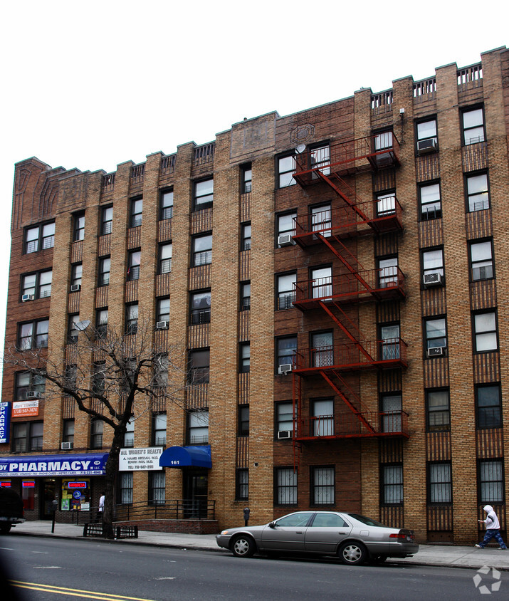
At 3510 Bainbridge Ave in Bronx, experience stylish living. This community is located in the 10467 area of Bronx. Be sure to view the available floorplans. The leasing staff is waiting to show you all that this community has in store. Drop by 3510 Bainbridge Ave today.
3510 Bainbridge Ave is an apartment community located in Bronx County and the 10467 ZIP Code. This area is served by the New York City Geographic District #10 attendance zone.
Laundry Facilities
Controlled Access
24 Hour Access
Maintenance on site
Refrigerator
Tub/Shower
Heating
Oven
Surrounded by green space and parkland, Norwood’s insular geography gives the neighborhood a small-town feel while remaining connected to the other New York City boroughs via major highways and subway lines. Norwood is nestled between Van Cortlandt Park, New York Botanical Garden, Bronx River Forest, and the Mosholu Parkway. The Williamsbridge Playground in the center of Norwood anchors the neighborhood, and many residents frequent the park on a regular basis. The green space has a playground, the park has a recreation center, skate park, running track, and sports fields. Along with multiple grocers, restaurants, delis, and stores, Norwood is home to several medical facilities including Montefiore Hospital. Similar to most New York neighborhoods, Norwood mainly has apartments and condos available for rent, but there are a few single-family houses as well.
Learn more about living in NorwoodCompare neighborhood and city base rent averages by bedroom.
| Norwood | Bronx, NY | |
|---|---|---|
| Studio | $1,332 | $1,616 |
| 1 Bedroom | $1,328 | $1,635 |
| 2 Bedrooms | $1,727 | $2,097 |
| 3 Bedrooms | $2,402 | $2,357 |
| Colleges & Universities | Distance | ||
|---|---|---|---|
| Colleges & Universities | Distance | ||
| Drive: | 3 min | 1.5 mi | |
| Drive: | 4 min | 1.8 mi | |
| Drive: | 5 min | 2.2 mi | |
| Drive: | 6 min | 2.2 mi |


Transportation options available in Bronx include Woodlawn, located 0.4 mile from 3510 Bainbridge Ave. 3510 Bainbridge Ave is near LaGuardia, located 12.4 miles or 23 minutes away, and Westchester County, located 21.4 miles or 32 minutes away.
| Transit / Subway | Distance | ||
|---|---|---|---|
| Transit / Subway | Distance | ||
|
|
Walk: | 7 min | 0.4 mi |
|
|
Walk: | 9 min | 0.5 mi |
|
|
Walk: | 12 min | 0.6 mi |
|
|
Walk: | 13 min | 0.7 mi |
|
|
Walk: | 18 min | 0.9 mi |
| Commuter Rail | Distance | ||
|---|---|---|---|
| Commuter Rail | Distance | ||
|
|
Walk: | 9 min | 0.5 mi |
|
|
Drive: | 3 min | 1.3 mi |
|
|
Drive: | 3 min | 1.8 mi |
|
|
Drive: | 4 min | 1.8 mi |
|
|
Drive: | 6 min | 2.8 mi |
| Airports | Distance | ||
|---|---|---|---|
| Airports | Distance | ||
|
LaGuardia
|
Drive: | 23 min | 12.4 mi |
|
Westchester County
|
Drive: | 32 min | 21.4 mi |
Scores provided by
Traffic
BusyAirport
CalmBusinesses
BusyScores provided by
HowLoud What is a Sound Score Rating? A Sound Score Rating aggregates noise caused by vehicle traffic, airplane traffic and local sources. How It WorksTime and distance from 3510 Bainbridge Ave.
| Shopping Centers | Distance | ||
|---|---|---|---|
| Shopping Centers | Distance | ||
| Drive: | 3 min | 1.5 mi | |
| Drive: | 3 min | 1.6 mi |
| Parks and Recreation | Distance | ||
|---|---|---|---|
| Parks and Recreation | Distance | ||
|
Williamsbridge Oval
|
Walk: | 7 min | 0.4 mi |
|
Van Cortlandt Park
|
Drive: | 2 min | 1.5 mi |
|
Poe Park
|
Drive: | 4 min | 1.9 mi |
|
New York Botanical Garden
|
Drive: | 9 min | 2.4 mi |
|
Bronx Park
|
Drive: | 7 min | 2.6 mi |
| Hospitals | Distance | ||
|---|---|---|---|
| Hospitals | Distance | ||
| Walk: | 3 min | 0.2 mi | |
| Drive: | 6 min | 2.6 mi | |
| Drive: | 7 min | 3.2 mi |
| Military Bases | Distance | ||
|---|---|---|---|
| Military Bases | Distance | ||
| Drive: | 21 min | 10.7 mi | |
| Drive: | 35 min | 19.0 mi | |
| Drive: | 40 min | 25.4 mi |
What Are Walk Score®, Transit Score®, and Bike Score® Ratings?
Walk Score® measures the walkability of any address. Transit Score® measures access to public transit. Bike Score® measures the bikeability of any address.
What is a Sound Score Rating?
A Sound Score Rating aggregates noise caused by vehicle traffic, airplane traffic and local sources.


