
The Grand at Penn
705 Newark Ave,
Elizabeth, NJ 07208
$2,395 - $2,895
1-2 Beds
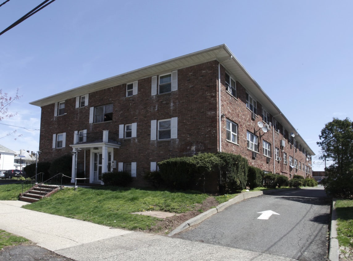
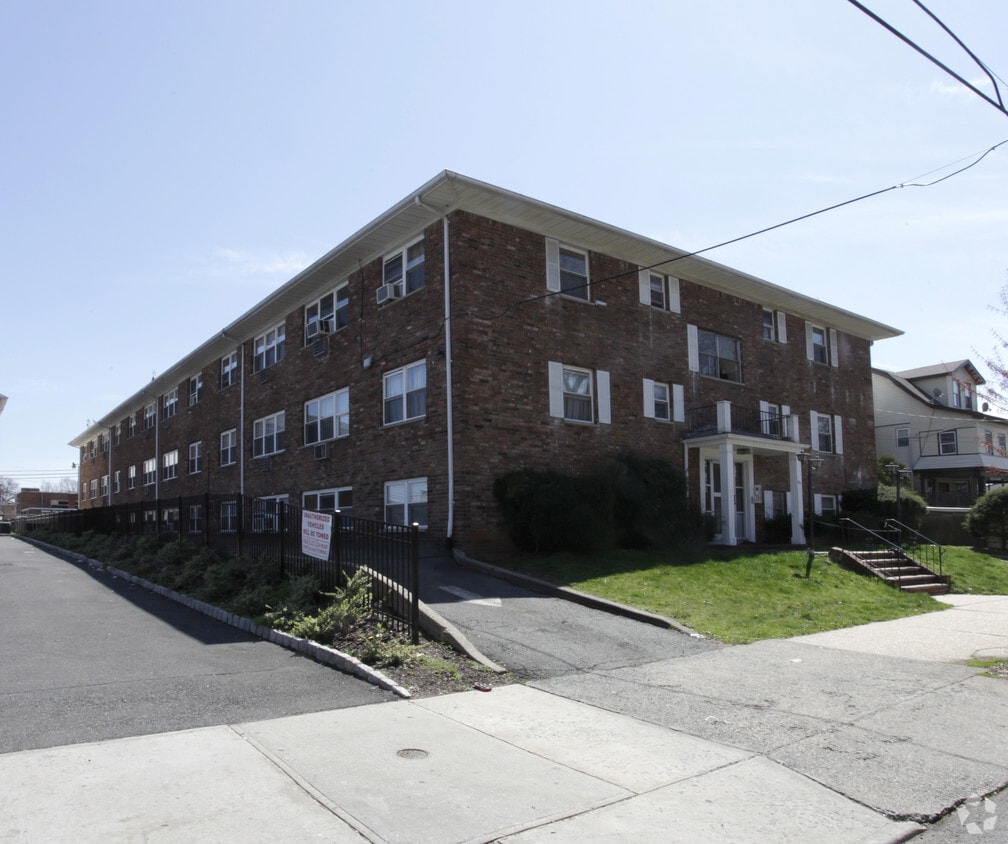

Experience 351 Union St in Elizabeth. A convenient Union St. address in the 07208 Zip code of Elizabeth is a popular place for those looking for a new home. Here at this community, the team of leasing professionals will assist you in finding your perfect home. At this community, you'll have access to top amenities and features like smoke free options, convenient on-site parking options, and high-speed internet access. Contact us or drop by the leasing office to check the availability and schedule a tour today and find your new home at 351 Union St.
351 Union St is an apartment community located in Union County and the 07208 ZIP Code. This area is served by the Elizabeth Public School District attendance zone.
Situated on the west side of Newark Bay, flowing into the Atlantic Ocean, Downtown Elizabeth is a diverse neighborhood in the heart of Elizabeth, New Jersey. This quaint commercial district offers various businesses and retailers, as well as local restaurants, banks, hospitals, and historic buildings.
Downtown Elizabeth is a great place to put down roots for those looking to commute to New York. This neighborhood is about 15 miles southwest of New York City and is easily accessible by road or public transit. The Elizabeth train station with New Jersey Transit will take you all the way north to Midtown Manhattan and all the way south to Bay Head, New Jersey.
Learn more about living in Downtown ElizabethCompare neighborhood and city base rent averages by bedroom.
| Downtown Elizabeth | Elizabeth, NJ | |
|---|---|---|
| Studio | $1,514 | $1,411 |
| 1 Bedroom | $1,693 | $1,567 |
| 2 Bedrooms | $2,427 | $2,022 |
| 3 Bedrooms | $1,829 | $2,080 |
| Colleges & Universities | Distance | ||
|---|---|---|---|
| Colleges & Universities | Distance | ||
| Walk: | 9 min | 0.5 mi | |
| Drive: | 5 min | 1.3 mi | |
| Drive: | 12 min | 6.7 mi | |
| Drive: | 17 min | 7.6 mi |


Transportation options available in Elizabeth include Military Park, located 6.4 miles from 351 Union St. 351 Union St is near Newark Liberty International, located 6.9 miles or 13 minutes away, and LaGuardia, located 24.8 miles or 47 minutes away.
| Transit / Subway | Distance | ||
|---|---|---|---|
| Transit / Subway | Distance | ||
|
|
Drive: | 11 min | 6.4 mi |
|
|
Drive: | 12 min | 7.0 mi |
|
|
Drive: | 13 min | 7.5 mi |
| Drive: | 17 min | 8.8 mi | |
|
|
Drive: | 19 min | 10.0 mi |
| Commuter Rail | Distance | ||
|---|---|---|---|
| Commuter Rail | Distance | ||
|
|
Walk: | 9 min | 0.5 mi |
|
|
Drive: | 4 min | 1.3 mi |
|
|
Drive: | 4 min | 1.7 mi |
|
|
Drive: | 9 min | 3.5 mi |
|
|
Drive: | 10 min | 3.7 mi |
| Airports | Distance | ||
|---|---|---|---|
| Airports | Distance | ||
|
Newark Liberty International
|
Drive: | 13 min | 6.9 mi |
|
LaGuardia
|
Drive: | 47 min | 24.8 mi |
Scores provided by
Traffic
-Airport
-Businesses
-Scores provided by
HowLoud What is a Sound Score Rating? A Sound Score Rating aggregates noise caused by vehicle traffic, airplane traffic and local sources. How It WorksTime and distance from 351 Union St.
| Shopping Centers | Distance | ||
|---|---|---|---|
| Shopping Centers | Distance | ||
| Walk: | 16 min | 0.8 mi | |
| Walk: | 17 min | 0.9 mi | |
| Drive: | 5 min | 1.5 mi |
| Parks and Recreation | Distance | ||
|---|---|---|---|
| Parks and Recreation | Distance | ||
|
Hawk Rise Sanctuary
|
Drive: | 14 min | 5.9 mi |
|
Staten Island Industrial Park
|
Drive: | 13 min | 6.2 mi |
|
Liberty State Park
|
Drive: | 15 min | 7.5 mi |
|
Faber Park
|
Drive: | 15 min | 7.6 mi |
|
G. Thomas DiDomenico Park
|
Drive: | 19 min | 9.1 mi |
| Hospitals | Distance | ||
|---|---|---|---|
| Hospitals | Distance | ||
| Drive: | 4 min | 1.2 mi | |
| Drive: | 7 min | 3.5 mi | |
| Drive: | 11 min | 5.6 mi |
| Military Bases | Distance | ||
|---|---|---|---|
| Military Bases | Distance | ||
| Drive: | 23 min | 9.8 mi | |
| Drive: | 18 min | 10.7 mi | |
| Drive: | 24 min | 11.8 mi |
What Are Walk Score®, Transit Score®, and Bike Score® Ratings?
Walk Score® measures the walkability of any address. Transit Score® measures access to public transit. Bike Score® measures the bikeability of any address.
What is a Sound Score Rating?
A Sound Score Rating aggregates noise caused by vehicle traffic, airplane traffic and local sources.

351 Union St
Elizabeth, NJ 07208


