
$925
/ Month
3500 Lyndale Ave
Baltimore, MD 21213
2 Weeks Ago
|
Edit
Favorites
3500 Lyndale Ave

Favorites
Check Back Soon for Upcoming Availability
| Beds | Baths | Average SF |
|---|---|---|
| 1 Bedroom 1 Bedroom 1 Br | 1 Bath 1 Bath 1 Ba | — |
About This Property
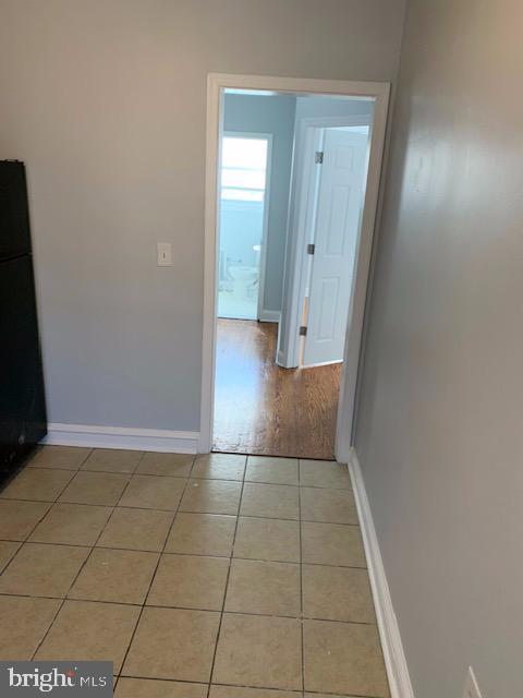
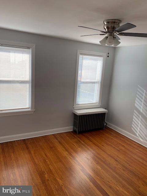
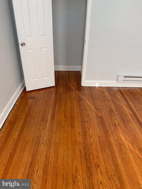
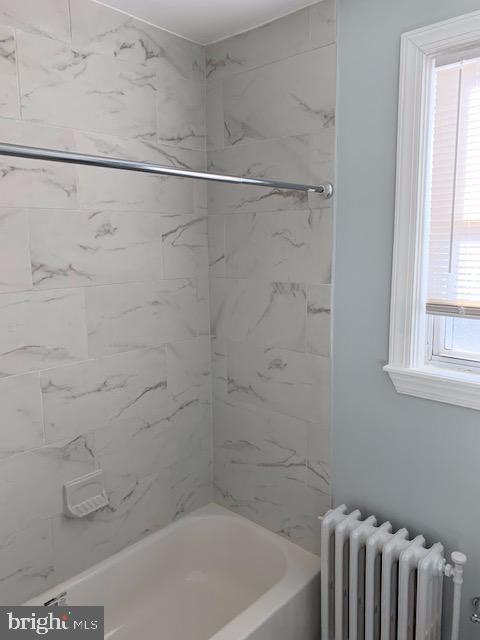
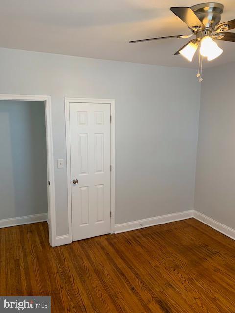
Charming 1-bed, 1-bath apartment situated on the 2nd floor at 3500 Lyndale Rd. This inviting space boasts a generously spacious kitchen perfect for culinary enthusiasts or casual dining experiences. Hardwood floors add a touch of elegance and warmth throughout, providing both durability and aesthetic appeal. The open floor plan creates a comfortable living environment ideal for a cozy night in or entertaining guests. Nestled in a convenient location, this apartment offers ease of access to local amenities and transportation links, making it a perfect living space for those seeking comfort and practicality in one package. Don't miss the opportunity to make this inviting apartment your new home.
3500 Lyndale Ave is a townhome located in Baltimore City County and the 21213 ZIP Code. This area is served by the Baltimore City Public Schools attendance zone.
Townhome Features
- Basement
Location
Get Directions
Belair-Edison, an architecturally diverse neighborhood with tons of history, sits about 15 minutes from Downtown Baltimore. Row houses and townhouses for rent dominate the residential landscape. Much of the housing remains from the 1920s to 1950s, offering residents charm and curb appeal.
Locals connect at one of the many organized events set up by the neighborhood association. They also like to stretch their legs at the town green spaces, including Herring Run Park and Clifton Park.
Take your pick of numerous delis and carry-out restaurants in Belair-Edison. Belair Road leads you to many local favorites which include Hummingbird Carryout, an establishment that makes Caribbean-inspired fare. Residents get their organic and locally-sourced produce at the Real Food Farm in Clifton Park, a volunteer-run market the makes local ingredients more accessible.
Learn more about living in Belair-EdisonBelow are rent ranges for similar nearby apartments
Amenities
- Basement
Education
| Colleges & Universities | Distance | ||
|---|---|---|---|
| Colleges & Universities | Distance | ||
| Drive: | 7 min | 2.3 mi | |
| Drive: | 8 min | 2.7 mi | |
| Drive: | 8 min | 2.9 mi | |
| Drive: | 7 min | 3.1 mi |
3500 Lyndale Ave is within 7 minutes or 2.3 miles from Johns Hopkins. It is also near Morgan State University and University of Baltimore.
Schools


Charter Elementary & Middle School
Grades PK-8
1,013 Students
Attendance Zone
Public Middle School
Grades 6-8
157 Students
Attendance Zone
Public Middle School
Grades 6-8
339 Students
Attendance Zone
Public High School
Grades 9-12
1,335 Students
Attendance Zone
Public High School
Grades 9-12
1,067 Students
Attendance Zone
Private Elementary & Middle School
Grades PK-8
Nearby
Private Elementary, Middle & High School
Grades 1-11
Nearby
Private Elementary School
Grades K-5
136 Students
Nearby
Private High School
Grades 9-12
312 Students
Nearby
School data provided by
 The GreatSchools Rating helps parents compare schools within a state based on a variety of school quality indicators and provides a helpful picture of how effectively each school serves all of its students. Ratings are on a scale of 1 (below average) to 10 (above average) and can include test scores, college readiness, academic progress, advanced courses, equity, discipline and attendance data. We also advise parents to visit schools, consider other information on school performance and programs, and consider family needs as part of the school selection process.
View GreatSchools Rating Methodology
Data provided by GreatSchools.org © 2025. All rights reserved.
View GreatSchools Rating Methodology
Data provided by GreatSchools.org © 2025. All rights reserved.
Transportation options available in Baltimore include Johns Hopkins Hospital, located 2.4 miles from 3500 Lyndale Ave. 3500 Lyndale Ave is near Baltimore/Washington International Thurgood Marshall, located 16.4 miles or 27 minutes away.
| Transit / Subway | Distance | ||
|---|---|---|---|
| Transit / Subway | Distance | ||
| Drive: | 7 min | 2.4 mi | |
|
|
Drive: | 8 min | 3.0 mi |
|
|
Drive: | 9 min | 3.1 mi |
|
|
Drive: | 9 min | 3.1 mi |
| Drive: | 9 min | 3.3 mi |
| Commuter Rail | Distance | ||
|---|---|---|---|
| Commuter Rail | Distance | ||
|
|
Drive: | 8 min | 2.9 mi |
|
|
Drive: | 13 min | 4.2 mi |
|
|
Drive: | 15 min | 5.5 mi |
|
|
Drive: | 20 min | 10.4 mi |
|
|
Drive: | 23 min | 13.5 mi |
| Airports | Distance | ||
|---|---|---|---|
| Airports | Distance | ||
|
Baltimore/Washington International Thurgood Marshall
|
Drive: | 27 min | 16.4 mi |
Time and distance from 3500 Lyndale Ave.
| Shopping Centers | Distance | ||
|---|---|---|---|
| Shopping Centers | Distance | ||
| Walk: | 5 min | 0.3 mi | |
| Walk: | 5 min | 0.3 mi | |
| Walk: | 24 min | 1.2 mi |
3500 Lyndale Ave has 3 shopping centers within 1.2 miles, which is about a 24-minute walk. The miles and minutes will be for the farthest away property.
| Parks and Recreation | Distance | ||
|---|---|---|---|
| Parks and Recreation | Distance | ||
|
Herring Run Park
|
Walk: | 17 min | 0.9 mi |
|
Clifton Park
|
Walk: | 18 min | 0.9 mi |
|
Patterson Park
|
Drive: | 7 min | 2.3 mi |
|
Patterson Park Audubon Center
|
Drive: | 8 min | 2.8 mi |
|
Port Discovery Children's Museum
|
Drive: | 11 min | 3.7 mi |
3500 Lyndale Ave has 5 parks within 3.7 miles, including Herring Run Park, Clifton Park, and Patterson Park.
| Hospitals | Distance | ||
|---|---|---|---|
| Hospitals | Distance | ||
| Drive: | 6 min | 2.0 mi | |
| Drive: | 6 min | 2.1 mi | |
| Drive: | 8 min | 2.9 mi |
3500 Lyndale Ave has 3 hospitals within 2.9 miles, the nearest is Johns Hopkins Hospital which is 2.0 miles away and a 6 minute drive.
| Military Bases | Distance | ||
|---|---|---|---|
| Military Bases | Distance | ||
| Drive: | 38 min | 22.9 mi |
3500 Lyndale Ave is 22.9 miles and a 38 minute drive from Fort George Meade.
You May Also Like
Similar Rentals Nearby


What Are Walk Score®, Transit Score®, and Bike Score® Ratings?
Walk Score® measures the walkability of any address. Transit Score® measures access to public transit. Bike Score® measures the bikeability of any address.
What is a Sound Score Rating?
A Sound Score Rating aggregates noise caused by vehicle traffic, airplane traffic and local sources
3500 Lyndale Ave
Baltimore, MD 21213