

$1,200 / Month
35 N Forklanding Rd
Maple Shade, NJ 08052
2 Weeks Ago
Favorites
35 N Forklanding Rd

Favorites
Check Back Soon for Upcoming Availability
| Beds | Baths | Average SF |
|---|---|---|
| 2 Bedrooms 2 Bedrooms 2 Br | 1 Bath 1 Bath 1 Ba | — |
About This Property
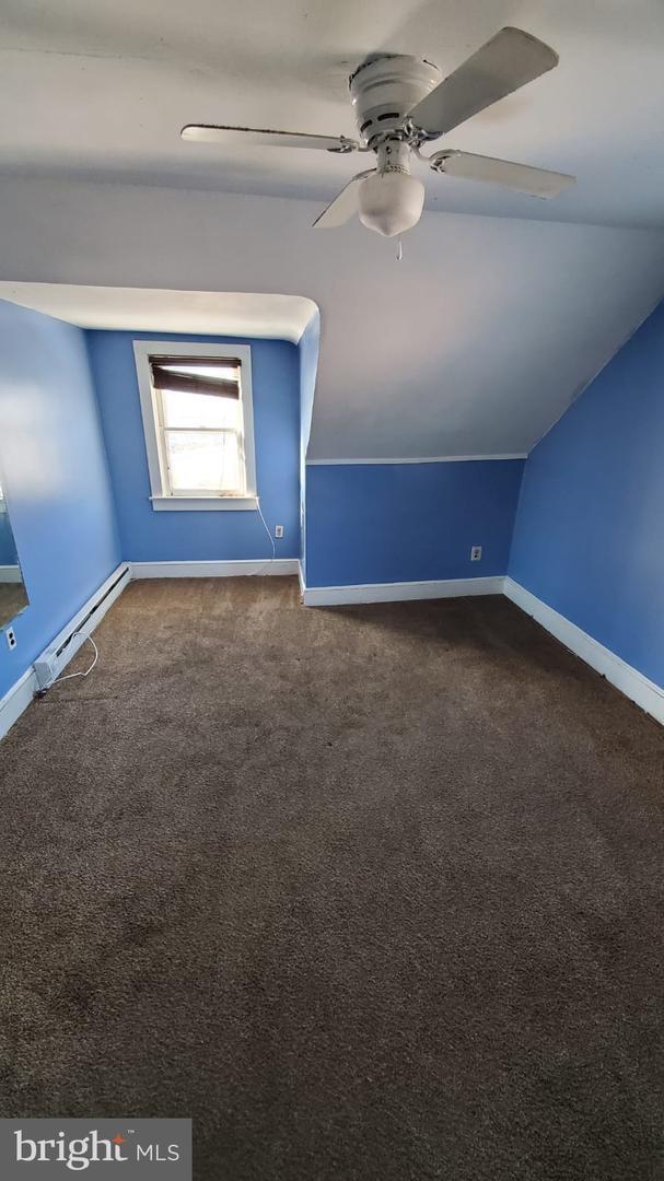
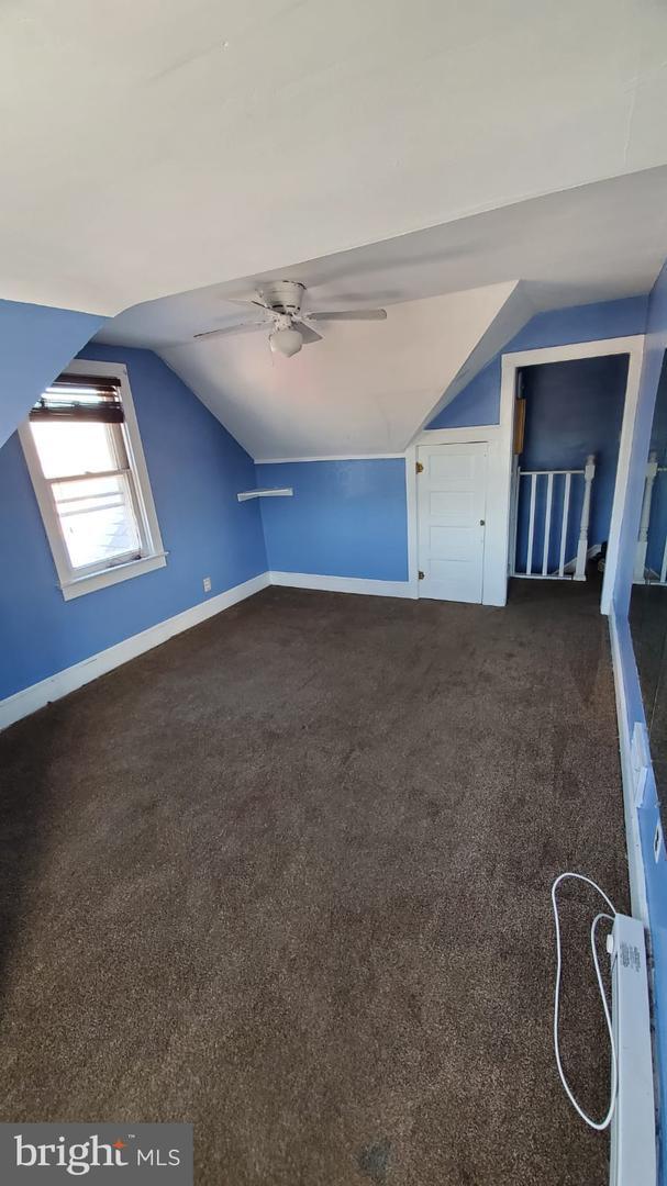
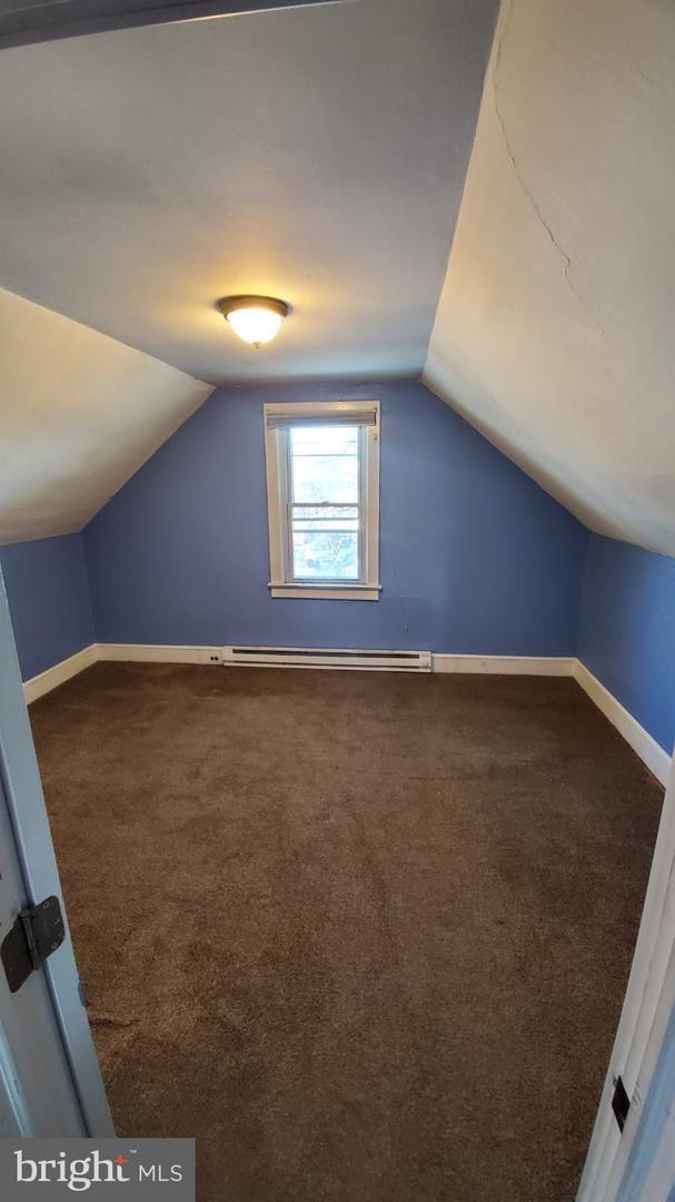
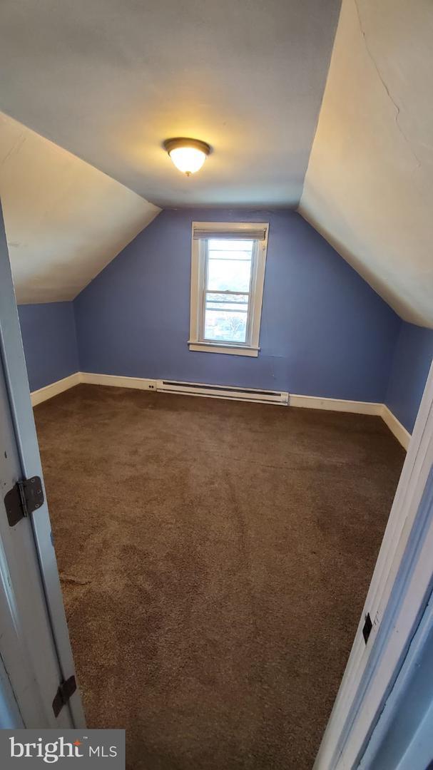
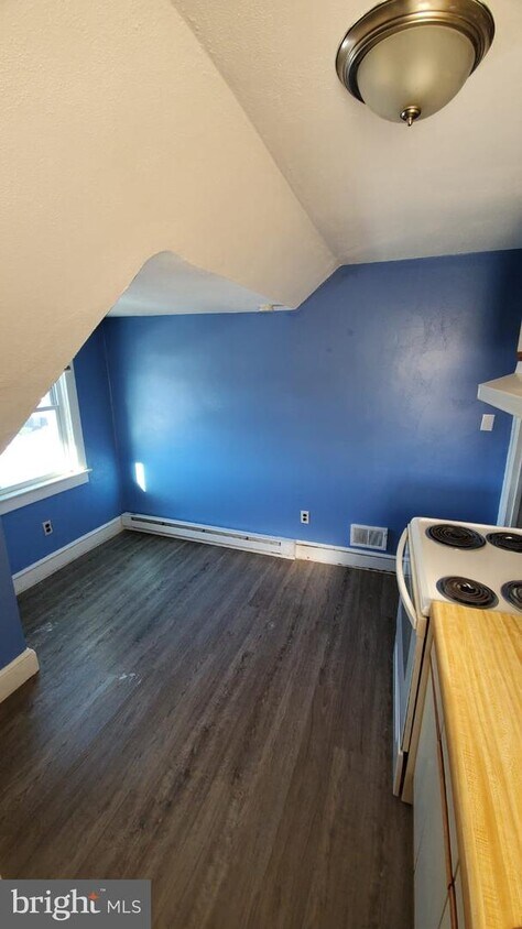
The Description of this House: 2nd unit has 2 bedrooms, kitchen, bathroom, separate entrance and 1 parking with a covered garage. Thank You
35 N Forklanding Rd is a house located in Burlington County and the 08052 ZIP Code. This area is served by the Maple Shade attendance zone.
Location
Get Directions
Maple Shade Township is known as a great place to raise a family. This suburb of New Jersey is only 10 miles from bustling Philadelphia and is in close proximity to neighboring country clubs, parks, and shopping malls. Maple Shade School District houses excellent public schools like Maple Shade High School. There’s an abundance of sports fields around the area. A well-kept football field, multiple baseball and softball fields, and a street hockey court all lie within a large area in Maple Shade.
Once you find your apartment in Maple Shade, you can rock climb indoors at Elite Climbing or bowl with friends and family at Laurel Lanes. There are ample possibilities for recreational fun in Maple Shade Township for your whole family.
Learn more about living in Maple Shade
Education
| Colleges & Universities | Distance | ||
|---|---|---|---|
| Colleges & Universities | Distance | ||
| Drive: | 13 min | 7.7 mi | |
| Drive: | 12 min | 7.8 mi | |
| Drive: | 13 min | 8.2 mi | |
| Drive: | 21 min | 9.8 mi |
35 N Forklanding Rd is within 13 minutes or 7.7 miles from Burlington Co., Mount Laurel. It is also near Camden Co. Coll., Camden City and Rutgers, Camden Campus.
Schools


Public Elementary School
Grades PK-5
437 Students
Nearby
Public Elementary School
Grades PK-1
568 Students
Nearby
Public Middle & High School
Grades PK & 7-12
931 Students
Attendance Zone
Public Elementary School
Grades 2-4
554 Students
Attendance Zone
Public Elementary School
Grades 5-6
350 Students
Attendance Zone
Private Elementary, Middle & High School
Grades 1-12
Nearby
Private Elementary & Middle School
Grades PK-8
142 Students
Nearby
School data provided by
 The GreatSchools Rating helps parents compare schools within a state based on a variety of school quality indicators and provides a helpful picture of how effectively each school serves all of its students. Ratings are on a scale of 1 (below average) to 10 (above average) and can include test scores, college readiness, academic progress, advanced courses, equity, discipline and attendance data. We also advise parents to visit schools, consider other information on school performance and programs, and consider family needs as part of the school selection process.
View GreatSchools Rating Methodology
Data provided by GreatSchools.org © 2025. All rights reserved.
View GreatSchools Rating Methodology
Data provided by GreatSchools.org © 2025. All rights reserved.
Transportation options available in Maple Shade include Pennsauken/Route 73, located 3.9 miles from 35 N Forklanding Rd. 35 N Forklanding Rd is near Philadelphia International, located 18.4 miles or 31 minutes away, and Trenton Mercer, located 34.1 miles or 49 minutes away.
| Transit / Subway | Distance | ||
|---|---|---|---|
| Transit / Subway | Distance | ||
|
|
Drive: | 7 min | 3.9 mi |
|
|
Drive: | 7 min | 4.3 mi |
|
|
Drive: | 8 min | 4.8 mi |
| Drive: | 9 min | 4.9 mi | |
|
|
Drive: | 11 min | 5.0 mi |
| Commuter Rail | Distance | ||
|---|---|---|---|
| Commuter Rail | Distance | ||
| Drive: | 9 min | 5.0 mi | |
|
|
Drive: | 9 min | 5.1 mi |
|
|
Drive: | 13 min | 5.8 mi |
|
|
Drive: | 15 min | 6.9 mi |
|
|
Drive: | 11 min | 7.8 mi |
| Airports | Distance | ||
|---|---|---|---|
| Airports | Distance | ||
|
Philadelphia International
|
Drive: | 31 min | 18.4 mi |
|
Trenton Mercer
|
Drive: | 49 min | 34.1 mi |
Time and distance from 35 N Forklanding Rd.
| Shopping Centers | Distance | ||
|---|---|---|---|
| Shopping Centers | Distance | ||
| Drive: | 4 min | 1.6 mi | |
| Drive: | 4 min | 1.6 mi | |
| Drive: | 4 min | 2.2 mi |
35 N Forklanding Rd has 3 shopping centers within 2.2 miles, which is about a 4-minute drive. The miles and minutes will be for the farthest away property.
| Parks and Recreation | Distance | ||
|---|---|---|---|
| Parks and Recreation | Distance | ||
|
Erlton North Trails
|
Drive: | 8 min | 3.2 mi |
|
Palmyra Cove Nature Park and Environmental Discovery Center
|
Drive: | 9 min | 4.6 mi |
|
Garden State Discovery Museum
|
Drive: | 8 min | 5.0 mi |
|
Croft Farm Nature Trail
|
Drive: | 10 min | 5.7 mi |
|
Barclay Farmstead Nature Trail
|
Drive: | 10 min | 6.0 mi |
35 N Forklanding Rd has 5 parks within 6.0 miles, including Erlton North Trails, Barclay Farmstead Nature Trail, and Palmyra Cove Nature Park and Environmental Discovery Center.
| Hospitals | Distance | ||
|---|---|---|---|
| Hospitals | Distance | ||
| Drive: | 10 min | 6.7 mi | |
| Drive: | 11 min | 7.3 mi | |
| Drive: | 11 min | 7.7 mi |
35 N Forklanding Rd has 3 hospitals within 7.7 miles, the nearest is Virtua Our Lady of Lourdes Hospital which is 6.7 miles away and a 10 minute drive.
| Military Bases | Distance | ||
|---|---|---|---|
| Military Bases | Distance | ||
| Drive: | 22 min | 13.5 mi |
35 N Forklanding Rd is 13.5 miles and a 22 minute drive from Philadelphia Naval Busi Center.
You May Also Like
Similar Rentals Nearby


What Are Walk Score®, Transit Score®, and Bike Score® Ratings?
Walk Score® measures the walkability of any address. Transit Score® measures access to public transit. Bike Score® measures the bikeability of any address.
What is a Sound Score Rating?
A Sound Score Rating aggregates noise caused by vehicle traffic, airplane traffic and local sources
35 N Forklanding Rd
Maple Shade, NJ 08052