

$1,850
/ Month
349 S Springfield Rd
Clifton Heights, PA 19018
2 Weeks Ago
Favorites
349 S Springfield Rd

Favorites
Check Back Soon for Upcoming Availability
| Beds | Baths | Average SF |
|---|---|---|
| 4 Bedrooms 4 Bedrooms 4 Br | 1 Bath 1 Bath 1 Ba | — |
About This Property
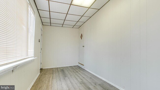
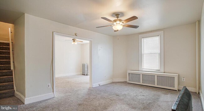
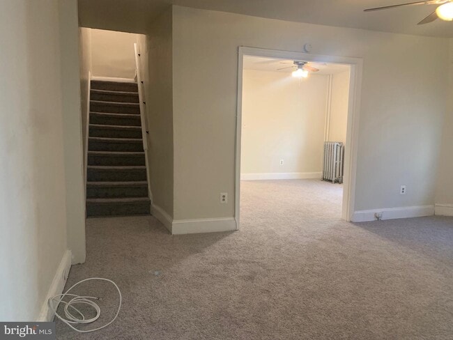
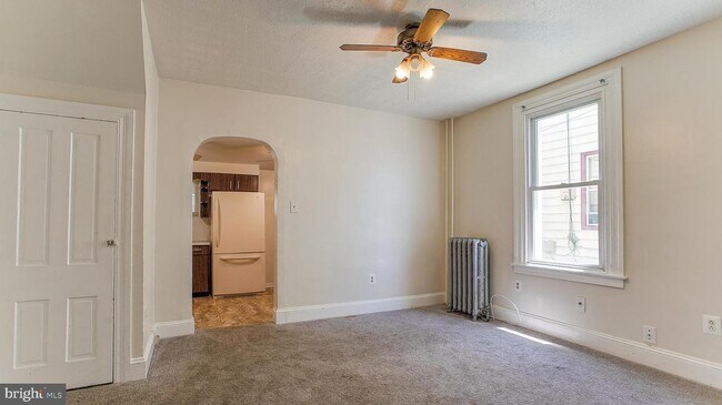
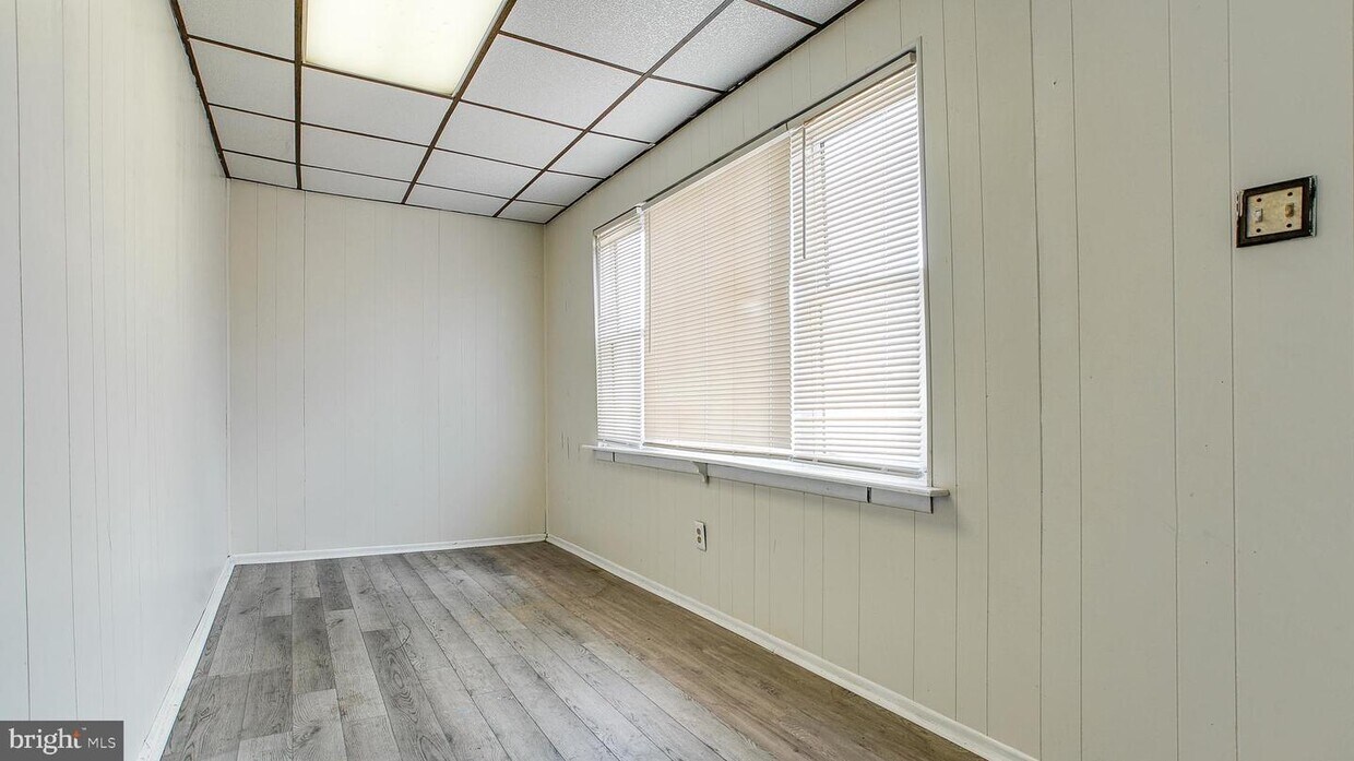
Amazing spacious Twin home in Amazing location available now!! This END-UNIT has 4 beds,1Bath and 2-car parking in the rear of the house. Convenient access to the property , both from springfield road and from the alley in rear! Getting your car in and out from alley is super easy! Just Minutes walk to Clifton-Alden Train station, Trolly, Bus stop and all businesses! Reach Philly by Septa in 10 mins and just about $6 only! Enter home through covered porch bursting with natural light and modern charming engineered wood floors . Minutes walk to Septa train, Trolly, Bus stop and all businesses! The home has a covered porch with modern charming wood floor, Huge living room, dining room, eat in kitchen, with ample natural light coming in! Kitchen has gas cooking .Each room on main floor has a fan with light. The back door from kitchen leads to nice private yard with driveway parking for 2 cars. The second floor has 3 good size bedrooms, and full bathroom. The 3rd floor has extra large area, could be used as home office or a 4th bedroom/rec room. All windows of home have easy operating blinds. Whole house has fresh paint and newer carpet in all bedrooms. Unfinished Basement can be used for your extra storage needs. This home checks it all and would not last so schedule your showing today!!! Tenant to have fair credit history, Clean background, no eviction and 3-4 times the income of the asking rent .
349 S Springfield Rd is a house located in Delaware County and the 19018 ZIP Code. This area is served by the Upper Darby attendance zone.
House Features
- Basement
Location
Get Directions
Clifton Heights is a tiny borough in Delaware County situated eight miles southwest of Philadelphia. The area attracts a diverse group of renters thanks to its quality public schools and relatively easy commute to the city. Locals also choose to call the Clifton Heights neighborhood home for employment opportunities throughout the surrounding areas and overall low crime rates. College students lend Clifton heights a college town feel as well. Interstate 476 lies to the west, making it easy for the commuter crowd to get around.
Learn more about living in Clifton Heights
Amenities
- Basement
Education
| Colleges & Universities | Distance | ||
|---|---|---|---|
| Colleges & Universities | Distance | ||
| Drive: | 10 min | 4.4 mi | |
| Drive: | 15 min | 5.9 mi | |
| Drive: | 16 min | 6.3 mi | |
| Drive: | 17 min | 6.7 mi |
349 S Springfield Rd is within 10 minutes or 4.4 miles from Swarthmore College. It is also near C.C. of Philadelphia, W Ctr and University of the Sciences.
Schools


Public Elementary School
Grades K-5
490 Students
Attendance Zone
Charter Elementary & Middle School
Grades PK-8
499 Students
Nearby
Public Middle School
Grades 6-8
1,318 Students
Attendance Zone
Public High School
Grades 9-12
4,191 Students
Attendance Zone
Private Elementary & Middle School
Grades K-8
172 Students
Nearby
Private Elementary & Middle School
Grades PK-8
239 Students
Nearby
Private High School
Grades 9-12
1,287 Students
Nearby
School data provided by
 The GreatSchools Rating helps parents compare schools within a state based on a variety of school quality indicators and provides a helpful picture of how effectively each school serves all of its students. Ratings are on a scale of 1 (below average) to 10 (above average) and can include test scores, college readiness, academic progress, advanced courses, equity, discipline and attendance data. We also advise parents to visit schools, consider other information on school performance and programs, and consider family needs as part of the school selection process.
View GreatSchools Rating Methodology
Data provided by GreatSchools.org © 2025. All rights reserved.
View GreatSchools Rating Methodology
Data provided by GreatSchools.org © 2025. All rights reserved.
Transportation options available in Clifton Heights include Springfield Road, located 0.1 mile from 349 S Springfield Rd. 349 S Springfield Rd is near Philadelphia International, located 7.2 miles or 17 minutes away, and Trenton Mercer, located 42.6 miles or 70 minutes away.
| Transit / Subway | Distance | ||
|---|---|---|---|
| Transit / Subway | Distance | ||
|
|
Walk: | 1 min | 0.1 mi |
|
|
Walk: | 2 min | 0.1 mi |
| Walk: | 3 min | 0.2 mi | |
|
|
Walk: | 6 min | 0.3 mi |
|
|
Walk: | 9 min | 0.5 mi |
| Commuter Rail | Distance | ||
|---|---|---|---|
| Commuter Rail | Distance | ||
|
|
Walk: | 2 min | 0.1 mi |
|
|
Walk: | 3 min | 0.2 mi |
|
|
Walk: | 14 min | 0.7 mi |
|
|
Drive: | 5 min | 1.2 mi |
|
|
Drive: | 5 min | 2.0 mi |
| Airports | Distance | ||
|---|---|---|---|
| Airports | Distance | ||
|
Philadelphia International
|
Drive: | 17 min | 7.2 mi |
|
Trenton Mercer
|
Drive: | 70 min | 42.6 mi |
Time and distance from 349 S Springfield Rd.
| Shopping Centers | Distance | ||
|---|---|---|---|
| Shopping Centers | Distance | ||
| Walk: | 8 min | 0.4 mi | |
| Walk: | 10 min | 0.6 mi | |
| Walk: | 14 min | 0.7 mi |
349 S Springfield Rd has 3 shopping centers within 0.7 mile, which is about a 14-minute walk. The miles and minutes will be for the farthest away property.
| Parks and Recreation | Distance | ||
|---|---|---|---|
| Parks and Recreation | Distance | ||
|
Cobbs Creek Environmental Education Center
|
Drive: | 11 min | 3.7 mi |
|
John Heinz National Wildlife Refuge
|
Drive: | 10 min | 4.0 mi |
|
Scott Arboretum
|
Drive: | 12 min | 4.4 mi |
|
Cobbs Creek Park
|
Drive: | 12 min | 4.5 mi |
|
Bartram's Garden
|
Drive: | 14 min | 5.5 mi |
349 S Springfield Rd has 5 parks within 5.5 miles, including Cobbs Creek Environmental Education Center, John Heinz National Wildlife Refuge, and Cobbs Creek Park.
| Hospitals | Distance | ||
|---|---|---|---|
| Hospitals | Distance | ||
| Drive: | 5 min | 1.9 mi | |
| Drive: | 10 min | 3.0 mi | |
| Drive: | 18 min | 7.2 mi |
349 S Springfield Rd has 3 hospitals within 7.2 miles, the nearest is Mercy Catholic Medical Center - Mercy Fitzgerald which is 1.9 miles away and a 5 minute drive.
| Military Bases | Distance | ||
|---|---|---|---|
| Military Bases | Distance | ||
| Drive: | 21 min | 9.6 mi |
349 S Springfield Rd is 9.6 miles and a 21 minute drive from Philadelphia Naval Busi Center.
You May Also Like
Similar Rentals Nearby


What Are Walk Score®, Transit Score®, and Bike Score® Ratings?
Walk Score® measures the walkability of any address. Transit Score® measures access to public transit. Bike Score® measures the bikeability of any address.
What is a Sound Score Rating?
A Sound Score Rating aggregates noise caused by vehicle traffic, airplane traffic and local sources
349 S Springfield Rd
Clifton Heights, PA 19018