
The Q Playa
5901-5921 Center Dr,
Los Angeles, CA 90045
$2,972 - $6,788
1-2 Beds
This impressive newly remodeled 3-bedroom/2-bath unit features new laminate flooring throughout, traditional dining room, kitchen equipped with a range and new electric stove, an on-site laundry facility. Parking space included. This building is conveniently located within walking distance to popular shops/businesses including Starbucks, Ralphs, Baskin Robbins, Pizza Hut, Dollar Tree, DMV, gas stations and banks; and within a short drive to the Ladera Center (Ross, CVS, Chuck-E-Cheese, TGIF’s, 99 cent store, amongst other popular services) and the Edward Vincent Junior Park and within 5 miles to LAX airport.
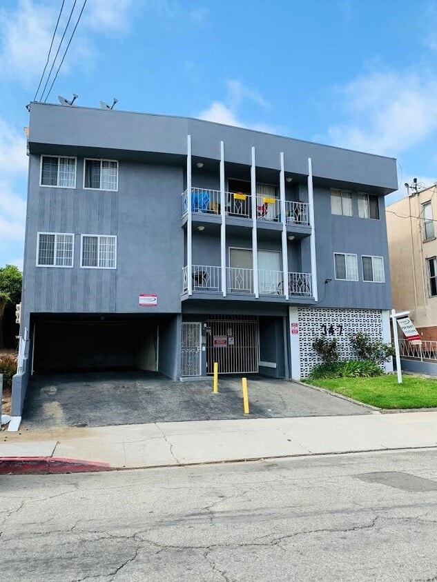
347 E Plymouth St is an apartment community located in Los Angeles County and the 90302 ZIP Code. This area is served by the Inglewood Unified School District attendance zone.
Welcome to Inglewood, located in the heart of Los Angeles County and emerging as Southern California's sports and entertainment destination. The city features residential options throughout neighborhoods like Morningside Park and Fairview Heights, as well as apartment communities near downtown. Current rental trends show one-bedroom apartments averaging $1,704, while two-bedroom units typically rent for $2,050. The market has remained relatively stable, with only minor fluctuations in pricing over the past year.
Inglewood's landscape includes SoFi Stadium, home to the NFL's Los Angeles Rams and Chargers, and the historic Kia Forum, a premier entertainment venue. The Intuit Dome, home court for the NBA's Los Angeles Clippers, further enhances the area's sports presence. Edward Vincent Sr. Park, featuring the historic Centinela Springs, provides outdoor recreation space for residents.
Learn more about living in Inglewood| Colleges & Universities | Distance | ||
|---|---|---|---|
| Colleges & Universities | Distance | ||
| Drive: | 10 min | 4.7 mi | |
| Drive: | 9 min | 4.7 mi | |
| Drive: | 11 min | 5.3 mi | |
| Drive: | 12 min | 6.1 mi |


Transportation options available in Inglewood include Downtown Inglewood Station, located 0.9 mile from 347 E Plymouth St. 347 E Plymouth St is near Los Angeles International, located 4.7 miles or 10 minutes away, and Bob Hope, located 17.8 miles or 34 minutes away.
| Transit / Subway | Distance | ||
|---|---|---|---|
| Transit / Subway | Distance | ||
| Walk: | 17 min | 0.9 mi | |
| Drive: | 3 min | 1.3 mi | |
| Drive: | 4 min | 1.9 mi | |
| Drive: | 4 min | 2.0 mi | |
| Drive: | 6 min | 3.0 mi |
| Commuter Rail | Distance | ||
|---|---|---|---|
| Commuter Rail | Distance | ||
|
|
Drive: | 18 min | 12.1 mi |
|
|
Drive: | 21 min | 12.3 mi |
|
|
Drive: | 25 min | 14.3 mi |
| Drive: | 22 min | 16.1 mi | |
|
|
Drive: | 25 min | 16.7 mi |
| Airports | Distance | ||
|---|---|---|---|
| Airports | Distance | ||
|
Los Angeles International
|
Drive: | 10 min | 4.7 mi |
|
Bob Hope
|
Drive: | 34 min | 17.8 mi |
Scores provided by
Traffic
-Airport
-Businesses
-Scores provided by
HowLoud What is a Sound Score Rating? A Sound Score Rating aggregates noise caused by vehicle traffic, airplane traffic and local sources. How It WorksTime and distance from 347 E Plymouth St.
| Shopping Centers | Distance | ||
|---|---|---|---|
| Shopping Centers | Distance | ||
| Walk: | 7 min | 0.4 mi | |
| Walk: | 9 min | 0.5 mi | |
| Walk: | 11 min | 0.6 mi |
| Parks and Recreation | Distance | ||
|---|---|---|---|
| Parks and Recreation | Distance | ||
|
Kenneth Hahn State Recreation Area
|
Drive: | 10 min | 4.6 mi |
|
Ballona Creek Trail - Ballona Wetlands Ecological Reserve Access
|
Drive: | 8 min | 4.6 mi |
|
Natural History Museum of LA County
|
Drive: | 12 min | 6.1 mi |
|
Exposition Park Rose Garden
|
Drive: | 12 min | 6.3 mi |
|
California Science Center
|
Drive: | 13 min | 6.4 mi |
| Hospitals | Distance | ||
|---|---|---|---|
| Hospitals | Distance | ||
| Drive: | 5 min | 2.4 mi | |
| Drive: | 10 min | 5.6 mi | |
| Drive: | 10 min | 6.4 mi |
| Military Bases | Distance | ||
|---|---|---|---|
| Military Bases | Distance | ||
| Drive: | 10 min | 6.3 mi | |
| Drive: | 32 min | 23.0 mi | |
| Drive: | 35 min | 25.3 mi |
Pets Allowed In Unit Washer & Dryer Maintenance on site Heat Controlled Access Elevator
What Are Walk Score®, Transit Score®, and Bike Score® Ratings?
Walk Score® measures the walkability of any address. Transit Score® measures access to public transit. Bike Score® measures the bikeability of any address.
What is a Sound Score Rating?
A Sound Score Rating aggregates noise caused by vehicle traffic, airplane traffic and local sources.

347 E Plymouth St
Inglewood, CA 90302


")


