
$2,500
/ Month
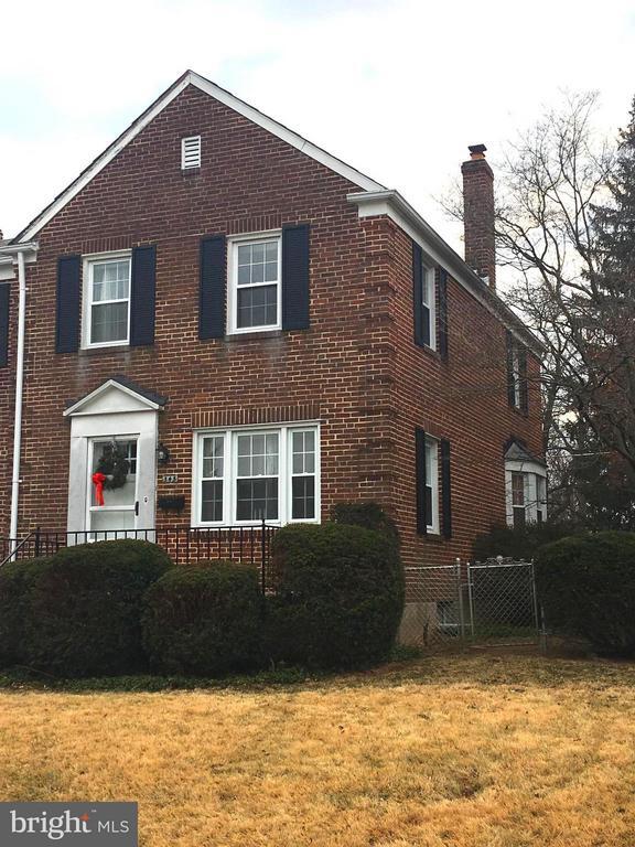
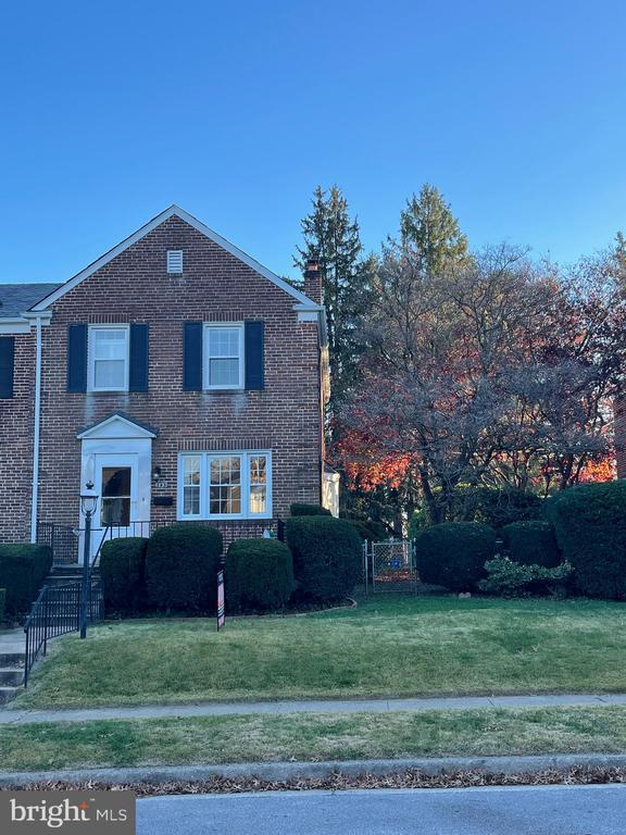
345 Old Trail
Baltimore, MD 21212
Favorites
443-867-7171
-
Bedrooms
3
-
Bathrooms
1.5
-
Square Feet
--
-
Available
Available Now
Highlight
- Basement
345 Old Trail

Favorites
About This Home
Available Now
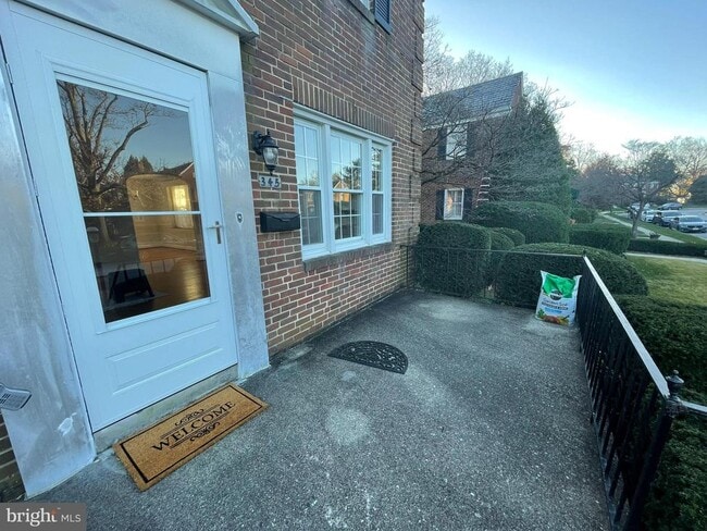
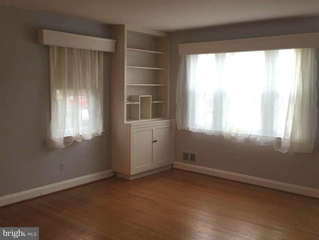
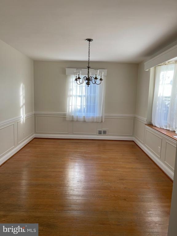
For Rent ONLY. Large End of Group Townhome in the Heart of Rodgers Forge. This rental is so convenient to all areas in Towson and Baltimore. The house has off street parking from the Alley and the house backs to the pickleball and tennis courts at the County property for Rodgers Forge Elementary and Dumbarton Middle School. Perfect for walks through the park! The back yard is level. The house has Hardwood Floors on the First and second level. 3 Bedrooms and 1 Full Bath are located on the second floor. The Basement has a clubroom and storage and laundry/workroom area with a half bath. There is a Walk up to the back yard with a railing around the entire stairway. Updated flooring in kitchen, clubroom and basement. Updated kitchen appliances. Updated kitchen Counters. New HVAC and updated water heater. Pets allowed on case by case basis. Beautiful molding in almost all rooms. Classic clubroom with knotty pine walls and carpet. Quiet street. Blue Ribbon Schools.
345 Old Trail is a townhome located in Baltimore County and the 21212 ZIP Code. This area is served by the Baltimore County Public Schools attendance zone.
* Price shown is base rent. Excludes user-selected optional fees and variable or usage-based fees and required charges due at or prior to move-in or at move-out. Price, availability, fees, and any applicable rent special are subject to change without notice.
* Square footage definitions vary. Displayed square footage is approximate.
Townhome Features
- Dishwasher
- Basement
Contact
- Listed by Carolyn B Wescott | Long & Foster Real Estate, Inc.
- Phone Number
- Contact
-
Source
 Bright MLS, Inc.
Copyright © 2026 Bright MLS, Inc.
Location
Get Directions
Towson Circle encompasses parts of Interstate 695, 83, and the slew of neighborhoods that surround the center of Towson. In recent years this part of the city has become the home of modern retail centers like Circle East, which provides upscale shopping and dining as well as impressive modern architecture for this charming Maryland suburb. There’s an amazing mix of single-family homes, affordable apartments, and modern mid-rise communities available to renters, all with fantastic proximity to the center of the city and the plentiful parks that surround it.
Learn more about living in Towson Circle
Amenities
- Dishwasher
- Basement
Education
| Colleges & Universities | Distance | ||
|---|---|---|---|
| Colleges & Universities | Distance | ||
| Walk: | 15 min | 0.8 mi | |
| Drive: | 7 min | 2.6 mi | |
| Drive: | 8 min | 2.9 mi | |
| Drive: | 9 min | 3.1 mi |
345 Old Trail is within 15 minutes or 0.8 mile from Towson University. It is also near Loyola University Maryland and Goucher College.
Schools


Public Elementary School
Grades K-5
396 Students
Attendance Zone
Public Elementary & Middle School
Grades PK-8
376 Students
Nearby
Public Middle School
Grades 6-8
1,073 Students
Attendance Zone
Public High School
Grades 9-12
1,676 Students
Attendance Zone
Private Elementary & Middle School
Grades PK-8
114 Students
Nearby
Private High School
Grades 9-12
6 Students
Nearby
School data provided by
 The GreatSchools Rating helps parents compare schools within a state based on a variety of school quality indicators and provides a helpful picture of how effectively each school serves all of its students. Ratings are on a scale of 1 (below average) to 10 (above average) and can include test scores, college readiness, academic progress, advanced courses, equity, discipline and attendance data. We also advise parents to visit schools, consider other information on school performance and programs, and consider family needs as part of the school selection process.
View GreatSchools Rating Methodology
Data provided by GreatSchools.org © 2026. All rights reserved.
View GreatSchools Rating Methodology
Data provided by GreatSchools.org © 2026. All rights reserved.
Transportation options available in Baltimore include Mount Washington, located 3.5 miles from 345 Old Trail. 345 Old Trail is near Baltimore/Washington International Thurgood Marshall, located 17.6 miles or 37 minutes away.
| Transit / Subway | Distance | ||
|---|---|---|---|
| Transit / Subway | Distance | ||
|
|
Drive: | 10 min | 3.5 mi |
|
|
Drive: | 10 min | 3.5 mi |
|
|
Drive: | 10 min | 4.2 mi |
|
|
Drive: | 10 min | 4.4 mi |
|
|
Drive: | 12 min | 5.1 mi |
| Commuter Rail | Distance | ||
|---|---|---|---|
| Commuter Rail | Distance | ||
|
|
Drive: | 16 min | 6.1 mi |
| Drive: | 22 min | 9.7 mi | |
| Drive: | 21 min | 10.3 mi | |
| Drive: | 34 min | 14.8 mi | |
| Drive: | 27 min | 15.9 mi |
| Airports | Distance | ||
|---|---|---|---|
| Airports | Distance | ||
|
Baltimore/Washington International Thurgood Marshall
|
Drive: | 37 min | 17.6 mi |
Getting Around
 What do Walkability, Transit, Drivability, and Bikeability mean?
Walkability measures the walking distance to day-to-day needs.
Transit measures access to public transportation.
Drivability measures congestion, parking availability, and access to major roads.
Bikeability measures the suitability for cycling.
How It Works
What do Walkability, Transit, Drivability, and Bikeability mean?
Walkability measures the walking distance to day-to-day needs.
Transit measures access to public transportation.
Drivability measures congestion, parking availability, and access to major roads.
Bikeability measures the suitability for cycling.
How It Works
Moderately Walkable
Walkability
70
/ 100
Some Public Transit
Transit
50
/ 100
Moderately Drivable
Drivability
60
/ 100
Fairly Bikeable
Bikeability
50
/ 100
Scores provided by
-
Soundscore™
-
/ 100
Traffic
-Airport
-Businesses
-Scores provided by
HowLoud What is a Sound Score Rating? A Sound Score Rating aggregates noise caused by vehicle traffic, airplane traffic and local sources. How It WorksTime and distance from 345 Old Trail.
| Shopping Centers | Distance | ||
|---|---|---|---|
| Shopping Centers | Distance | ||
| Walk: | 17 min | 0.9 mi | |
| Walk: | 18 min | 1.0 mi |
345 Old Trail has 2 shopping centers within 1.0 mile, which is about a 18-minute walk. The miles and minutes will be for the farthest away property.
| Parks and Recreation | Distance | ||
|---|---|---|---|
| Parks and Recreation | Distance | ||
|
Watson-King Planetarium
|
Drive: | 4 min | 1.1 mi |
|
Hampton National Historic Site
|
Drive: | 7 min | 3.0 mi |
|
Lake Roland Park
|
Drive: | 12 min | 3.7 mi |
|
Cylburn Arboretum
|
Drive: | 13 min | 4.6 mi |
|
Cromwell Valley Park
|
Drive: | 11 min | 4.6 mi |
345 Old Trail has 5 parks within 4.6 miles, including Watson-King Planetarium, Lake Roland Park, and Hampton National Historic Site.
| Hospitals | Distance | ||
|---|---|---|---|
| Hospitals | Distance | ||
| Walk: | 10 min | 0.5 mi | |
| Drive: | 4 min | 1.5 mi | |
| Drive: | 5 min | 2.0 mi |
345 Old Trail has 3 hospitals within 2.0 miles, the nearest is University of Maryland St. Joseph Medical Center which is 0.5 mile away and a 10 minute walk.
| Military Bases | Distance | ||
|---|---|---|---|
| Military Bases | Distance | ||
| Drive: | 50 min | 25.7 mi | |
| Drive: | 70 min | 42.7 mi | |
| Drive: | 79 min | 48.5 mi |
345 Old Trail has 3 military bases within 48.5 miles, the nearest is Fort George Meade which is 25.7 miles away and a 50 minute drive.
You May Also Like
Similar Rentals Nearby


What Are Walk Score®, Transit Score®, and Bike Score® Ratings?
Walk Score® measures the walkability of any address. Transit Score® measures access to public transit. Bike Score® measures the bikeability of any address.
What is a Sound Score Rating?
A Sound Score Rating aggregates noise caused by vehicle traffic, airplane traffic and local sources.
345 Old Trail
Baltimore, MD 21212