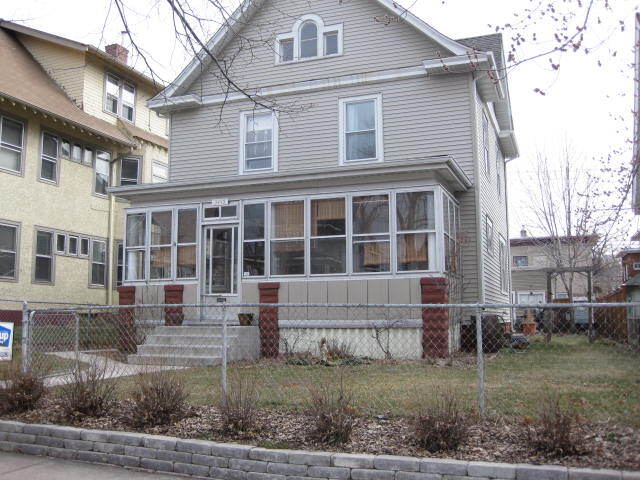
3445 5th Ave S
Minneapolis, MN 55408
-
Bedrooms
4
-
Bathrooms
1.5
-
Square Feet
1,500 sq ft
-
Available
Available Jun 15

Contact
- Contact
Characterized by single-family homes and low-rise multi-family rentals along tree-lined streets, the Central neighborhood of Minneapolis lies about three miles due south of the city center. Bordered on the west by I-35, the Central area provides its residents with a convenient location and easy access to the amenities of the greater Minneapolis-St. Paul region.
Stroll well-kept sidewalks or the walking paths at Powderhorn Park, a 66-acre spread providing picnic facilities, an ice skating rink, a fishing pier, and athletic fields. For a change of pace, visit Central Gym Park on the neighborhood's south side to play tennis or shoot hoops indoors. Then drop into the highly popular Café South Side for a soup and sandwich, a fresh-baked pastry, or a cup of coffee brewed from organic beans.
Learn more about living in Central| Colleges & Universities | Distance | ||
|---|---|---|---|
| Colleges & Universities | Distance | ||
| Drive: | 6 min | 2.9 mi | |
| Drive: | 6 min | 3.0 mi | |
| Drive: | 7 min | 3.3 mi | |
| Drive: | 7 min | 4.1 mi |


View GreatSchools Rating Methodology
Data provided by GreatSchools.org © 2026. All rights reserved.
Transportation options available in Minneapolis include Lake Street/Midtown Station, located 2.1 miles from 3445 5th Ave S. 3445 5th Ave S is near Minneapolis-St Paul International/Wold-Chamberlain, located 10.4 miles or 18 minutes away.
| Transit / Subway | Distance | ||
|---|---|---|---|
| Transit / Subway | Distance | ||
|
|
Drive: | 6 min | 2.1 mi |
|
|
Drive: | 8 min | 2.4 mi |
|
|
Drive: | 7 min | 2.7 mi |
| Drive: | 7 min | 3.4 mi | |
|
|
Drive: | 8 min | 4.0 mi |
| Commuter Rail | Distance | ||
|---|---|---|---|
| Commuter Rail | Distance | ||
|
|
Drive: | 9 min | 3.9 mi |
|
|
Drive: | 18 min | 11.9 mi |
|
|
Drive: | 18 min | 12.0 mi |
|
|
Drive: | 32 min | 23.0 mi |
|
|
Drive: | 34 min | 24.7 mi |
| Airports | Distance | ||
|---|---|---|---|
| Airports | Distance | ||
|
Minneapolis-St Paul International/Wold-Chamberlain
|
Drive: | 18 min | 10.4 mi |
Scores provided by
Traffic
-Airport
-Businesses
-Scores provided by
HowLoud What is a Sound Score Rating? A Sound Score Rating aggregates noise caused by vehicle traffic, airplane traffic and local sources. How It WorksTime and distance from 3445 5th Ave S.
| Shopping Centers | Distance | ||
|---|---|---|---|
| Shopping Centers | Distance | ||
| Walk: | 18 min | 0.9 mi | |
| Drive: | 4 min | 1.2 mi | |
| Drive: | 5 min | 1.5 mi |
| Parks and Recreation | Distance | ||
|---|---|---|---|
| Parks and Recreation | Distance | ||
|
Painter Park
|
Walk: | 21 min | 1.1 mi |
|
Powderhorn Park
|
Drive: | 4 min | 1.2 mi |
|
Phelps Park
|
Drive: | 4 min | 1.2 mi |
|
Rev. Dr. Martin Luther King Jr. Park
|
Drive: | 4 min | 1.3 mi |
|
Stewart Park
|
Drive: | 5 min | 1.6 mi |
| Hospitals | Distance | ||
|---|---|---|---|
| Hospitals | Distance | ||
| Drive: | 4 min | 1.2 mi | |
| Drive: | 5 min | 1.5 mi | |
| Drive: | 6 min | 3.1 mi |
| Military Bases | Distance | ||
|---|---|---|---|
| Military Bases | Distance | ||
| Drive: | 15 min | 8.2 mi |
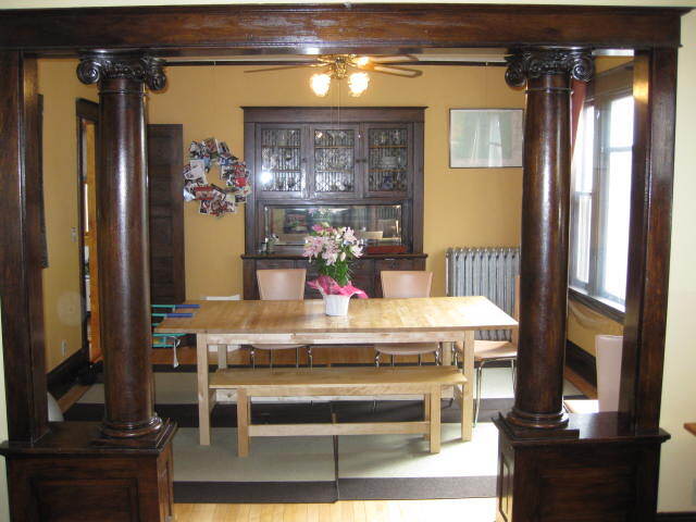
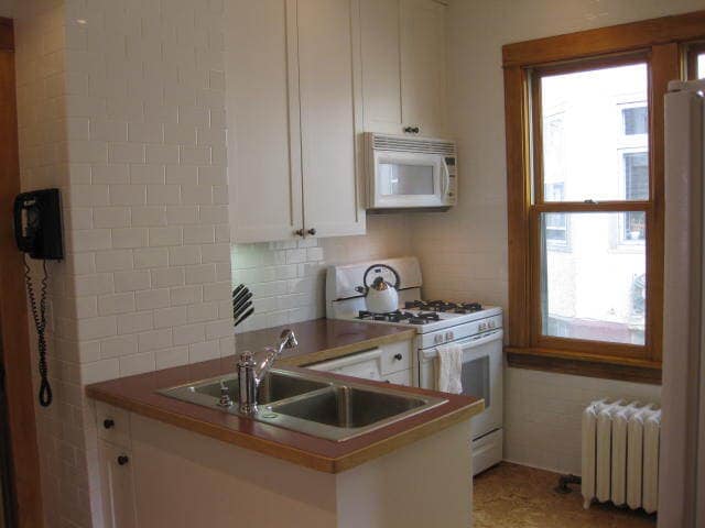
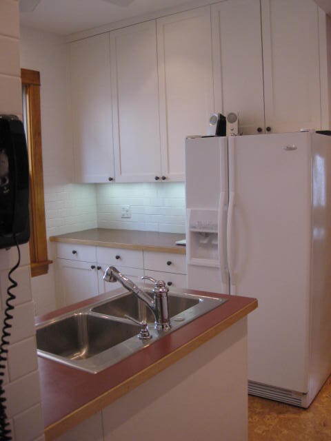
3445 5th Ave S Photos
What Are Walk Score®, Transit Score®, and Bike Score® Ratings?
Walk Score® measures the walkability of any address. Transit Score® measures access to public transit. Bike Score® measures the bikeability of any address.
What is a Sound Score Rating?
A Sound Score Rating aggregates noise caused by vehicle traffic, airplane traffic and local sources.

3445 5th Ave S
Minneapolis, MN 55408