
-
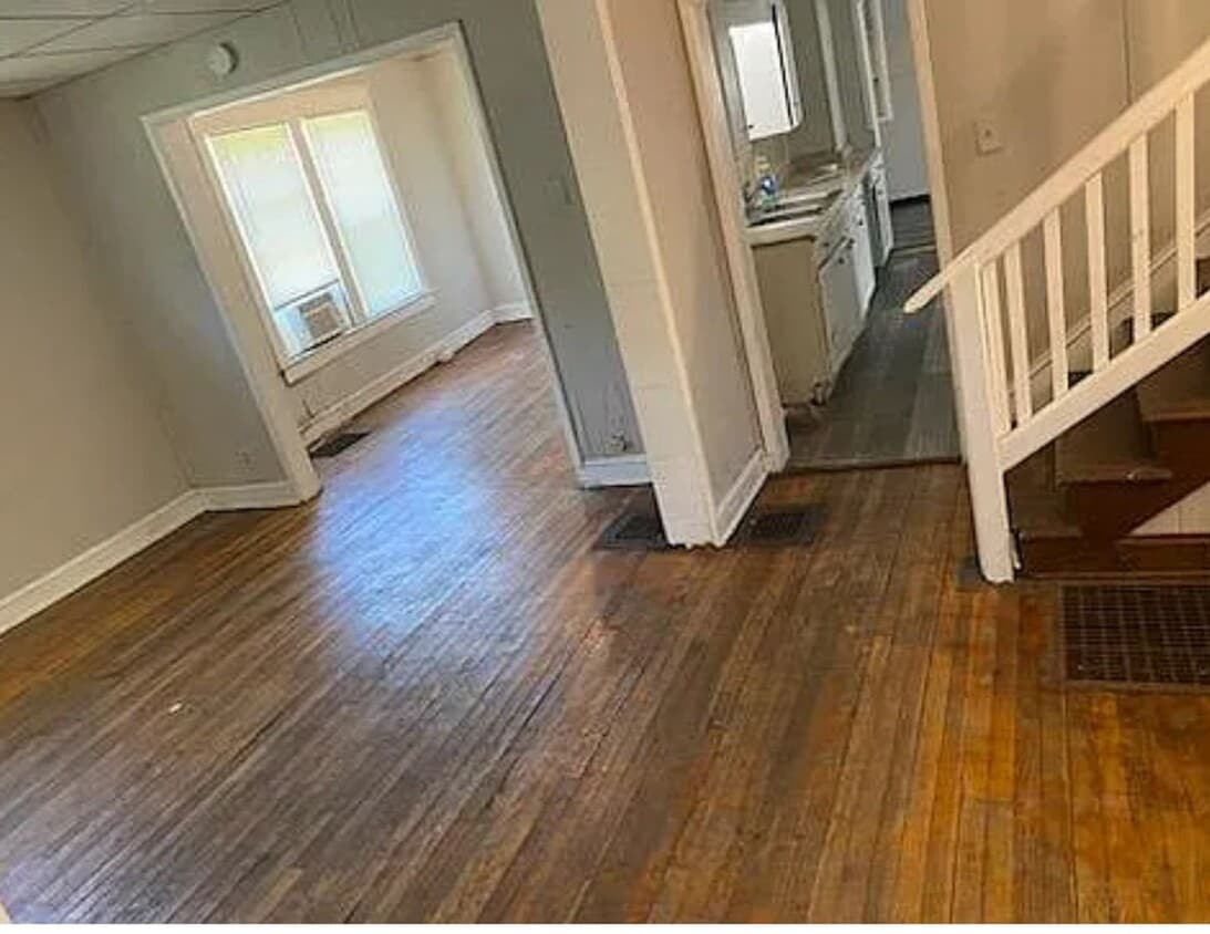
3 bed 2 bath
-
$775
/ Month
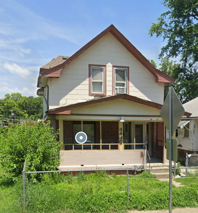
3430 E 6 St
Kansas City, MO 64124
Today
Favorites
913-602-3088
-
Bedrooms
3
-
Bathrooms
2
-
Square Feet
900 sq ft
-
Available
Available Now
3430 E 6 St

Favorites
Single-family homes as well as apartments and condos in low-rise buildings dot the streets of the Lykins neighborhood of Kansas City, which sits about three miles due east of the downtown area. This neighborhood has bonded together in a unique way to create a sustainable community centered around the idea of urban agriculture. Community gardens throughout Lykins produce healthy food for locals, raise fish, and create alternative energy.
Spinoffs from the community garden initiative include after-school arts programs and a robust neighborhood association. Expect to meet up with your neighbors at monthly lunches with city officials held at neighborhood gathering spots such as Eleo's Coffee House. Lykins stays well connected to the rest of Kansas City and beyond with its easy access to Interstate 70.
Learn more about living in Lykins
Education
| Colleges & Universities | Distance | ||
|---|---|---|---|
| Colleges & Universities | Distance | ||
| Drive: | 14 min | 6.5 mi | |
| Drive: | 14 min | 6.6 mi | |
| Drive: | 13 min | 7.1 mi | |
| Drive: | 14 min | 7.1 mi |
3430 E 6 St is within 14 minutes or 6.5 miles from Kansas City Art Institute. It is also near Rockhurst University and Graceland University.
Schools


Public Elementary School
Grades PK-6
351 Students
Attendance Zone
Public Middle School
Grades 7-8
555 Students
Attendance Zone
Public High School
Grades 9-12
657 Students
Attendance Zone
Private Elementary & Middle School
Grades PK-8
170 Students
Nearby
Private High School
Grades 9-12
60 Students
Nearby
School data provided by
 The GreatSchools Rating helps parents compare schools within a state based on a variety of school quality indicators and provides a helpful picture of how effectively each school serves all of its students. Ratings are on a scale of 1 (below average) to 10 (above average) and can include test scores, college readiness, academic progress, advanced courses, equity, discipline and attendance data. We also advise parents to visit schools, consider other information on school performance and programs, and consider family needs as part of the school selection process.
View GreatSchools Rating Methodology
Data provided by GreatSchools.org © 2025. All rights reserved.
View GreatSchools Rating Methodology
Data provided by GreatSchools.org © 2025. All rights reserved.
Transportation options available in Kansas City include City Market On Walnut At 5Th St Eb, located 2.4 miles from 3430 E 6 St. 3430 E 6 St is near Kansas City International, located 21.2 miles or 30 minutes away.
| Transit / Subway | Distance | ||
|---|---|---|---|
| Transit / Subway | Distance | ||
| Drive: | 5 min | 2.4 mi | |
| Drive: | 6 min | 2.5 mi | |
| Drive: | 5 min | 2.5 mi | |
| Drive: | 6 min | 2.6 mi | |
| Drive: | 5 min | 2.6 mi |
| Commuter Rail | Distance | ||
|---|---|---|---|
| Commuter Rail | Distance | ||
|
|
Drive: | 9 min | 4.0 mi |
|
|
Drive: | 15 min | 8.1 mi |
|
|
Drive: | 30 min | 19.0 mi |
| Airports | Distance | ||
|---|---|---|---|
| Airports | Distance | ||
|
Kansas City International
|
Drive: | 30 min | 21.2 mi |
Time and distance from 3430 E 6 St.
| Shopping Centers | Distance | ||
|---|---|---|---|
| Shopping Centers | Distance | ||
| Drive: | 3 min | 1.3 mi | |
| Drive: | 6 min | 2.4 mi | |
| Drive: | 6 min | 2.7 mi |
3430 E 6 St has 3 shopping centers within 2.7 miles, which is about a 6-minute drive. The miles and minutes will be for the farthest away property.
| Parks and Recreation | Distance | ||
|---|---|---|---|
| Parks and Recreation | Distance | ||
|
Richard Berkley Riverfront Park
|
Drive: | 7 min | 3.0 mi |
|
Science City at Union Station
|
Drive: | 9 min | 3.8 mi |
|
Mill Creek Park
|
Drive: | 13 min | 6.3 mi |
|
Anita B. Gorman Conservation Discovery Center
|
Drive: | 12 min | 6.4 mi |
|
Donald J. Hall Sculpture Park
|
Drive: | 13 min | 6.6 mi |
3430 E 6 St has 5 parks within 6.6 miles, including Richard Berkley Riverfront Park, Science City at Union Station, and Anita B. Gorman Conservation Discovery Center.
| Hospitals | Distance | ||
|---|---|---|---|
| Hospitals | Distance | ||
| Drive: | 6 min | 3.2 mi | |
| Drive: | 7 min | 3.6 mi | |
| Drive: | 7 min | 3.8 mi |
3430 E 6 St has 3 hospitals within 3.8 miles, the nearest is Center for Behavioral Medicine which is 3.2 miles away and a 6 minute drive.
| Military Bases | Distance | ||
|---|---|---|---|
| Military Bases | Distance | ||
| Drive: | 54 min | 33.1 mi |
3430 E 6 St is 33.1 miles and a 54 minute drive from Fort Leavenworth.
You May Also Like
Similar Rentals Nearby


What Are Walk Score®, Transit Score®, and Bike Score® Ratings?
Walk Score® measures the walkability of any address. Transit Score® measures access to public transit. Bike Score® measures the bikeability of any address.
What is a Sound Score Rating?
A Sound Score Rating aggregates noise caused by vehicle traffic, airplane traffic and local sources

3430 E 6 St
Kansas City, MO 64124