
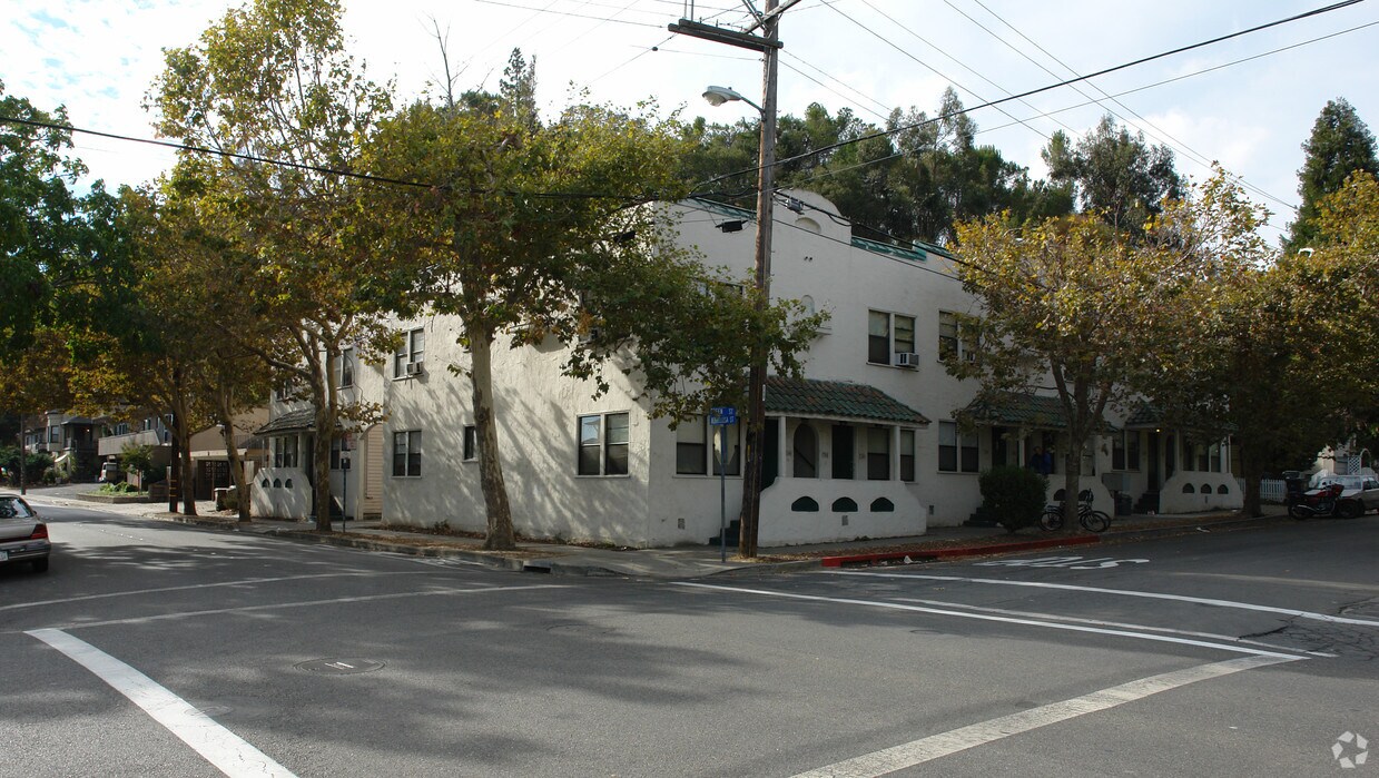
Lotus Apartments / L87
3979 Alhambra Ave,
Martinez, CA 94553
$1,575 - $2,840
Studio - 3 Beds
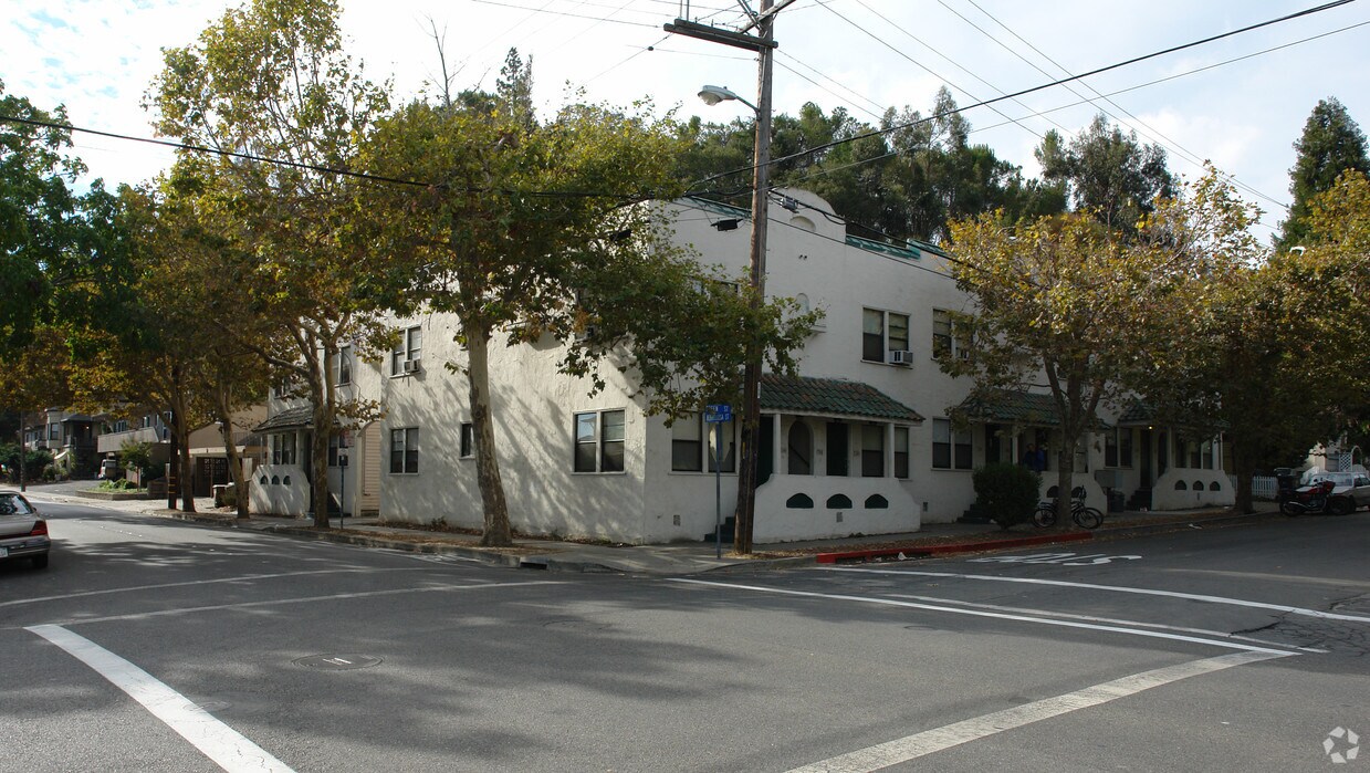
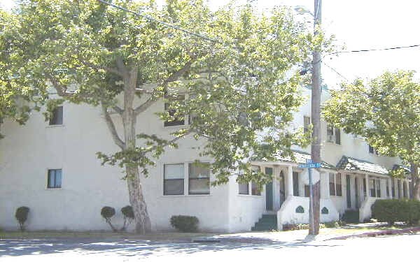
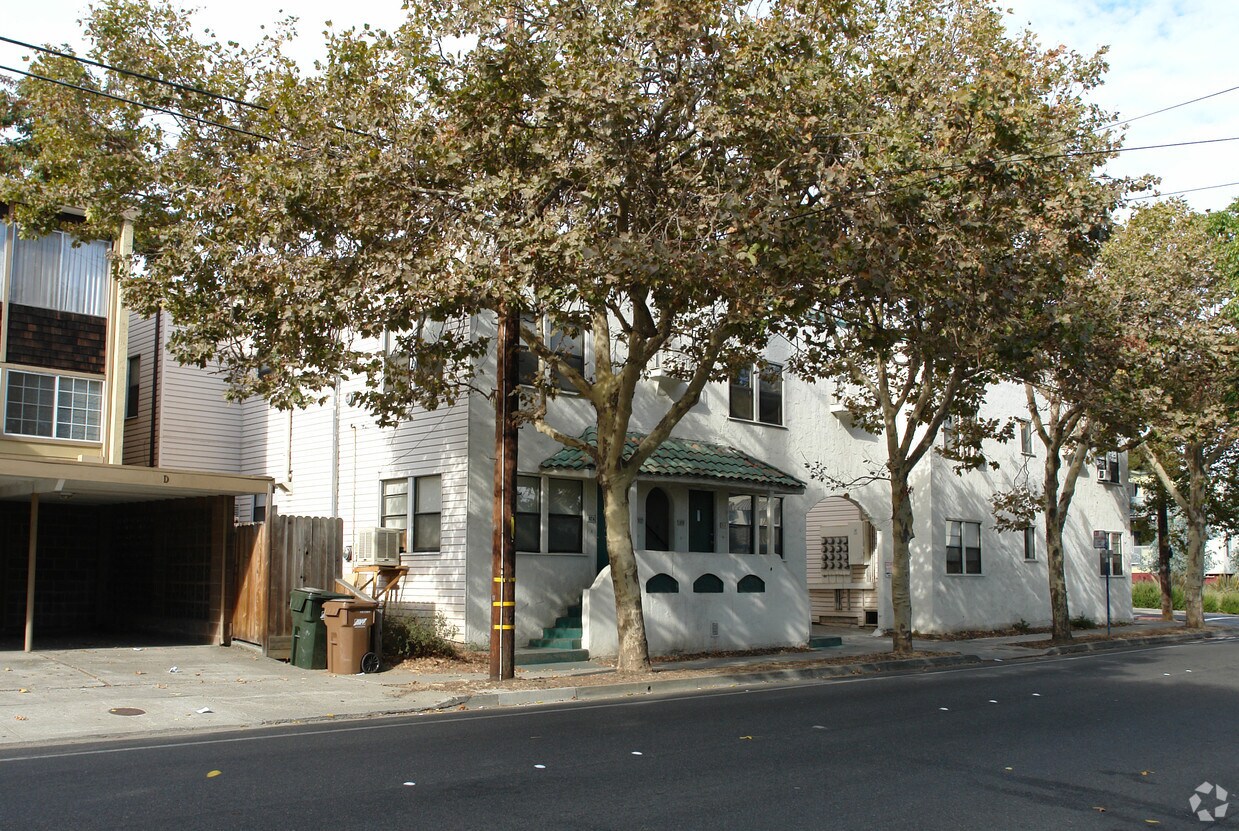

Discover your next home at 342 Green St in Martinez. This apartment community is located in the 94553 area of Martinez. Schedule a time to check out the apartment floorplan options. The knowledgeable leasing staff is waiting to show you all that this community has to offer. Visit 342 Green St today.
342 Green St is an apartment community located in Contra Costa County and the 94553 ZIP Code. This area is served by the Martinez Unified attendance zone.
Situated on the southern shore of the Carquinez Strait in the San Francisco Bay Area, Martinez is known for its unique architecture. Downtown Martinez shops and restaurants maintain a distinctive, early 20th-Century look.
For over 25 years, Martinez was home to John Muir, “The Father of Our National Park System." You can feel his naturalist influence at the John Muir National Historic Site as well as the 16 city parks and one marina in Martinez today. Martinez Regional Shoreline is a popular spot among residents for sweeping natural views and water-related activities.
Renting in Martinez also gives you the option to engage in nightlife festivities such as catching live music at Armando’s or watching a performance at the California Magic Dinner Theatre.
With Amtrak and BART stops in the city in addition to convenient access to I-680 and State Route 4, traveling to and from Martinez is easy.
Learn more about living in Martinez| Colleges & Universities | Distance | ||
|---|---|---|---|
| Colleges & Universities | Distance | ||
| Drive: | 14 min | 7.8 mi | |
| Drive: | 22 min | 15.8 mi | |
| Drive: | 27 min | 16.6 mi | |
| Drive: | 37 min | 21.4 mi |


Transportation options available in Martinez include North Concord Martinez Station, located 8.9 miles from 342 Green St. 342 Green St is near Metro Oakland International, located 31.2 miles or 47 minutes away, and San Francisco International, located 45.5 miles or 62 minutes away.
| Transit / Subway | Distance | ||
|---|---|---|---|
| Transit / Subway | Distance | ||
|
|
Drive: | 14 min | 8.9 mi |
|
|
Drive: | 14 min | 8.9 mi |
|
|
Drive: | 16 min | 9.7 mi |
|
|
Drive: | 16 min | 10.7 mi |
|
|
Drive: | 20 min | 11.2 mi |
| Commuter Rail | Distance | ||
|---|---|---|---|
| Commuter Rail | Distance | ||
|
|
Walk: | 9 min | 0.5 mi |
| Drive: | 27 min | 19.4 mi | |
|
|
Drive: | 29 min | 22.8 mi |
|
|
Drive: | 30 min | 23.5 mi |
|
|
Drive: | 33 min | 25.3 mi |
| Airports | Distance | ||
|---|---|---|---|
| Airports | Distance | ||
|
Metro Oakland International
|
Drive: | 47 min | 31.2 mi |
|
San Francisco International
|
Drive: | 62 min | 45.5 mi |
Time and distance from 342 Green St.
| Shopping Centers | Distance | ||
|---|---|---|---|
| Shopping Centers | Distance | ||
| Walk: | 3 min | 0.2 mi | |
| Drive: | 2 min | 1.1 mi | |
| Drive: | 6 min | 2.7 mi |
| Parks and Recreation | Distance | ||
|---|---|---|---|
| Parks and Recreation | Distance | ||
|
Alhambra Creek Watershed
|
Walk: | 4 min | 0.3 mi |
|
John Muir National Historic Site
|
Drive: | 5 min | 1.9 mi |
|
Waterbird Regional Preserve
|
Drive: | 5 min | 2.5 mi |
|
Martinez Regional Shoreline
|
Drive: | 8 min | 2.7 mi |
|
Dutra Ranch, Sky Ranch and Gustin Properties
|
Drive: | 7 min | 3.2 mi |
| Hospitals | Distance | ||
|---|---|---|---|
| Hospitals | Distance | ||
| Walk: | 13 min | 0.7 mi | |
| Drive: | 13 min | 8.7 mi | |
| Drive: | 13 min | 9.0 mi |
| Military Bases | Distance | ||
|---|---|---|---|
| Military Bases | Distance | ||
| Drive: | 10 min | 6.1 mi |
What Are Walk Score®, Transit Score®, and Bike Score® Ratings?
Walk Score® measures the walkability of any address. Transit Score® measures access to public transit. Bike Score® measures the bikeability of any address.
What is a Sound Score Rating?
A Sound Score Rating aggregates noise caused by vehicle traffic, airplane traffic and local sources
342 Green St
Martinez, CA 94553


