
$1,600
Total Monthly Price
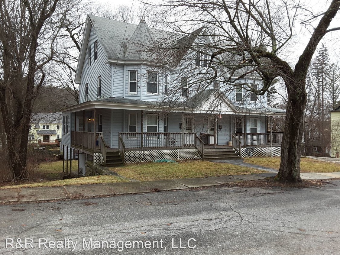
34 Pine St
Whitinsville, MA 01588
Favorites
34 Pine St

Favorites
Check Back Soon for Upcoming Availability
| Beds | Baths | Average SF |
|---|---|---|
| 3 Bedrooms 3 Bedrooms 3 Br | 2 Baths 2 Baths 2 Ba | 1,573 SF |
About This Property
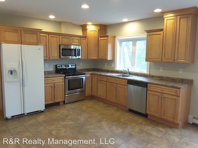
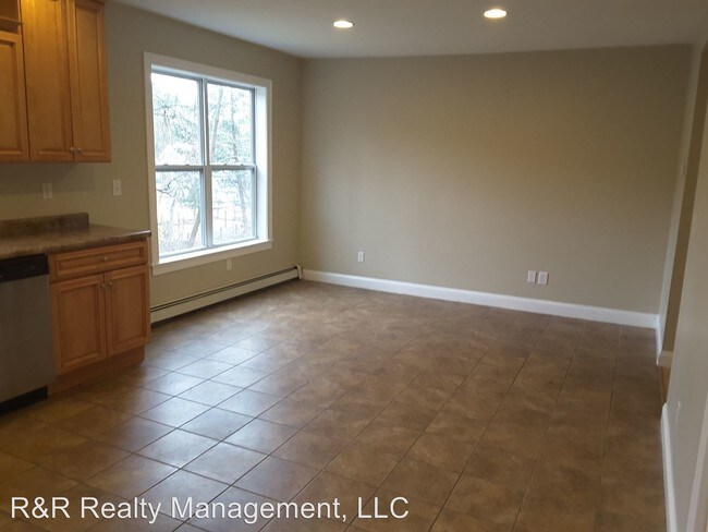
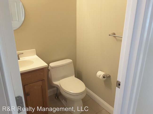
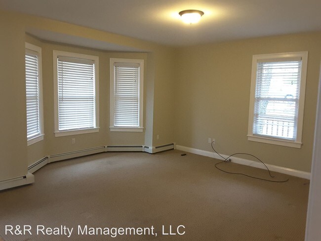
(508) 234-3414 - Large 3 Bedroom Half Duplex - This large 3 bedroom apartment was the owners unit. It has a large fully applianced eat-in kitchen with a pantry closet. Laundry is off the kitchen. There is a carpeted living room with a walkout bay window and 1/2 bath on the first floor. The second floor has a full tiled bath and 3 bedrooms with wood floors. The third floor has 2 rooms that could be used as a playroom, office or storage area. A full bath with shower is also on the third floor. The apartment is heated by a gas furnace and gas hot water. No Pets Allowed (RLNE3908335) Pet policies - No Dogs Allowed, No Cats Allowed.
34 Pine St is a condo located in Worcester County and the 01588 ZIP Code. This area is served by the Northbridge School District attendance zone.
34 Pine St,
Whitinsville,
MA
01588
Covered in lush forests and ponds, Whitinsville is a historic village within the town of Northbridge in Worcester County. Located just 14 miles southeast of Worcester, Whitinsville maintains a small-town atmosphere. Whitinsville’s quaint downtown area stretches along Church Street with a bevy of local shops, restaurants, and salons.
Whitinsville’s rich history is evident in the Whitinsville Historic District, where residents and visitors can take walking tours to see what life was like in an Industrial Revolution company town. Whitinsville is home to West End Creamery, a farm that offers guests access to locally made ice cream, an 18-hole mini golf course, Barnyard Jump, and a corn maze.
Attractions like Purgatory Chasm State Reservation and Southwick’s Zoo are also just minutes from Whitinsville. Larger cities such as Worcester, Providence, and Boston are all within an hour’s drive of Whitinsville.
Learn more about living in Whitinsville
Education
| Colleges & Universities | Distance | ||
|---|---|---|---|
| Colleges & Universities | Distance | ||
| Drive: | 27 min | 11.9 mi | |
| Drive: | 22 min | 13.2 mi | |
| Drive: | 22 min | 14.5 mi | |
| Drive: | 25 min | 16.1 mi |
34 Pine St is within 27 minutes or 11.9 miles from Tufts University, Grafton. It is also near College of the Holy Cross and Clark University.
Schools


Public Elementary School
Grades PK-5
975 Students
Attendance Zone
Public Elementary School
Grades PK-5
353 Students
Attendance Zone
Public Middle School
Grades 6-8
249 Students
Attendance Zone
Public High School
Grades 9-12
581 Students
Attendance Zone
Private Elementary, Middle & High School
Grades PK-12
638 Students
Nearby
School data provided by
 The GreatSchools Rating helps parents compare schools within a state based on a variety of school quality indicators and provides a helpful picture of how effectively each school serves all of its students. Ratings are on a scale of 1 (below average) to 10 (above average) and can include test scores, college readiness, academic progress, advanced courses, equity, discipline and attendance data. We also advise parents to visit schools, consider other information on school performance and programs, and consider family needs as part of the school selection process.
View GreatSchools Rating Methodology
Data provided by GreatSchools.org © 2026. All rights reserved.
View GreatSchools Rating Methodology
Data provided by GreatSchools.org © 2026. All rights reserved.
Walkability Near 34 Pine St Whitinsville, MA 01588
Getting Around
 What do Walkability, Transit, Drivability, and Bikeability mean?
Walkability measures the walking distance to day-to-day needs.
Transit measures access to public transportation.
Drivability measures congestion, parking availability, and access to major roads.
Bikeability measures the suitability for cycling.
How It Works
What do Walkability, Transit, Drivability, and Bikeability mean?
Walkability measures the walking distance to day-to-day needs.
Transit measures access to public transportation.
Drivability measures congestion, parking availability, and access to major roads.
Bikeability measures the suitability for cycling.
How It Works
Somewhat Walkable
Walkability
30
/ 100
Limited Public Transit
Transit
30
/ 100
Very Drivable
Drivability
80
/ 100
Fairly Bikeable
Bikeability
40
/ 100
Scores provided by
-
Soundscore™
-
/ 100
Traffic
-Airport
-Businesses
-Scores provided by
HowLoud What is a Sound Score Rating? A Sound Score Rating aggregates noise caused by vehicle traffic, airplane traffic and local sources. How It WorksYou May Also Like
Similar Rentals Nearby
-
-
-

-

-

-

-
 3 Beds, 1 Bath, 1,274 sq ft$2,300Total Monthly PriceTotal Monthly Price NewPrices include all required monthly fees.183 Vernon St Unit 2
 -
 3 Beds, 1 Bath, 1,274 sq ft$2,300Total Monthly PriceTotal Monthly Price NewPrices include all required monthly fees.183 Vernon St Unit 3
 -
 3 Beds, 1 Bath, 1,080 sq ft$2,300Total Monthly PriceTotal Monthly Price NewPrices include all required monthly fees.5 Maple Ave Unit 2
 -
 3 Beds, 1 Bath, 1,436 sq ft$2,100Total Monthly PriceTotal Monthly Price NewPrices include all required monthly fees.132 Coburn Ave Unit 1
What Are Walk Score®, Transit Score®, and Bike Score® Ratings?
Walk Score® measures the walkability of any address. Transit Score® measures access to public transit. Bike Score® measures the bikeability of any address.
What is a Sound Score Rating?
A Sound Score Rating aggregates noise caused by vehicle traffic, airplane traffic and local sources.

34 Pine St
Whitinsville, MA 01588