

$845
/ Month
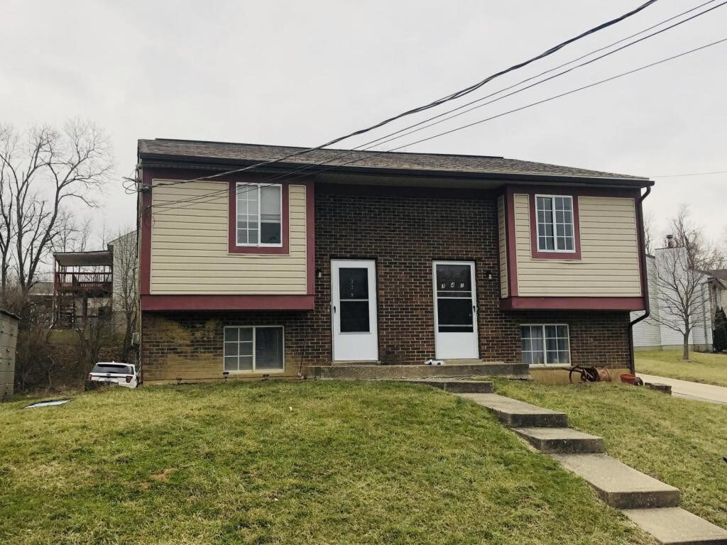
339 Eastern Ave
Elsmere, KY 41018
2 Weeks Ago
Favorites
339 Eastern Ave

Favorites
Check Back Soon for Upcoming Availability
| Beds | Baths | Average SF |
|---|---|---|
| 3 Bedrooms 3 Bedrooms 3 Br | 1 Bath 1 Bath 1 Ba | — |
About This Property
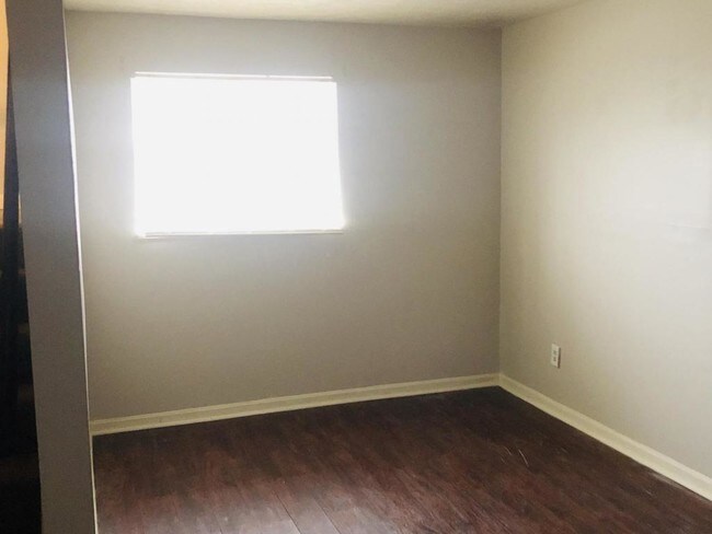
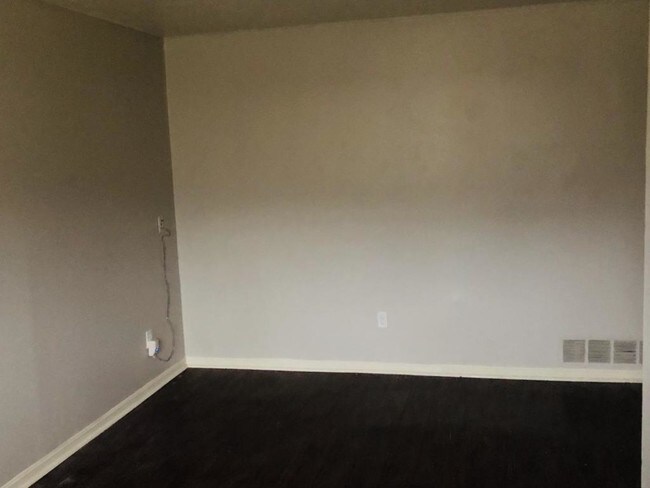
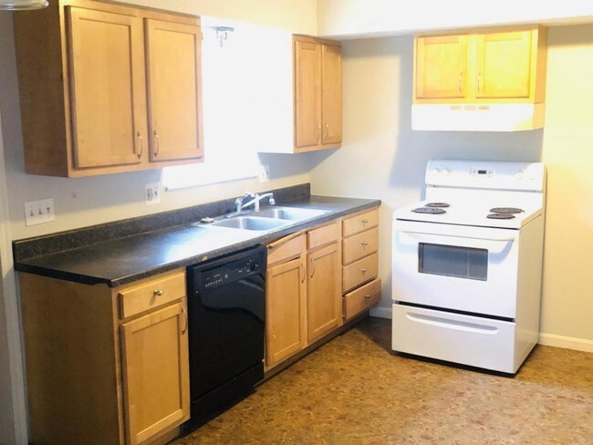
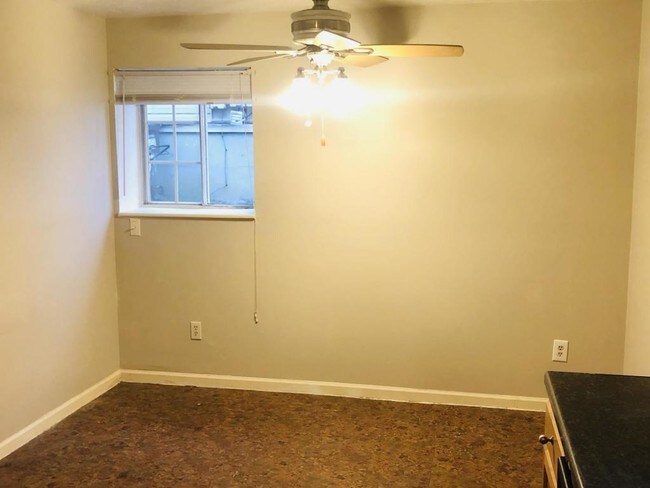
Make this two story, 3 bedroom 1 bath your new home today! Laminate hardwood in the living room and carpet throughout. Your new home is located at the back of a dead end street. The property is also continently located near downtown Florence, KY and minutes from Mall Road.
339 Eastern Ave is a house located in Kenton County and the 41018 ZIP Code. This area is served by the Erlanger-Elsmere Independent attendance zone.
Location
Get Directions
Northern Kentucky is a sprawling region located just south of Cincinnati, Ohio. The Ohio River hugs the northern, eastern, and western portions of the region, serving as a scenic destination for all kinds of outdoor recreation throughout the year. Florence, Dayton, Newport, Covington, Burlington, and Highland Heights are among the many communities included in the Northern Kentucky region.
Each community in Northern Kentucky offers its own unique identity and sense of character. The rentals in the area are just as diverse as Northern Kentucky itself, ranging from luxury apartments to charming houses and everything in between. Getting around the region is a breeze with convenience to Interstates 71, 75, 275, and 471.
Learn more about living in Northern KentuckyBelow are rent ranges for similar nearby apartments
Education
| Colleges & Universities | Distance | ||
|---|---|---|---|
| Colleges & Universities | Distance | ||
| Drive: | 11 min | 4.2 mi | |
| Drive: | 20 min | 11.1 mi | |
| Drive: | 25 min | 16.0 mi | |
| Drive: | 33 min | 19.1 mi |
339 Eastern Ave is within 11 minutes or 4.2 miles from Thomas More College. It is also near College of Mount St. Joseph and Northern Kentucky University.
Schools


Public Elementary School
Grades PK-5
483 Students
Nearby
Public Elementary School
Grades K-5
230 Students
Attendance Zone
Public Middle School
Grades 6-8
539 Students
Attendance Zone
Public High School
Grades 9-12
697 Students
Attendance Zone
Private Elementary, Middle & High School
Grades PK-12
139 Students
Nearby
Private Elementary & Middle School
Grades PK-8
273 Students
Nearby
School data provided by
 The GreatSchools Rating helps parents compare schools within a state based on a variety of school quality indicators and provides a helpful picture of how effectively each school serves all of its students. Ratings are on a scale of 1 (below average) to 10 (above average) and can include test scores, college readiness, academic progress, advanced courses, equity, discipline and attendance data. We also advise parents to visit schools, consider other information on school performance and programs, and consider family needs as part of the school selection process.
View GreatSchools Rating Methodology
Data provided by GreatSchools.org © 2025. All rights reserved.
View GreatSchools Rating Methodology
Data provided by GreatSchools.org © 2025. All rights reserved.
Transportation options available in Elsmere include The Banks Station, 2Nd & Main, located 11.9 miles from 339 Eastern Ave. 339 Eastern Ave is near Cincinnati/Northern Kentucky International, located 5.6 miles or 16 minutes away.
| Transit / Subway | Distance | ||
|---|---|---|---|
| Transit / Subway | Distance | ||
| Drive: | 19 min | 11.9 mi | |
| Drive: | 19 min | 12.0 mi | |
| Drive: | 20 min | 12.1 mi | |
| Drive: | 20 min | 12.2 mi | |
| Drive: | 20 min | 12.3 mi |
| Commuter Rail | Distance | ||
|---|---|---|---|
| Commuter Rail | Distance | ||
|
|
Drive: | 22 min | 13.0 mi |
| Airports | Distance | ||
|---|---|---|---|
| Airports | Distance | ||
|
Cincinnati/Northern Kentucky International
|
Drive: | 16 min | 5.6 mi |
Time and distance from 339 Eastern Ave.
| Shopping Centers | Distance | ||
|---|---|---|---|
| Shopping Centers | Distance | ||
| Drive: | 4 min | 1.1 mi | |
| Drive: | 3 min | 1.2 mi | |
| Drive: | 4 min | 1.4 mi |
339 Eastern Ave has 3 shopping centers within 1.4 miles, which is about a 4-minute drive. The miles and minutes will be for the farthest away property.
| Parks and Recreation | Distance | ||
|---|---|---|---|
| Parks and Recreation | Distance | ||
|
Boone County Arboretum
|
Drive: | 19 min | 10.7 mi |
|
John G. & Phyllis W. Smale Riverfront Park
|
Drive: | 19 min | 12.0 mi |
|
Wilson Commons
|
Drive: | 23 min | 14.1 mi |
|
Imago Earth Center
|
Drive: | 25 min | 15.3 mi |
|
Embshoff Woods
|
Drive: | 29 min | 16.9 mi |
339 Eastern Ave has 5 parks within 16.9 miles, including Boone County Arboretum, John G. & Phyllis W. Smale Riverfront Park, and Embshoff Woods.
| Hospitals | Distance | ||
|---|---|---|---|
| Hospitals | Distance | ||
| Drive: | 5 min | 2.4 mi | |
| Drive: | 11 min | 4.9 mi | |
| Drive: | 13 min | 5.1 mi |
339 Eastern Ave has 3 hospitals within 5.1 miles, the nearest is St. Elizabeth Florence which is 2.4 miles away and a 5 minute drive.
| Military Bases | Distance | ||
|---|---|---|---|
| Military Bases | Distance | ||
| Drive: | 88 min | 66.5 mi | |
| Drive: | 94 min | 71.5 mi | |
| Drive: | 96 min | 74.8 mi |
339 Eastern Ave has 3 military bases within 74.8 miles, the nearest is Gentile Air Force Station which is 66.5 miles away and a 88 minute drive.
You May Also Like
Similar Rentals Nearby


What Are Walk Score®, Transit Score®, and Bike Score® Ratings?
Walk Score® measures the walkability of any address. Transit Score® measures access to public transit. Bike Score® measures the bikeability of any address.
What is a Sound Score Rating?
A Sound Score Rating aggregates noise caused by vehicle traffic, airplane traffic and local sources
339 Eastern Ave
Elsmere, KY 41018