$1,800
Total Monthly Price
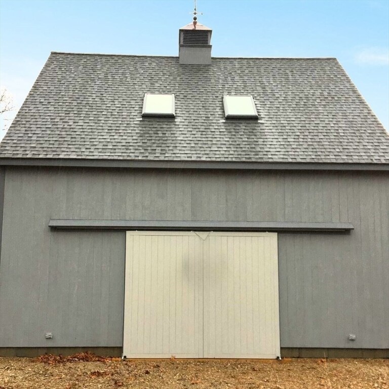
338R Smith Neck Rd Unit 2
Dartmouth, MA 02748
2 Weeks Ago
|
Edit
Favorites
338R Smith Neck Rd Unit 2

Favorites
Check Back Soon for Upcoming Availability
| Beds | Baths | Average SF |
|---|---|---|
| 1 Bedroom 1 Bedroom 1 Br | 1 Bath 1 Bath 1 Ba | 750 SF |
About This Property
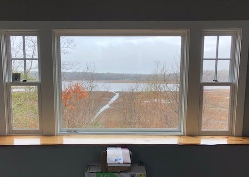
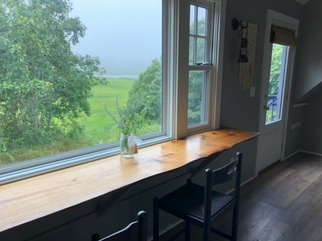
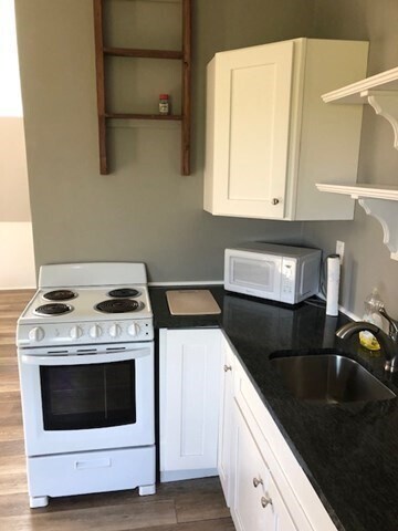
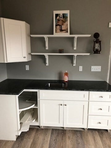
RENT INCLUDES BOTH HEATING & ELECTRIC. Enjoy picturesque views overlooking the Little River Reserve in South Dartmouth. The upstairs level of this barn is available for rent immediately starting May 1. Apartment includes sitting room,full kitchen,full bath,and bedroom which has a large wall partition dividing the space. Apartment does not contain a washer & dryer.
338R Smith Neck Rd is an apartment community located in Bristol County and the 02748 ZIP Code.
338R Smith Neck Rd,
Dartmouth,
MA
02748
Education
| Colleges & Universities | Distance | ||
|---|---|---|---|
| Colleges & Universities | Distance | ||
| Drive: | 26 min | 10.8 mi | |
| Drive: | 41 min | 21.4 mi | |
| Drive: | 48 min | 27.7 mi | |
| Drive: | 63 min | 34.9 mi |
338R Smith Neck Rd Unit 2 is within 26 minutes or 10.8 miles from UMass Dartmouth. It is also near Bristol Community College and Roger Williams University.
Walkability Near 338R Smith Neck Rd Dartmouth, MA 02748
Getting Around
 What do Walkability, Transit, Drivability, and Bikeability mean?
Walkability measures the walking distance to day-to-day needs.
Transit measures access to public transportation.
Drivability measures congestion, parking availability, and access to major roads.
Bikeability measures the suitability for cycling.
How It Works
What do Walkability, Transit, Drivability, and Bikeability mean?
Walkability measures the walking distance to day-to-day needs.
Transit measures access to public transportation.
Drivability measures congestion, parking availability, and access to major roads.
Bikeability measures the suitability for cycling.
How It Works
Not Walkable
Walkability
0
/ 100
Exceptionally Drivable
Drivability
90
/ 100
Moderately Bikeable
Bikeability
60
/ 100
Scores provided by
-
Soundscore™
-
/ 100
Traffic
-Airport
-Businesses
-Scores provided by
HowLoud What is a Sound Score Rating? A Sound Score Rating aggregates noise caused by vehicle traffic, airplane traffic and local sources. How It WorksYou May Also Like
-
Royal Crest Estates
37 Courtney St
Fall River, MA 02720
$1,813 - $2,713 Total Monthly Price
1-2 Br 15.5 mi
-
Commonwealth Landing Lofts
1082 Davol St
Fall River, MA 02720
$1,850 - $3,400 Plus Fees
1-3 Br 12 Month Lease 15.7 mi
-
South Winds Apartments
24 Rolling Green Dr
Fall River, MA 02720
$1,823 - $7,067 Total Monthly Price
1-3 Br 16.8 mi
Similar Rentals Nearby
-
-
-
-
-
1 Bed$2,150+3 Beds$3,200+Total Monthly PriceTotal Monthly Price NewPrices include all required monthly fees.Specials
Pets Allowed Fitness Center Dishwasher Kitchen Clubhouse Range
-
-
-
1 / 55
 Plus Fees1 Bed$1,700+
 -
-


What Are Walk Score®, Transit Score®, and Bike Score® Ratings?
Walk Score® measures the walkability of any address. Transit Score® measures access to public transit. Bike Score® measures the bikeability of any address.
What is a Sound Score Rating?
A Sound Score Rating aggregates noise caused by vehicle traffic, airplane traffic and local sources.

338R Smith Neck Rd
Dartmouth, MA 02748