

$3,500
/ Month
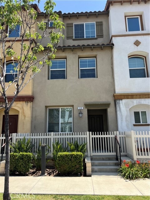
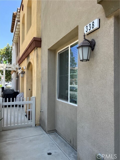
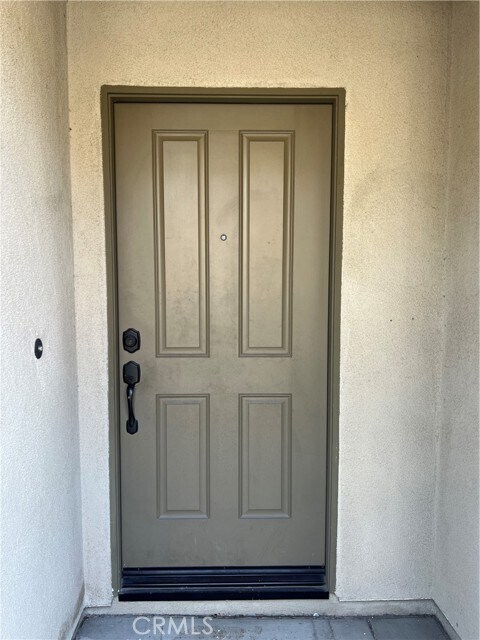
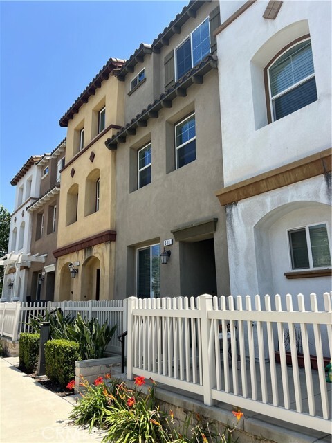
338 N Fenimore Ave
Azusa, CA 91702
Favorites
338 N Fenimore Ave

Favorites
Check Back Soon for Upcoming Availability
| Beds | Baths | Average SF |
|---|---|---|
| 4 Bedrooms 4 Bedrooms 4 Br | 4 Baths 4 Baths 4 Ba | 1,850 SF |
Fees and Policies
The fees listed below are community-provided and may exclude utilities or add-ons. All payments are made directly to the property and are non-refundable unless otherwise specified.
- Parking
-
Other--
Details
Utilities Included
-
Trash Removal
About This Property
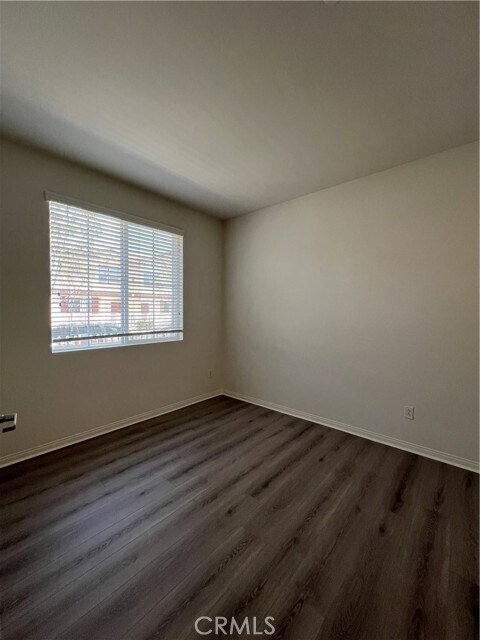
Beautiful 2017 Home in Great Location in the City of Azusa...CITRUS JUNCTION. Azusa Pacific University is just a block away and Citrus College is around the corner. An open design floor plan with 1850+ square feet of living space in this beautiful home. Featuring 4 bedrooms, 4 baths. Home includes upgraded cabinets, upgraded countertops, stainless steel appliances, enclosed front patio area as well as washer and dryer. 9-foot ceilings and spacious living space on three floors w/ a two-car garage. This home has a bedroom on the first floor and bathroom w/ a two-car garage. Home has many energy-saving features including energy-efficient appliances, tankless hot water heater, excellent SEER ratings, insulated garage doors, and more. Close to Citrus Crossing Mall where you will find restaurants, shopping, car services, kid walk to school, and much more. Fwy access on the 210 to LA/Pasadena and to the desert communities, 57 to the south to Orange County Beaches. Don't miss this incredible opportunity!
338 N Fenimore Ave is a condo located in Los Angeles County and the 91702 ZIP Code. This area is served by the Azusa Unified School District attendance zone.
Condo Features
Air Conditioning
Dishwasher
Microwave
Heating
- Air Conditioning
- Heating
- Dishwasher
- Microwave
- Range
338 N Fenimore Ave,
Azusa,
CA
91702
Azusa sits at the base of the San Gabriel Mountains in Los Angeles County, where the foothills meet the eastern edge of the San Gabriel Valley along historic Route 66. Known locally as the Canyon City, it occupies about 10 square miles and carries a distinctly grounded, working-city feel that sets it apart from more polished suburbs to the west. Azusa Pacific University anchors much of the city's identity, drawing students and staff who give the area steady energy throughout the academic year. The city's neighborhoods range from quieter residential streets near the canyon entrance to denser corridors along Foothill Boulevard and Azusa Avenue, where retail and services concentrate. Housing options include older single-family homes, garden-style apartment communities, and smaller multi-unit buildings typical of San Gabriel Valley suburbs.
Learn more about living in Azusa
Amenities
- Air Conditioning
- Heating
- Dishwasher
- Microwave
- Range
Expenses
Utilities Included
Trash Removal
Included
Education
| Colleges & Universities | Distance | ||
|---|---|---|---|
| Colleges & Universities | Distance | ||
| Walk: | 12 min | 0.7 mi | |
| Walk: | 19 min | 1.0 mi | |
| Drive: | 16 min | 8.2 mi | |
| Drive: | 17 min | 9.5 mi |
338 N Fenimore Ave is within 12 minutes or 0.7 mile from Azusa Pacific University. It is also near Citrus College and Mt. San Antonio College.
Schools


Public Elementary School
Grades K-5
208 Students
Attendance Zone
Public Elementary School
Grades K-5
367 Students
Nearby
Public Middle School
Grades 6-8
285 Students
Attendance Zone
Public High School
Grades 9-12
1,609 Students
Attendance Zone
Private Elementary & Middle School
Grades PK-8
127 Students
Nearby
Private Elementary School
Grades PK-5
Nearby
Private Elementary, Middle & High School
Grades K-12
Nearby
School data provided by
 The GreatSchools Rating helps parents compare schools within a state based on a variety of school quality indicators and provides a helpful picture of how effectively each school serves all of its students. Ratings are on a scale of 1 (below average) to 10 (above average) and can include test scores, college readiness, academic progress, advanced courses, equity, discipline and attendance data. We also advise parents to visit schools, consider other information on school performance and programs, and consider family needs as part of the school selection process.
View GreatSchools Rating Methodology
Data provided by GreatSchools.org © 2026. All rights reserved.
View GreatSchools Rating Methodology
Data provided by GreatSchools.org © 2026. All rights reserved.
Transportation options available in Azusa include Apu / Citrus College Station, located 1.3 miles from 338 N Fenimore Ave. 338 N Fenimore Ave is near Ontario International, located 22.0 miles or 30 minutes away, and Long Beach (Daugherty Field), located 33.4 miles or 43 minutes away.
| Transit / Subway | Distance | ||
|---|---|---|---|
| Transit / Subway | Distance | ||
| Drive: | 4 min | 1.3 mi | |
| Drive: | 3 min | 1.3 mi | |
| Drive: | 7 min | 3.6 mi | |
| Drive: | 9 min | 6.0 mi | |
| Drive: | 11 min | 7.5 mi |
| Commuter Rail | Distance | ||
|---|---|---|---|
| Commuter Rail | Distance | ||
|
|
Drive: | 6 min | 2.7 mi |
|
|
Drive: | 12 min | 6.6 mi |
|
|
Drive: | 16 min | 10.5 mi |
|
|
Drive: | 17 min | 11.5 mi |
|
|
Drive: | 20 min | 15.0 mi |
| Airports | Distance | ||
|---|---|---|---|
| Airports | Distance | ||
|
Ontario International
|
Drive: | 30 min | 22.0 mi |
|
Long Beach (Daugherty Field)
|
Drive: | 43 min | 33.4 mi |
Walkability Near 338 N Fenimore Ave Azusa, CA 91702
Getting Around
 What do Walkability, Transit, Drivability, and Bikeability mean?
Walkability measures the walking distance to day-to-day needs.
Transit measures access to public transportation.
Drivability measures congestion, parking availability, and access to major roads.
Bikeability measures the suitability for cycling.
How It Works
What do Walkability, Transit, Drivability, and Bikeability mean?
Walkability measures the walking distance to day-to-day needs.
Transit measures access to public transportation.
Drivability measures congestion, parking availability, and access to major roads.
Bikeability measures the suitability for cycling.
How It Works
Fairly Walkable
Walkability
50
/ 100
Limited Public Transit
Transit
30
/ 100
Exceptionally Drivable
Drivability
100
/ 100
Fairly Bikeable
Bikeability
40
/ 100
Scores provided by
-
Soundscore™
-
/ 100
Traffic
-Airport
-Businesses
-Scores provided by
HowLoud What is a Sound Score Rating? A Sound Score Rating aggregates noise caused by vehicle traffic, airplane traffic and local sources. How It WorksTime and distance from 338 N Fenimore Ave.
| Shopping Centers | Distance | ||
|---|---|---|---|
| Shopping Centers | Distance | ||
| Walk: | 3 min | 0.2 mi | |
| Walk: | 6 min | 0.3 mi | |
| Walk: | 6 min | 0.4 mi |
338 N Fenimore Ave has 3 shopping centers within 0.4 mile, which is about a 6-minute walk. The miles and minutes will be for the farthest away property.
| Parks and Recreation | Distance | ||
|---|---|---|---|
| Parks and Recreation | Distance | ||
|
Covina Park
|
Drive: | 7 min | 3.2 mi |
|
Santa Fe Dam Recreation Area
|
Drive: | 18 min | 5.9 mi |
|
Santa Fe Dam Nature Center
|
Drive: | 18 min | 5.9 mi |
|
Galster Wilderness Park Nature Center
|
Drive: | 14 min | 7.0 mi |
|
San Dimas Canyon Nature Center
|
Drive: | 11 min | 7.1 mi |
338 N Fenimore Ave has 5 parks within 7.1 miles, including Covina Park, Santa Fe Dam Recreation Area, and Santa Fe Dam Nature Center.
| Hospitals | Distance | ||
|---|---|---|---|
| Hospitals | Distance | ||
| Drive: | 3 min | 1.7 mi | |
| Drive: | 3 min | 1.9 mi | |
| Drive: | 6 min | 3.0 mi |
338 N Fenimore Ave has 3 hospitals within 3.0 miles, the nearest is Emanate Health Foothill Presbyterian Hospital which is 1.7 miles away and a 3 minute drive.
| Military Bases | Distance | ||
|---|---|---|---|
| Military Bases | Distance | ||
| Drive: | 45 min | 35.4 mi | |
| Drive: | 48 min | 40.0 mi | |
| Drive: | 58 min | 43.3 mi |
338 N Fenimore Ave has 3 military bases within 43.3 miles, the nearest is Los Alamitos Army Airfield which is 35.4 miles away and a 45 minute drive.
You May Also Like
Similar Rentals Nearby


What Are Walk Score®, Transit Score®, and Bike Score® Ratings?
Walk Score® measures the walkability of any address. Transit Score® measures access to public transit. Bike Score® measures the bikeability of any address.
What is a Sound Score Rating?
A Sound Score Rating aggregates noise caused by vehicle traffic, airplane traffic and local sources.
338 N Fenimore Ave
Azusa, CA 91702