

$3,650
/ Month
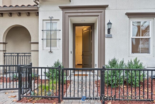
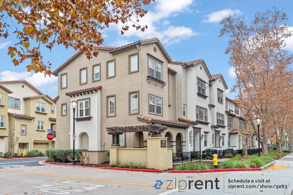
33473 Alvarado-Niles Rd
Union City, CA 94587
2 Weeks Ago
Favorites
33473 Alvarado-Niles Rd

Favorites
Check Back Soon for Upcoming Availability
| Beds | Baths | Average SF |
|---|---|---|
| 3 Bedrooms 3 Bedrooms 3 Br | 3 Baths 3 Baths 3 Ba | 1,976 SF |
Fees and Policies
The fees below are based on community-supplied data and may exclude additional fees and utilities.
- Parking
-
Garage--
About This Property
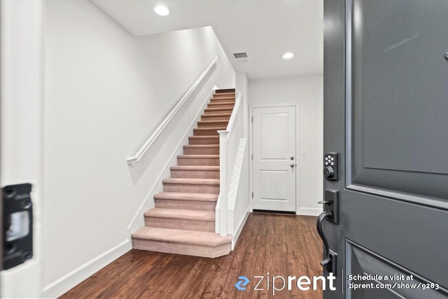
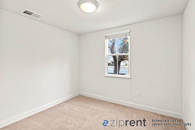
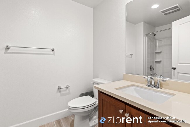
This property is available. Please inquire on this site to schedule a showing. Great 3-story 2019 built townhouse: 3 bed, 3.5 bath 1,976 sq ft with 2-car garage AVAILABLE NOW in Union City! This unit is conveniently located near shopping, restaurants, schools, major freeways (880/680/84/92), and Union City Bart. In Home Features: Master Suite: spacious with en-suite bathroom and walk-in-closet, Bedroom 2: spacious with en-suite bathroom and walk-in-closet, Bedroom 3: sizeable 1st floor room with en-suite bathroom, Laundry Room: Washer and Dryer with plenty of cabinets, Kitchen: Quartz countertops, 2019 stainless steel appliances. Additional Features: A balcony deck, Air Conditioning Unit, Tankless on Demand Gas Water Heater, Smart Home Features: SmartCode Electronic Door Lock, Sky Bell Door Bell, EERO Built-in Whole Home Wi-Fi System. Small HOA community playground and walking trail nearby. Security Deposit: 1 month's rent. Tenant is responsible for all utilities. Rental insurance is required. Disclaimer: Ziprent is acting as the agent for the owner. Information Deemed Reliable but not Guaranteed. All information should be independently verified by renter.
33473 Alvarado-Niles Rd is a townhome located in Alameda County and the 94587 ZIP Code. This area is served by the New Haven Unified attendance zone.
Townhome Features
- Washer/Dryer
- Air Conditioning
- Heating
Location
Get Directions
Amenities
- Washer/Dryer
- Air Conditioning
- Heating
Education
| Colleges & Universities | Distance | ||
|---|---|---|---|
| Colleges & Universities | Distance | ||
| Drive: | 12 min | 7.1 mi | |
| Drive: | 12 min | 7.1 mi | |
| Drive: | 13 min | 7.9 mi | |
| Drive: | 17 min | 8.7 mi |
33473 Alvarado-Niles Rd is within 12 minutes or 7.1 miles from Chabot College. It is also near Cal State East Bay and Ohlone College, Newark.
Schools


Public Elementary School
Grades K-5
497 Students
Nearby
Public Elementary School
Grades K-5
615 Students
Attendance Zone
Public Middle School
Grades 6-8
1,012 Students
Attendance Zone
Public High School
Grades 9-12
3,315 Students
Attendance Zone
Private Elementary & Middle School
Grades PK-8
Nearby
Private Elementary, Middle & High School
Grades K-12
Nearby
School data provided by
 The GreatSchools Rating helps parents compare schools within a state based on a variety of school quality indicators and provides a helpful picture of how effectively each school serves all of its students. Ratings are on a scale of 1 (below average) to 10 (above average) and can include test scores, college readiness, academic progress, advanced courses, equity, discipline and attendance data. We also advise parents to visit schools, consider other information on school performance and programs, and consider family needs as part of the school selection process.
View GreatSchools Rating Methodology
Data provided by GreatSchools.org © 2025. All rights reserved.
View GreatSchools Rating Methodology
Data provided by GreatSchools.org © 2025. All rights reserved.
Transportation options available in Union City include Union City Station, located 1.6 miles from 33473 Alvarado-Niles Rd. 33473 Alvarado-Niles Rd is near Metro Oakland International, located 15.8 miles or 22 minutes away, and Norman Y Mineta San Jose International, located 22.0 miles or 30 minutes away.
| Transit / Subway | Distance | ||
|---|---|---|---|
| Transit / Subway | Distance | ||
|
|
Drive: | 4 min | 1.6 mi |
|
|
Drive: | 11 min | 5.2 mi |
|
|
Drive: | 11 min | 5.3 mi |
|
|
Drive: | 10 min | 5.8 mi |
|
|
Drive: | 12 min | 7.3 mi |
| Commuter Rail | Distance | ||
|---|---|---|---|
| Commuter Rail | Distance | ||
| Drive: | 7 min | 3.7 mi | |
| Drive: | 8 min | 3.9 mi | |
| Drive: | 12 min | 7.7 mi | |
|
|
Drive: | 12 min | 7.7 mi |
| Drive: | 28 min | 16.8 mi |
| Airports | Distance | ||
|---|---|---|---|
| Airports | Distance | ||
|
Metro Oakland International
|
Drive: | 22 min | 15.8 mi |
|
Norman Y Mineta San Jose International
|
Drive: | 30 min | 22.0 mi |
Time and distance from 33473 Alvarado-Niles Rd.
| Shopping Centers | Distance | ||
|---|---|---|---|
| Shopping Centers | Distance | ||
| Walk: | 2 min | 0.2 mi | |
| Walk: | 4 min | 0.2 mi | |
| Walk: | 8 min | 0.4 mi |
33473 Alvarado-Niles Rd has 3 shopping centers within 0.4 mile, which is about a 8-minute walk. The miles and minutes will be for the farthest away property.
| Parks and Recreation | Distance | ||
|---|---|---|---|
| Parks and Recreation | Distance | ||
|
Alameda Creek Regional Trail
|
Drive: | 5 min | 2.2 mi |
|
Quarry Lakes Regional Recreation Area
|
Drive: | 5 min | 2.6 mi |
|
Garin/Dry Creek Pioneer Parks
|
Drive: | 6 min | 2.9 mi |
|
Niles Community Park
|
Drive: | 7 min | 3.3 mi |
|
Ardenwood Historic Farm
|
Drive: | 8 min | 4.2 mi |
33473 Alvarado-Niles Rd has 5 parks within 4.2 miles, including Alameda Creek Regional Trail, Quarry Lakes Regional Recreation Area, and Garin/Dry Creek Pioneer Parks.
| Hospitals | Distance | ||
|---|---|---|---|
| Hospitals | Distance | ||
| Drive: | 9 min | 4.9 mi | |
| Drive: | 10 min | 5.2 mi | |
| Drive: | 10 min | 5.3 mi |
33473 Alvarado-Niles Rd has 3 hospitals within 5.3 miles, the nearest is St. Rose Hospital which is 4.9 miles away and a 9 minute drive.
| Military Bases | Distance | ||
|---|---|---|---|
| Military Bases | Distance | ||
| Drive: | 32 min | 20.4 mi |
33473 Alvarado-Niles Rd is 20.4 miles and a 32 minute drive from Ames Research Center.
You May Also Like
Similar Rentals Nearby


What Are Walk Score®, Transit Score®, and Bike Score® Ratings?
Walk Score® measures the walkability of any address. Transit Score® measures access to public transit. Bike Score® measures the bikeability of any address.
What is a Sound Score Rating?
A Sound Score Rating aggregates noise caused by vehicle traffic, airplane traffic and local sources
33473 Alvarado-Niles Rd
Union City, CA 94587