33421 2nd St
Union City, CA 94587
-
Bedrooms
1
-
Bathrooms
1
-
Square Feet
--
-
Available
Available Now
Highlights
- Furnished
- Fenced Lot
- Security System

About This Home
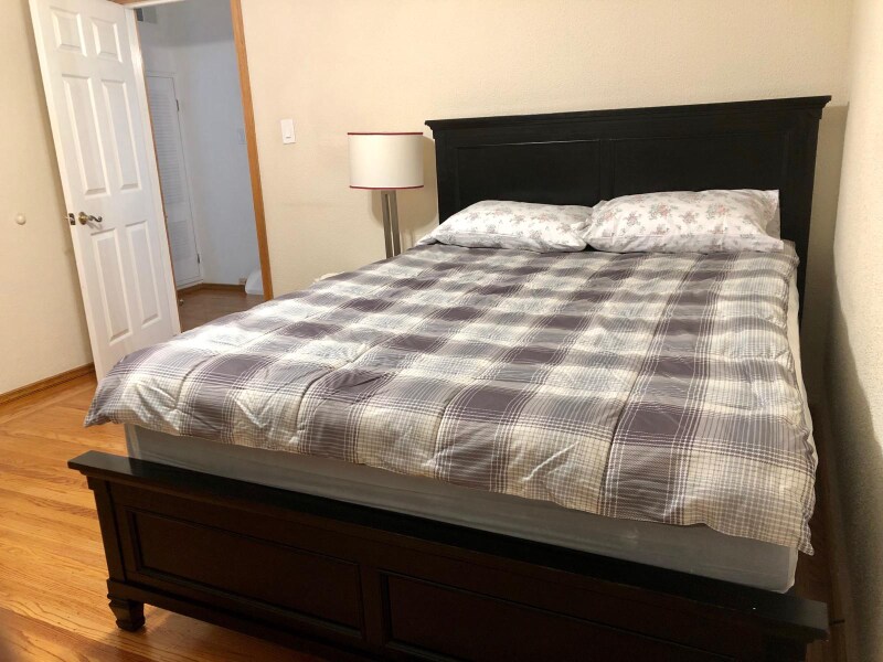
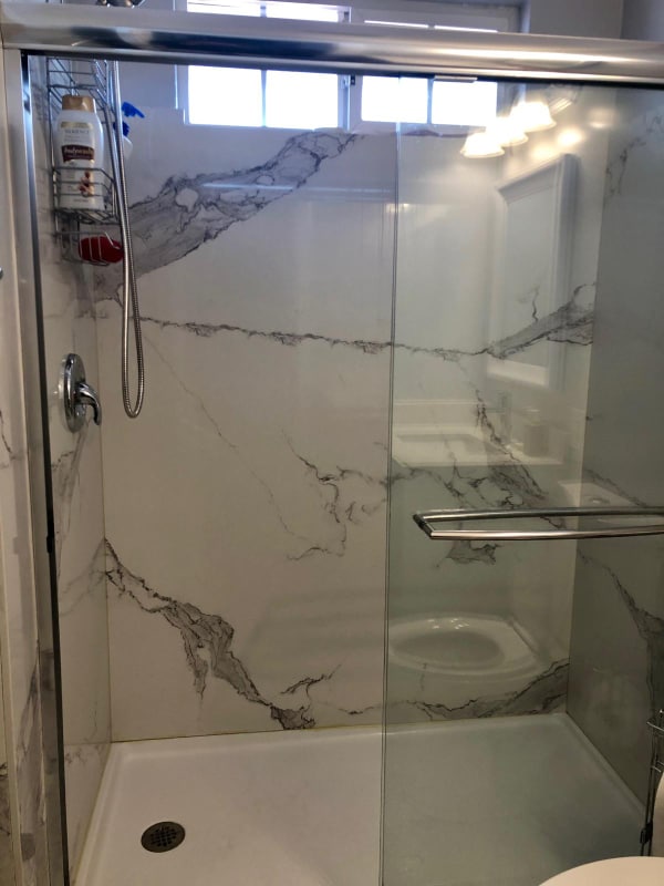
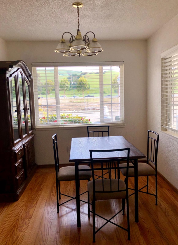
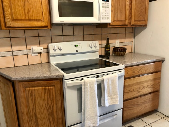
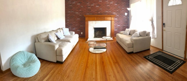
Property Id: 2050732 1 BR with living room, dining area, half bath, separate front and back entrances. Kitchen and full bath shared with another professional. Beautiful Front and backyards. Plenty of storage space. Many street parking spaces. Rent includes all utilities. Washer and dryer in the premises. The rent is negotiable if you stay more than a year. Trail is across the road. Bart station is a mile away. Bus stop across the road. Safe and quiet neighborhood.
33421 2nd St is a house located in Alameda County and the 94587 ZIP Code.
House Features
Washer/Dryer
Dishwasher
Microwave
Refrigerator
- Washer/Dryer
- Security System
- Dishwasher
- Disposal
- Microwave
- Oven
- Refrigerator
- Freezer
- Tile Floors
- Furnished
- Bicycle Storage
- Fenced Lot
- Lawn
Fees and Policies
The fees below are based on community-supplied data and may exclude additional fees and utilities.
Details
Utilities Included
-
Gas
-
Water
-
Electricity
-
Trash Removal
-
Sewer
Property Information
-
Furnished Units Available
Contact
- Phone Number
- Contact
-
Source

- Washer/Dryer
- Security System
- Dishwasher
- Disposal
- Microwave
- Oven
- Refrigerator
- Freezer
- Tile Floors
- Furnished
- Fenced Lot
- Lawn
- Bicycle Storage
| Colleges & Universities | Distance | ||
|---|---|---|---|
| Colleges & Universities | Distance | ||
| Drive: | 11 min | 5.1 mi | |
| Drive: | 13 min | 7.5 mi | |
| Drive: | 14 min | 7.8 mi | |
| Drive: | 16 min | 8.5 mi |
Transportation options available in Union City include Union City Station, located 1.3 miles from 33421 2nd St. 33421 2nd St is near Metro Oakland International, located 16.2 miles or 23 minutes away, and Norman Y Mineta San Jose International, located 22.6 miles or 31 minutes away.
| Transit / Subway | Distance | ||
|---|---|---|---|
| Transit / Subway | Distance | ||
|
|
Drive: | 3 min | 1.3 mi |
|
|
Drive: | 7 min | 3.3 mi |
|
|
Drive: | 10 min | 5.2 mi |
|
|
Drive: | 10 min | 5.6 mi |
|
|
Drive: | 13 min | 7.7 mi |
| Commuter Rail | Distance | ||
|---|---|---|---|
| Commuter Rail | Distance | ||
| Drive: | 9 min | 4.3 mi | |
| Drive: | 10 min | 4.5 mi | |
|
|
Drive: | 13 min | 8.1 mi |
| Drive: | 13 min | 8.1 mi | |
| Drive: | 27 min | 16.6 mi |
| Airports | Distance | ||
|---|---|---|---|
| Airports | Distance | ||
|
Metro Oakland International
|
Drive: | 23 min | 16.2 mi |
|
Norman Y Mineta San Jose International
|
Drive: | 31 min | 22.6 mi |
Time and distance from 33421 2nd St.
| Shopping Centers | Distance | ||
|---|---|---|---|
| Shopping Centers | Distance | ||
| Drive: | 4 min | 1.5 mi | |
| Drive: | 4 min | 1.6 mi | |
| Drive: | 4 min | 1.6 mi |
| Parks and Recreation | Distance | ||
|---|---|---|---|
| Parks and Recreation | Distance | ||
|
Garin/Dry Creek Pioneer Parks
|
Walk: | 28 min | 1.5 mi |
|
Niles Canyon Railway
|
Drive: | 5 min | 2.9 mi |
|
Niles Community Park
|
Drive: | 7 min | 3.2 mi |
|
Quarry Lakes Regional Recreation Area
|
Drive: | 7 min | 3.2 mi |
|
Alameda Creek Regional Trail
|
Drive: | 7 min | 3.4 mi |
| Hospitals | Distance | ||
|---|---|---|---|
| Hospitals | Distance | ||
| Drive: | 9 min | 5.2 mi | |
| Drive: | 10 min | 5.3 mi | |
| Drive: | 10 min | 5.9 mi |
| Military Bases | Distance | ||
|---|---|---|---|
| Military Bases | Distance | ||
| Drive: | 33 min | 21.1 mi |
33421 2nd St Photos
Nearby Apartments
Within 50 Miles of 33421 2nd St Union City, CA 94587
-
36840 Olive St
Newark, CA 94560
3 Br $900 5.1 mi
-
37237 Salt Pond Pl
Newark, CA 94560
4 Br $5,499 6.2 mi
-
1153 Sanchez Way
Redwood City, CA 94061
2 Br $4,200 15.0 mi
-
2518 Lincoln Ave
Alameda, CA 94501
1 Br $1,950 16.3 mi
-
2231 Sherwin Ave
Santa Clara, CA 95050
1 Br $3,600 18.4 mi
-
1320 Drake Ave
Burlingame, CA 94010
4 Br $11,890 19.3 mi
What Are Walk Score®, Transit Score®, and Bike Score® Ratings?
Walk Score® measures the walkability of any address. Transit Score® measures access to public transit. Bike Score® measures the bikeability of any address.
What is a Sound Score Rating?
A Sound Score Rating aggregates noise caused by vehicle traffic, airplane traffic and local sources

33421 2nd St
Union City, CA 94587