
$1,700
/ Month
3341 Mary St
Drexel Hill, PA 19026
1 Day Ago
|
Edit
Favorites
484-632-4190
-
Bedrooms
2
-
Bathrooms
1
-
Square Feet
920 sq ft
-
Available
Available Now
Highlights
- Traditional Architecture
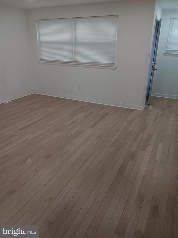
- Living Room
- Property is in excellent condition
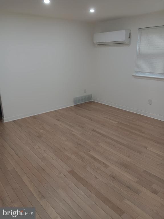
- Wall Furnace
3341 Mary St

Favorites
About This Home
Available Now
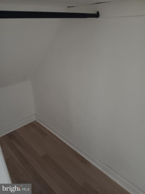
Change in offering . Ready to show. Come see. Convenient 1st floor. First Floor Apartment's highest demand. Nice size rooms. Like new. 3 closets 1 each Bedroom and hall. Parking in rear of duplex. Basement laundry area with dedicated Washer and dryer. Space in basement to store less valuable items. Everything you may need. Enough said. Come see. Vacant. Go and Show. Call service first. Upfront requires first month , last month and 1 month security deposit. Renovated less than a year ago. Worth a look!!Definitely!!! Updated cooling /Heating split. Toasty in Winter/ Cool in Summer.
3341 Mary St is a house located in Delaware County and the 19026 ZIP Code. This area is served by the Upper Darby attendance zone.
* Price shown is base rent. Excludes user-selected optional fees and variable or usage-based fees and required charges due at or prior to move-in or at move-out. Price, availability, fees, and any applicable rent special are subject to change without notice.
* Square footage definitions vary. Displayed square footage is approximate.
Home Details
Home Type
Semi-Detached or Twin Home
Year Built
Built in 1960 | Remodeled in 2024
Basement
Laundry in Basement
Bedrooms and Bathrooms
2 Main Level Bedrooms
1 Full Bathroom
Home Design
Traditional Architecture
Brick Exterior Construction
Concrete Perimeter Foundation
Poured Concrete
Interior Spaces
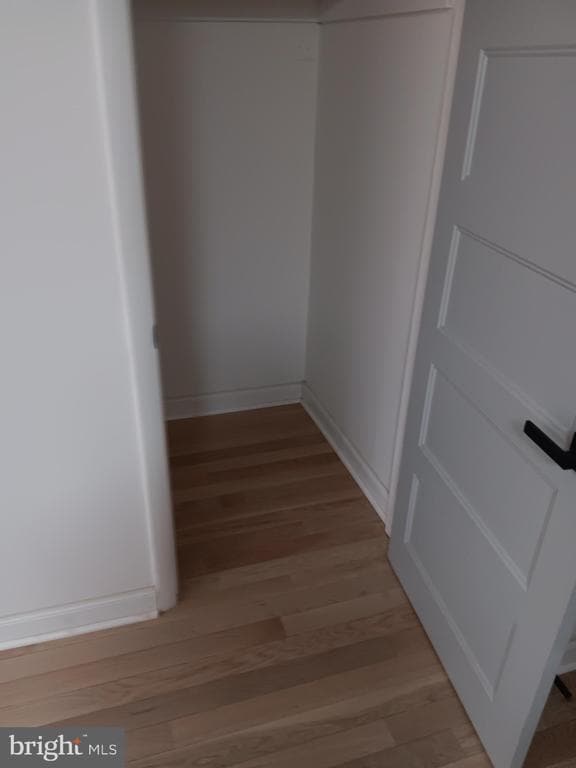
Living Room
920 Sq Ft Home
Property has 2 Levels
Listing and Financial Details
Security Deposit $3,400
Requires 1 Month of Rent Paid Up Front
12-Month Min and 24-Month Max Lease Term
Available 12/29/25
Assessor Parcel Number 16-13-02420-02
Tenant pays for all utilities
No Smoking Allowed
Residential Lease
Lot Details
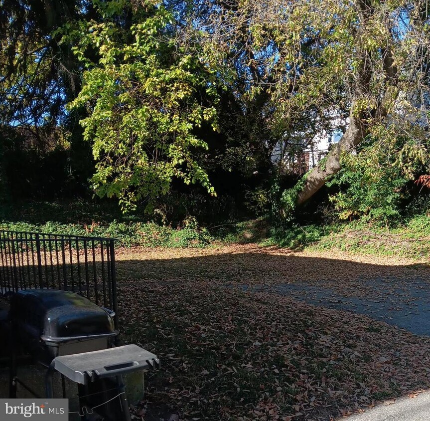
3,920 Sq Ft Lot
Property is in excellent condition
Lot Dimensions are 28.00 x 137.00
Parking
On-Street Parking
Utilities
Wall Furnace
Municipal Trash
Natural Gas Water Heater
Ductless Heating Or Cooling System
Community Details
Overview
No Home Owners Association
Drexel Hill Subdivision
Pet Policy
No Pets Allowed
Contact
- Listed by Norman C Barnes Sr. | Long & Foster Real Estate, Inc.
- Phone Number
- Contact
-
Source
 Bright MLS, Inc.
Copyright © 2026 Bright MLS, Inc.
Location
Get Directions
Amenities
- Basement
Drexel Hill is a suburb of Philadelphia and is known as one of the best areas to live in the metro area. With several parks and excellent schools, Drexel Hill exudes a family-friend vibe. This wooded neighborhood has rentals for every budget. Along with apartments in brick buildings, the neighborhood features single-family houses in a variety of classic styles including Colonials and Victorians. Renters are attracted to Drexel Hill's excellent location. Center City is only 10 miles away and is convenient to several colleges and universities. The University of Pennsylvania, Temple University, and Saint Joseph's College are just a few of the institutions that are only a few miles from Drexel Hill. Renters can take U.S. Route 1 or Highway 2 to travel around the metro area or hop on a train at one of the transit stations located right outside of Drexel Hill. Great for out-of-state trips, the Philly International Airport is about a 30-minute drive away.
Learn more about living in Drexel Hill
Education
| Colleges & Universities | Distance | ||
|---|---|---|---|
| Colleges & Universities | Distance | ||
| Drive: | 12 min | 4.9 mi | |
| Drive: | 15 min | 5.1 mi | |
| Drive: | 14 min | 5.3 mi | |
| Drive: | 18 min | 6.8 mi |
3341 Mary St is within 12 minutes or 4.9 miles from Swarthmore College. It is also near C.C. of Philadelphia, W Ctr and University of the Sciences.
Schools


Charter Elementary & Middle School
Grades PK-8
499 Students
Nearby
Public Elementary School
Grades K-6
555 Students
Nearby
Public Elementary School
Grades 1-5
568 Students
Attendance Zone
Public Middle School
Grades 6-8
1,318 Students
Attendance Zone
Public High School
Grades 9-12
4,191 Students
Attendance Zone
Private Elementary & Middle School
Grades PK-8
153 Students
Nearby
Private Elementary & Middle School
Grades K-8
Nearby
Private High School
Grades 9-12
1,287 Students
Nearby
School data provided by
 The GreatSchools Rating helps parents compare schools within a state based on a variety of school quality indicators and provides a helpful picture of how effectively each school serves all of its students. Ratings are on a scale of 1 (below average) to 10 (above average) and can include test scores, college readiness, academic progress, advanced courses, equity, discipline and attendance data. We also advise parents to visit schools, consider other information on school performance and programs, and consider family needs as part of the school selection process.
View GreatSchools Rating Methodology
Data provided by GreatSchools.org © 2026. All rights reserved.
View GreatSchools Rating Methodology
Data provided by GreatSchools.org © 2026. All rights reserved.
Transportation options available in Drexel Hill include Marshall Road, located 0.6 mile from 3341 Mary St. 3341 Mary St is near Philadelphia International, located 8.0 miles or 21 minutes away, and Trenton Mercer, located 41.7 miles or 69 minutes away.
| Transit / Subway | Distance | ||
|---|---|---|---|
| Transit / Subway | Distance | ||
|
|
Walk: | 11 min | 0.6 mi |
| Walk: | 11 min | 0.6 mi | |
|
|
Walk: | 11 min | 0.6 mi |
|
|
Walk: | 13 min | 0.7 mi |
|
|
Walk: | 13 min | 0.7 mi |
| Commuter Rail | Distance | ||
|---|---|---|---|
| Commuter Rail | Distance | ||
|
|
Walk: | 16 min | 0.8 mi |
|
|
Drive: | 4 min | 1.2 mi |
|
|
Drive: | 5 min | 1.2 mi |
|
|
Drive: | 4 min | 1.4 mi |
|
|
Drive: | 6 min | 1.9 mi |
| Airports | Distance | ||
|---|---|---|---|
| Airports | Distance | ||
|
Philadelphia International
|
Drive: | 21 min | 8.0 mi |
|
Trenton Mercer
|
Drive: | 69 min | 41.7 mi |
Time and distance from 3341 Mary St.
| Shopping Centers | Distance | ||
|---|---|---|---|
| Shopping Centers | Distance | ||
| Walk: | 13 min | 0.7 mi | |
| Walk: | 15 min | 0.8 mi | |
| Walk: | 19 min | 1.0 mi |
3341 Mary St has 3 shopping centers within 1.0 mile, which is about a 19-minute walk. The miles and minutes will be for the farthest away property.
| Parks and Recreation | Distance | ||
|---|---|---|---|
| Parks and Recreation | Distance | ||
|
Cobbs Creek Environmental Education Center
|
Drive: | 9 min | 3.2 mi |
|
Cobbs Creek Park
|
Drive: | 9 min | 3.5 mi |
|
John Heinz National Wildlife Refuge
|
Drive: | 14 min | 4.8 mi |
|
Scott Arboretum
|
Drive: | 14 min | 4.9 mi |
|
Bartram's Garden
|
Drive: | 15 min | 5.1 mi |
3341 Mary St has 5 parks within 5.1 miles, including Cobbs Creek Environmental Education Center, Cobbs Creek Park, and John Heinz National Wildlife Refuge.
| Hospitals | Distance | ||
|---|---|---|---|
| Hospitals | Distance | ||
| Drive: | 7 min | 2.0 mi | |
| Drive: | 6 min | 2.1 mi | |
| Drive: | 17 min | 6.2 mi |
3341 Mary St has 3 hospitals within 6.2 miles, the nearest is Delaware County Memorial Hospital which is 2.0 miles away and a 7 minute drive.
| Military Bases | Distance | ||
|---|---|---|---|
| Military Bases | Distance | ||
| Drive: | 25 min | 10.2 mi |
3341 Mary St is 10.2 miles and a 25 minute drive from Philadelphia Naval Busi Center.
You May Also Like
Similar Rentals Nearby


What Are Walk Score®, Transit Score®, and Bike Score® Ratings?
Walk Score® measures the walkability of any address. Transit Score® measures access to public transit. Bike Score® measures the bikeability of any address.
What is a Sound Score Rating?
A Sound Score Rating aggregates noise caused by vehicle traffic, airplane traffic and local sources

3341 Mary St
Drexel Hill, PA 19026