

$845
/ Month
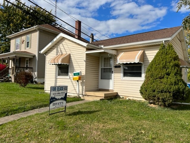
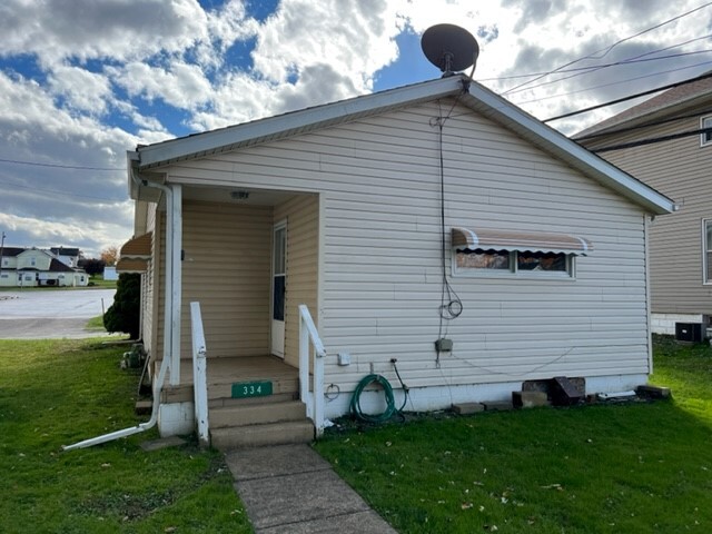
334 Main St
Byesville, OH 43723
Favorites
334 Main St

Favorites
Check Back Soon for Upcoming Availability
| Beds | Baths | Average SF |
|---|---|---|
| 2 Bedrooms 2 Bedrooms 2 Br | 1 Bath 1 Bath 1 Ba | 768 SF |
Fees and Policies
The fees listed below are community-provided and may exclude utilities or add-ons. All payments are made directly to the property and are non-refundable unless otherwise specified.
- Dogs Allowed
-
Fees not specified
-
Weight limit--
-
Pet Limit--
About This Property
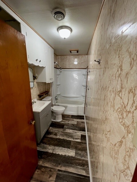
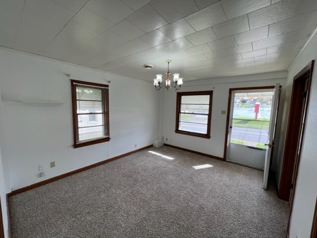
2-bedroom possible 3,1 bath single family home sits on a .11 acre lot in the Byesville area. 768 sq ft comes with range, refrigerator elect range, electric w/d hook up, gas heat, off street parking, As a tenant you pay gas, electric, water/sewer /trash you also take care of ground care and snow removal
334 Main St is a house located in Guernsey County and the 43723 ZIP Code. This area is served by the Rolling Hills Local School District attendance zone.
334 Main St,
Byesville,
OH
43723
Education
| Colleges & Universities | Distance | ||
|---|---|---|---|
| Colleges & Universities | Distance | ||
| Drive: | 19 min | 15.3 mi | |
| Drive: | 38 min | 31.2 mi |
334 Main St is within 19 minutes or 15.3 miles from Muskingum University. It is also near Ohio University Zanesville.
Schools


Public Elementary School
Grades K-5
433 Students
Nearby
Public Elementary School
Grades K-5
347 Students
Nearby
Public Elementary School
Grades PK-5
209 Students
Nearby
Public Middle School
Grades 6-8
353 Students
Nearby
Public High School
Grades 9-12
394 Students
Attendance Zone
Private Elementary & Middle School
Grades PK-8
333 Students
Nearby
Private Elementary & Middle School
Grades PK-8
112 Students
Nearby
Private Elementary School
Grades K-5
40 Students
Nearby
Private High School
Grades 9-12
39 Students
Nearby
School data provided by
 The GreatSchools Rating helps parents compare schools within a state based on a variety of school quality indicators and provides a helpful picture of how effectively each school serves all of its students. Ratings are on a scale of 1 (below average) to 10 (above average) and can include test scores, college readiness, academic progress, advanced courses, equity, discipline and attendance data. We also advise parents to visit schools, consider other information on school performance and programs, and consider family needs as part of the school selection process.
View GreatSchools Rating Methodology
Data provided by GreatSchools.org © 2026. All rights reserved.
View GreatSchools Rating Methodology
Data provided by GreatSchools.org © 2026. All rights reserved.
Walkability Near 334 Main St Byesville, OH 43723
Getting Around
 What do Walkability, Transit, Drivability, and Bikeability mean?
Walkability measures the walking distance to day-to-day needs.
Transit measures access to public transportation.
Drivability measures congestion, parking availability, and access to major roads.
Bikeability measures the suitability for cycling.
How It Works
What do Walkability, Transit, Drivability, and Bikeability mean?
Walkability measures the walking distance to day-to-day needs.
Transit measures access to public transportation.
Drivability measures congestion, parking availability, and access to major roads.
Bikeability measures the suitability for cycling.
How It Works
Somewhat Walkable
Walkability
30
/ 100
Limited Public Transit
Transit
30
/ 100
Very Drivable
Drivability
80
/ 100
Somewhat Bikeable
Bikeability
30
/ 100
Scores provided by
-
Soundscore™
-
/ 100
Traffic
-Airport
-Businesses
-Scores provided by
HowLoud What is a Sound Score Rating? A Sound Score Rating aggregates noise caused by vehicle traffic, airplane traffic and local sources. How It WorksSimilar Rentals Nearby
What Are Walk Score®, Transit Score®, and Bike Score® Ratings?
Walk Score® measures the walkability of any address. Transit Score® measures access to public transit. Bike Score® measures the bikeability of any address.
What is a Sound Score Rating?
A Sound Score Rating aggregates noise caused by vehicle traffic, airplane traffic and local sources.

334 Main St
Byesville, OH 43723