
$1,350 / Month
3322 Daisy Ave
Cleveland, OH 44109
2 Weeks Ago
Favorites
3322 Daisy Ave

Favorites
Check Back Soon for Upcoming Availability
| Beds | Baths | Average SF |
|---|---|---|
| 3 Bedrooms 3 Bedrooms 3 Br | 1 Bath 1 Bath 1 Ba | 1,550 SF |
About This Property
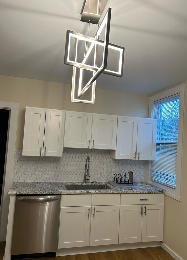
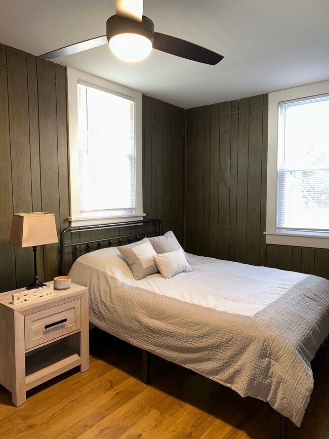
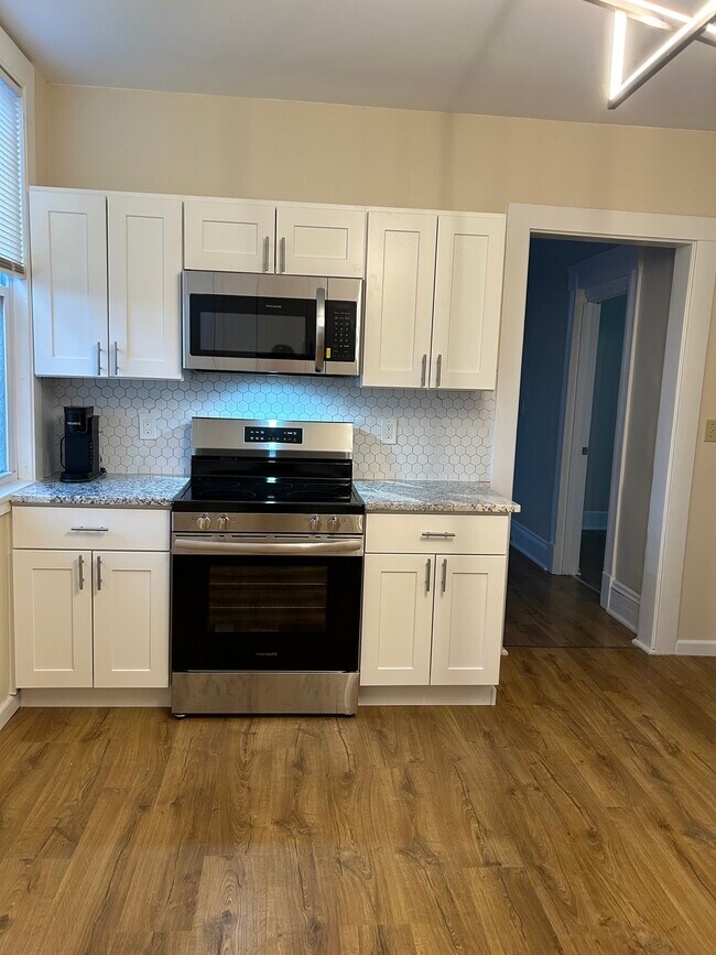
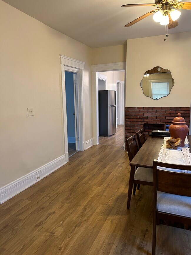
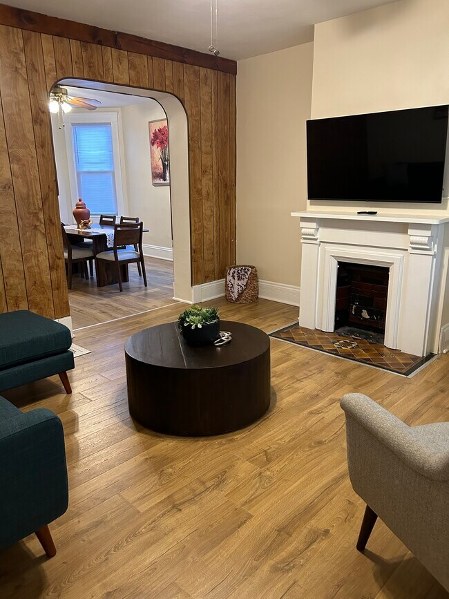
Right by the Interstate 71, this charming duplex home offers a cozy and comfortable stay. The kitchen is newly updated and remodeled with all brand new appliances. It is fully stocked with serveware, drinkware, utensils, pots, and pans. Enjoy your fresh cup of coffee made in the new Keurig Machine. The dining room table is made of mango wood, perfect for enjoying a meal with family or friends. Quiet and peaceful neighborhood located right by the police station.
3322 Daisy Ave is a house located in Cuyahoga County and the 44109 ZIP Code. This area is served by the Cleveland Metropolitan attendance zone.
House Features
- Washer/Dryer
- Dishwasher
- Hardwood Floors
Location
Get Directions
The Cleveland community of Clark-Fulton sits on the west side of the city, providing residents direct access to three major roadways: Interstate 90, Interstate 490, and Interstate 71. Even though it resides in an urban community, Clark-Fulton has a very suburban vibe due to the many residential homes and yards within it.
On the other side of Interstate 71 is the home that was used in the 1983 holiday classic, A Christmas Story. In addition to the house, other family-friendly attractions in the area include the aquarium and the Rock and Roll Hall of Fame. Foodies gather at the West Side Market for a selection of artisan cheeses, baked goods, blended spices, produce, and cured meats. The market has been in existence since 1912 and is just two miles north of the neighborhood.
Learn more about living in Clark-FultonBelow are rent ranges for similar nearby apartments
Amenities
- Washer/Dryer
- Dishwasher
- Hardwood Floors
Education
| Colleges & Universities | Distance | ||
|---|---|---|---|
| Colleges & Universities | Distance | ||
| Drive: | 8 min | 4.6 mi | |
| Drive: | 8 min | 4.7 mi | |
| Drive: | 15 min | 8.0 mi | |
| Drive: | 16 min | 8.1 mi |
3322 Daisy Ave is within 8 minutes or 4.7 miles from Cleveland State University. It is also near Cuyahoga C.C., Metropolitan and Case Western Reserve.
Schools


Public Elementary & High School
Grades 4 & 9-12
150 Students
Attendance Zone
Public Elementary, Middle & High School
Grades 1 & 7-12
224 Students
Attendance Zone
Public Elementary & Middle School
Grades PK-8
222 Students
Attendance Zone
Public Elementary & Middle School
Grades PK-8
293 Students
Attendance Zone
Public High School
Grades 9-12
358 Students
Attendance Zone
Public High School
Grades 9-12
388 Students
Attendance Zone
Private Elementary & Middle School
Grades PK-8
134 Students
Nearby
Private Middle & High School
Grades 6-12
1,550 Students
Nearby
School data provided by
 The GreatSchools Rating helps parents compare schools within a state based on a variety of school quality indicators and provides a helpful picture of how effectively each school serves all of its students. Ratings are on a scale of 1 (below average) to 10 (above average) and can include test scores, college readiness, academic progress, advanced courses, equity, discipline and attendance data. We also advise parents to visit schools, consider other information on school performance and programs, and consider family needs as part of the school selection process.
View GreatSchools Rating Methodology
Data provided by GreatSchools.org © 2025. All rights reserved.
View GreatSchools Rating Methodology
Data provided by GreatSchools.org © 2025. All rights reserved.
Transportation options available in Cleveland include West 25 - Ohio City, located 2.5 miles from 3322 Daisy Ave. 3322 Daisy Ave is near Cleveland-Hopkins International, located 9.9 miles or 18 minutes away.
| Transit / Subway | Distance | ||
|---|---|---|---|
| Transit / Subway | Distance | ||
|
|
Drive: | 6 min | 2.5 mi |
| Drive: | 9 min | 2.9 mi | |
| Drive: | 7 min | 3.0 mi | |
|
|
Drive: | 7 min | 3.0 mi |
| Drive: | 8 min | 4.3 mi |
| Commuter Rail | Distance | ||
|---|---|---|---|
| Commuter Rail | Distance | ||
|
|
Drive: | 13 min | 5.3 mi |
| Drive: | 17 min | 9.1 mi | |
| Drive: | 20 min | 10.2 mi | |
| Drive: | 28 min | 15.5 mi | |
|
Boston Mill
|
Drive: | 35 min | 20.6 mi |
| Airports | Distance | ||
|---|---|---|---|
| Airports | Distance | ||
|
Cleveland-Hopkins International
|
Drive: | 18 min | 9.9 mi |
Time and distance from 3322 Daisy Ave.
| Shopping Centers | Distance | ||
|---|---|---|---|
| Shopping Centers | Distance | ||
| Walk: | 13 min | 0.7 mi | |
| Drive: | 3 min | 1.3 mi | |
| Drive: | 4 min | 1.4 mi |
3322 Daisy Ave has 3 shopping centers within 1.4 miles, which is about a 4-minute walk. The miles and minutes will be for the farthest away property.
| Parks and Recreation | Distance | ||
|---|---|---|---|
| Parks and Recreation | Distance | ||
|
Cleveland Metroparks Zoo
|
Drive: | 3 min | 1.4 mi |
|
Ohio & Erie Canal Reservation
|
Drive: | 9 min | 3.3 mi |
|
Great Lakes Science Center
|
Drive: | 10 min | 4.4 mi |
|
Lakefront Reservation and Edgewater Park
|
Drive: | 11 min | 4.5 mi |
|
CanalWay Center
|
Drive: | 13 min | 4.6 mi |
3322 Daisy Ave has 5 parks within 4.6 miles, including Cleveland Metroparks Zoo, Ohio & Erie Canal Reservation, and Lakefront Reservation and Edgewater Park.
| Hospitals | Distance | ||
|---|---|---|---|
| Hospitals | Distance | ||
| Walk: | 11 min | 0.6 mi | |
| Drive: | 7 min | 2.6 mi | |
| Drive: | 8 min | 4.2 mi |
3322 Daisy Ave has 3 hospitals within 4.2 miles, the nearest is Metrohealth System which is 0.6 mile away and a 11 minute walk.
| Military Bases | Distance | ||
|---|---|---|---|
| Military Bases | Distance | ||
| Drive: | 92 min | 78.7 mi | |
| Drive: | 99 min | 81.4 mi |
3322 Daisy Ave is 78.7 miles from Mansfield Lahm Airport Air Guard Station, and is convenient to other military bases, including Camp Perry Air Guard Station.
You May Also Like
Similar Rentals Nearby


What Are Walk Score®, Transit Score®, and Bike Score® Ratings?
Walk Score® measures the walkability of any address. Transit Score® measures access to public transit. Bike Score® measures the bikeability of any address.
What is a Sound Score Rating?
A Sound Score Rating aggregates noise caused by vehicle traffic, airplane traffic and local sources

3322 Daisy Ave
Cleveland, OH 44109