

$2,400
/ Month
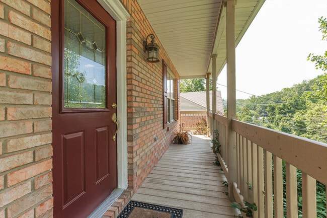
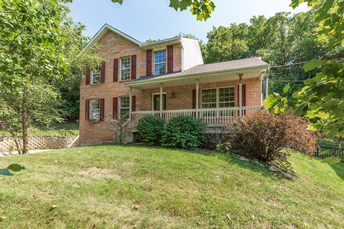
330 River Rd
Fort Thomas, KY 41075
Today
|
Edit
Favorites
859-547-6324
-
Bedrooms
3
-
Bathrooms
2.5
-
Square Feet
1,584 sq ft
-
Available
Available Dec 5
Highlight
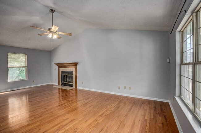
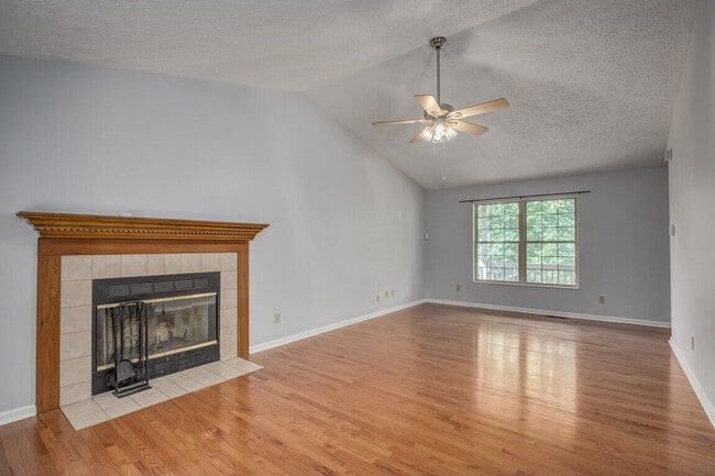
- Fireplace
330 River Rd

Favorites
About This Home
Available Dec 5
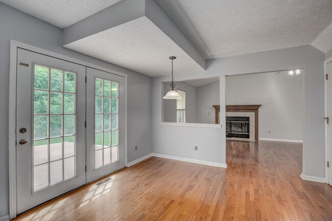
Well-Maintained 3 Bedrooms*2.5 Bathrooms*Ft. Thomas Schools*2 Car Garage*Beautiful Hardwood Floors*Washer/Dryer*New Roof-June 2023*Freshly Painted Interior*Large Family Rm w/Fireplace**Dining Rm*Open Kitchen & Breakfast Rm*Huge First Floor Laundry Rm/Pantry Combo w/New Flooring*Storage Space*Shed*Covered Front Porch*Composite Decking*Private Fenced Backyard*Immediate Occupancy*Lawn Maintenance Property owner pays for sewer,trash,recycling and lawn care for front and back yards.
330 River Rd is a house located in Campbell County and the 41075 ZIP Code. This area is served by the Fort Thomas Independent attendance zone.
* Price shown is base rent. Excludes user-selected optional fees and variable or usage-based fees and required charges due at or prior to move-in or at move-out. Price, availability, fees, and any applicable rent special are subject to change without notice.
* Square footage definitions vary. Displayed square footage is approximate.
House Features
Washer/Dryer
Air Conditioning
Dishwasher
Fireplace
- Washer/Dryer
- Air Conditioning
- Fireplace
- Dishwasher
- Oven
- Range
- Views
Contact
- Listed by The Apex Group | Keller Williams Realty Services
- Phone Number
- Contact
-
Source
Northern Kentucky Association of REALTORS®
Copyright © 2025 Northern Kentucky Association of REALTORS. All rights reserved. All information provided by the listing agent/broker is deemed reliable but is not guaranteed and should be independently verified.
Location
Get Directions
Amenities
- Washer/Dryer
- Air Conditioning
- Fireplace
- Dishwasher
- Oven
- Range
- Views
Fort Thomas is a small suburban city on the bank of the Ohio River, practically within sight of Cincinnati’s Central Business District. Most of the city’s landscape is filled by residential neighborhoods, with lush greenspaces like Highland Hills Park and Highland Country Club augmenting the scenery.
A small Downtown district along Fort Thomas Avenue provides residents with a great area to hang out amid the town’s historic buildings, with coffee shops, restaurants, and cozy neighborhood taverns operating out of the area’s vintage storefronts. Boasting exceptional public schools and a very low crime rate, Fort Thomas is a terrific option for folks raising families.
Learn more about living in Fort Thomas
Education
| Colleges & Universities | Distance | ||
|---|---|---|---|
| Colleges & Universities | Distance | ||
| Drive: | 9 min | 3.5 mi | |
| Drive: | 14 min | 7.8 mi | |
| Drive: | 14 min | 7.9 mi | |
| Drive: | 17 min | 9.4 mi |
330 River Rd is within 9 minutes or 3.5 miles from Northern Kentucky University. It is also near University of Cincinnati and Univ. of Cincinnati, Medical.
Schools


Public Elementary School
Grades K-5
411 Students
Attendance Zone
Public Elementary & Middle School
Grades PK-8
207 Students
Nearby
Public Middle School
Grades 6-8
732 Students
Attendance Zone
Public High School
Grades 9-12
1,015 Students
Attendance Zone
Private Elementary & Middle School
Grades PK-8
213 Students
Nearby
Private High School
Grades 9-12
256 Students
Nearby
School data provided by
 The GreatSchools Rating helps parents compare schools within a state based on a variety of school quality indicators and provides a helpful picture of how effectively each school serves all of its students. Ratings are on a scale of 1 (below average) to 10 (above average) and can include test scores, college readiness, academic progress, advanced courses, equity, discipline and attendance data. We also advise parents to visit schools, consider other information on school performance and programs, and consider family needs as part of the school selection process.
View GreatSchools Rating Methodology
Data provided by GreatSchools.org © 2025. All rights reserved.
View GreatSchools Rating Methodology
Data provided by GreatSchools.org © 2025. All rights reserved.
Transportation options available in Fort Thomas include Richter & Phillips Station, 6Th & Main, located 5.6 miles from 330 River Rd. 330 River Rd is near Cincinnati/Northern Kentucky International, located 16.8 miles or 31 minutes away.
| Transit / Subway | Distance | ||
|---|---|---|---|
| Transit / Subway | Distance | ||
| Drive: | 9 min | 5.6 mi | |
| Drive: | 10 min | 5.8 mi | |
| Drive: | 10 min | 5.8 mi | |
| Drive: | 10 min | 5.9 mi | |
| Drive: | 10 min | 6.0 mi |
| Commuter Rail | Distance | ||
|---|---|---|---|
| Commuter Rail | Distance | ||
|
|
Drive: | 14 min | 7.8 mi |
| Airports | Distance | ||
|---|---|---|---|
| Airports | Distance | ||
|
Cincinnati/Northern Kentucky International
|
Drive: | 31 min | 16.8 mi |
Time and distance from 330 River Rd.
| Shopping Centers | Distance | ||
|---|---|---|---|
| Shopping Centers | Distance | ||
| Drive: | 5 min | 1.8 mi | |
| Drive: | 7 min | 3.0 mi | |
| Drive: | 7 min | 3.1 mi |
330 River Rd has 3 shopping centers within 3.1 miles, which is about a 7-minute drive. The miles and minutes will be for the farthest away property.
| Parks and Recreation | Distance | ||
|---|---|---|---|
| Parks and Recreation | Distance | ||
|
Newport Aquarium
|
Drive: | 11 min | 5.0 mi |
|
Theodore M. Berry Friendship Park
|
Drive: | 10 min | 6.0 mi |
|
California Woods Nature Preserve
|
Drive: | 14 min | 7.1 mi |
|
Stanbery Park
|
Drive: | 17 min | 9.3 mi |
|
Withrow Nature Preserve
|
Drive: | 15 min | 10.2 mi |
330 River Rd has 5 parks within 10.2 miles, including Newport Aquarium, Theodore M. Berry Friendship Park, and California Woods Nature Preserve.
| Hospitals | Distance | ||
|---|---|---|---|
| Hospitals | Distance | ||
| Drive: | 5 min | 2.1 mi | |
| Drive: | 12 min | 7.0 mi | |
| Drive: | 13 min | 7.5 mi |
330 River Rd has 3 hospitals within 7.5 miles, the nearest is St. Elizabeth Ft. Thomas Hospital which is 2.1 miles away and a 5 minute drive.
| Military Bases | Distance | ||
|---|---|---|---|
| Military Bases | Distance | ||
| Drive: | 81 min | 58.5 mi | |
| Drive: | 87 min | 63.5 mi | |
| Drive: | 89 min | 66.8 mi |
330 River Rd has 3 military bases within 66.8 miles, the nearest is Gentile Air Force Station which is 58.5 miles away and a 81 minute drive.
You May Also Like
Similar Rentals Nearby


What Are Walk Score®, Transit Score®, and Bike Score® Ratings?
Walk Score® measures the walkability of any address. Transit Score® measures access to public transit. Bike Score® measures the bikeability of any address.
What is a Sound Score Rating?
A Sound Score Rating aggregates noise caused by vehicle traffic, airplane traffic and local sources
330 River Rd
Fort Thomas, KY 41075