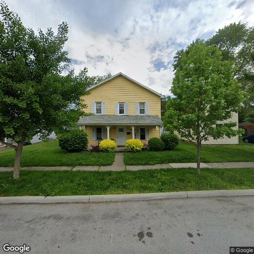
330 Liberty St

330 Liberty St

,

Bowling Green, OH 43402

2 Weeks Ago
| Edit

Under 30 minutes

Commute Time is calculated at rush hour.
Share Listing
Favorites
330 Liberty St
Share Listing
Favorites

Check Back Soon for Upcoming Availability

Beds Baths Average SF
4 Bedrooms 4 Bedrooms 4 Br 2 Baths 2 Baths 2 Ba
Location
330 Liberty St, Bowling Green,
OH 43402
Get Directions
City - Bowling Green

Located in northwestern Ohio, Bowling Green combines small-city living with the energy of a college town. Home to Bowling Green State University, this community of approximately 30,000 residents offers rental options from apartments near campus to homes throughout established neighborhoods. The downtown district preserves historic architecture from the city's oil boom era, particularly along Wooster Street. One-bedroom units in Bowling Green average $669 per month, while two-bedroom homes typically rent for $859.

The city stands out for its environmental initiatives, including four 257-foot wind turbines west of the city limits. Community events bring residents together throughout the year, including the Black Swamp Arts Festival, a free arts and music celebration each September. The 13-mile Slippery Elm Trail connects Bowling Green to North Baltimore, offering opportunities for cycling and outdoor activities.

Learn more about living in Bowling Green 
Education
Colleges & Universities Distance
Drive: 4 min 1.9 mi
Drive: 26 min 17.4 mi
Drive: 30 min 18.7 mi
Drive: 31 min 19.0 mi
330 Liberty St is within 4 minutes or 1.9 miles from Bowling Green State University. It is also near Owens C.C., Arrowhead Park and Owens C.C., Toledo Area Campus.
Transportation

330 Liberty St is near Eugene F Kranz Toledo Express, located 24.1 miles or 43 minutes away.

Commuter Rail Distance
Drive: 33 min 21.9 mi
Airports Distance
Airports Distance
Eugene F Kranz Toledo Express
Drive: 43 min 24.1 mi

Walkability Near 330 Liberty St Bowling Green, OH 43402

Getting Around
Fairly Walkable
Walkability
50 / 100
Moderately Drivable
Drivability
70 / 100
Moderately Bikeable
Bikeability
60 / 100

Scores provided by

What do Walkability, Transit, Drivability, and Bikeability mean? Walkability measures the walking distance to day-to-day needs. Transit measures access to public transportation. Drivability measures congestion, parking availability, and access to major roads. Bikeability measures the suitability for cycling. How It Works
-
Soundscore
- / 100

Traffic

-

Airport

-

Businesses

-

Scores provided by

HowLoud What is a Sound Score Rating? A Sound Score Rating aggregates noise caused by vehicle traffic, airplane traffic and local sources. How It Works
Points of Interest

Time and distance from 330 Liberty St.

Shopping Centers Distance
Drive: 3 min 1.1 mi
Drive: 4 min 1.3 mi
Drive: 5 min 1.7 mi
330 Liberty St has 3 shopping centers within 1.7 miles, which is about a 5-minute drive. The miles and minutes will be for the farthest away property.
Parks and Recreation Distance
Bowling Green State University Planetarium and Observatory
Walk: 18 min 1.0 mi
Wintergarden/St. Johns Nature Preserve and Rotary Nature Center
Drive: 4 min 1.8 mi
Toledo, Lake Erie and Western Railway
Drive: 31 min 19.7 mi
330 Liberty St has 3 parks within 19.7 miles, including Bowling Green State University Planetarium and Observatory, Wintergarden/St. Johns Nature Preserve and Rotary Nature Center, and Toledo, Lake Erie and Western Railway.
Hospitals Distance
Hospitals Distance
Walk: 16 min 0.9 mi
330 Liberty St is 0.9 mile and a 16 minute walk from Wood County Hospital.
Military Bases Distance
Drive: 74 min 41.9 mi
Drive: 119 min 100.8 mi
330 Liberty St is 41.9 miles from Camp Perry Air Guard Station, and is convenient to other military bases, including Mansfield Lahm Airport Air Guard Station.

Similar Rentals Nearby