

$2,275 / Month
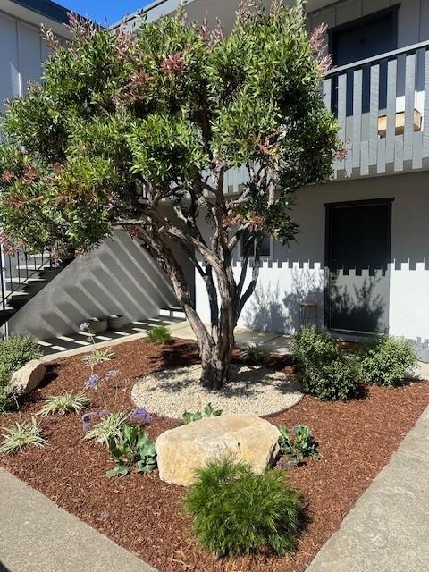
3257 Glendora Dr
San Mateo, CA 94403
2 Weeks Ago
Favorites
3257 Glendora Dr

Favorites
Check Back Soon for Upcoming Availability
| Beds | Baths | Average SF |
|---|---|---|
| 1 Bedroom 1 Bedroom 1 Br | 1 Bath 1 Bath 1 Ba | 12,234 SF |
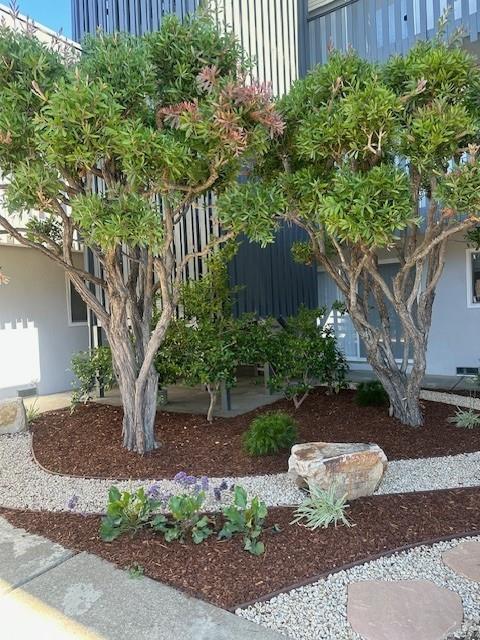
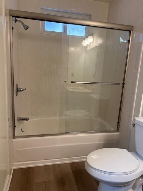
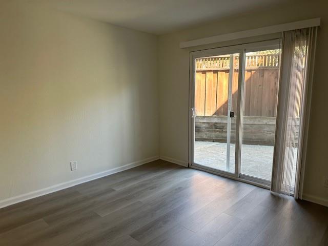
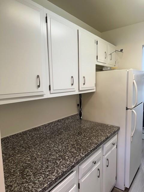
About This Property
Spacious one bedroom ground floor unit with new luxury vinyl flooring, fresh paint, and new blinds. This unit is move in ready with updated kitchen and bath. Property includes one car carport, storage locker and coin op laundry on site. Fantastic neighborhood just steps to Laurelwood shopping, and EZ access to 92, 280 and 101. $2,275 per month $2,275 Deposit One year lease Water & trash included Application documents needed: Complete application Credit report (700+ score) Copy of pay stub or job offer letter Rental income requirement 3x monthly rent Letter of introduction Rental verification form Copy of driver's license
3257 Glendora Dr is a condo located in San Mateo County and the 94403 ZIP Code.
Location
Get Directions
Located about halfway between San Francisco and San Jose, Sugarloaf is a peaceful, suburban neighborhood in San Mateo. Sugarloaf is predominantly residential, touting an array of single-family houses and apartment buildings atop scenic hillsides. However, Sugarloaf also provides plenty of shopping opportunities, from the extensive retail offerings of the Hillsdale Shopping Center to the unique finds in local shops along 37th Avenue.
Sugarloaf residents enjoy ample outdoor activities at the sprawling Laurelwood Park in addition to quick commutes for those working at the San Mateo Medical Center and the College of San Mateo. Convenience to El Camino Real, J. Arthur Younger Freeway, the Hillsdale CalTrain Station, and San Francisco International Airport makes getting around from Sugarloaf a breeze.
Learn more about living in SugarloafBelow are rent ranges for similar nearby apartments
Education
| Colleges & Universities | Distance | ||
|---|---|---|---|
| Colleges & Universities | Distance | ||
| Drive: | 3 min | 1.2 mi | |
| Drive: | 15 min | 9.9 mi | |
| Drive: | 20 min | 13.6 mi | |
| Drive: | 20 min | 14.0 mi |
3257 Glendora Dr is within 3 minutes or 1.2 miles from College of San Mateo. It is also near Canada College and Menlo College.
Transportation options available in San Mateo include Millbrae (Caltrain Transfer Platform), located 7.6 miles from 3257 Glendora Dr. 3257 Glendora Dr is near San Francisco International, located 11.2 miles or 16 minutes away, and Metro Oakland International, located 26.8 miles or 34 minutes away.
| Transit / Subway | Distance | ||
|---|---|---|---|
| Transit / Subway | Distance | ||
|
|
Drive: | 14 min | 7.6 mi |
|
|
Drive: | 14 min | 7.6 mi |
|
|
Drive: | 15 min | 10.8 mi |
| Drive: | 16 min | 10.9 mi | |
|
|
Drive: | 16 min | 11.1 mi |
| Commuter Rail | Distance | ||
|---|---|---|---|
| Commuter Rail | Distance | ||
| Drive: | 5 min | 1.9 mi | |
| Drive: | 5 min | 2.9 mi | |
| Drive: | 5 min | 2.9 mi | |
| Drive: | 7 min | 4.2 mi | |
| Drive: | 8 min | 5.8 mi |
| Airports | Distance | ||
|---|---|---|---|
| Airports | Distance | ||
|
San Francisco International
|
Drive: | 16 min | 11.2 mi |
|
Metro Oakland International
|
Drive: | 34 min | 26.8 mi |
Time and distance from 3257 Glendora Dr.
| Shopping Centers | Distance | ||
|---|---|---|---|
| Shopping Centers | Distance | ||
| Walk: | 7 min | 0.4 mi | |
| Drive: | 3 min | 1.4 mi | |
| Drive: | 3 min | 2.2 mi |
3257 Glendora Dr has 3 shopping centers within 2.2 miles, which is about a 3-minute walk. The miles and minutes will be for the farthest away property.
| Parks and Recreation | Distance | ||
|---|---|---|---|
| Parks and Recreation | Distance | ||
|
San Mateo Arboretum
|
Drive: | 5 min | 3.2 mi |
|
Japanese Tea Garden (San Mateo)
|
Drive: | 6 min | 3.5 mi |
|
Crystal Springs Trail
|
Drive: | 7 min | 4.7 mi |
|
Shoreline Parks
|
Drive: | 9 min | 5.8 mi |
|
Pulgas Ridge Open Space Preserve
|
Drive: | 12 min | 7.5 mi |
3257 Glendora Dr has 5 parks within 7.5 miles, including Crystal Springs Trail, San Mateo Arboretum, and Japanese Tea Garden (San Mateo).
| Hospitals | Distance | ||
|---|---|---|---|
| Hospitals | Distance | ||
| Drive: | 4 min | 2.1 mi | |
| Drive: | 12 min | 7.1 mi | |
| Drive: | 14 min | 9.3 mi |
3257 Glendora Dr has 3 hospitals within 9.3 miles, the nearest is San Mateo Medical Center which is 2.1 miles away and a 4 minute drive.
| Military Bases | Distance | ||
|---|---|---|---|
| Military Bases | Distance | ||
| Drive: | 29 min | 21.1 mi |
3257 Glendora Dr is 21.1 miles and a 29 minute drive from Ames Research Center.
You May Also Like
Similar Rentals Nearby


What Are Walk Score®, Transit Score®, and Bike Score® Ratings?
Walk Score® measures the walkability of any address. Transit Score® measures access to public transit. Bike Score® measures the bikeability of any address.
What is a Sound Score Rating?
A Sound Score Rating aggregates noise caused by vehicle traffic, airplane traffic and local sources
3257 Glendora Dr
San Mateo, CA 94403