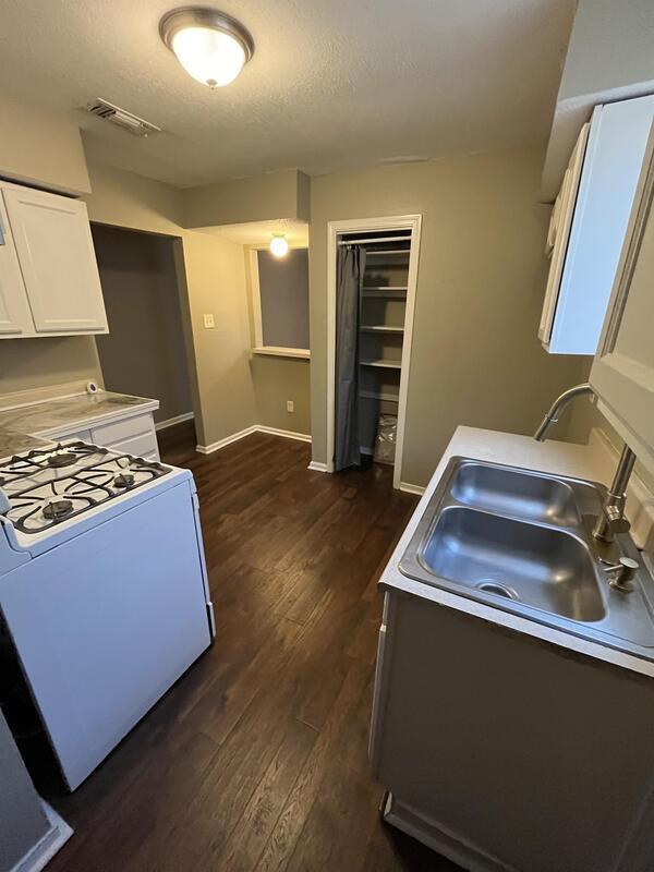

$1,000 / Month
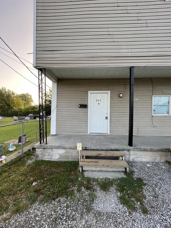
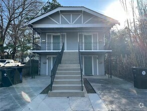
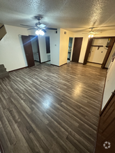
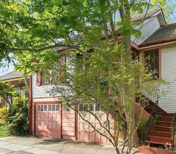
321 Robinson Ave
Marrero, LA 70072
2 Weeks Ago
Favorites
321 Robinson Ave

Favorites
Check Back Soon for Upcoming Availability
| Beds | Baths | Average SF |
|---|---|---|
| 2 Bedrooms 2 Bedrooms 2 Br | 1 Bath 1 Bath 1 Ba | — |
Location
Get Directions
The Westbank area of Gretna encompasses the geographical area to the west and also to the south of the Mississippi River, including Jefferson Parish, and a portion of Orleans Parish. Residents enjoy the close proximity to nature while having easy access to Downtown New Orleans. Take a stroll through Westbank hub and you’ll find plenty of down-home restaurants serving up Creole staples. Old Downtown has been revived here, with historic buildings newly preserved.
The apartment offerings are as diverse as the residents. You’ll find low-lying apartment communities and charming single-family homes for rent. U.S. Highway 90 cuts through the area, making commuting into New Orleans a breeze.
Learn more about living in WestbankBelow are rent ranges for similar nearby apartments
Education
| Colleges & Universities | Distance | ||
|---|---|---|---|
| Colleges & Universities | Distance | ||
| Drive: | 14 min | 9.8 mi | |
| Drive: | 21 min | 12.0 mi | |
| Drive: | 22 min | 12.5 mi | |
| Drive: | 24 min | 12.7 mi |
321 Robinson Ave is within 14 minutes or 9.8 miles from Tulane Univ., Health Ctr. It is also near Tulane University, New Orleans and Loyola University, New Orleans.
Schools


Public Elementary & Middle School
Grades PK-8
541 Students
Attendance Zone
Public Elementary School
Grades PK-5
336 Students
Attendance Zone
Public Elementary School
Grades PK-5
330 Students
Attendance Zone
Public Middle School
Grades 6-8
672 Students
Attendance Zone
Public High School
Grades 9-12
1,579 Students
Attendance Zone
Private Elementary & Middle School
Grades PK-8
Nearby
Private Middle & High School
Grades 7-12
18 Students
Nearby
School data provided by
 The GreatSchools Rating helps parents compare schools within a state based on a variety of school quality indicators and provides a helpful picture of how effectively each school serves all of its students. Ratings are on a scale of 1 (below average) to 10 (above average) and can include test scores, college readiness, academic progress, advanced courses, equity, discipline and attendance data. We also advise parents to visit schools, consider other information on school performance and programs, and consider family needs as part of the school selection process.
View GreatSchools Rating Methodology
View GreatSchools Rating Methodology
Transportation options available in Marrero include St Charles And Cadiz, located 11.2 miles from 321 Robinson Ave. 321 Robinson Ave is near Louis Armstrong New Orleans International, located 16.6 miles or 31 minutes away.
| Transit / Subway | Distance | ||
|---|---|---|---|
| Transit / Subway | Distance | ||
|
|
Drive: | 19 min | 11.2 mi |
|
|
Drive: | 19 min | 11.3 mi |
|
|
Drive: | 19 min | 11.5 mi |
|
|
Drive: | 19 min | 11.6 mi |
|
|
Drive: | 19 min | 11.6 mi |
| Commuter Rail | Distance | ||
|---|---|---|---|
| Commuter Rail | Distance | ||
|
|
Drive: | 14 min | 8.9 mi |
|
|
Drive: | 52 min | 41.3 mi |
| Airports | Distance | ||
|---|---|---|---|
| Airports | Distance | ||
|
Louis Armstrong New Orleans International
|
Drive: | 31 min | 16.6 mi |
Time and distance from 321 Robinson Ave.
| Shopping Centers | Distance | ||
|---|---|---|---|
| Shopping Centers | Distance | ||
| Drive: | 3 min | 1.1 mi | |
| Drive: | 3 min | 1.8 mi | |
| Drive: | 5 min | 2.1 mi |
321 Robinson Ave has 3 shopping centers within 2.1 miles, which is about a 5-minute drive. The miles and minutes will be for the farthest away property.
| Parks and Recreation | Distance | ||
|---|---|---|---|
| Parks and Recreation | Distance | ||
|
Bayou Segnette State Park
|
Drive: | 9 min | 4.1 mi |
|
Louisiana Children's Museum
|
Drive: | 14 min | 8.7 mi |
|
Entergy IMAX Theatre
|
Drive: | 15 min | 9.1 mi |
|
Audubon Insectarium
|
Drive: | 23 min | 11.7 mi |
|
Audubon Zoo
|
Drive: | 24 min | 12.9 mi |
321 Robinson Ave has 5 parks within 12.9 miles, including Bayou Segnette State Park, Entergy IMAX Theatre, and Louisiana Children's Museum.
| Hospitals | Distance | ||
|---|---|---|---|
| Hospitals | Distance | ||
| Drive: | 4 min | 1.5 mi | |
| Drive: | 14 min | 9.3 mi | |
| Drive: | 18 min | 10.7 mi |
321 Robinson Ave has 3 hospitals within 10.7 miles, the nearest is West Jefferson Medical Center which is 1.5 miles away and a 4 minute drive.
| Military Bases | Distance | ||
|---|---|---|---|
| Military Bases | Distance | ||
| Drive: | 13 min | 7.5 mi | |
| Drive: | 24 min | 13.1 mi |
321 Robinson Ave is 7.5 miles from New Orleans Naval Support, and is convenient to other military bases, including New Orleans Naval Air Station.
You May Also Like
Similar Rentals Nearby
-
-
-
-
-
 $12,0004 Beds, 4 Baths, 2,217 sq ftApartment for Rent
 -
-
-
-
-

What Are Walk Score®, Transit Score®, and Bike Score® Ratings?
Walk Score® measures the walkability of any address. Transit Score® measures access to public transit. Bike Score® measures the bikeability of any address.
What is a Sound Score Rating?
A Sound Score Rating aggregates noise caused by vehicle traffic, airplane traffic and local sources

321 Robinson Ave
Marrero, LA 70072