
The Station Apartments
5959 Broadway,
Bronx, NY 10463
$1,750 - $2,300
Studio - 1 Bed
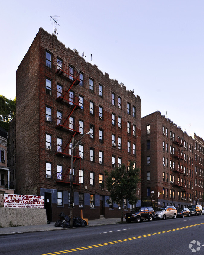
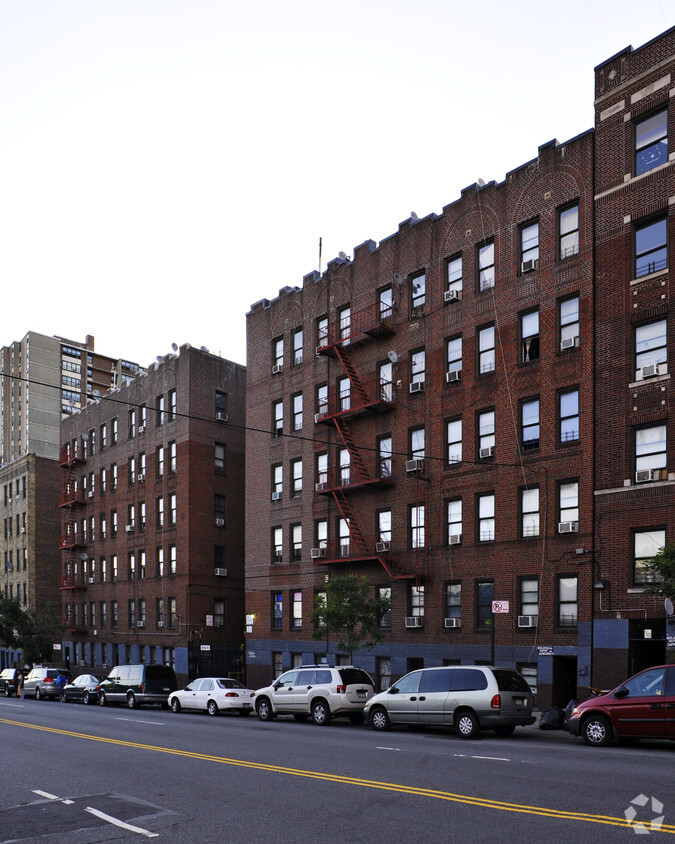
Experience Bronx living at 3150 Bailey Ave. In a location on Bailey Ave in Bronx's 10463 area, residents can easily connect with a number of attractions in the surrounding area. Come by to see the current floorplan options. The leasing staff is ready and waiting for you to visit. You're sure to live the good life at 3150 Bailey Ave. Contact or drop by the leasing office to talk about leasing your new apartment.
3150 Bailey Ave is an apartment community located in Bronx County and the 10463 ZIP Code. This area is served by the New York City Geographic District #10 attendance zone.
Heating
Oven
Range
Kitchen
Filled with parks and centered around a namesake greenspace and reservoir, Jerome Park has some of the best scenery in the Bronx. Jerome Park is surrounded by popular parks including Van Cortlandt Park and the New York Botanical Garden. Jerome Park is home to Lehman College School of Continuing and Professional Studies and lies adjacent to Fordham University, so it’s a great choice for students, faculty, and staff who want easy trips to campus. Conveniently, Jerome Park has several bus stops and subway stations so residents can travel throughout New York City. Similar to many rentals in New York City, apartments in Jerome Park are expensive, but there are options that are more affordable compared to other neighborhoods. Apartments in Jerome Park are also known for being slightly larger than other typical NYC rentals.
Learn more about living in Jerome ParkCompare neighborhood and city base rent averages by bedroom.
| Jerome Park | Bronx, NY | |
|---|---|---|
| Studio | $1,273 | $1,628 |
| 1 Bedroom | $1,453 | $1,632 |
| 2 Bedrooms | $1,810 | $2,099 |
| 3 Bedrooms | $2,048 | $2,368 |
| Colleges & Universities | Distance | ||
|---|---|---|---|
| Colleges & Universities | Distance | ||
| Walk: | 19 min | 1.0 mi | |
| Drive: | 3 min | 1.5 mi | |
| Drive: | 4 min | 1.7 mi | |
| Drive: | 5 min | 2.2 mi |


Transportation options available in Bronx include 231 Street, located 0.2 mile from 3150 Bailey Ave. 3150 Bailey Ave is near LaGuardia, located 11.5 miles or 20 minutes away, and Westchester County, located 21.9 miles or 33 minutes away.
| Transit / Subway | Distance | ||
|---|---|---|---|
| Transit / Subway | Distance | ||
|
|
Walk: | 4 min | 0.2 mi |
|
|
Walk: | 9 min | 0.5 mi |
|
|
Walk: | 14 min | 0.7 mi |
|
|
Walk: | 18 min | 0.9 mi |
|
|
Drive: | 4 min | 1.8 mi |
| Commuter Rail | Distance | ||
|---|---|---|---|
| Commuter Rail | Distance | ||
|
|
Walk: | 14 min | 0.7 mi |
|
|
Drive: | 3 min | 1.5 mi |
|
|
Drive: | 4 min | 1.7 mi |
|
|
Drive: | 3 min | 1.8 mi |
|
|
Drive: | 4 min | 2.4 mi |
| Airports | Distance | ||
|---|---|---|---|
| Airports | Distance | ||
|
LaGuardia
|
Drive: | 20 min | 11.5 mi |
|
Westchester County
|
Drive: | 33 min | 21.9 mi |
Scores provided by
Traffic
-Airport
-Businesses
-Scores provided by
HowLoud What is a Sound Score Rating? A Sound Score Rating aggregates noise caused by vehicle traffic, airplane traffic and local sources. How It WorksTime and distance from 3150 Bailey Ave.
| Shopping Centers | Distance | ||
|---|---|---|---|
| Shopping Centers | Distance | ||
| Walk: | 9 min | 0.5 mi | |
| Walk: | 9 min | 0.5 mi | |
| Walk: | 14 min | 0.7 mi |
| Parks and Recreation | Distance | ||
|---|---|---|---|
| Parks and Recreation | Distance | ||
|
St. James Park
|
Drive: | 2 min | 1.3 mi |
|
Poe Park
|
Drive: | 2 min | 1.4 mi |
|
Henry Hudson Park
|
Drive: | 3 min | 1.6 mi |
|
Williamsbridge Oval
|
Drive: | 4 min | 2.0 mi |
|
Riverdale Park
|
Drive: | 5 min | 2.3 mi |
| Hospitals | Distance | ||
|---|---|---|---|
| Hospitals | Distance | ||
| Drive: | 3 min | 1.9 mi | |
| Drive: | 6 min | 2.6 mi | |
| Drive: | 8 min | 3.8 mi |
| Military Bases | Distance | ||
|---|---|---|---|
| Military Bases | Distance | ||
| Drive: | 23 min | 12.7 mi |
What Are Walk Score®, Transit Score®, and Bike Score® Ratings?
Walk Score® measures the walkability of any address. Transit Score® measures access to public transit. Bike Score® measures the bikeability of any address.
What is a Sound Score Rating?
A Sound Score Rating aggregates noise caused by vehicle traffic, airplane traffic and local sources.

3150 Bailey Ave
Bronx, NY 10463


