

$6,900 / Month
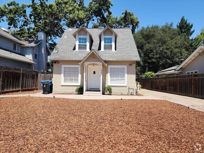
315 W Portola Ave
Los Altos, CA 94022
2 Weeks Ago
Favorites
315 W Portola Ave

Favorites
Check Back Soon for Upcoming Availability
| Beds | Baths | Average SF |
|---|---|---|
| 4 Bedrooms 4 Bedrooms 4 Br | 2.5 Baths 2.5 Baths 2.5 Ba | 1,998 SF |
About This Property
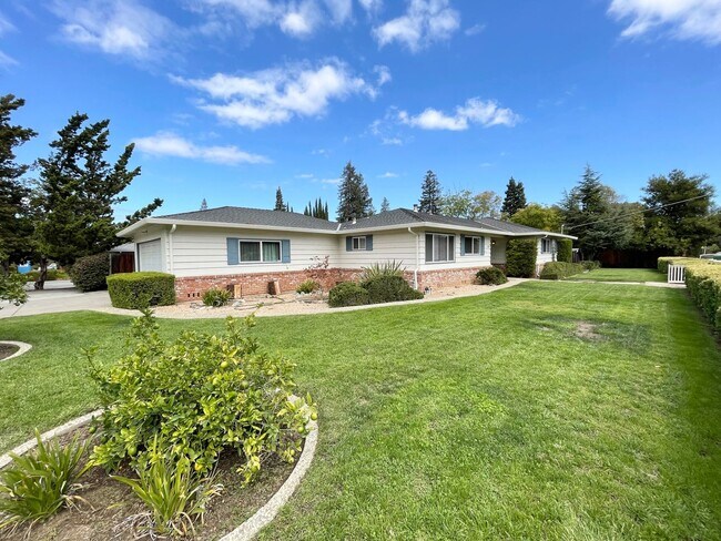
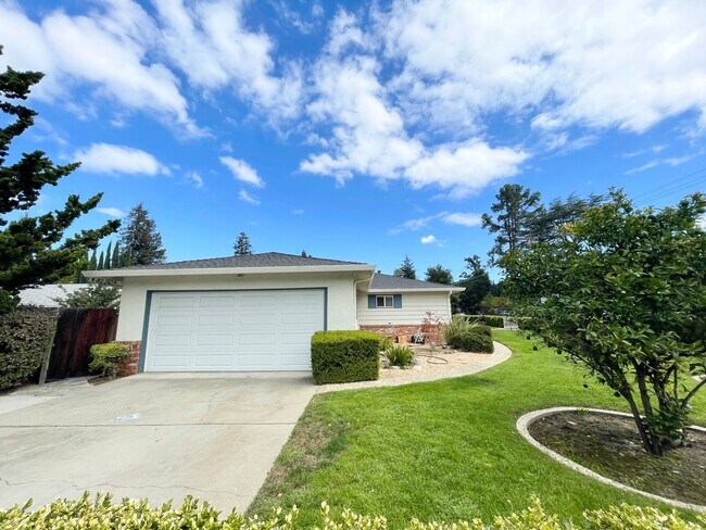
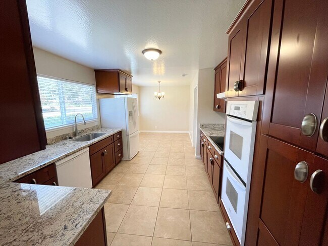
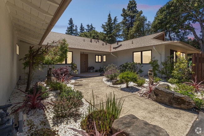
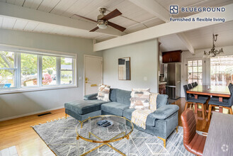
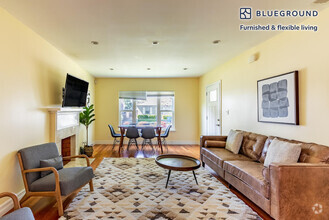
This beautiful 4 bed 2.5 bath Los Altos home features nearly 2,000 square feet of living space on a 12,000+ square foot corner lot. The home features a living, dining, and family room with multiple fireplaces, laundry room and 2-car garage. Large grassy front yard. The home has two backyards separated by a fence with a pool and gazebo. The kitchen features cherry shaker cabinets, granite countertops, double ovens, and updated electrical. Hardwood floors throughout. Freshly painted inside and out! This home is located in a very desirable neighborhood. Only one block from both Santa Rita Elementary and Egan Junior High. Just off Los Altos Ave with quick access to El Camino Real, San Antonio Road, and Foothill Expressway. No Pets, No Smoking Please. Parking 2-Car Garage Pets No Pets Allowed Laundry W/D Included Central Forced Air Heating No Air Conditioning Utilities Gardener & Pool Services Included All Other Utilities Paid by Tenant Schools(*Tenants to Verify*) Santa Rita Elementary Egan Junior High Los Altos High If this doesn’t quite meet your needs, check out our other available properties at or give us a call at .
315 W Portola Ave is a house located in Santa Clara County and the 94022 ZIP Code. This area is served by the Los Altos Elementary attendance zone.
Location
Get Directions
North Los Altos contains the city’s vibrant commercial centers. The many shops and eateries of Main Street are in the southern portion of North Los Altos, while the diverse restaurants and cafes of San Antonio Road are in the northern stretches near San Antonio Center.
Outside of these commercial areas, North Los Altos is predominantly residential, offering an array of apartments available for rent along tree-lined avenues. Many of the rentals in North Los Altos feature stunning mountain views, as well as close proximity to Mountain View, Foothill College, Stanford University, and Palo Alto. Getting around from North Los Altos is simple with access to El Camino Real, Interstate 280, and San Antonio Station.
Learn more about living in North Los AltosBelow are rent ranges for similar nearby apartments
Education
| Colleges & Universities | Distance | ||
|---|---|---|---|
| Colleges & Universities | Distance | ||
| Drive: | 6 min | 2.2 mi | |
| Drive: | 9 min | 3.4 mi | |
| Drive: | 11 min | 4.3 mi | |
| Drive: | 16 min | 6.5 mi |
315 W Portola Ave is within 6 minutes or 2.2 miles from Foothill College, Middlefield. It is also near Foothill Coll., Los Altos and Stanford University.
Schools

Public Elementary School
Grades K-5
367 Students
Nearby
Public Elementary School
Grades K-6
385 Students
Attendance Zone
Public Middle School
Grades 7-8
497 Students
Attendance Zone
Public High School
Grades 9-12
2,141 Students
Attendance Zone
Private Elementary School
Grades PK-5
Nearby
Private Elementary, Middle & High School
Grades K-12
612 Students
Nearby
Private Elementary & Middle School
Grades K-8
268 Students
Nearby
School data provided by
 The GreatSchools Rating helps parents compare schools within a state based on a variety of school quality indicators and provides a helpful picture of how effectively each school serves all of its students. Ratings are on a scale of 1 (below average) to 10 (above average) and can include test scores, college readiness, academic progress, advanced courses, equity, discipline and attendance data. We also advise parents to visit schools, consider other information on school performance and programs, and consider family needs as part of the school selection process.
View GreatSchools Rating Methodology
View GreatSchools Rating Methodology
Transportation options available in Los Altos include Mountain View Station, located 3.2 miles from 315 W Portola Ave. 315 W Portola Ave is near Norman Y Mineta San Jose International, located 12.7 miles or 20 minutes away, and San Francisco International, located 24.9 miles or 35 minutes away.
| Transit / Subway | Distance | ||
|---|---|---|---|
| Transit / Subway | Distance | ||
|
|
Drive: | 6 min | 3.2 mi |
|
|
Drive: | 9 min | 4.4 mi |
|
|
Drive: | 11 min | 5.1 mi |
|
Bayshore/Nasa Station
|
Drive: | 11 min | 5.2 mi |
|
|
Drive: | 12 min | 6.0 mi |
| Commuter Rail | Distance | ||
|---|---|---|---|
| Commuter Rail | Distance | ||
| Drive: | 3 min | 1.3 mi | |
| Drive: | 8 min | 3.3 mi | |
| Drive: | 9 min | 3.4 mi | |
| Drive: | 12 min | 4.6 mi | |
| Drive: | 13 min | 6.4 mi |
| Airports | Distance | ||
|---|---|---|---|
| Airports | Distance | ||
|
Norman Y Mineta San Jose International
|
Drive: | 20 min | 12.7 mi |
|
San Francisco International
|
Drive: | 35 min | 24.9 mi |
Time and distance from 315 W Portola Ave.
| Shopping Centers | Distance | ||
|---|---|---|---|
| Shopping Centers | Distance | ||
| Walk: | 13 min | 0.7 mi | |
| Walk: | 16 min | 0.8 mi | |
| Walk: | 17 min | 0.9 mi |
315 W Portola Ave has 3 shopping centers within 0.9 mile, which is about a 17-minute walk. The miles and minutes will be for the farthest away property.
| Parks and Recreation | Distance | ||
|---|---|---|---|
| Parks and Recreation | Distance | ||
|
Redwood Grove
|
Drive: | 5 min | 1.8 mi |
|
Terman Park
|
Drive: | 5 min | 1.9 mi |
|
J. Pearce Mitchell Park
|
Drive: | 8 min | 2.5 mi |
|
Bol Park
|
Drive: | 7 min | 2.7 mi |
|
Esther Clark Nature Preserve
|
Drive: | 7 min | 3.2 mi |
315 W Portola Ave has 5 parks within 3.2 miles, including Terman Park, Redwood Grove, and Esther Clark Nature Preserve.
| Hospitals | Distance | ||
|---|---|---|---|
| Hospitals | Distance | ||
| Drive: | 9 min | 3.9 mi | |
| Drive: | 12 min | 5.0 mi | |
| Drive: | 14 min | 5.5 mi |
315 W Portola Ave has 3 hospitals within 5.5 miles, the nearest is El Camino Hospital which is 3.9 miles away and a 9 minute drive.
| Military Bases | Distance | ||
|---|---|---|---|
| Military Bases | Distance | ||
| Drive: | 13 min | 5.5 mi |
315 W Portola Ave is 5.5 miles and a 13 minute drive from Ames Research Center.
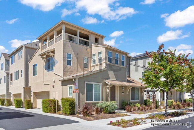
You May Also Like
Similar Rentals Nearby


What Are Walk Score®, Transit Score®, and Bike Score® Ratings?
Walk Score® measures the walkability of any address. Transit Score® measures access to public transit. Bike Score® measures the bikeability of any address.
What is a Sound Score Rating?
A Sound Score Rating aggregates noise caused by vehicle traffic, airplane traffic and local sources
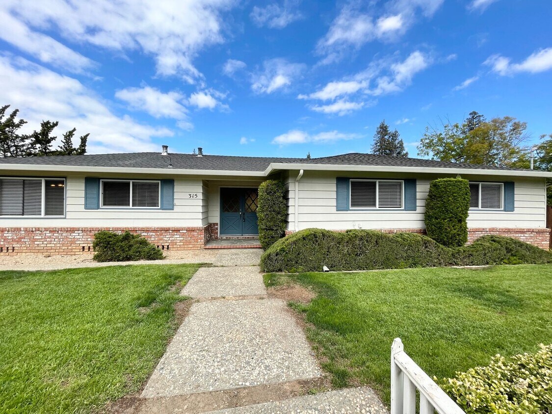
315 W Portola Ave
Los Altos, CA 94022